Starting from the village of Alwinton this route covers 13 miles of typical Cheviots terrain. There’s undulating paths, dense forest, wide bridleways, rolling hills, rolling valleys and lots of rich green green grass. This was a first walk from Alwinton as I usually drive west through the village, so it was interesting to walk along a familiar road and onto the quirkily named Pass Peth. Yes in this post I’ll definitely be taking the Peth.
- Distance = 13.5 miles (21.73 km)
- Duration = 6 hrs 32 mins, (start 12.10pm, finish 6.42pm)
- Total Ascent = 2,845ft (867m), max height Shillhope Law 1,644ft
- Start/Finish = Alwinton, west of Rothbury
- Date = Sunday 16th February 2014, blue cloud, wind, sleet shower
- Total people seen = 7 (one family, 2 runners & a cyclist)
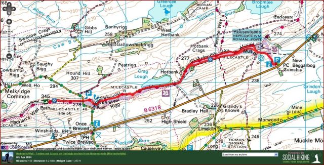
- Click on the Route Map below to zoom in/out

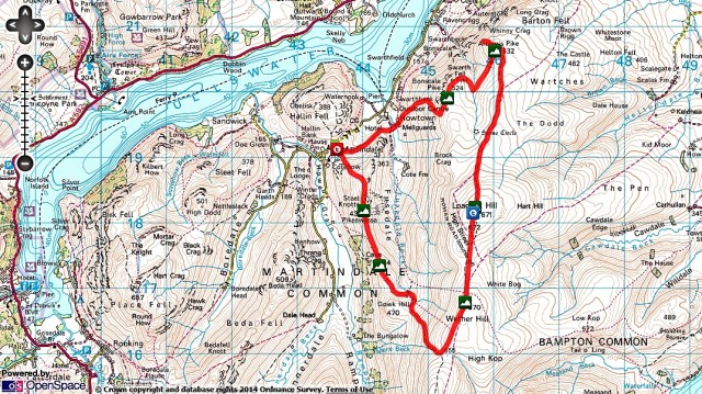
Cheviots walk from Alwinton – Pass Peth, Shillmoor, Shillhope Law, The Middle, Clennell Stt, 13.5 miles
Starting Point
National Parks car park on the right as you leave Alwinton driving west, however instead I parked for free on the large grass verge by the river Alwin where the road bends left entering the village. (For thirsty people there’s a pub in the village too, the Rose & Thistle).
Route Summary – five stages
- Alwinton along the road & up the Pass Peth to Shillmoor; (1 hour)
- Shillmoor up over Inner Hill to Shillhope Law summit; (1 hour)
- Shillhope Law to The Middle down to the bridge over the Usway Burn; (1.5 hrs)
- Usway Burn up along Clennel Street through the Kidland Forest; (1 hour)
- Main Clennell St track back to Alwinton; (2 hours)
Route Detail & Pics from Sunday 16th Feb 2014
Stage 1 – From Alwinton along the Pass Peth to Shillmoor (55 mins) – an inauspicious start along the road heading west. It did feel a little odd walking on this much driven piece of tarmac, however technically it was new ground for me and still peaceful, with only 3 cars passing by. After around 15-20mins out of the village take a wooden gate on the right where a clear path heads north east to Lords Seat. Don’t take this path, instead turn west and keep parallel with the road on a feint grassy track. Soon you see a stile coming off the road with a sign saying Shillmoor. Much better to have left the road earlier than trudge along to here. Things improve as you ascend along the Pass Peth path, the name is famous for being very difficult to repeat after several pints at the Rose & Thistle. I met a couple of runners here & briefly discussed headtorches, as you do.

Parked on the verge at Alwinton – 12.10pm

Road section out of Alwinton, weather looking good – 12.13pm

Leaving the road, looking back – 12.30pm

Higher up the path, Alwinton back in the distance – 12.35pm
")
The way ahead is baaarred (bad sheep joke)

Through the gate take the left fork – 12.40pm

First sign of Shillhope Law on the horizon
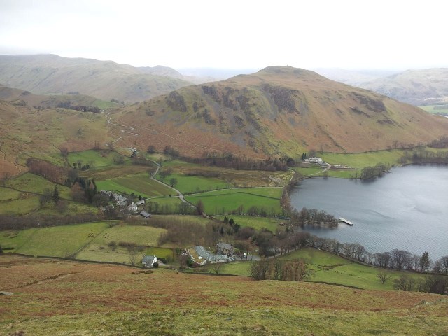
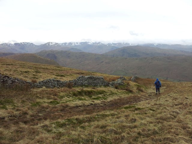
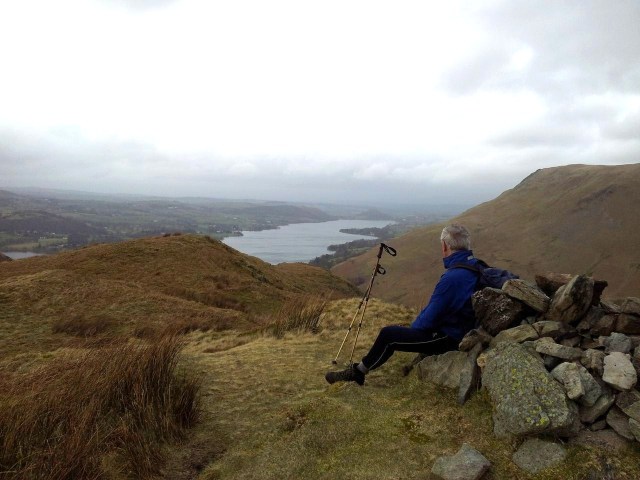
The path gently ascends and you start to get views across to Shillhope Law when suddenly the Pass Peth path drops giving a spectacular view up the Upper Coquet valley. Worth taking a minute to enjoy this as all your ascent has now been in vain as you drop down to road level again. Actually the height loss is minimal, it just looks despairingly impressive. Soon you arrive at Shillmoor Farmhouse where you cross a bridge over the Usway Burn. If this river isn’t already familiar then it soon will be as the walk will take a high level route to follow it upstream. Shillmoor is a popular stating place for walkers and can also be easily confused visually with Barrowburn further up the valley.

Highlight of the Pass Peth path, lovely view with Shillmoor in the distance – 12.50pm

South over the Coquet from the Pass Peth path (can’t stop typing Pass Peth path)

Path appoaching Shillmoor – 1.00pm

Shillmoor, cross the bridge then start heading up by the wall – 1.05pm
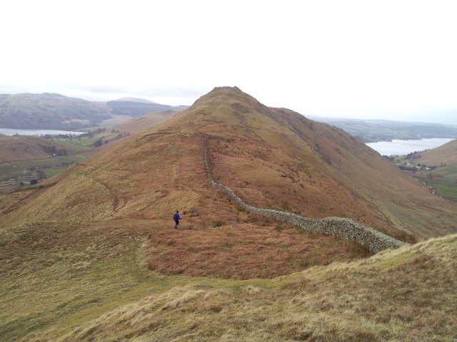
Stage 2 – Shillmoor over Inner Hill to Shillhope Law (1,644ft) (55 mins) – Keep straight from the bridge past a few farm houses & cut round the back to pick up a track with the river on the right and a drystone wall on the left. Here the path splits with a low route option to follow the Usway Burn to Fairhaugh then pick up Clennel St & return to Alwinton. For me the highlight of the day is to take the high level route turning left to initially follow the wall then up over Inner Hill and then on to Shillhope Law. It’s a steady plod but the ever improving views are worth it after having been relatively low for the first hour. Met a family on Inner Hill and didn’t see another soul for another 3hrs 40min, that’s the Cheviots for you, love it.

Above Shillmoor, head up left towards Shillhope (right keeps low along the Usway Burn) – 1.10pm

Looking down at Shillmoor

Photo tip one – add foreground interest. The ascent up Inner Hill ahead

Looking down at Shillmoor with the Usway Burn left – 1.30pm

Textures of grass – nearing Shillhope Law looking east over Copper Snout

From Inner Hill up to top of Shillhope Law -1.40pm

Looking back towards Inner Hill – 1.55pm
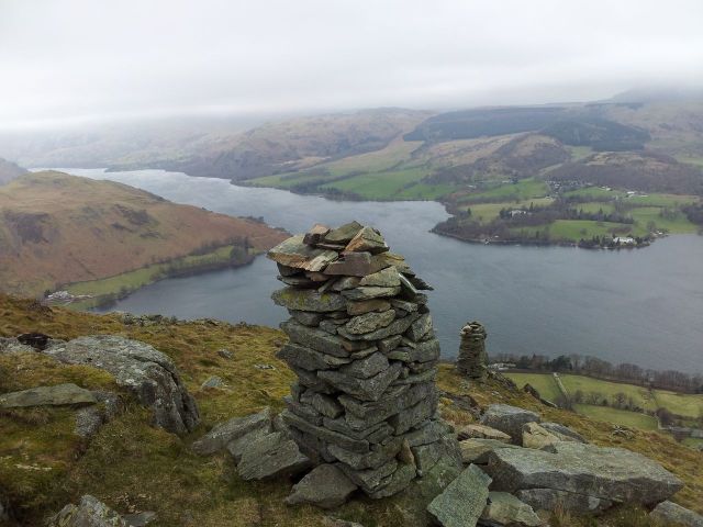
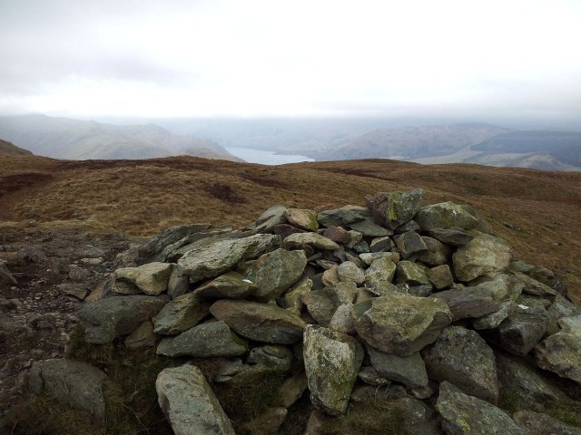
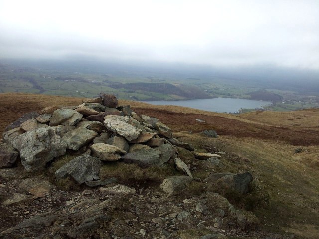
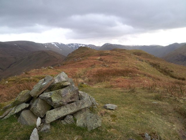
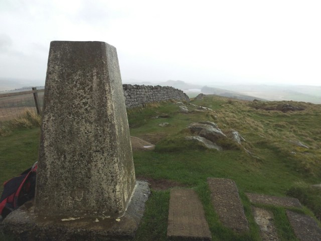
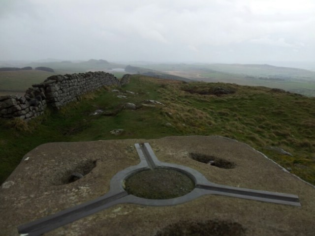
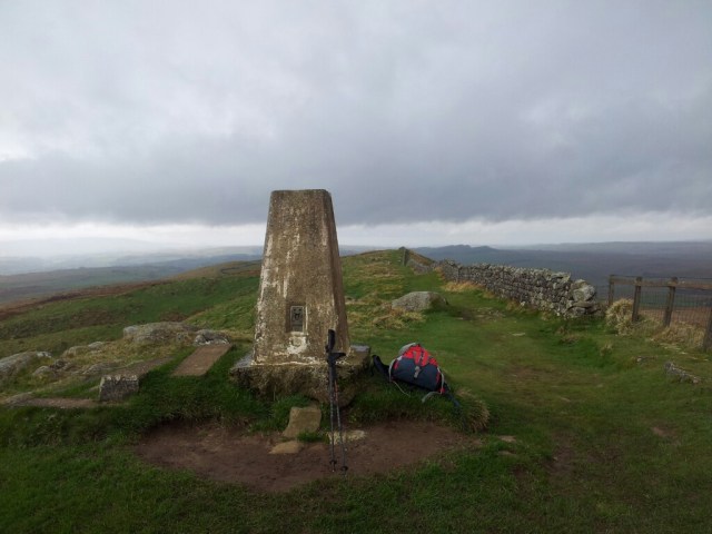
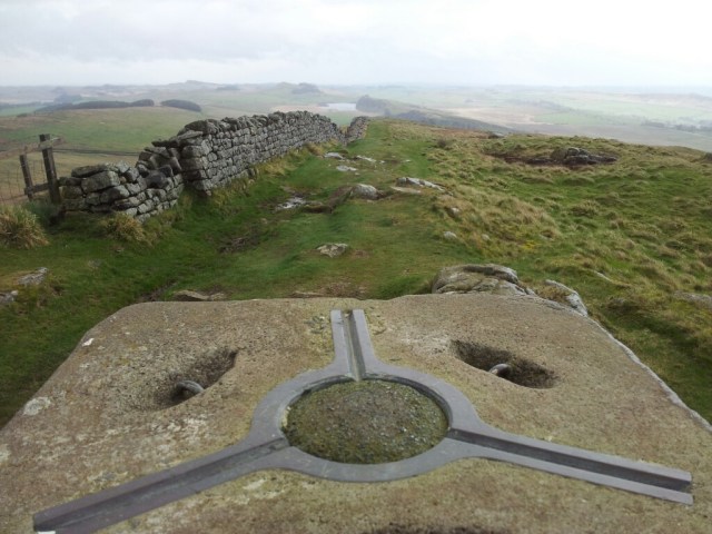
Shillhope Law has a flat grassy top with small cairn shelter allowing one person to position themselves on a rock behind the trig point sheltering from the wind. That person has been me on several occasions. Views are very good in all directions particularly west and north although on very clear days you can actually see the Lakeland peaks 80 miles away.

Shillhope Law summit plateau with The Cheviot in snow on the horizon – 2.00pm

Shillhope Law view & cairns

Shillhope Law summit cairn again – 2.00pm
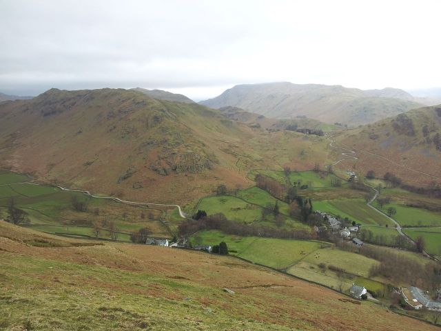
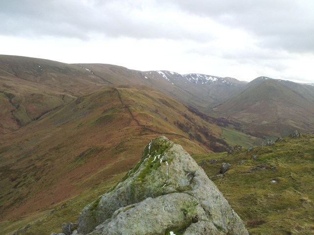
Stage 3 – Shillhope Law to The Middle down to the bridge over the Usway Burn; I was back on familiar ground up on Shillhope and for the ‘high level’ walk section along the west side of the Usway Burn. Reluctantly you leave Shillhope taking a few last glances at that view before descending heading north down through a wooden gate. Difficult to fully concentrate on the squelchy ground when the views ahead are so rewarding.

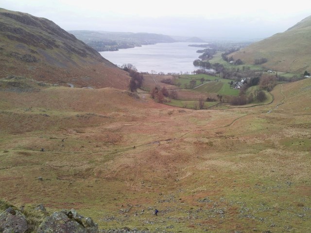
Lovely view up the Upper Coquet valley descending Shillhope – 2.20pm

Nearly down from Shillhope & through the gate
Go through the gate and swing right the two hills ahead trying to lose as little height as possible in the process. There’s a little bump which provides a nice view down the Usway Burn valley. I circumvent between Kyloe Shin and the higher unnamed hill along to the end bump which then slopes down to the edge of the Kidland forest.

Keep to the high ground curving right then head for the middle bump – 2.30pm

View down the Usway Burn over The Castles

Looking back to Shillhope Law with Inner Hill peeping left – 2.45pm
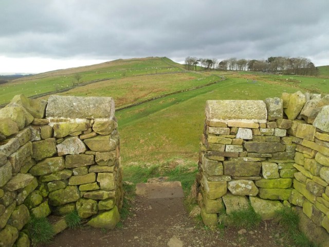
Detour slightly east to catch the impressive view down to the remote cottage of Fairhaugh. There is a wondrous greenness to this section, it makes me smile every time. At a stile entering a corner of the Kidland Forest I normally take the detour east to Fairhaugh, however today I was pushed for time so took the quicker path left then up over Middle Hill then past some excellent mud and out of the forest over a stile.

Always nice to see this view down to Fairhaugh. The Border Ridge on the horizon – 2.55pm

Fairhaugh

Route down to the stile into the Kidland trees

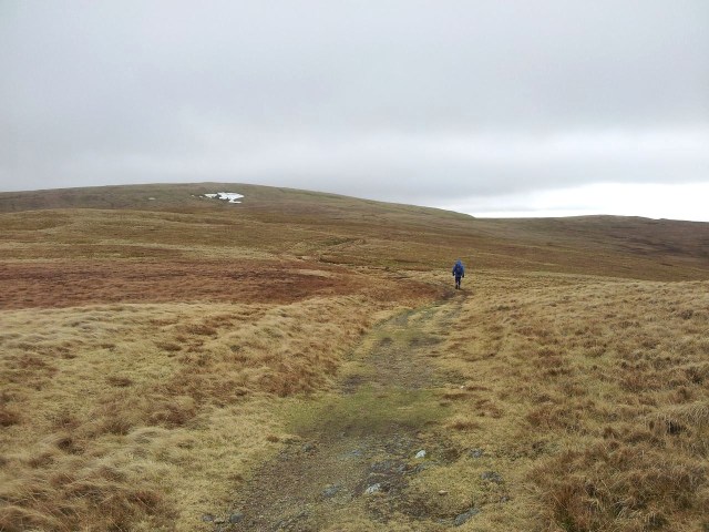
Leaving the forest & up The Middle – 3.10pm
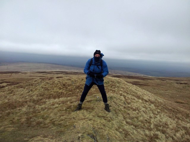
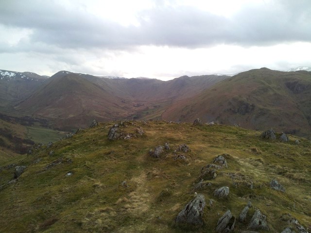
Head straight up to a favourite cute little hill called The Middle, there’s nowt here yet it gives great views all around to bigger stuff and particularly up along the Usway Burn to Uswayford. Due to the wind I carried straight over & down to a stile for a sit down to ponder routes. I considered going up to Uswayford but after 10mins staring at map contours I concluded I didn’t have time, especially having wasted 10 mins in trying to decide this. I wanted to press on but time was against me and I’d already be getting back to Alwinton in darkness. I’d planned this in any case to test out my new Lenser H7.2 headtorch and Clennell St seemed an uncomplicated route back.

Looking back from The Middle. Shillhope on horizon, Clennel St left

View north east from The Middle – 2.20pm

Route is straight down to the shed then right across the Usway Burn bridge

Turning back at last, over the bridge along Clennell St bridleway – 3.40pm
Stage 4 – Usway Burn up along Clennel Street through the Kidland Forest – Now for another new section for me, from the stile I crossed over a bridge onto Clennell Street an ancient drovers track where farmers would take their cattle over the hills to markets in Kelso & Morpeth. It was also used by smugglers and Border raiders, here’s some info on the remaining route back to Alwinton. The path goes up at a decent angle giving views back across The Middle to Windy Gyle. Soon it levels out and is engulfed by Fangorn Forest, I mean the Kidland Forest Not a fan of coniferous forests but at least the shade meant there was some snow to play with which certainly brightened things up.

Gaining height looking back over the Usway Burn & The Middle – 4.00pm

About to enter the forest, nice view of Windy Gyle – 4.05pm

Through the Kidland forest, looks much better in snow

Out of the forest looking south to Shillhope Law

More views south from the forested Clennell St section – 4.30pm

Leaving the Kidland forest, final sight of Windy Gyle on the horizon – 4.40pm
Stage 5 – Main Clennell St track back to Alwinton – I’d walked the start of this section before and wasn’t anticipating too much but also knowing it was a means to an end, i.e. to get back to Alwinton. Like many hillgoers I’d much prefer to be on hill tracks or no track at all rather than a flat forest road. The initial desolate areas of deforestation on either side didn’t help either though could be attractive to anyone appreciating that post-nuclear bomb look. Not nice or natural, however this is still a popular walkway providing a very good path for walkers of all abilities. I kept telling myself it’s an ancient bridleway 🙂

Clennell St road section, keep thinking ancient drovers way – 5.00pm

Shillhope across grass, lots of grass

The sun disappearing – 5.15pm

Clennell St heads right then across the fields round the bump distant left – 5.20pm
At the point above after being alone for 3hrs a cyclist suddenly appeared behind me, so we had a chat & he gave me some tips on mountain bike technique. He’d been over the border and soon disappeared from sight at an envied great speed. At least the forest road veered left and Clennell Street continues as a grassy track which felt better. Views however were decreasing with the failing light and soon the Lenser headtorch made an impressive debut.

Last views ahead down Clennell St 5.30pm
A welcome alert on my phone indicated the ISS (International Space Station) was due overhead so I got a perfect unobscured view of it crossing right across a starry sky. Nice.

New head torch performing well – 6.20pm (20 mins from car)
Twenty mins after this photo I was back at the car having had an interesting day. Despite starting somewhere new I had found myself gravitating towards my favourite areas in Upper Coquetdale. Parts of Clennell St are a trudge although a good way of getting back to Alwinton quickly. My ambitious Plan A for this walk was to try & reach Windy Gyle from Alwinton, however I started way to late at 12.10pm to get back at a reasonable time. Would have added at least 90 mins to the day so I sensibly turned round after The Middle. I also thought about walking out to Uswayford then up over the shoulder of Yarnspath for Clennell St. All of these routes are possible with an earlier start or more daylight. A great feature of the Cheviots is the small variations that can shorten or lengthen the day.
If you want any more info on these routes drop me a line via the Contact page or by commenting on the blog. Enjoy.
- PS. Times here are simply what it took me on the day, sometimes I’m quick, sometimes slow, so these will vary for others depending on fitness, conditions, rest stops etc.
- PPS. Pass Peth Path, Pass Pethf Paff, Pass Pithf Pasf, Pass the Pisths…..you know where this is heading.


 Food has been mainly caterpillars, grubs, greenfly/aphids and also some suet mix I’d put out for the adults. Feeding goes on till 9.30pm some nights taking advantage of the long daylight hours. Interesting to see some chicks taking a rest when food comes in whilst those at the front get fed as that’s the only space for the parents to land. Interestingly Springwatch did a feature showing speeded up footage how their chicks often rotated their position clockwise or anti clockwise around the nest. The parents also somehow try and spread the food around ignoring the positioning. Despite this it looks like one chick is behind the others, though bear in mind chicks crouching down look smaller than those stretching up as they are further from the camera.
 Springwatch’s Blue Tit’s fledged last Monday which was Day 8 for mine here in the colder north east. Chris Packham also explained a few finer points of Blue Tit nest life. The constant nest tending by the female adult also includes inspecting for fleas which it will remove from the box. Fleas are one reason why removing the empty nest in the autumn will increase the chances of them nesting again next Spring. Now for one of Mr P’s favourite subjects, ‘poo’! In the videos you’ll notice small ‘poo sacks’ being expelled by the chicks and removed by the parents. Apparently these are covered in a mucus excreted by the chick to allow safe removal. The mucus breaks down after 48hrs. As things get busier and more congested in the nest it’s easy for a parent to miss some poo but they’ll certainly have it all removed within the 48hrs. It’s instinctive but clever. Poo talk over 🙂


 Car Park")


