
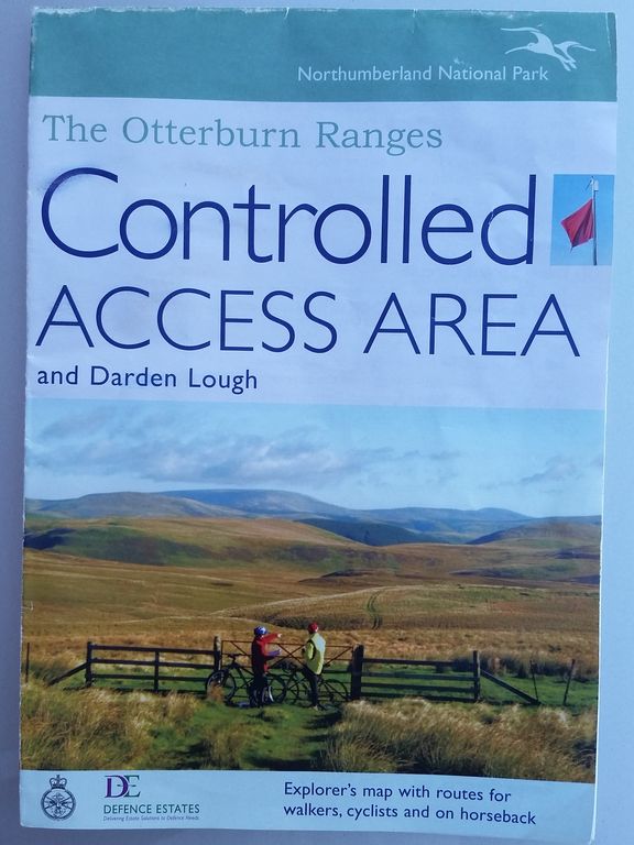
Until recently I’d assumed there was only one permissible way to reach Barrowburn and Coquet Valley by car. Along the twisty single track road from the east through Alwinton, there’s even a T sign outside the village! Then I heard of a twisty way through the military zone from the A68 near Otterburn. All was revealed when a walker very kindly gave me an access map whilst chatting on Windy Gyle summit, (as you do). So here’s a quick guide which hopefully might be of help anyone interested in this remote and remarkable area of Northumberland.
To quote the MOD; “there are no restrictions to public access on MOD land north of the River Coquet (Open Access Area). The remainder of the training area is operated under military bye-laws, and access is restricted when the area is used for live firing, (Controlled Access Area). However when it is not being used for live firing there are opportunities for cycling, riding, walking and climbing or just a drive in the car along the military roads” .
So the most important consideration is;- any road access from the west crosses Otterburn military ranges which are closed when live firing. Red flags warn when the ranges are closed. If no red flags are flying, visitors MUST keep to the roads or way-marked paths.
You can find Range firing times here, which apparently are accurate. I find the best option is simply to phone Range Control before travelling and ask if it’s ok to drive through Dere Street;- Range Control number is 01830 520569
Second consideration;- some of these roads are remote narrow single track, twisty and hilly in places, similar to some Lake District passes, (not as bad as Hardnott). Driving can be hampered by sheep on the road, farm vehicles or military trucks. Weather can change quickly with low cloud making navigation difficult. It can be bleak on the ranges and I wouldn’t go anywhere near in sleet & snow. This is for lovers of wild places, there’s no petrol stations, facilities or shops until Alwinton; just one remote and wonderful tea room, which has sadly now closed.
So why do it? Well in decent weather this might be the best road trip in Northumberland. Plus lots more;-
- Outstanding Scenery – moorlands, valleys, green hills, rivers, loadsa sheep
- Access to great hillwalking and cycling – plenty of routes in both Access areas
- Military Ranges – eerily bleak, a ruined tank, grenade shelters, loadsa sheep
- History – Chew Green Roman Fort, Dere Street Roman Road, Border Reivers etc
- Follow the Coquet River virtually from it’s source to the sea
- (Barrowburn Tea Room is now closed unfortunately).

Controlled Access roads from the A68 north of Otterburn
Two alternative routes to Chew Green & Upper Coquet Valley from the A68;-
Route 1) Cottonshope Road
Quickest access to Coquet Valley on a decent single track road. Turn north off the A68 at Cottonshopeburnfoot south of Byrness, at a sign marked ‘MOD Ranges Cottons Hope’. The junction is about 10 mins drive from Otterburn, opposite ‘Border Forest Holiday Park’. There’s also handy brown Caravan signs either side giving brief advanced notice, (park postcode is NE19 1TF).
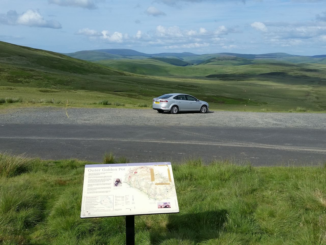
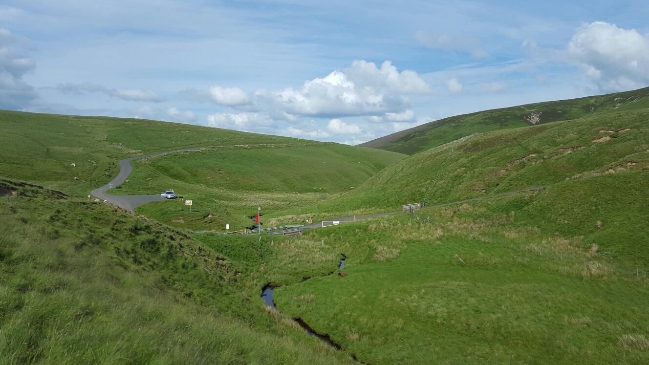
This initially runs through trees almost parallel with the Pennine Way before opening out spectacularly into green moorland Ranges. Continue north east gaining height to a junction near Middle Golden Pot, turn left (north), joining Dere Street past Outer Golden Pot, a great viewpoint with Commando memorial hidden a few feet west of the road. Then past Chew Green view, which unsurprisingly has a view across to the fort site. Final steep descent to a small bridge over a tiny trickling River Coquet.
Access – According to Ian who ran Barrowburn Tea Room this route can be safe to use even when red flag fly as it’s right on the edge of the military area. He stressed they occasionally shut the road when an Apache helicopter fires heat seeking missiles across it. Makes a change from sheep on the road I guess.
I always phone ahead asking if it’s ‘ok to drive over Cottonshope to the Coquet Valley’. I’ve definitely been told it’s ok and have then found red flags flying, all went ok.
Route 2) via Dere Street
A longer more scenic section through the ranges, but more likely closed when red flags fly. Leave the A68 north of Rochester, 6 mins drive from Otterburn. Not easy to find as not signposted. If coming from Otterburn, go through Rochester and it’s about one mile past the Camien Cafe with it’s ‘Last Cafe in England’ sign Turn right at a farmhouse, the road bends sharply right going uphill into trees. Pass a MOD sign saying ‘Private Road’, carry on to a crossroads. Go straight ahead following the ‘Otterburn Camp’ sign. Continue north east past conifers till another crossroads, turn left northwards, passing a sign saying ‘Siloans Battle Run’. You are now on Dere Street, a Roman road running from York to Edinburgh. Continue straight bending right, past Featherwood Farm then taking a left (north) to Middle Golden Pot. Great viewpoint here. Dere Street bends left over a cattle grid then right. (Route 1 joins from the left). Follow as Route 1 to Chew Green.
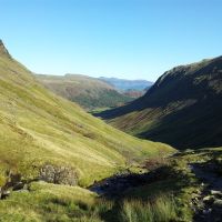
From Chew Green along Upper Coquet Valley – From the bridge the road turns sharp right uphill to Chew Green car park. Now for a contrast from the open moorlands of the Ranges to a twisty valley route through the Cheviot hills passing Barrowburn to Alwinton. Lovely route in nice weather, see photos below for a sunny day. Gradually the valley opens out following an ever broadening River Coquet on its way to the coast and sea at Amble.

Map showing road access in Upper Coquetdale
Additional info – The army have been training on the ranges since 1911, the area covers 58,000 acres, and 30,000 troops train here every year. Red flags around the range boundary are put up/down by two vans from Landmarc Support Services. Ian at Barrowburn Tea Room can tell you how many flags are involved and the boundary length. In fact anything you want to know, just ask him, nice tea & cakes too. There are many working farms on the ranges, sheep are moved away from firing areas. The ranges are open during lambing season 15th April – 15th May, and there’s at least one non firing weekend a month, and two weeks off at Xmas.
Download the Otterburn Ranges Controlled Access Area guide below, or pick up a free copy from Elsdon or Barrowburn Tea Rooms;-
- Download Otterburn Controlled Access guide PDF (A3)
- Alternative Controlled Access Guide here
- More guides to the area Gov.uk Access Maps to all Otterburn areas
- Monthly Firing times, Otterburn Range Firing times
- Interesting info on the area from National Park info and routes
- Quote from the National Park, “It is the shared aim of the Northumberland National Park and the MoD to encourage as much access to the area as possible”, within the guidelines.
Single Track Roads – please please follow the Highway Code on using passing places. “Some take things easy and drive very slowly, enjoying the landscape, but forget that behind them are people who make a living here without letting them pass. Such behaviour sometimes ends up in annoyed locals and stressed holiday makers”. A good guide for drivers here I know it’s Scotland but you’re just next to the border. Enjoy 🙂

Grenade Range on Dere Street
Outer Golden Pot, Dere St, looking east, Commando memorial 15 metres behind sign

Viewpoint above Chew Green on Dere St looking east

Chew Green viewpoint looking north over the Roman Fort (top left)

Lowering the Red warning flags from Chew Green parking, here the road turns east
Chew Green layby above a young river Coquet, Dere St crossing from the right

Trows Rd End can be the most secure car park in Northumberland

Info board at Trows Road End / Slymefoot
Ian and Eunice who run the Barrowburn Tea Rooms are retiring in November and unfortunately the tea rooms are now closed. More info and a nice tribute here. I’m sure everyone wishes them well.
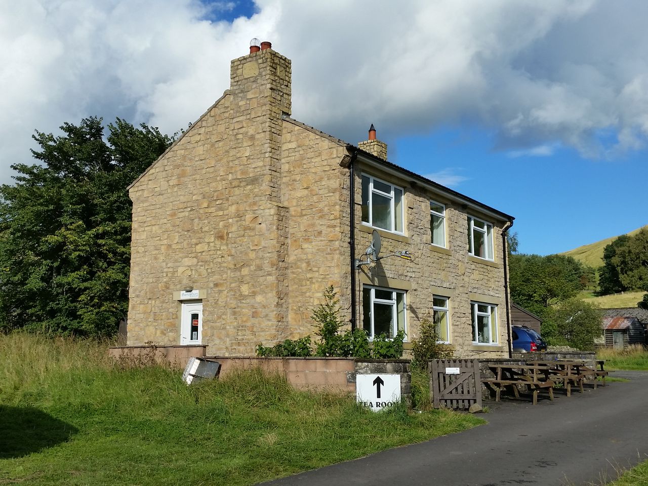
Barrowburn Tea Room, (now closed)
Finally a short video of the Upper Coquet Valley from the hills above the road.


What a great post and photos are wonderful. If I ever make it back across the pond, this one will go with me! We made a foray thru a ‘red flag’ zone heading up from Leyburn to Swaledale and Reeth. At the time, we knew nothing about these firing zones, but read the sign and saw no red flags, so we proceeded on. Some really great views and really wild country. Loved every minute!
Thanks, yes this was all new to me too, but found it all fascinating. Not sure what all the sheep make of it though.
Thanks for putting this together. Really helpful.
Thanks Pedr
wow!! 27Ben Alder and the Bike-Hammer-Brake Adventure