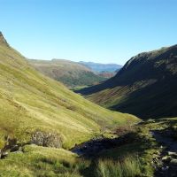
A fairly straightforward afternoon taking in 5 Wainwrights whilst trying to beat some dismal Lake District weather. The Met Office suggested possible afternoon brightness in the north east Lakes, so this was an opportunity to make first ascents of Arthurs Pike, Bonscale Pike & mini mighty Pikewassa (Steel Knotts). There was nowt to be gained by leaving early so after a lie-in we drove through low cloud, wind & rain with only the optimistic forecast preventing us from turning back. Once parked there was a little reluctance in leaving the car due mainly to the high winds. Both Loadpot & Wether Hill were in grey cloud but off we set hoping there might at least be some views on the lower Wainwrights. I’d downloaded a great route for this walk from the Walking Englishman site which was spot on.
- Distance = 8.1 miles (13.04 km)
- Duration = 5 hrs 20 mins, (start 12.26pm, finish 5.46pm)
- Total Ascent = 2,730ft (832m), max height Loadpot Hill 2,201ft
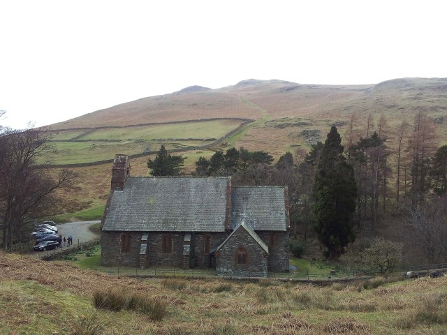
- Start/Finish = Layby opposite St Peters Church, Martindale (below Hallin Fell)
- Date = Sunday 15th March 2014, cloudy, grey, high winds but dry
- Click on my Route Map below to zoom in/out
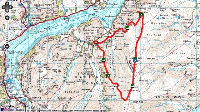
Bonscale Pike, Arthur’s Pike, Loadpot Hill, Wether Hill & Pikewassa (Steel Knotts) from Martindale
Starting Point
The layby outside St Peters Church, Martindale just below Hallin Fell. Have done two previous walks from this pleasant spot via Place Fell & Beda Fell. It also features a ‘Martin’ in the name which is always a good thing.
Route Summary – in 4 stages
- Martindale to Bonscale Pike; (1 hour 20 mins)
- Bonscale to Arthurs Pike; (25 mins)
- Arthurs to Loadpot & Wether Hill (40 mins + 40 mins)
- Descent over Steel Knotts (Pikewassa) & down to Martindale; (1 hr 50mins)
Route Detail & Pics from Sunday 15th March 2014 (photos a bit dark initially)
Stage 1 – Martindale to Bonscale Pike; (1 hour 20 mins) – The walk starts initially south east past the side of the church straight up & over the hill swinging quickly north east to pick up a level path that skirts Howtown. We broke off the path to start heading straight up towards Bonscale Pike which was still invitingly clear. Views improved with every step and even though everywhere was covered in low cloud we were just glad to be out. The route zig zags right to gain the shoulder of the high ridge at it’s lowest point.
Grey start looking back over St Peter’s Church to Hallin Fell, car’s parked over the trees – 12.30

Good path on the right descending past Howtown then diagonally up the far shoulder – 12.33
Steel Knotts from slopes of Bonscale above Howtown, St Peters Church mid right – 12.50
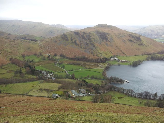
Hallin Fell from higher up with Place Fell to the left, Ullswater right (obviously)
Pleasant panorama & at least the weather was ok here – 1.05pm

We turned south east on a grassy path to this point then north east to the top – 1.30pm
Having gained the main shoulder we quickly discovered how sheltered it had been on the way up. Now it was heads down & everything zipped up for the grassy trudge to the top.

Now just a grassy plod north east to Bonscale Pike far more exposed to that wind – 1.33pm

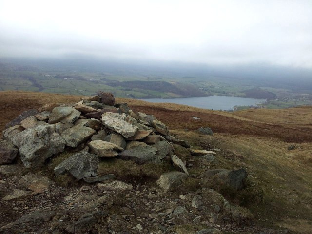
View over Bonscale Pike cairn faeturing Hallin Fell, Ullswater & a low cloud line – 1.45pm

Bonscale Pike looking north east to Little Mell Fell still in cloud

Bonscale Pike looking north across Ullswater to more grim weather everywhere but here!
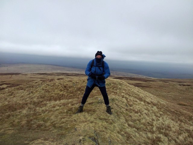
Photos usually dont do justice to extreme wind, so to illustrate how bad it was up here please see the one below of me trying to take one of the pic’s above 🙂

Wind problem on Bonscale Pike, it wasn’t possible to hold the camera any nearer the edge
Th e wind was being funnelled up and over the shoulder of the ridge so the closer you got the more incredible the force. Trying to take pictures any nearer were impossible without a tripod and a 2 ton anchor. Views were limited by the greyness however an interesting feature up here is the 2 stone towers just a few feet north of the summit cairn.

Bonscale Tower
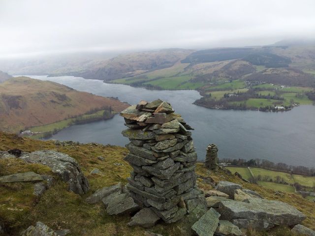
Lord of the Lakes, the Two Towers!

Seeking any shelter possible on Bonscale, taking the pic below – 1.55pm
Stage 2 – Bonscale Pike to Arthur’s Pike; (only 25 mins) – We followed a path heading north west straight for Arthur’s Pike but then had to quickly divert back south east to circumvent a stream cutting deeply through the grassy shoulder. (It could therefore be a bit quicker to head east from the top). Either way it’s then a grassy featureless trudge to the cairn on Arthur’s Pike which is located a little off the shoulder edge. To get better views of Ullswater we dropped down to a couple of lower cairns.

Looking north west to Arthur’s Pike, the grassy path top right

Cutting back south east to circumvent the stream, Loadpot in cloud, we turned left next – 2 pm
Summit cairn on Arthurs Pike – 2.20pm
Arthur’s Pike looking north west
Alan suffering from bad wind, no change there then

Bigger cairn down from the summit giving better views

Would imagine on a better day this would be very pleasant – 2.25 pm
Stage 3 – Arthur’s Pike to Loadpot & Wether Hills (via Roman Road, 40 mins + 40 mins) We’d been wondering if the next stage might be a little rough as there’s not much shelter up on the higher flat ground of Loadpot & Wether Hill. Fortunately retracing our steps back up over Arthur’s Pike we found the wind effects lessening as we walked away from the funnelled shoulder. Encouragingly Loadpot also looked cloud free for the first time today. We soon found the path running south along the old Roman Road (High Street) and up to the trig point on Loadpot Hill. The weather was improving just in time 🙂
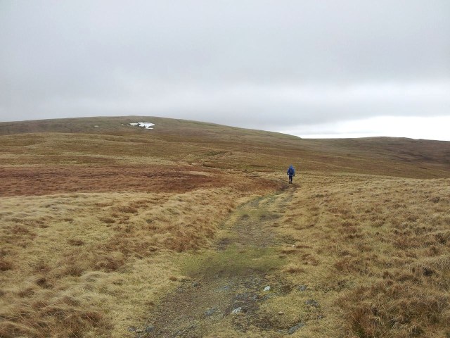
The Roman Road to Loadpot, this is all – 2.50pm
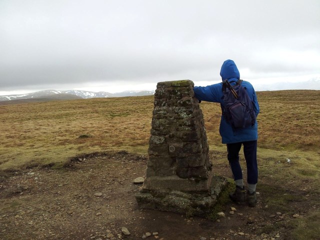
Loadpot Hill and hey the cloud is lifting, and there’s more mountains out there!! – 3.10pm

Me on Loadpot Hill taking the only shelter available, looking happy(ish)
Due to the lack of shelter we didn’t hang about on Loadpot so set off south through the flat brown grassy terrain arriving on Wether Hill at 3.55pm. My phone crashed for some reason and wouldn’t restart until a battery change so there were no photos for a while. This was ok as Wether Hill is remarkable for being erm unremarkable. Actually there was one remarkable thing as the weather on Wether hill was distinctly improving. Seemed like the Met Office were right and we had good views west to the Helvellyn range.
Stage 4 – Descent from Wether Hill over Pikewassa back to Martindale; (1 hour 50mins) We continued on southwards over and past Wether Hill keeping to the high ground eventually to meet a wall. Here it was time to turn right and start the descent back to the car over Steel Knotts. There had been a big temptation to angle down the grassy slopes of Wether Hill before this point however by trusting the downloaded route we discovered the path following the wall to be mostly excellent. We were soon closing in on lowly but lovely looking Pikewassa (it just sounds so much better than Steel Knotts).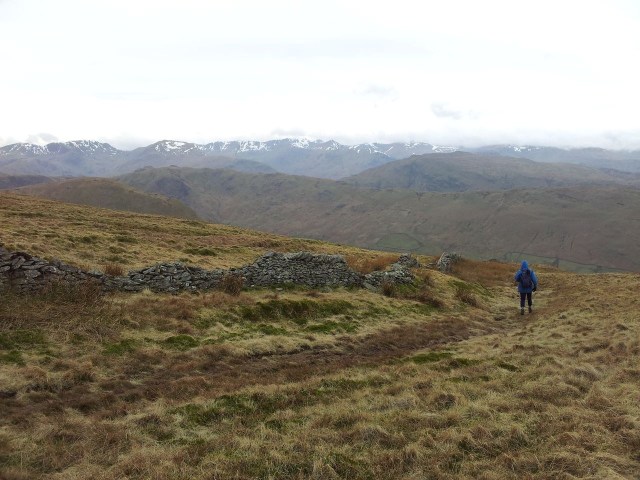
Leaving the main ridge & turning north west to Pikewassa – 4.10pm

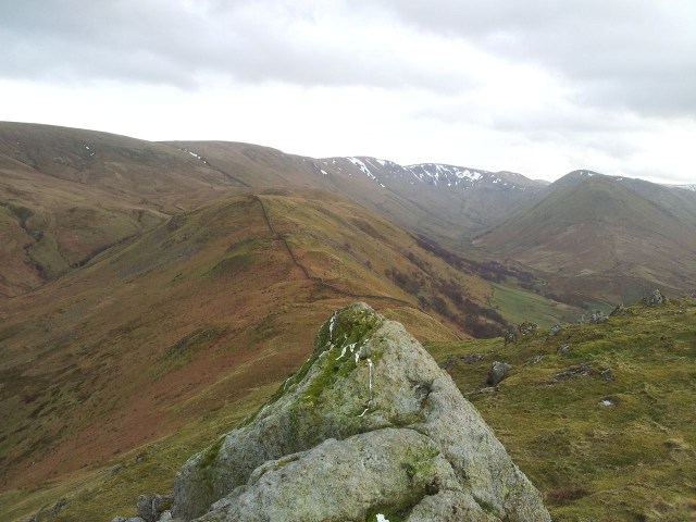
Remnants of what must of been impressive snow cover, with the Helvellyn range beyond

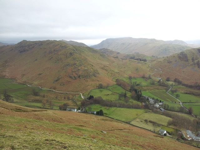
The old ruin, Alan crossing the stream. Route follows the wall over Brownthwaite Crag, with Pikewassa far right – 4.40pm

Best light of the day now with Pikewassa ahead & Great Mell Fell appearing further left

A lovely old path, nice to walk on – 4.55pm
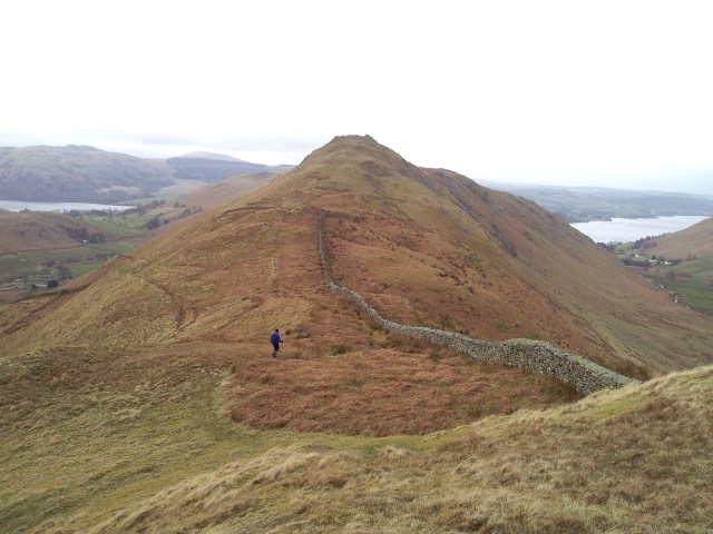
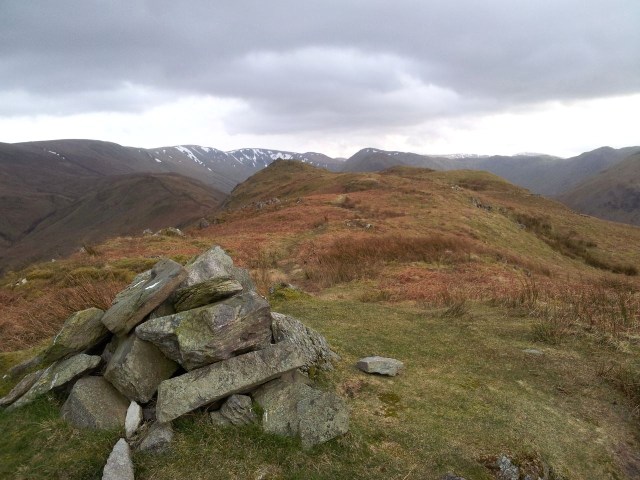
Steel Knotts, topped by the bit of rock, Pikewassa (below)
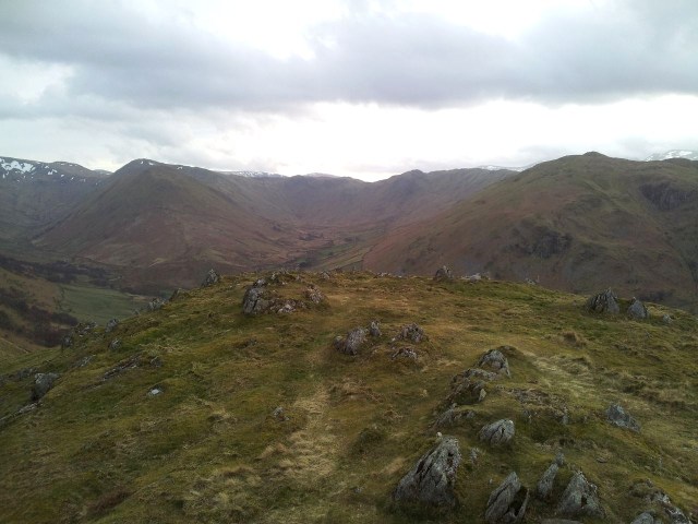
View s east over Pikewassa, descent route along wall plus Rampsgill Head, The Knott & The Nab

View north from the same spot, we carried on along to the next cairn on Steel Knotts – 5.20pm
View south west, The Nab and Beda Fell
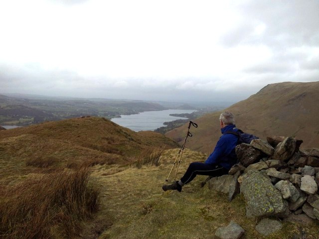
Alan in contemplative Wainwright pose looking north, Alfred was considerably younger

The route down, with Hallin Fell above, hey that Alan’s buggered off ahead again – 5.30pm
From the same spot but looking south back over Pikewaassa to the bigger stuff
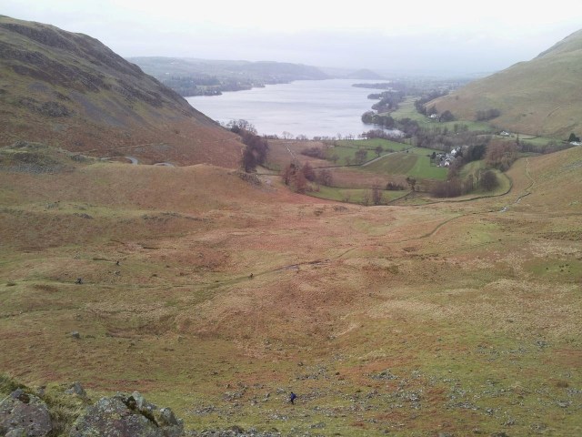
From Pikewassa to Ullswater (our start path to Howtown crosses right). Alan down below

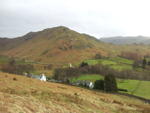
St Peters Church, Martindale below with Hallin Fell beyond, the car’s not far now – 5.36pm
Back at the car for 5.50pm after a short drop down to the church. Lowly Pikewassa was fun, not far from the road, good viewpoint, nice shape. Enjoyed it. This was a day we could so easily have have saved some fuel money and stayed in Hexham, however by placing our trust in the Met Office over other less optimistic forecasts the day was saved. It was also a day where trying to do something more spectacular would have been less spectacular – if that makes sense. At the end of the day it was a good day. And that’s a lot mentions of the word day.
- The Walking Englishman gives 3-5 hours for this walk, we did it leisurely over 5 hours
- Can do clockwise or anti clockwise, depends on the breeze, nice finishing on Pikewassa
- Main ridge is wide and featureless so needs careful navigation in cloud
- Mid March & only my second Lakes trip this year, at least the blog is back after 8 laptopless weeks
- Alans farts are less dangerous in high funnelled wind conditions