
Another weekend Windy Gyle walk, a slightly new route and a chance to play in the snow! What could go possibly wrong, well actually nothing, it was an excellent adventure. Also the chance to show a friend the Upper Coquet valley for the first time and views from the Border Ridge. Clear skies were forecast with hill fog due on the tops from mid afternoon, so a quicker ascent route was needed to ensure those views. With far more snow on the hills than expected this would be a fun afternoon in the Cheviots.
- Distance = 9.4 miles (15.13 km)
- Duration = slow snowy 5 hrs 42 mins, (12.00am – 5.42pm with 50 mins on top)
- Total Ascent = 1,962ft (600m), max height Windy Gyle 2,031ft, 619m
- Start/Finish = Wedder Leap Car Park, Barrowburn
- Date = Sunday 8th February 2015, clear, dry, cool and impressive
- Click on the interactive Route Map below for more detail

Wintry walk up Windy Gyle from Wedder Leap – Barrowburn, Border Gate & Fairhaugh route
Start/Finish Point – Wedder Leap Car Park near Barrowburn Tea Room 15 mins drive west of Alwinton along a scenic single track road, mind the sheep, armed forces & potholes
The stunning drive up the upper Coquet valley had rarely looked better as we pulled into a snow filled car park. First thing was to whip my ancient Yeti gaiters on, luckily no one was around to see this distressing sight!
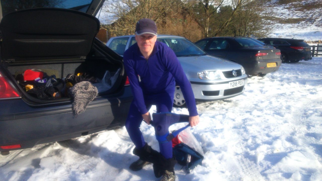
Whipping my gaiters on at Wedder Leap car park
Once dressed it’s a pleasant short walk north up the road by the river turning off to the Farm Tea Shop. They were closing at 4.00pm so little chance of finally making it back in time for a cuppa. Instead of following the Hepden Burn we walked around the farm making for a path ascending the hillside directly behind. This is marked “Border Country Ride” on the OS maps ands takes a rough line up towards the direction of Windy Gyle bypassing Barrow Law, gently rising with attractive views back down the valley.
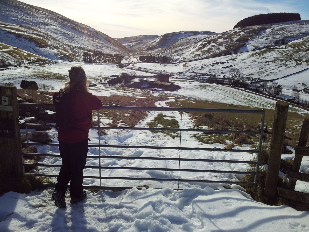
Gate posing – looking down south over Barrowburn

Look no gate! Car is parked in the trees above the farm buildings
Soon the path starts to level out with views opening up along the Usway Burn valley across to the remote farmstead of Uswayford. We passed a few armed squaddies, (always slightly alarming), fortunately due to my Ron Hills and the cold weather it was obvious I had no concealed weapons. After a few minutes of gentle descent we passed a small wood, but this is no ordinary wood, it’s Murder Cleugh! A Cleugh is a valley/ravine, a murder is an unlawful killing, which you probably knew. And here marks the spot!
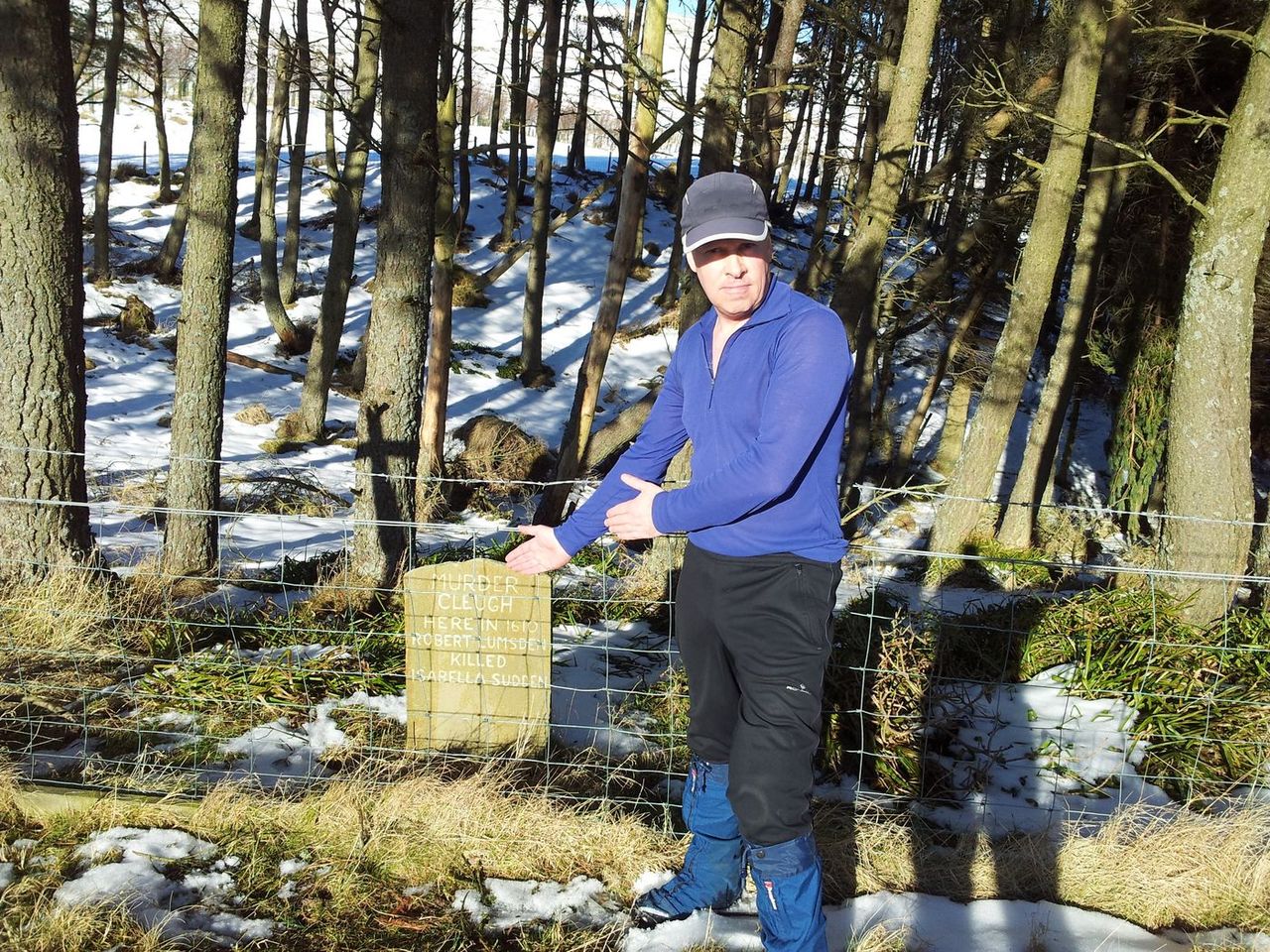
I’m actually a cardboard cut-out for the tourists
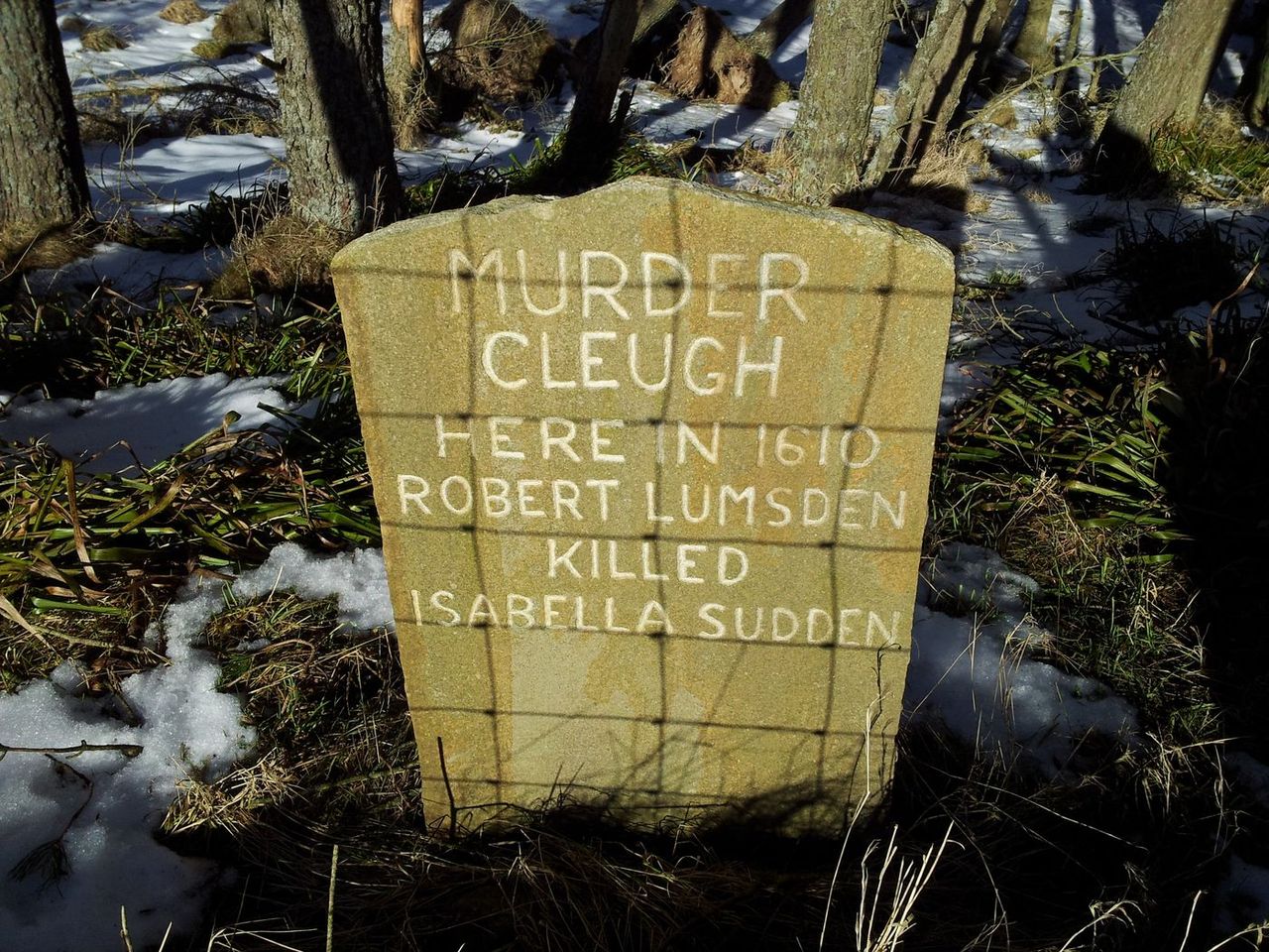
There’s been a murrderr!!
Next the gate incident! Hadn’t slept well due to a take away the night before, anyway as I bent down to gallantly open a gate there was an ungallant wind noise. It’s very quiet in the Cheviots, I’d hoped my friend hadn’t noticed, alas she’d already collapsed crying with laughter. I tried blaming the rusty gate hinge to no avail, if only Alan had been here I could’ve blamed him! Anyway let’s say nothing more about the Windy Gate incident, (hangs head in shame).

The Windy Gate of shame!
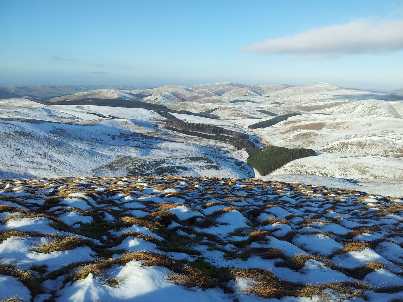
Through the gate, we crossed the private road/track following the walkers in the photo above to start another gentle ascent heading north. With a little height gain we suddenly noticed behind us a distant line of low cloud which seemed to have sprung up from nowhere. Slight panic ensued as I feared the delights of Windy Gyle may be lost in mist. We made a quick diversion to the nearby bump of Ward Law to at least secure some views. Nice bump, nice views, worth the detour.
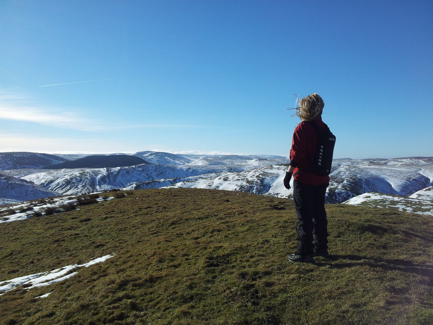
The hills are alive with the Sound of Music (winter edition)

Ward Law looking over to Bloodybush Edge – (not bloody, not bushy & not an edge)
We needn’t have worried as the improved views soon allayed any cloud fears. All was ok looking west which meant Windy Gyle would be something to look forward to. Firstly a boggy descent to rejoin the path which then swings north west to start the final peaty ascent up Windy Gyle. Bit snowy too.

How to walk in snow lesson one – this is not how to walk in snow!
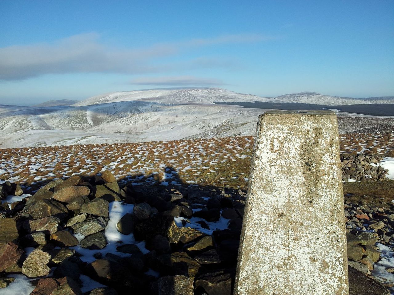
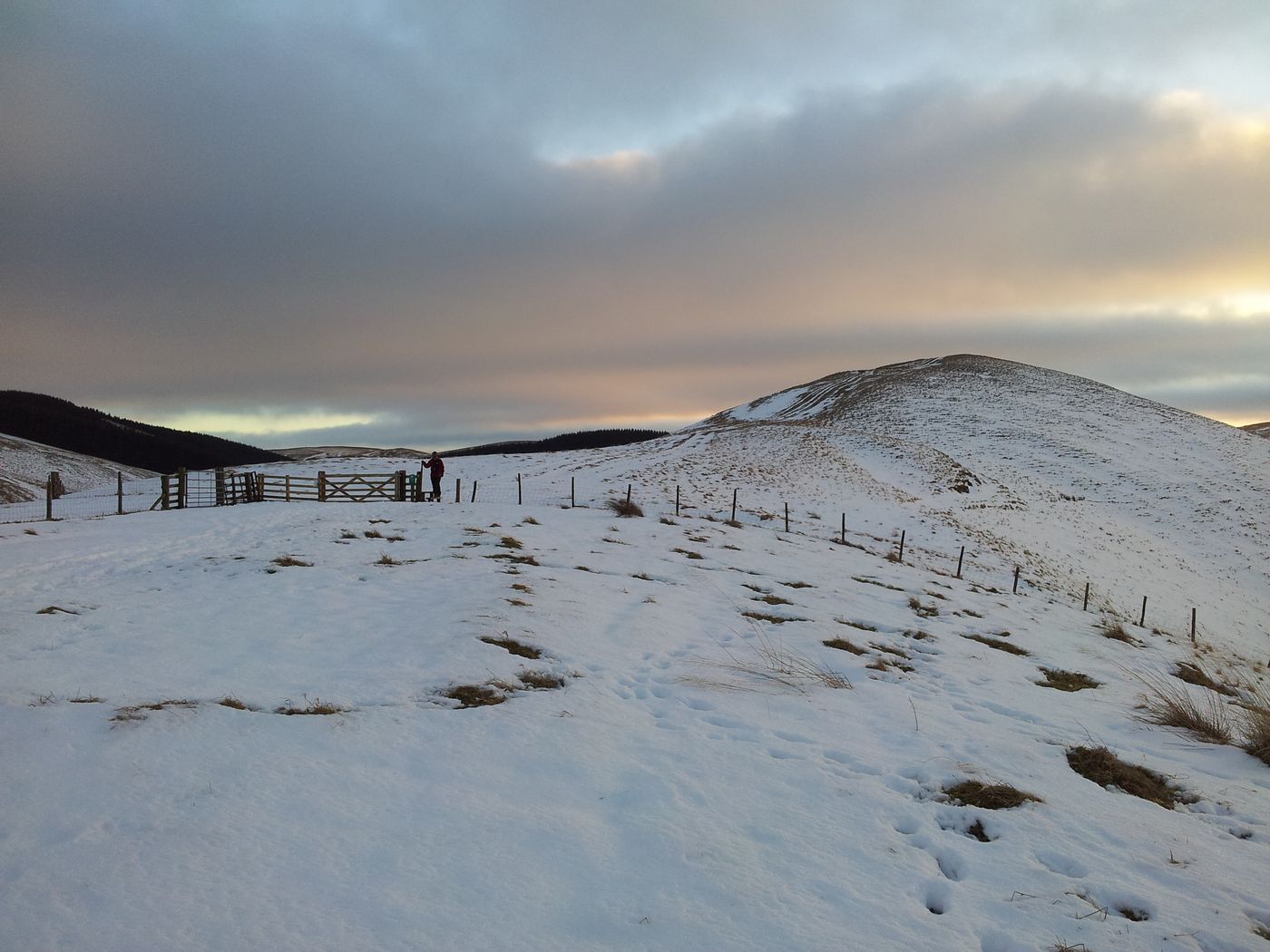
One of the advantages of the more direct routes from the Coquet valley is you’re shielded by the high ground until the end. Firstly you see a gate then a sign and a large cairn.

The view back south from Windy Gyle summit
Then the full scene west and north bursts into view, something that grabs you every time. For a relatively ordinary looking 2,030 ft hill Windy Gyle certainly delivers and is my favourite spot in the Cheviots. You are in England and Scotland AND Lord Francis Russell was killed near here in a border dispute in 1585. It’s all kicking off on Windy Gyle.
The Cheviot & Hedgehope looking east from Windy Gyle
There’s a welcome shelter too, it’s often windy on Windy, and you may want to stay awhile.
Windy Gyle view north over Russells Cairn cairn shelter
Always the highlight of the day and a good place to refuel but always wrap up as the body seems to cool faster here than the coldest of cold places. Wearing a dead squirrel on yer head can help apparently. As can being slightly silly.
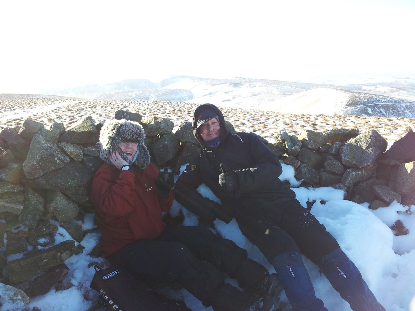
Windy on Windy – and it’s not me this time!

Brownie selfie, such a flattering photo, check our Buffs out!

I can describe the horizon with my eyes shut – that’s Great Gable over there!
Bizarrely I met my hill twin in the car park and then again on top, both of us wearing black Paramo Fuera windshirts with red rucksacks. I pointed out he’d let the side down with his non regulation black trousers!

Two fashion icons, colour coordination is allegedly vital in the hills!
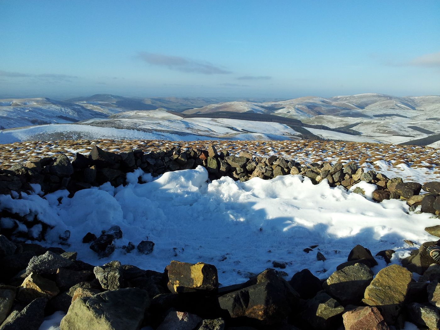
Descending slightly north from the summit gives a better view north, lots of lovely bumps.
Windy Gyle view north, not bad at all

Windy Gyle view east again with the Pennine Way snaking to the Cheviot
Always a reluctant place to leave, usually the stinging pain in your freezing fingers helps you on your way. We retraced our steps southwards to the stile by the gate, then turned east following the paving slabs of the Pennine Way down to the Border Gate. These often slippy slabs were a joy to walk on in the snow but ALWAYS stick to the path as the snow obscures some watery hell holes either side. A few deep foot steps left by previous walkers served as a constant reminder – and raised the odd laugh too 🙂 Ooh notice that patch of cloud forming over the Cheviot in the pic above which had rapidly expanded in the photo below. 3.15pm and the Met Office were pretty accurate again.

On the Border Ridge/Pennine Way balancing on a stile with a furry hat, as you do

Looking back up west to Windy Gyle
Windy Gyle has an excellent cairn shelter, two in fact as there’s also a mini one. The Border Gate however has a wooden log, nice. I’ve sat on it so many times and poured a cuppa. Today it was also a good place to throw snowballs.

Border Gate looking west – I may just allegedly have broken wind again
Time to leave the high ground and turn south for the slow descent back, firstly the featureless plateau between the forests before dropping down by Hazely Law. Walking down this section was mostly hilarious with the snow holding most but not all footsteps with just a few crashing through to bowl you over.

Snow plateau

Hepden Burn & Murder Cleugh from the east
The path descends to the Usway Burn valley before we nipped up over The Middle in tremendous light then through the dark forest of death via Fairhaugh.
Approaching The Middle
The wonderful light started to fade and we carried on south descending gradually back down to Barrowburn and the car at Wedder Leap for 5.40pm. It had been hard going at times in the snow but worth every deep step. That crunching sound of boot on snow was also a constant and welcome companion throughout the afternoon. The windy sound from my backside less welcome.
Today had been immense fun mainly due to the great weather, great light, great company and lovely snow. Not too cold, not too windy, no need for axe or crampons, just nice gentle gradients, (in icy conditions more care would be needed of course).
Another plus was ascending Windy Gyle via a missing route in addition to the usual ones;- 1) Via Trows Road/Slymefoot, 2) The Street, and 3) Today’s descent route via Fairhaugh. All differing in timings and features and all with their merits. Pint & food at the Anglers Arms at Weldon Bridge, on the drive back to snowless North Tyneside.
Some alternate routes;-
- Anti clockwise from Trows Rd End – 10 miles
- Alternative 13 miler inc Bloodbush edge & Davidsons Linn
- Slightly longer route including Shillhope – 10 miles
- Trows Rd End inc Lamb Hill – 15 miles
Link to Windy Gyle weather forecast


Snow!! What is snow? Dont have that here in oz! Great pics!
Ah there’s nowt like a bit of snow, it’s just the cold & darkness I don’t like 🙂 Thanks.
Looked a great day out, nice photos.
Thanks Paul, it’s not the Highlands or the Lakes yet the Cheviots can be an excellent walking area. If ever your knees give in head for Northumberland 🙂
We seem to regularly frequent the Coquet Valley, and have done the first half of that walk at some point (we went back a different route!). It’s a great place to wild-van-camp for a few nights. 🙂
Was just looking at a couple of your Cheviot walks 🙂 Yes I’m drawn to the Barrowburn area, only 50 miles away, 80 min drive. Many route variations available. I always end up on Windy Gyle which adds a nice incentive.
Yet to make it to Chew Green though it’s on the list. Lovely area isn’t it even with the odd explosion 🙂
We don’t actually mind the odd explosion! Spent a while one afternoon watching an Apache helicopter shooting at targets – was great fun 😀
Ooh where was that from? Have you walked inside the military area at all?
If you drive right up to the bridge at the little Chew Green car park and then continue another half mile or so past the flag, there’s an information board/viewing area. We were stood there watching it. But no, I’ve not walked inside the military area yet. Not that I know of, anyway! We’ve certainly driven through it, as we usually approach from the Byrness road.
Ah now is that the way in to the Coquet Valley from Otterburn? Very curious to try this, what’s the best route, is it straightforward?
I think it’s straight forward once you’ve done it a few times! From memory, I’m not sure if all the little roads there are on the map, but there are different turn offs you can take from the main Byrness road. We’ve definitely done at least two different routes in, but have now saved the favourite turn off on the sat nav…
Ok thanks, might try this when driving up from Hexham, would be much quicker.