
For many of us the Cheviot often seems a big boring lump of soggy Northumberland peat. But at 2,674ft this is England’s highest point outside the Lakes & Pennines. It’s few interesting features are hidden away on the remote north western edges (best accessed from the College Valley). Unfortunately those of us approaching from the more populated south east get the boggy lumpy side!
There’s three familiar route options, all from Langleeford in the Harthope Valley ;-
- Direct route up Scald Hill – popular, increasingly tedious, often annoyingly boggy
- Follow the Harthope Burn up the valley – some like it, not keen myself, feels hemmed in with limited views.
- Via Hedgehope – often climbed after the Cheviot but can be done first. A fine hill but in either direction the peat hags over Comb Fell are rarely less than unpleasant, spoiling what could be a fine route. Best kept for a dry period or after frost.
However here’s a fine fourth alternative, avoiding the Scald Hill ascent by a diversion north west. This longer but hugely more interesting route continues around the Cheviot then clambers up through its very best feature. Put simply, the best route from the east is simply to ascend from the west!
Covering 13 miles, 3 valleys and 3,300ft of ascent, this circular walk starts in Harthope Valley, through remote and peaceful Lambden Valley, joins remote and peaceful College Valley, then ascends through the fascinating craggy waterfall-filled Hen Hole. The Cheviot’s bog filled summit plateau is traversed on the firm slabbed path, with a final fairly rapid descent over Scald hill back to the car.
If you never felt any affinity with the Cheviot then try this. You’ll leave with a greater understanding of this remote area, and you might just begin to like it.

The Cheviot via Lambden Valley, College Valley and Hen Hole from Langleeford
- Distance = 13 miles (21 km), anticlockwise
- Duration = 6hrs, (start 12.50, finish 18.50)
- Total Ascent = 3,300 ft (1,006 m), max height the Cheviot 2,674 ft (815m)
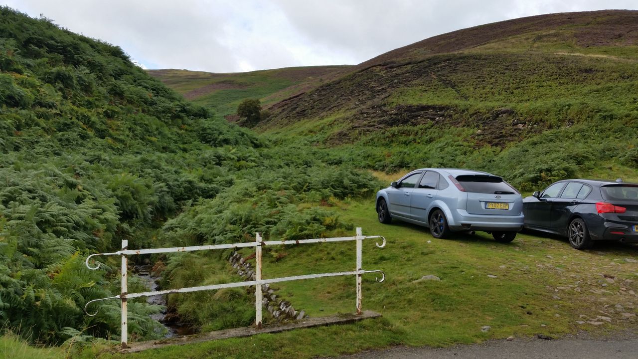
- Start/Finish = Car park east of Langleeford, Harthope Valley, Northumberland
- Walk Date = Sun 15th May 2016 (some late summer photos added for contrast)
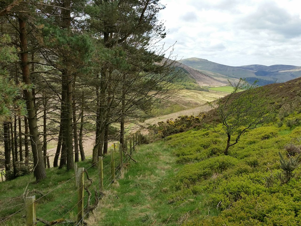
Park at the popular grassy parking area near the end of the single track road up Harthope Valley, just before Langleeford Farm. Take the usual Cheviot route by walking westwards along the road. Almost immediately, leave the road at a small bridge over Hawsen Burn. The aim is to follow the north side of the Hawsen as it curves westwards. Avoid an inviting low path along the burn banks as this has become eroded and is infested with dense bracken in summer. It’s a faff, so instead angle northwards from the bridge up a feint track through heather as if heading directly to Cold Law. After 30ft or so veer north west keeping high above the burn. Trust me, it’s worth it. Soon the feint track turns into a path which joins a much wider access path still high above the burn.

Turn off the road northwards on the east side of the Hawsen Burn. Don’t follow the path by the burn, go diagonally up a few feet to find a higher track
Same spot in late summer full of dense bracken

View back down the Hawsen valley after a few mins walking
Stay on this path, keeping to the left as it splits (photo below), gently rising north westwards. I tried a signposted track closer to the stream but this just slows you down, especially in summer. Not the most inspiring scenery so far, best views are backwards. Heard Cuckoos and saw my first Ring Ouzels, which livened things up.

Path splits, go left

Looking back east again from higher up the Hawsen Burn, Cold Law left

The Cheviot suddenly reappears to the south west but our route heads round the lumpy thing to the right
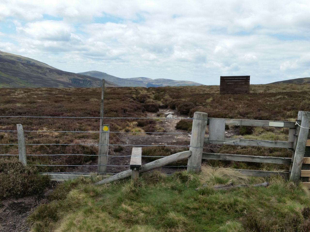
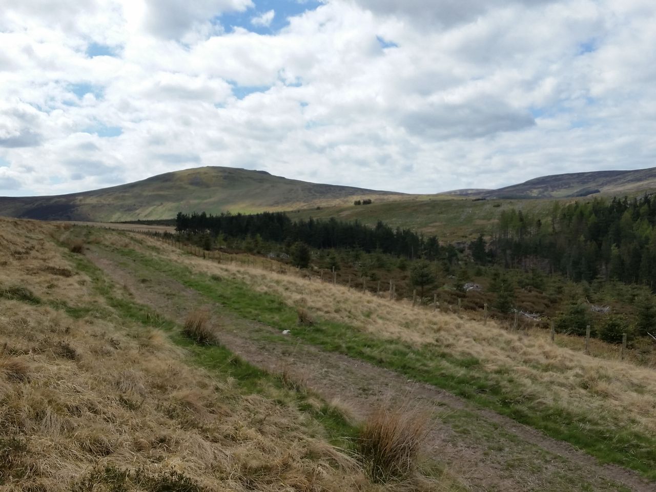
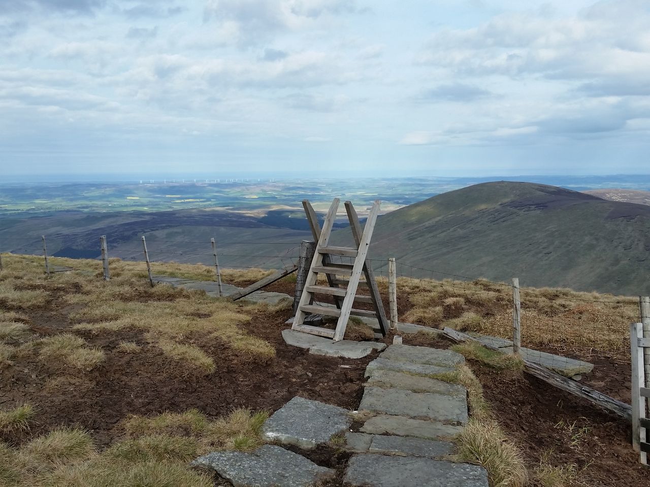
Once the path levels, continue westwards by one of the heather tracks to meet a fence. If lucky you’ll end up opposite a wooden gate, if not then just follow the fence north till the stile appears. Do try and use the tracks as the heather ground is not particularly invitin,g unless you’re a grouse. Once across the stile, follow a path westwards.
Cross the stile to start the Lambden Valley section
And on a nice late summers day
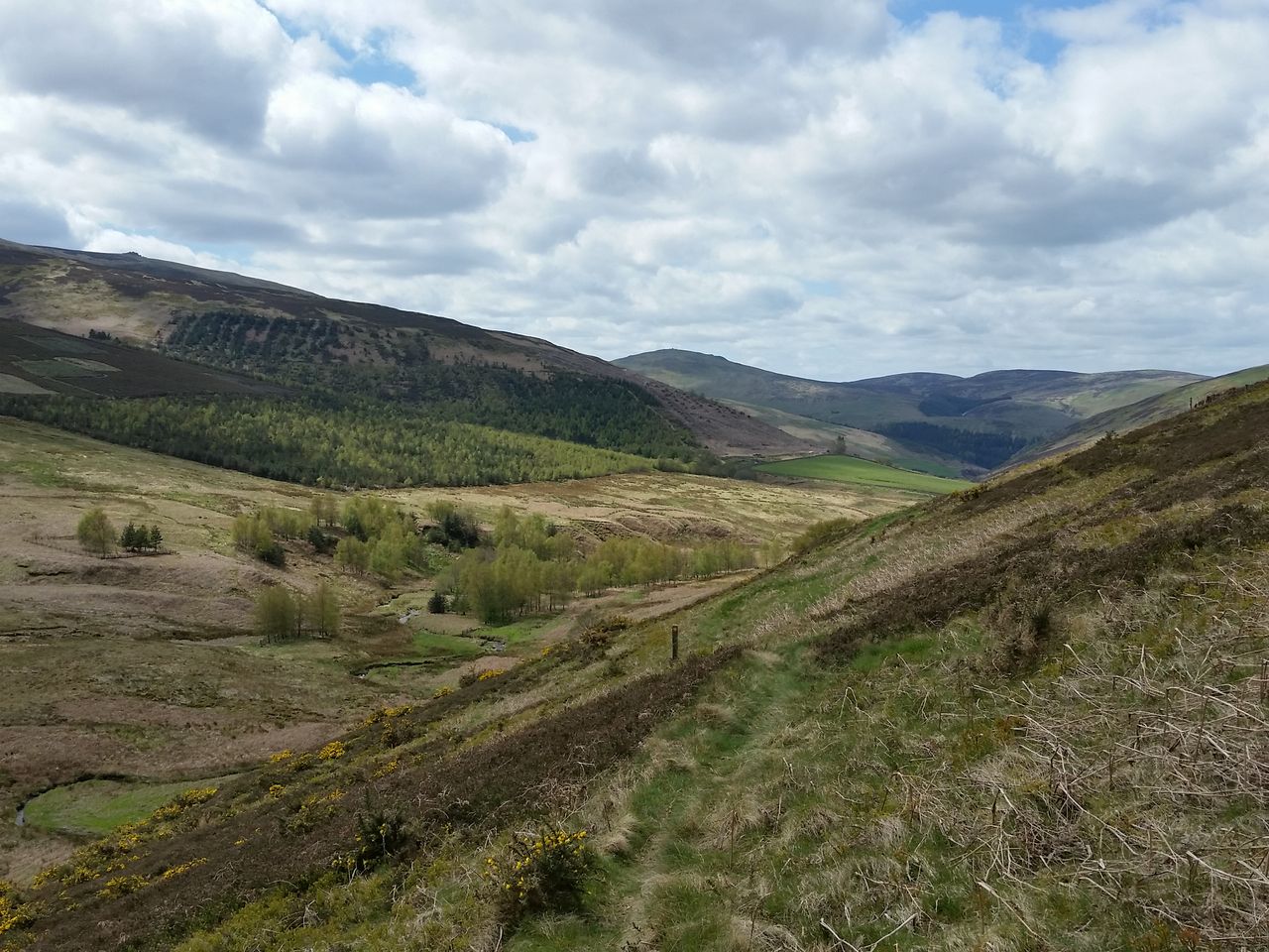
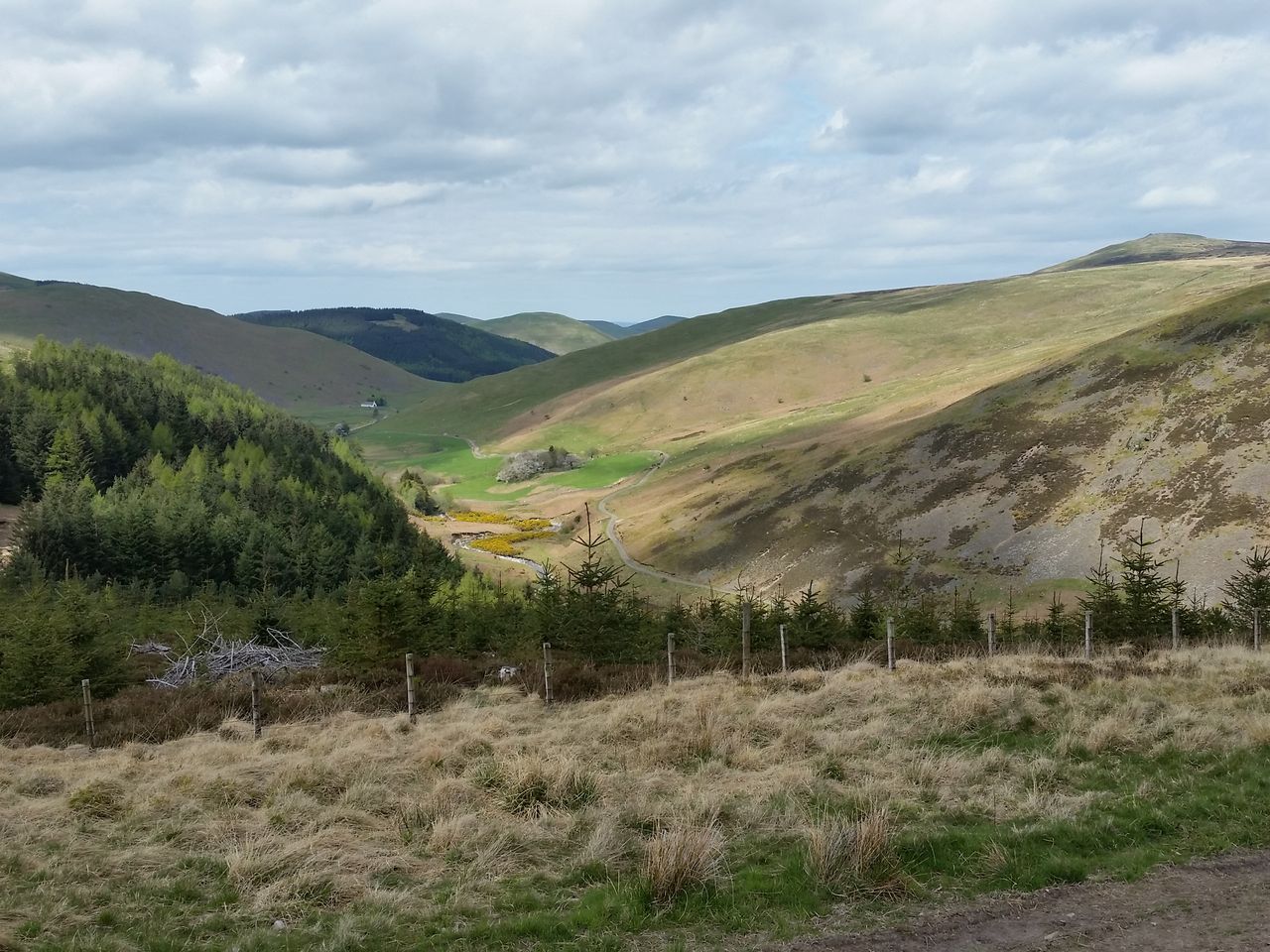
Lambden Valley – Now for a change of scene as the Lambden valley opens up ahead. Flanked by the Cheviot’s more attractive northern side, these are pleasant views many Cheviot baggers never see. The path descends gradually through heather moorland, watch out for hidden holes in the last section, harder to see in summer.
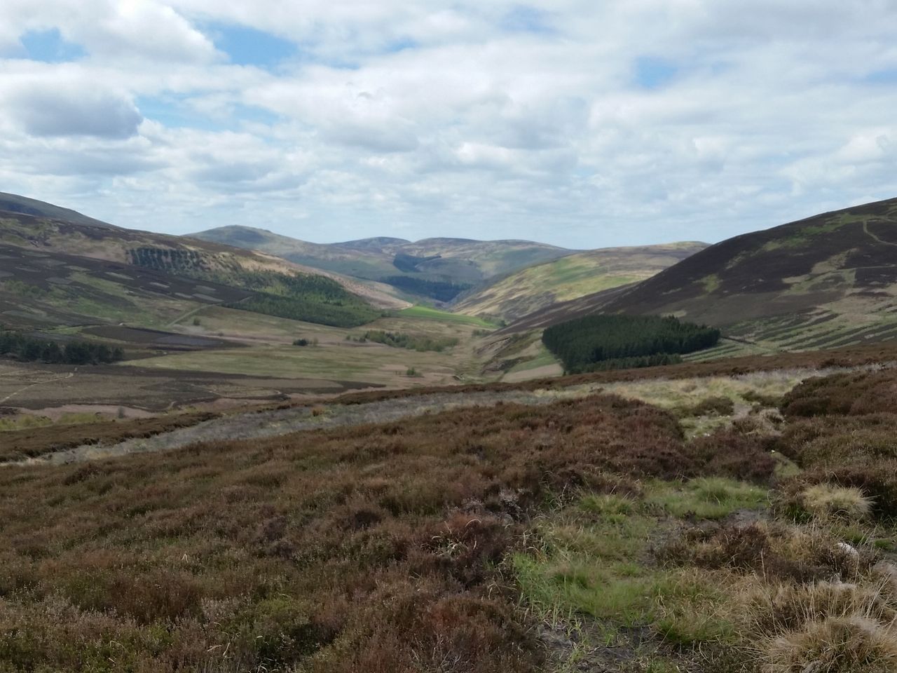
Lambden valley ahead, the Schil on the horizon, head for the wood
A forest vehicle track is joined briefly then continue to a small wood below Preston Hill.

Follow path round to the wood below Preston Hill

Go over the gate then left along the side of the wood round a fallen tree
This used to be simply a bit of fun winding through the trees dodging conifer branches before emerging into the open. However recent tree falls have barred the initial woodland path. Best go over the gate and round the wood along it’s north side. Once past a fallen tree either follow the fence or nip over it back into the wood to find the path. This can be full of ferns in summer, so if poss try to get back into the wood.
By-passing the trees, easy in May, less so in late summer

Leaving the wood, head straight on, through more bracken in late summer
Westwards along the open Lambden valley descending gradually
This is now an attractive valley walk, more open and varied than the upper Harthope. It’s pleasantly peaceful here, colours vary through the seasons and the Cheviot shows off it’s finer side. Continue west over a small stream then sharp right over another stile to emerge above remote and lonely Goldscleugh. Cross a larger stream then pass the abandoned farmhouse and inhabited bungalow to join a pleasant little road section to Dunsdale.
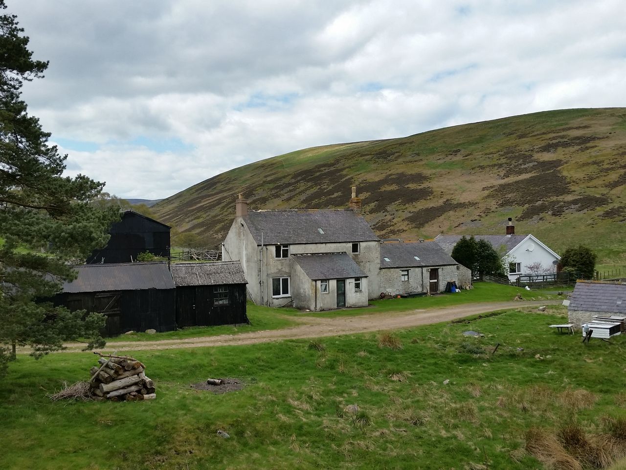
Remote and lonely Goldscleugh

Now along the private road to Dunsdale, nice views down to the river on the right
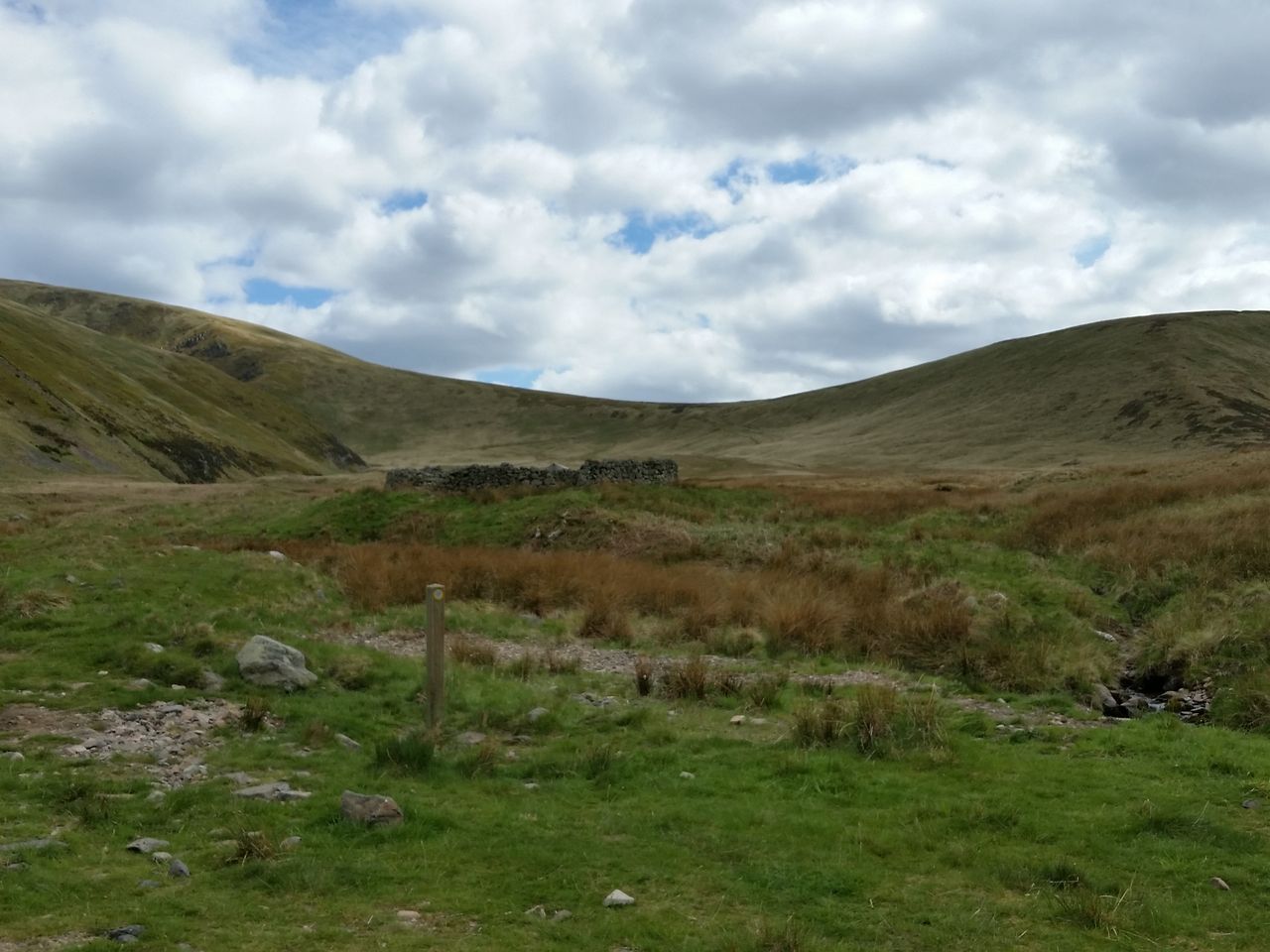
Amidst the air of solitude Dunsdale is now a holiday cottage so you might actually see a human being! Great views south up the Bizzle which gives an alternative route up the Cheviot. By now Langleeford seems far away, but remember that initial ascent, well you’ve just lost all that height gain just to arrive down here! But the best bit’s ahead.

The Bizzle from Dunsdale, a rare feature on the Cheviot
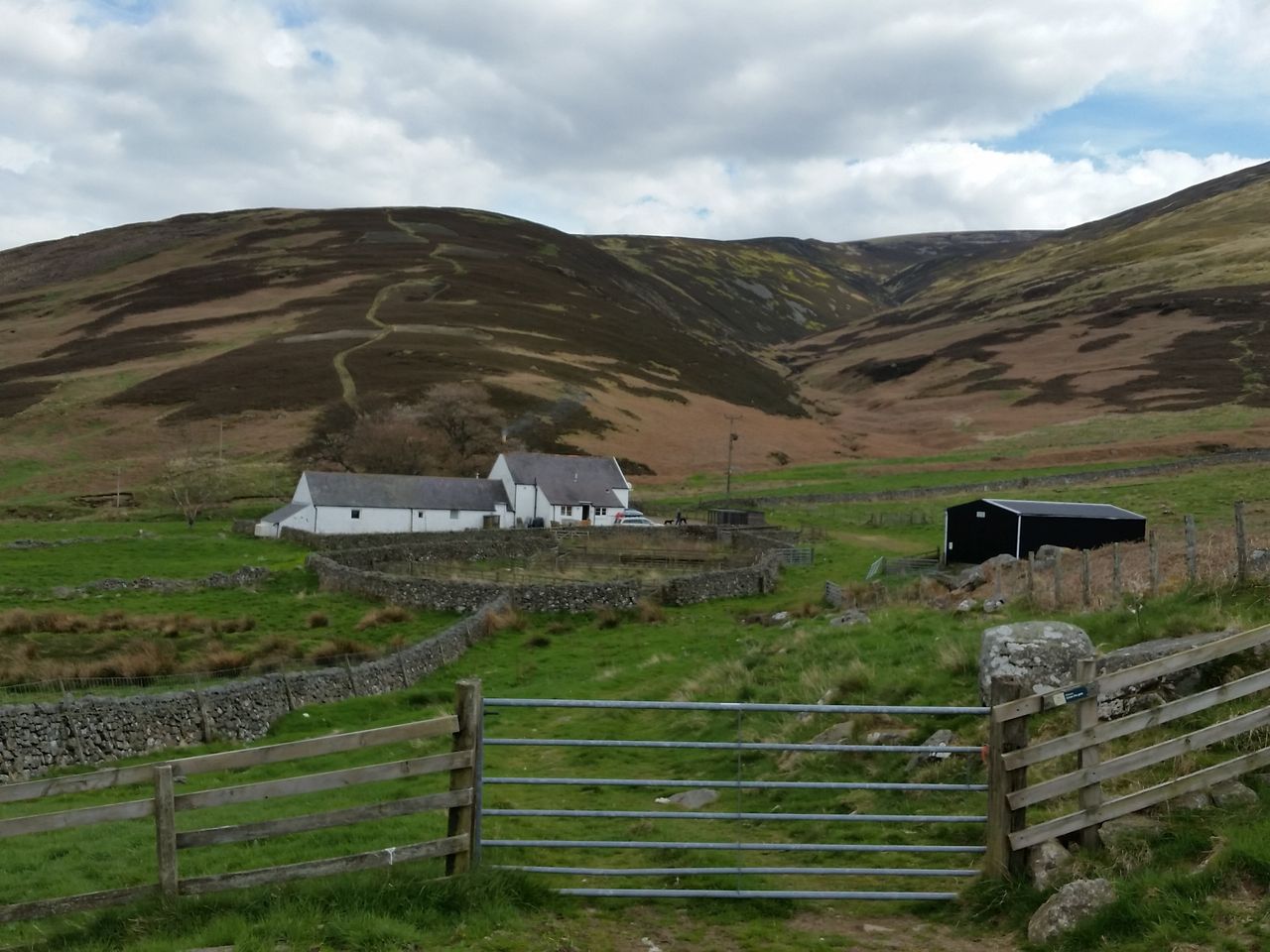
Looking back at Dunsdale
Walk by the south side of Dunsdale cottage through a gate past the barn, then through the gate above (looking back east). Now to leave the Lambden Valley and start gaining a little height again turning south west still flanking the Cheviot. Another change of scene with views northwards down the College Valley.
Looking back up (but really down) the College Valley northwards
Looking to the route ahead with the Schil getting closer

Now descending into the upper College Valley
Descend gradually through open ground then over a huge stile to ford the College Burn. Or before the stile head straight down and round the fence. The ford was a trickle in May but in late summer after a downpour was above boot height. I carefully traversed the stones using trekking poles for balance.
College Valley – Once over the river you join a wide path to the head of the valley. Now to follow the College Burn virtually to it’s source on the Cheviot plateau. College Valley has a well deserved reputation as a remote and beautiful place. Access is usually from Hethpool as vehicle access is restricted. A few cars are allowed up each day so you might see a few people at the Mounthooly YHA bunkhouse. Enjoy the situation and appreciate the variety on this walk.

The main College Valley path south up the valley

Upper College Valley
Approaching the head of the valley you’ve reached the furthest point from the start. So far it’s been reasonably gentle which makes for decent progress. Now to finally turn back to Langleeford and start the ascent over Cheviot. Quickest route would be to follow one of 2 paths either side of the Refuge Hut, then trudge up to Auchope Cairn.
However if you want the best route up the Cheviot then take the Hen Hole, probably the most impressive hike in the Cheviot hills.
Main paths go up to to the Refuge Hut, but we go to the left following the river bank

Looking back down the valley to the Schil from the College Burn
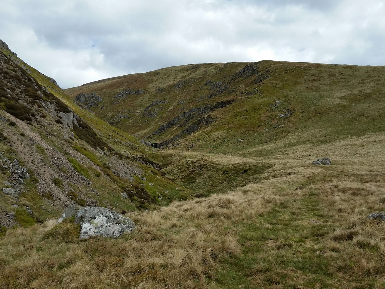
Following the burn as it turns east into the Hen Hole
The Hen Hole – A hanging valley formed in the ice age, this is the surprise of the Cheviot hills. There’s an initial path but then you end up criss-cross the stream trying for the best line of ascent. Nothing difficult, hands on in places. It’s as though all the waterfalls in the Cheviots were scooped up and deposited in this narrow ravine. The photos below give the best description even on a hazy day. I had a smile all the way through, it’s pure joy.
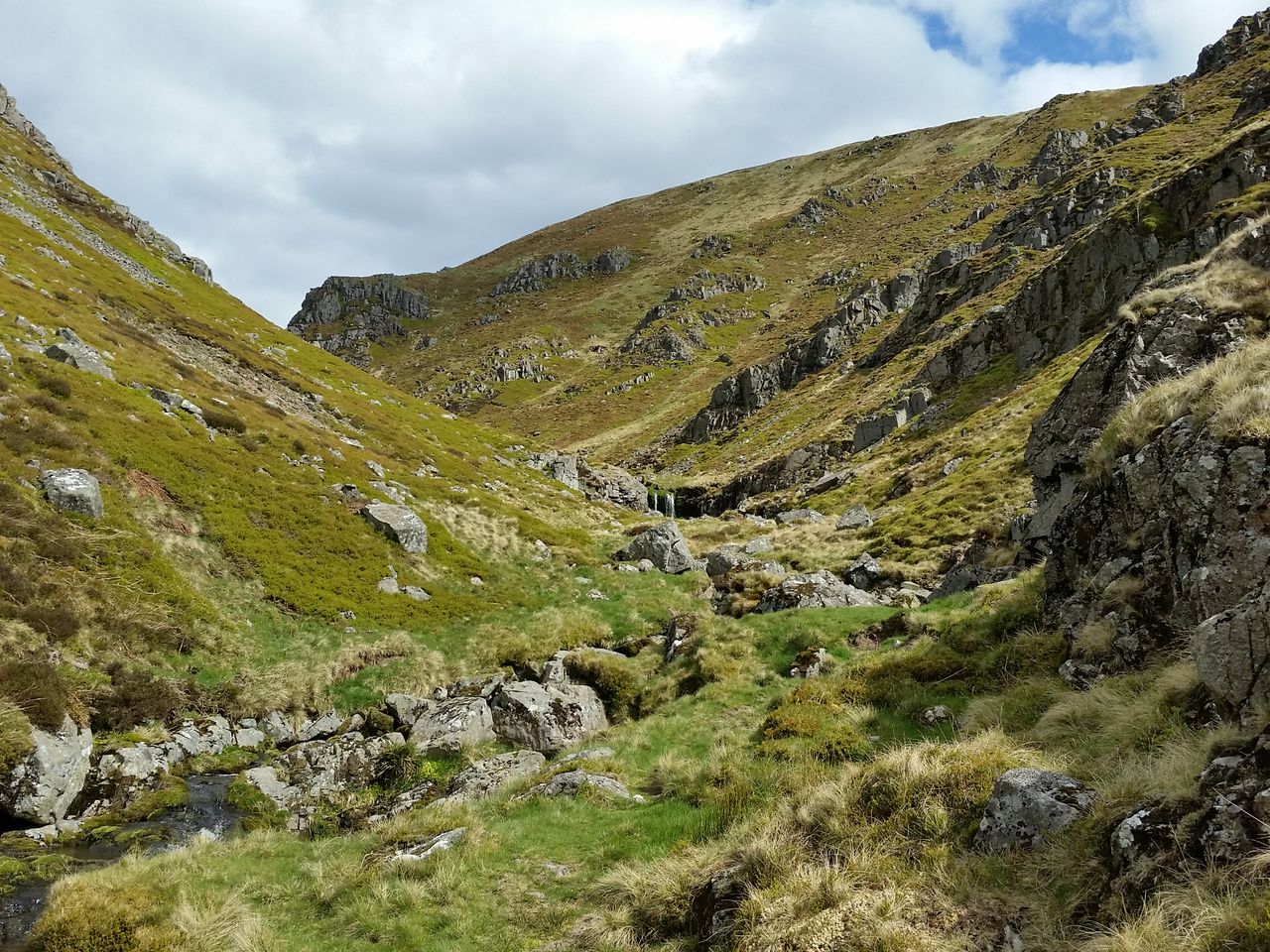
Entrance to the Hen Hole

Triple waterfall

Just keep going

looking back at the refuge hut
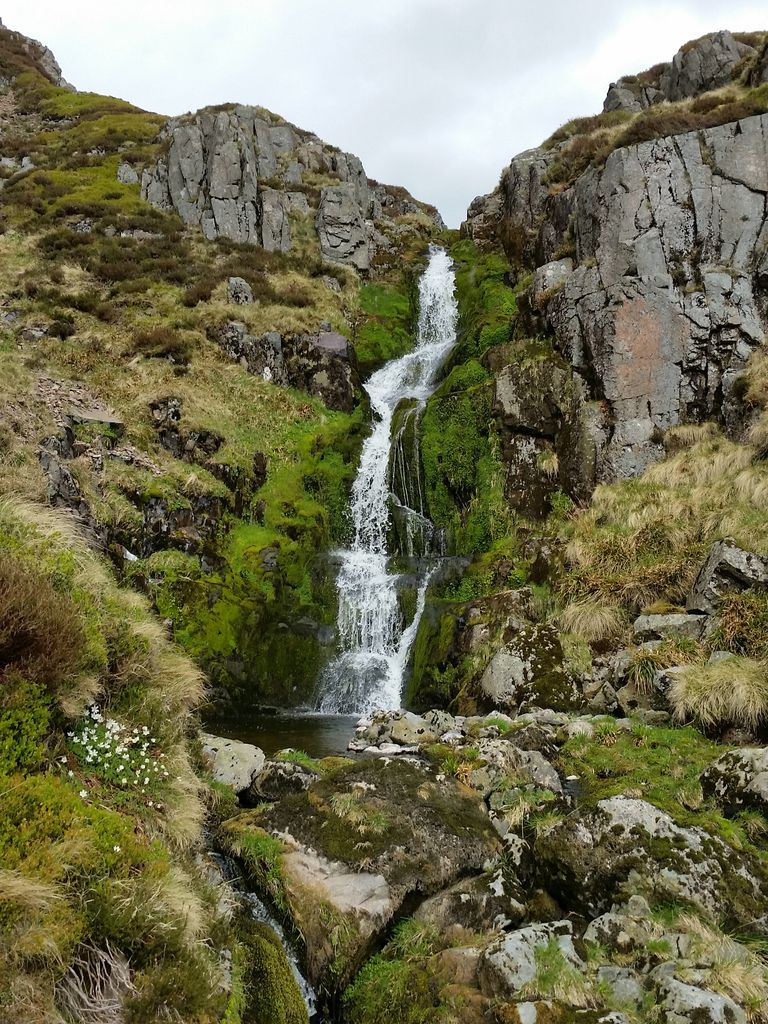
Another waterfall
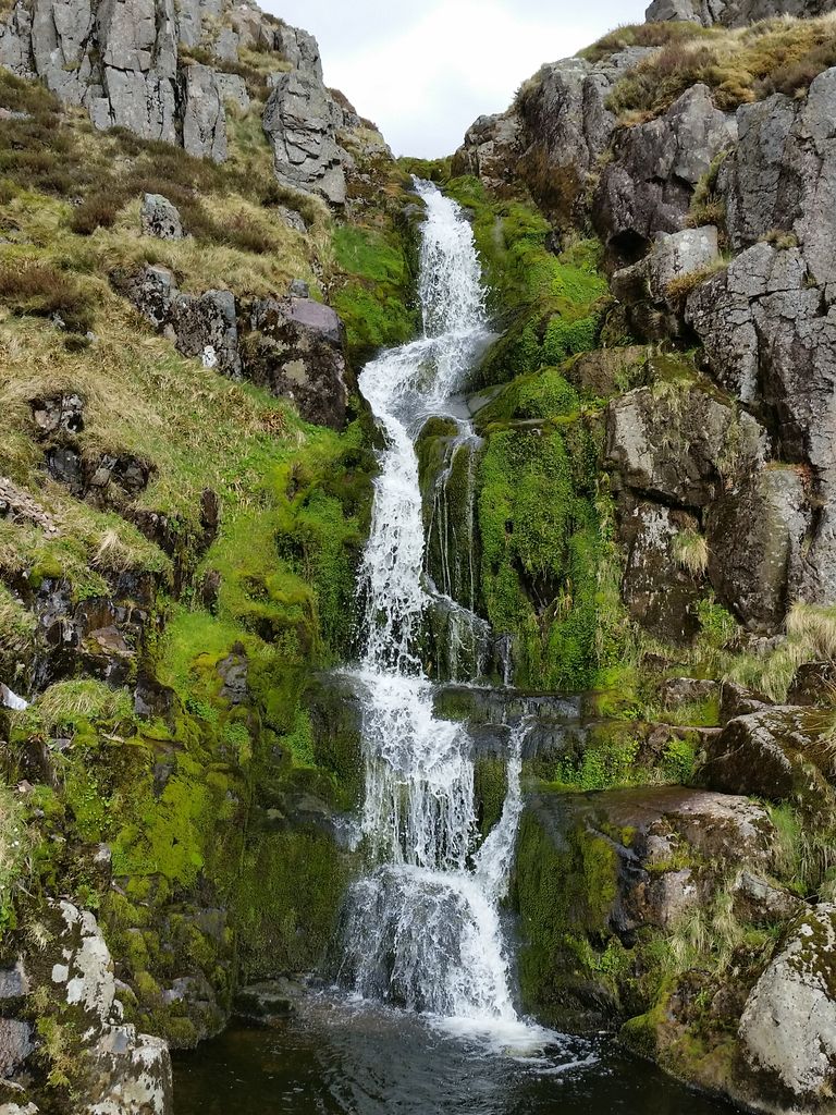
Keep stopping for photos

Looking back from higher up

Even better angle
Reaching the end is a mixture of relief that you’re through, with regret that it’s over. But by now you’re probably in a rush to get back, I certainly was. But you are still in the ravine which opens up before turning 90 degrees right.
Hen Hole turning right
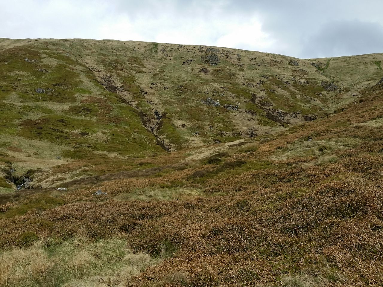
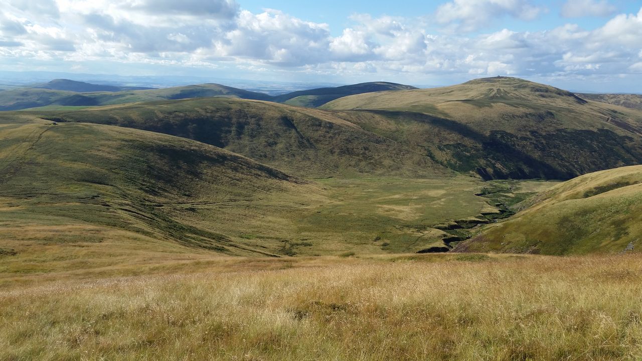
I tried following the valley round but the path petered out and I ended up scrabbling around on mossy slopes. Far better to simply turn south and scramble up directly up to Auchope cairn. A viewpoint is soon reached and on a fine day the vista is extensive. Such a contrast to what’s just gone before.

View west above the Hen Hole into Scotland
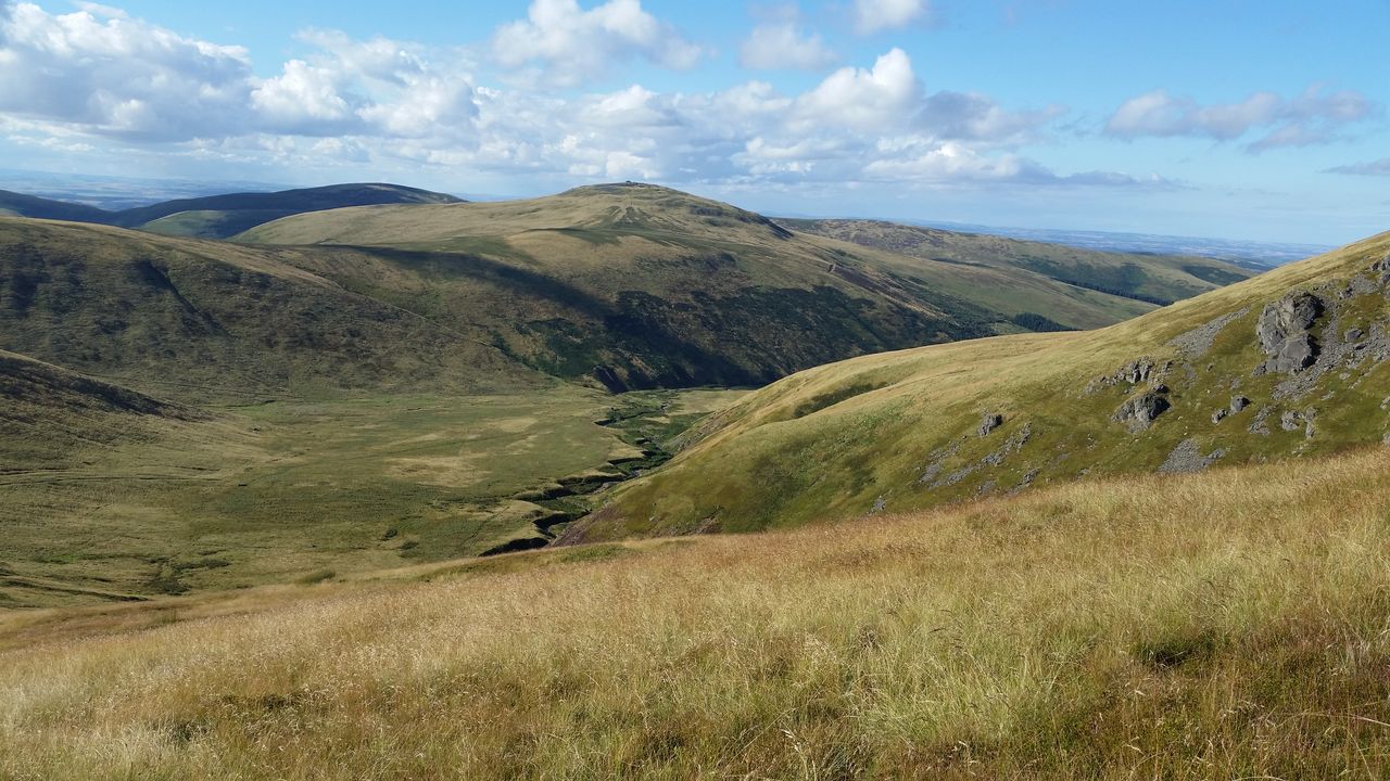
Auchope Cairn on a fine day
Auchope view late summer
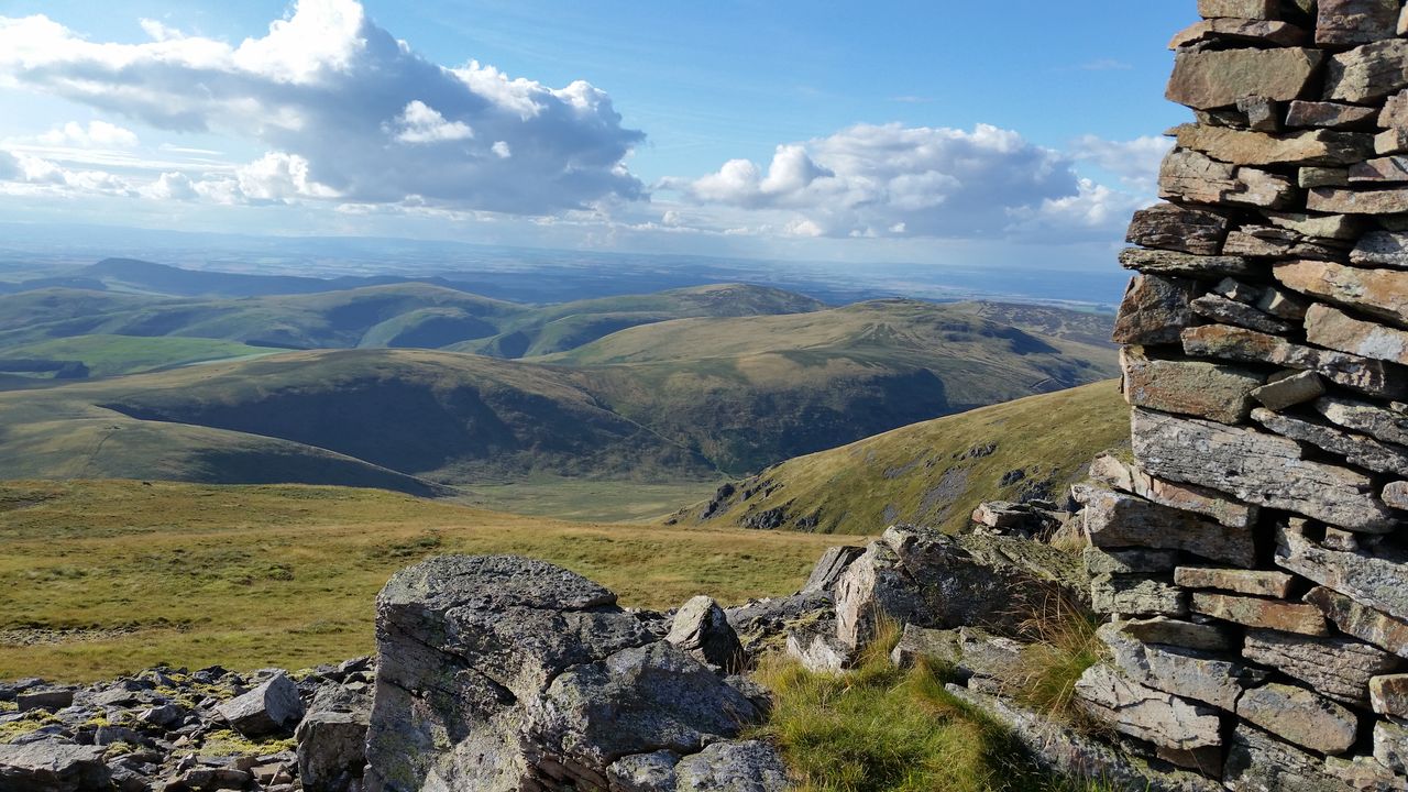
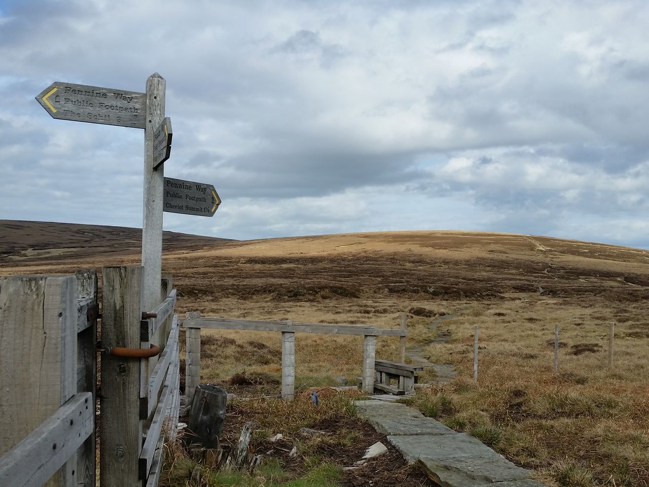
You just have to stop at Auchope. Have some food, drink, anything, just gaze and take a moment. After all, it’s the Cheviot plateau next, not much fun there! The route is simple, follow the millstone grit pavement, part of the Pennine Way. Firstly to a gate and stile, then taking the path to the Cheviot trig.

Joining the paved Pennine way to cross the Cheviot plateau
Follow the yellow brick road, I mean grey millstone grit slabs
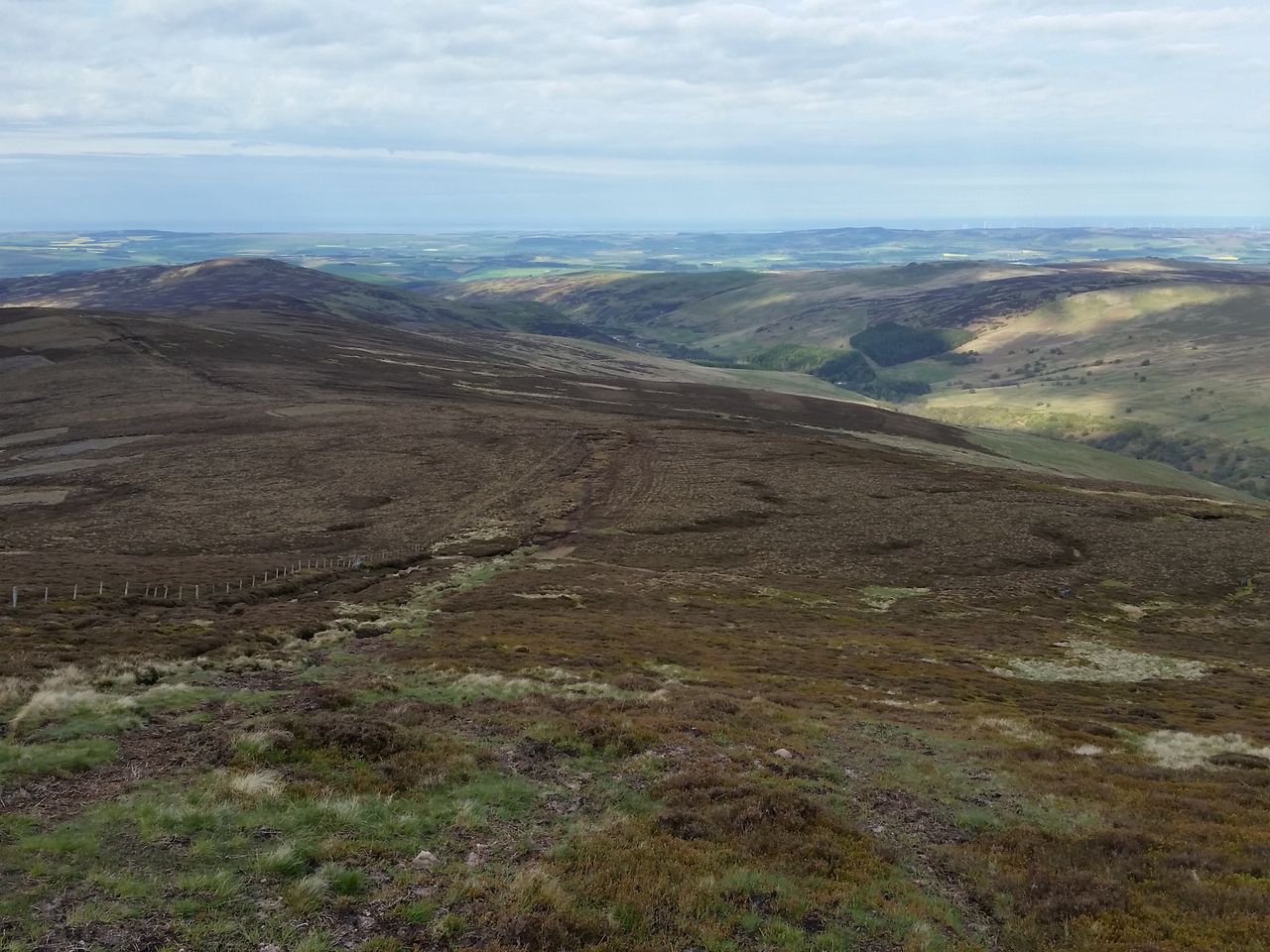
If you like bleak peat bogs then you’re in luck. Not much to be said for the Cheviot plateau, except be grateful you’re on stone and not floundering in the mire. It’s a means to an end, we are heading for the car and just as things get tedious, a giant weathered trig appears.

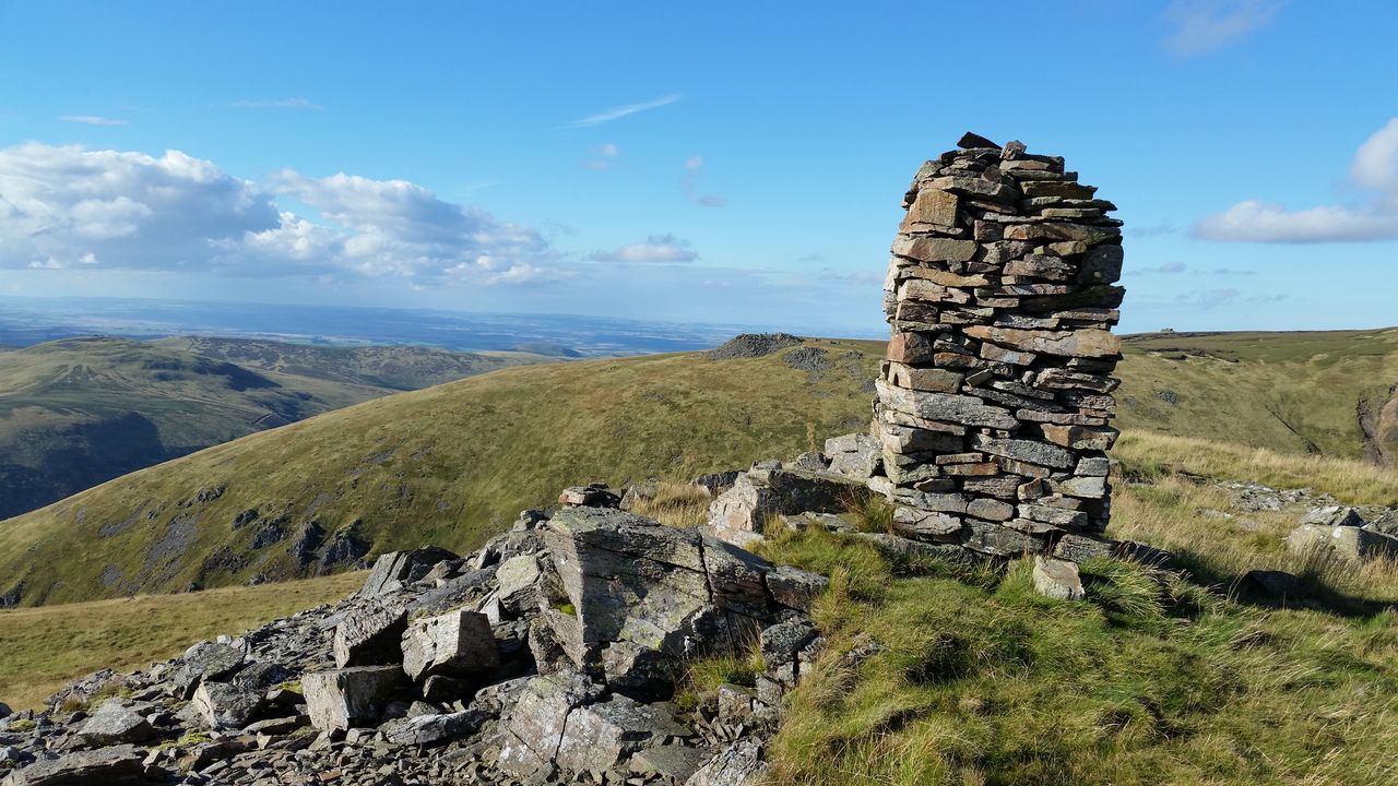
Such an impressive monolith for such an unimpressive summit
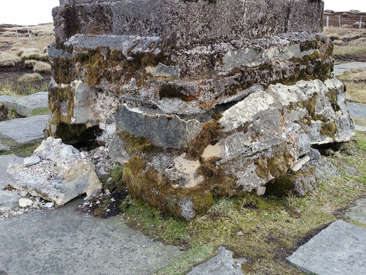
Surprised by the damaged base and trig, reported to Ordnance Survey
The base and trig are in a poor state, I’ve reported it to the Ordnance Survey so hopefully they’ll make repair before it falls down. Anyway, the single pavement continues to another stile and at last a proper viewpoint, now looking east.
Welcome view after crossing the peaty plateau, Hedgehope and the east coast
Now to descend over Scald Hill which can be boggy after rain, but is certainly better coming down than trudging up. And there’s quite an inspiring view ahead, with a potential coastal panorama depending on the haze. Lindisfarne and Farne Islands just visible.
Scald Hill left, Harthope Valley down right – a far better descent than the walk up
Turn off for Langleeford which is quicker than it looks, usually only taking me about 70 mins from the trig without stops. A line of newly installed grouse butts were noticeable next to the lower path in September.

Final descent to Langleeford and the sun’s come out!
So a fine tramp around, up and over the Cheviot, with plenty of variety and interest. I’ve never met a soul on some sections of the Lambden valley. There’s also a few variations available and I need to do a walk around the summit edges next. Finally 20 years after I first did the Cheviot, I’m finally getting to like the bloomin thing:-)
Variations;-
- Could be done in reverse of course, which gets the highest climb over the Cheviot done first, but the Hen Hole is best going up.
- Same route avoiding the Hen Hole – instead of the Hen Hole just head for the skyline either side of the Refuge hut. Then a steep and unforgiving trudge up to Auchope Cairn. This tests your stamina after the long walk-in. Fortunately the ground is very good and views outstanding, see below;-
- Longer 16 mile route from Langleeford including the Schill you can divert through the Hen Hole if required, tougher day.
- Shorter walk up the Bizzle, (though avoid summit bogs by walking round to Auchope)
Views from the slog up to Auchope
The Schil and College Valley


My brother and I have just completed our first walk up the cheviot (first walk up any big lump!) two portly ashingtonians in our forties and loved it! took the route up harthope valley and the killer climb( to us) up scotsmans then to the summit of the cheviot, carried 3 litres of water each (25 degree heat) but we made it and really loved every minute. You don’t need to be super fit to enjoy walking the cheviots but good boots are a must!!!!!I learned that.
Glad you enjoyed it Michael, it should be a right of passage for all north easterners 🙂 Take as long as you want, watching out for darkness of course nowadays. Try Windy Gyle next it’s a cracker!
I didn’t know this route as I tend to stick to one valley but this looks much more interesting than the up Scald Hill route. I’d love the GPX file if you have it? Rose
It’s a belter but a longer tramp of course. You should be able to get a gpx from the social hiking link by clicking on the map?
If not I’ll try to send you the Viewranger one so let me know?
Brill thanks
This was a real beauty. Thank you.
Thanks Pedr
I did the exact same round trip when I lived in Durham almost 15 years ago (well almost the same, except for the Hen Holes part that I just discover here!) I really enjoyed the Cheviot and hill-walking. Being French (from the Alps) I was a little bit skeptical about walking in England but the Pennines and the Cheviot definitively made me change my mind. I really had good time here. Hope I can come back one day.
Hen Hole is a highlight for sure, unlike anything else in the Cheviots. Slightly more like the Alps maybe 🙂
Lake District and the Highlands have more dramatic and varied walks, you could try those too next time?
Ho yes I know, I went to the Lakes (Scafell Pike + Great Gable in a long day walk, Blencathra, Helvellyn by the two edges) and to the Highlands as well (Beinn Alliginn) although it was really a looong drive up North. Overall great fun and great walks in all areas but my feeling was that the Lakes are very much like some parts in the Alps (without the altitude but with more beautiful Lakes). Cheviot (and also North Pennines) offered something completely different to what I was used to. Highlands are Highlands and especially around Torridon can not be compared to anything I know.
Interesting, I guess the great thing here is that there’s plenty of variety in the UK and most mountains are possible on day walks.
North of Torridon brings even more uncomparables. Assynt recommended.
Hi Mart in the Hills
Just completed your ‘Best way up Cheviot from Langleeford’ absolutely brilliant, a tad tough on the scramble up to Auchope Cairn, but more than worth it when you get there. Many thanks for your concise information on the route.
PS. looks like OS heeded your comments on the trig base, has been shuttered and concreted now. July 2017
Ian
Glad you enjoyed it! Agree about Auchope, the alternative being to carry on round but the cairn viewpoint is definitely worth the short pull up. Have seen pics of the repaired cairn, looks a good job, due back myself soon hopefully. Hope the bracken isn’t too high 🙂
How much of the terrain is boggy? I know the summit of cheviot is boggy, but you have the stone path to walk on to avoid the boggy ground. Thanks.
Most of the route round and to the top is on decent ground, probably some bracken in parts and some damp grass down to the College Valley. The route on top is along the pavement then there’s a few boggy bits on the descent to Scald Hill. I try to avoid the Cheviot after heavy rain, this also helps to keep your boots dry crossing of the College Burn. It is a long hill walk with the main ascent after a long walk-in.
A very enjoyable route, thank you for sharing your knowledge I had a fantastic day. (2nd Aug 18)
Thanks Steve, hope you had good weather, the ground is so dry at the moment, it’s a good time to be on the Cheviot.
Hi is your route easy to follow if your not local
Hi David, this is a remote and often pathless route, you won’t meet many people if any, so you’d need a proper map or hillwalking gps. I’d say it’s for experienced hillwalkers only who are comfortable on a long hillwalking day. It’s a long way around the back then a steep climb back up and I only do it with a decent fitness level.
If it’s your first time trying the Cheviot then stick to the usual route and see how it goes first. Can always try this later.
Thanks for this suggested route. Followed it today, with variation 2 – my wife wasn’t confident about the approach up Hen Hole so we took the path up to the skyline. Loved the route, plenty of interesting terrain, and had it almost to ourselves until we got to Cairn Hill.
Thanks for the comment and I’m pleased you both enjoyed it, I must do this again myself this summer.
Looks a great route and well described! Do you have the GPX for it at all?
Hi Liam, you should get one from this;-
http://www.shareyouradventure.com/map/64791/Martinthehills/15th-May-2016
This one is longer and more ascent including the Schil
http://www.shareyouradventure.com/map/7872/Martinthehills/9th-September-2012
Let me know if any problems
My first walk in the Cheviots (Scotland usually) and that’s a great route, particularly up the Hen Hole. Thanks. The description is very accurate but should say that there is (now) a small walkers’ bridge over the College Burn about 10m North of the point where the wood path meets the water. The path in Hen hole is also (now) not too bad – on the South side of the stream for about 2/3 of the way up and then on the North side when a rock wall / waterfall blocks the South bank.
Thanks Andrew I’ll certainly check this out as a bridge is an advantage if the burn is high, I usually try and do this route at least once or twice a year but haven’t been on the Cheviot in 2020 yet, lockdown didn’t help of course.
Does anyone have a working GPX file the one in the blog does work.
Thanks in advance
Climbed The Cheviot 1962 from Wooler Youth Hostel via Langleeford with 2 6th form geology schoolmates from Middlesbrough High School. The no path way up was over a newly burned heather moor – horrible in our mouths and the top was a 4″ deep bog surrounding a small island with the trig point! We managed the wet splodge! A can of cold baked beans each for lunch- never done that before – or since!!! Super countryside all round and for describing, accurately, the top, the warden stamped Cheviot in our membership cards. Proud as punch! Wonderful memory. Remember Brian Robinson & Mike Norris?
Thanks for the 13 and a bit mile hike up the Cheviot route. We did it on 27-05-21 and it was a lot more impressive than the 8.5mile we did the week before heading up Harthope valley.
We incorporated Hen Hole as you suggested but must’ve missed your turning as the climb out was a bit challenging. We came out a good 100yards South of the cairn at Auchope. Never mind it was still great. Still big patches of snow up there at the end of May.
Thanks again for a great route to make a bit of an uninspiring hill interesting.
Thanks Richard, I’ve tried a few alternatives but personally favour just going straight up before the valley starts to turn right, so this is north of Auchope and it’s a steep pull up to an initial viewpoint which then levels off to the cairn.
My son (14) and I (56) did this route in scorching weather on 24 July 2021. I forgot to take a printout of your route guide so had to rely on my memory of the route plan my OS map. Looking through your guide again I pretty much got the route right. Wrong turns included coming out of Henhole in the wrong direction and having to tramp half a mile through knee high heather towards the signposted stile for the Pennine Way, completely missing Auchope and going directly down to the road from Scald Hill because I thought we had already done Scald Hill and couldn’t understand why there was no path down. Climbing up Henhole was well worth the tramp across the moors, lots of inviting waterfalls and pools in the scorching weather. Our actual walking time, 10 hours! Still, a cracking route in outstanding weather. Many thanks for the guide!
Glad you enjoyed it David it’s a bit remote on top isn’t it. When descending I often have to check the map as it does seem sensible to start down the way you did rather than go up again a little. Bit steeper maybe.
Hi Martin, me and 4 other family members are doing this route of yours you have so kindly put together. As novice trek walkers this is just in right information we need. We are doing this for a sponsorship charity walk for Alopecia Uk as my 8 year old daughter Ella has this condition and is raising funds for research. We are starting the walk at 9am on the 18th of September and it would be great if someone with experience of the route would like to join us to make sure that we keep on track and don’t get lost. Once again thanks for the helpful information on here Martin.
Hi Martin, thanks for messaging and I fully support your intentions. However I definitely wouldn’t recommend this route to novice trek walkers. It’s a long undulating walk and mostly very remote, you’re unlikely to meet another soul for a few hours which can be a bit daunting. Once the west side of the Cheviot is reached you’ve already covered quite a distance with the only options being to walk further up a steep slope on to the top, or retrace your route back the way you’ve come. It’s for experienced hill walkers who are more used to these situations and who are used to hill walking. I only do this myself after a few decent hill walks to build up.
For anyone new to hill walking wanting to do the Cheviot then the standard route is best, it’s shorter, with less ascent, shorter ‘escape’ options and you’ll be in the company of a few other walkers .
I’m up in the highlands at the moment so can only type via my mobile so I hope this makes sense 🙂
Mart
Thanks for the advice Martin, we will take the more direct route I think this time and the more adventurous route next time round. Do we still park up at the same spot as you have on the map as a starting point?
Yes this sounds like sound advice. We will take on a more adventurous route next time round I think so not to get caught out and lost in the elements if the weather takes a severe turn. Much appreciated for the quick reply Martin 👍🏻
Good decision. Even more important when you have a fixed date and can’t choose the weather 👍
Great route – thank you for the detailed descriptions. We did it on a part cloudy and (by the end) rather wet and windy September Sunday. The woods under Preston Hill are no longer there, so it is an easy walk through the cleared ground. There is a wooden bridge over the College Burn if you go over the very big stile and follow the path down through the trees. We found the Henhole a bit challenging as neither of us are good with heights and some of the tracks up above the burn were narrow, slippy and precarious. We also had a few delays getting across the burn a couple of times to try to find the least risky path. Having said that, two young lads came up after us and were off ahead into the distance in what seemed like minutes, so it was obviously our nervousness slowing us down. Followed the path out around to the right as far as we could but it looked a bit dangerous towards the end, so we did a scramble up the edge of a section of scree, clinging onto heather and bilberries as it was very steep, and came out right in front of Auchope Cairn, just in time to enjoy the views before the clouds dropped and we had a soggy and blustery trudge over Cheviot back to the car. It took us 8 hours 45 mins in total. I doubt I would do the whole route again, but I would definitely visit the Henhole again and then walk back out the bottom rather than go all the way up. It is too beautiful a place to only see once. Thanks again, Pete
Hi! Planning on hiking this within the next week i’ve tried the links for the map but not working, any chance you still have one that does? thanks!
Hi sorry for the delay. Yes both Viewranger and Social Hiking are no longer with us unfortunately. If it’s not too late I should be able to sort a gpx route if that helps?
Mart
Hi, if you can let me know your email address I can send a gpx?
Thanks
Mart
Hi, I would love to do this route next time. Would be possibel to have sent by e,ail as none of the links works? angelo.maracci@gmail.com
Thank you so much