Lakes on Sunday again, and this time a rare short walk of 4.5 miles due to the inclement weather. I’m not entirely sure what inclement means so the term ‘shite’ would also be applicable here! We used the opportunity to pick off a couple of low Wainwrights that had been missed on previous trips. An unexpected advantage of this walk is that it left plenty time for tea shops & pubs🙂
Distance = 4.5 miles (7.3 km)
Duration = 3 hours 30 mins
Total Ascent = 1,840 ft (560 m)
Start/Finish = Car park over road from Patterdale Hotel on A592, £4.50
Wainwrights = Birks & Arnison Crag
Date = Sun 15th December 2013, start 10.35 am, finish 2.05 pm
Click on Route Map below to zoom in/out
Birks & Arnison Crag route from Patterdale Hotel
Sunday morning’s trusty Met Office Mountain Weather Forecast didn’t bring much joy, so we reckoned by keeping north & low we could still get a decent day. Plan A was for Birks and Arnison Crag followed by a drive to Gowbarrow Fell, thereby ticking off 3 missing Wainwrights before the rain came.
Morning weather forecast
The weather actually looked surprisingly ok as we arrived in the Lakes, so we headed for the highest first, Birks. We also formulated a Plan B to maybe carry on up to St Sunday Crag and extend the walk. Driving round Ullswater we met a LOT of water on the roads then after unsuccessfully trying to find some free parking we reluctantly parked opposite the Patterdale Hotel. There was a charge of £4.50 here which produced only a minor shriek from Alan, as compared to the louder high pitched one 2 weeks earlier when faced with £6.90 at Whinlatter. Outside the hotel we saw a group of young attractive nuns. We thought this strange until we saw Superman got out of a car. Assuming this was unlikely to be the real Superman we also concluded the Nuns were unlikely to be authentic. The reasons behind all this was never established but given the high winds we wouldn’t have been surprised to see Superman flying by at any time.
Parking at the Patterdale Hotel – I engaged some fellow walkers in hearty conversation
The fellow walkers were suitably riveted
We crossed the road past the front of the hotel looking for young nuns as you do, then went through the rear gate & up onto the fells following a clear rising path. We soon met 4 guys who were off to do St Sunday Crag but were interested to hear there was a Wainwright called Birks on the way. We left them behind studying a map & started up for Birks.
Alan ascending, the Berk, I mean Birks
On the way up Birks, Ullswater behind
Last year somehow we managed to miss the top of Birks whilst descending over St Sunday Crag in fading light. So rather than take the same path up the side we went straight along the top even though this meant meeting the weather full on. At one point the wind was so strong I was struggling for breath. It was a bit rough and a few extra layers were needed.
Meeting the wind on the final pull to the top of Birks
The innocuous cairn on Birks with St Sunday Crag behind
There’s no cover up here so we dropped down the west side to shelter and admire the views.
Enjoying the weather & views. Really I am.
Getting a bit nippy, views to Place Fell & Ullswater, not much further.
As we couldn’t tell for sure which bit was the Birks Wainwright top we carried on to the other two bumps then stopped to discuss options. Weather had already deteriorated and St Sunday Crag looked more & more uninviting. At that point the 4 guys from before arrived and said they were still intent on carrying on up, we wished them well, I said it looked fun 🙂 We had already decided to forget that and head back round to Arnison Crag keeping below the cloud. This decision got better with every step as within minutes the rain arrived earlier than forecast, much earlier. One consolation was we that were now heading north east with the wind behind us, whereas the route up St Sunday would have been straight in our faces.
Arnison Crag ahead in the rain
On way to Arnison, top right
Alan going grey
Oh and last year I finally bought some waterproof trousers, and this day this year I finally put them on. Berghaus Deluges, on sale at Go Outdoors, not the lightest but recommendations on Twitter suggested they’d do the job. Must admit they seemed good.
Waterproof trouser time
Arnison Crag summit & Ullswater
Arnison summit back to Birks
We were glad of the shelter offered by the rocks up on top of Arnison. The rain eased temporarily allowing some grey photos before starting down to the sanctuary of the car.
An Alan on Arnison, don’t be alarmed people, he’s harmless
On Arnison Crag wrapped up
On Arnison Crag – note technique for taking a photo in wind & rain 🙂
Ullswater and just a hint of Meal Fell
Descending Arnison
Patterdale & Hotel to the right
A manly pose above the Patterdale Hotel
Well at least the car’s still there then.
Back down at the car for 2pm which was far too early for us, oh for the longer days of September! Trying to fit in Gowbarrow Fell was definitely not worth the misery now so we drove to Keswick in the rain for a cuppa at George Fishers, followed by a quick pint at the Dog & Gun. This quick pint turned out to be Loweswater Gold, so 3 hours, some soup & Hungarian Goulash later we eventually left the Dog & Gun and finally drove home.
Keswick’s Dog & Gunn, trying to read a menu – and yep that cap’s welded to my head 🙂
So 3.5 hours on the hills yet 4.5 hours in tearooms & pubs, surely a step towards old age and chronic tannin & alcohol addiction. Thanks for reading 🙂
Christmas Keswick – courtesy of Alan Images, ie Alan’s camera:-)
Some mountains get into your soul. I remember 30 years ago leafing through my first book of Scottish mountains becoming increasingly inspired by photos of classic Munros. Some were gradually visited, some were more remote. A few were very remote, whilst a select few were extremely remote – and scary too. As we became familiar with the mountain playgrounds of Glencoe, Glen Shiel, Torridon and Skye, one extremely remote scary mountain became the Holy Grail – the 3,474ft serrated sandstone massif of An Teallach (The Forge). For some hikers it’s simply the best mainland mountain in Britain.
Sitting majestically in the far North West Highlands beyond a range of almost equally magnificent peaks, it’s remoteness only adds to the mystique. For the past 10 years a framed picture of An Teallach has hung on my lounge wall taunting me, yet I’d rarely ever seen the mountain in the flesh, (or the rock). There had been brief distant glimpses from mountains further south, whilst my only trip that far north was dogged by 3 days of mist covering even the lowest foothills.
Colin Prior An Teallach picture on the wall above my settee
Last year however saw the closest encounter yet during the ascent of mighty Slioch near Kinlochewe. A perfect peaky panorama of remoteness burst into view with the unmistakeably huge bristly shape of An Teallach looking menacingly broodingly hugely erm bristly. You see normal adjectives just aren’t enough for An Teallach.
From Slioch 2012 – a sighting of An Teallach on horizon (mid-right)
It bristles due to the notorious Corrag Bhuidhe pinnacles which necessitate an exposed scramble above sheer drops down to Loch Toll an Lochan. Ever since seeing those early guidebook photos there had been a fear & apprehension about An Teallach, mixed with wonder & intrigue. Over the years various route guides & trip reports had been read, many pictures examined and pinnacles pondered upon. Questions were posed;- how did it compare to others, was it beyond us, would we be forced back, and would we ever be able to plant our arses on Lord Berkeleys Seat?
Time and knee joints were ticking away so whilst up on Slioch gazing at the bristly behemoth, we resolved that the fear had to be faced and in 2013 we would plan a return to the far North Highlands to hopefully attempt the Holy Grail.
And so in July 2013 during the national UK heatwave we arrived in Ullapool – only to be dogged by 3 days of persistent storm force winds which kept us off the high mountains. Day 1 saw me blown over on Cul Beag, Day 2 was a low walk out to remote Sandwood Bay & Day 3 an amazing ferry trip in the gales & rain to Stornoway & the Outer Hebrides.
An Teallach from the Stornoway ferry the previous day
It was soon our final night in Ullapool, the chance we had waited for all these years seemed to have gone. There was nothing we could do about it and at least we had managed 3 great days in a wonderful location despite the 70mph mountain gusts. We wanted clear weather to enjoy An Teallach at it’s best and for safety reasons too. Then on that final evening in Ullapool the forecast did something fatefully unexpected, it finally changed for the better.
Morning arrived and a quick check of the trusted forecasts confirmed a bright but hazy day, some cloud patches, dry and crucially little wind. Our guesthouse was full that evening so I’d booked the next 2 nights in picturesque Plockton 2 hours drive further south. Plan A had always been to include a Munro on the way but trying to fit An Teallach in was looking logistically impossible. The usual ascent route is a clockwise traverse around it’s big U shape ridge with the notoriously exposed pinnacles barring the way to the two Munros. Taking the pinnacles clockwise meant ascending the steep exposed sections (reportedly easier than descending). If the pinnacles were too difficult then a lower bypass path could be taken which is reportedly worryingly worn by countless boots and exposed. Note the use of that ‘exposed’ word again, as I get older I’m becoming less comfortable with ‘exposed’ situations and the knees just aren’t enjoying the scrambling like they used to, it kinda hurts.
Exposure = empty space below a climber, usually referring to a great distance a climber is above the ground or large ledge, or the psychological sense of this distance due to being unprotected (Wikipedia)
This all adds to the fear factor of the Forge and if we were to attempt the full traverse then we would need plenty of time to tread carefully, this was not a place to slip. Time however was one thing we didn’t have, yet the opportunity and that weather looked so inviting, we needed a Munro and would be driving right past the Holy Grail.
Ullapool guest house view 8am, calmness after 3 days of stormforce winds
My mate Alan however had a plan B. This involved doing the route in reverse thereby reaching the two Munro summits first and without any exposed sections. We could bag the two tops then gaze out over the ridge and maybe even try tottering out to Lord Berkeleys Seat (info later). We could call this a preliminary trip to check out the full route for next time. This plan also fitted our time constraints and mentally eased 30 years of apprehensive fear. So we had a plan and if anyone asked us why we were wimping out of the pinnacles we could explain the time constraints whilst still retaining what little manly mountain dignity we had left. Luckily Alan hadn’t shaved so that was a good start and I had my poles & knee supports. Doh, that’s the dignity buggered!
And so once upon a time that morning we drove south to attempt An Teallach, as you do. Even though this was to be a wimpy safe ascent route we were subconsciously apprehensive, I certainly hadn’t felt this way before any previous trip. This one was different, this one was personal. Soon we drew nearer along the Destitution Road (built in 1840 to provide relief during famine) and then An Teallach came into view, typically still playing hard to get with all tops hidden in cloud. The pits of our stomachs had that unnerving feeling. I reassured Alan that I was 100% sure the cloud would lift and we would get views ( I was actually 86% sure). We drove past the visible foothills and parked in the large lay-by at Dundonnell. This was our destiny, (cue Darth Vader music).
Looking like a constipated hamster, it’s pure apprehension, perhaps I could stay in the car? 9.50am
We were strangely quiet getting our gear ready and boots on, then set off walking past the large Mountain Rescue Hut, hmm wonder why it’s situated there! We crossed the road by a cottage and followed a path zig zagging up through good ground gaining height quickly. It’s worth mentioning An Teallach is one of those mountains where the ascent is very definitely from sea level, no high starts here as the photo below illustrates 🙂
Views north over Little Loch Broom & Dundonnell with car by mountain hut on right – 11.05am
We reached a small cairn where the path splits either straight up following the river or an older route zig zagging further west over Meall Garbh then arching south. Having read previous recommendations we chose the latter and it certainly seemed straightforward. This even started feeling like a normal mountain with no hint of the pointy bits ahead. Eventually we came to an expansive flattish moonscape with the two Munro tops now poking above the horizon and clear of cloud. Silently we knew it was soon going to start feeling unlike a normal mountain.
Glimpses of pointy things across a rock desert, the other path is left of the stream – 11.55am
We soon came to the end of the moonscape boulder field and rounded the head of the stream (Coir a Mhuilinn) by Sron a Choire. Despite the cloud swirling in again we were given a hint of what lay ahead by the first sight of sharp things, the infamous pinnacles. The low one in the middle is Lord Berkeleys Seat. Kinda nice to see it at last, especially at this safe distance (cue Vader music).
Things are going to become interesting, hope the bloomin cloud lifts – 12.10
After a little traversing we found a rocky path skirting up the steep shoulder of Bidein a Ghlas Thuill, the first of An Teallachs two Munro tops. Finally after nearly 3hrs it felt that we were at last getting to grips with this mountain and consequently the reality, excitement & fear of what lay ahead began to resurface. Things were about to become more interesting.
Alan had gone on ahead whilst I stowed my poles, he reached the skyline, waved and pointed, I clambered up to have my visual senses assaulted by a view I’d waited 30 years to see. It’s an oft used word but this was truly breathtaking.
The emotional view of An Teallach from Bidein a Ghlas Thuill – 12.45
Taking in this scene was all a bit overwhelming, after a period of open mouthed gazing I took the pic above on my phone and sent it to Twitter. I typed the only words I could think of,“Let me present to you An Teallach”.
I sent it and a strange thing happened, my eyes started to water. What the heck, this doesn’t normally happen, come on Mart get a grip, for goodness sake I was wearing tight Ron Hill leggings and any sign of emotion might attract the mountain goats. I wiped a tear away and gazed again at the scene, it had really got to me, I just didn’t realise what this bloomin mountain had meant and how much I’d probably been apprehensively avoiding it. I walked up the short distance to the trig point where Alan was already videoing the peaky panorama. Big smiles on our faces, I wasn’t going to mention the watery eyes thing cos he’d only laugh but then found myself shamefully admitting it. Alan replied matter of factly “hey yeah me too, had to wipe away a tear”. I couldn’t believe it, the great big wuss!!
An emotional summit experience on Bidein a Ghlas Thuill, An Teallach
Distant views were hazy, sadly much of the sea views were lost, yet the incredible view behind us commanded attention perhaps more than any previous incredible pointy panorama. It was pretty damn good up here on An Teallach. Due to the light the photos don’t really do it it justice, what’s needed is a dodgy 360 degree video with commentary;-
We were joined on the summit by a guy we had seen back down at the car, it turned out he was a Geordie. For some reason many summits seem to come complete with a Geordie, luckily we speak the language and he agreed to take the photo above. Just below us we spotted one of the fabled An Teallach goats…I checked my Ron Hills, pleasingly all was in place and the goat remained aloof. After a 20 minute stop on top we retreated down to the lower viewpoint for some more classic pics of the classic view. Note extensive demonstration of the classic bent raised leg posing technique with arms on hips. Classic.
Admiring An Teallach, classically
An Teallach, a true classic
More closer up An Teallach
Eyes drawn to the route ahead – 1.25pm
Time was pressing so we made our way to the second Munro, Sgurr Fiona involving a slight descent then a diagonal path up to the skyline left of my head in the photo above – of course by then my head was on the skyline but lets not complicate things. With only a short pull remaining up to the summit there was a brief diversion to take in some more wondrous views over the remote Fisherfield Forest & the pointy Corbett of Beinn Dearg Mor. This is another remote pointy peak that’s long fascinated me, so this was extremely satisfying to say the least, a classic smiley moment.
Loch na Seagla, Beinn Dearg Mor & the Fisherfield Wilderness – 1.40pm
We couldn’t stay long. From here it’s a 45 degree easy scramble to the top and time to stow the walking poles away. There’s no place for poles on what lies ahead.
Clambering up Sgurr Fiona with Bidein a Ghlas Thuill behind – 1.55pm
More of a clamber than a scramble to the top, Fiona was soon reached and proved to be more airy than Bidein with a closer intimate view over the Ridge. It was another brilliant moment. We sat down trying to work out which pointy bits were which, then we spotted the lower bypass path with some walkers scratching their way along. There were two walkers sat with us on top and one was explaining Lord Berkeleys Seat which made us realise that it was totally camouflaged against the higher pinnacle.
From Sgurr Fiona over Lord Berkeleys Seat, almost hidden against the higher pinnacles
Lord Berkeleys Seat & Corrag Bhuidhe – 2.00pm
360 degree video, from Sgurr Fiona;-
Now for a decision, do we end the hike here perfectly satisfied with the day, or do we go out onto pointyland to investigate. We had come a long way after all these many years and despite time pressing and despite the trepidation we clambered down and edged carefully along one of the higher rocky paths. We were being watched by the two guys behind on Fiona so tried looking like we knew what we were doing, whilst a slight tightness of the stomach indicated perhaps we didn’t. The infamous shape of Lord Berkeley’s Seat gradually separated itself from the background and it certainly lived up to expectations standing below. Wowza!
Lord Berkeley’s Seat from the low point in the middle of the previous pic – 2.15pm
Lord Berkeley’s Seat is the first (or last) pinnacle and sensationally overhangs the sheer cliffs below. The story is that Lord Berkeley is supposed to have sat on the top with his legs dangling over the edge whilst he smoked a pipe (probably drugs). It’s become a symbolic feature of An Teallach and it provided another emotional mountain moment, I’d particularly wanted to reach this point, and particularly wanted to try getting to the top. We deferred this by carrying on edging carefully around the base of Berkeley then descending slightly before starting the scramble up towards the next higher pinnacle.
From on next Pinnacle see the figures on Lord Berkeley’s Seat hidden against Sgurr Fiona
You can see traces of a path on these photos and you get very close to the sheer edge at times but it’s not yet too exposed. It’s certainly interesting, we wanted to try to get up this higher pinnacle then call it a day. We got close, removing rucksacks and stopping at the final ledge at the top which wasn’t difficult but the situation just got to us and we retreated.
From first of the Corrag Bhuidhe Pinnacles over Lord Berkeleys Seat and up to Sgurr Fiona – 2.30pm
The high bypass path running along the next section of the Corrag Bhuidhe pinnacles
Time to turn back however one thing remained, Lord Berkeleys Seat! It didn’t look too difficult so we had to go for it, leaving everything including cameras & phones at the base we scrambled up from the east. It’s ok if you don’t think of the plunging precipice just feet away. I purged it from my mind, until Alan reminded me. I requested politely that he shut the **** up 🙂 We got there, not to the actual seat to dangle our legs but to the main top and sat there proudly taking refreshment (no pipes). Then we started to feel the situation again and clambered gingerly down the west side which turned out to be easier. There just remained the clamber back along and up to Fiona which brought a relieved end to our tentative exposure adventures. The hard part was over, relax and breathe at last, just time for some final views then reverse the route down.
On the path back towards Bidean Ghlas Thuill, we kept left to circumvent the top – 3.30pm
Rather than reascend Bidean we skirted left keeping levelish across stony scree slopes back to the head of the Coir a Mhuilin. This put us back on schedule and we chose to come straight down the easier looking path to the right of the stream.
Heading down along the Coir a Mhuilin stream – 4.10pm
This route started encouragingly on a good firm nicely angled path then deteriorated becoming messy & eroded. We concluded our ascent route was the better choice although probably more difficult to locate if coming down in mist. Eventually we turned a corner and I experienced THAT moment when you see the car and every aching muscle & joint in your body silently cries out in joyous relief.
Nearly back, car’s parked past trees over Alan’ head near Dundonnell Mountain Hut – 5.30pm
Back at the car after 8 hours on one of the most iconic mountains in Britain, yet having only seen 13 people all day (plus one goat)! We were far more relaxed figures than the two apprehensive old guys who had set off into the unknown that morning. After a quick change it was time to drive down to Plockton and a class Plockton Shores meal. There was one last distraction, something in the car mirror demanded attention, a final photo was taken.
An Teallach from the Destitution Road
Arriving to a typically peaceful Plockton evening, the gales a distant memory!
That night we feasted on good food, good beer & tales of daring do. Due to the haze we had missed out on some mouthwatering views of the far north highlands & western seascape. The day though had been a huge success, more about the mountain and fulfilling a long held dream. Some of that fear had finally subsided (not gone, just subsided). Is it the best mountain in Britain? We will have to defer on that one, hopefully we will return one year for the full An Teallach experience including those views & pinnacles (or the high bypass path) and maybe, just maybe try a leg dangle on Lord Berkeleys Seat. This all seems quite easy as I type this below my now more familiar framed picture of An Teallach the Holy Grail. You see some mountains get into your soul.
Another Lakes on Sunday trip, and only just! A depressingly densely cloudy forecast meant I was about to head up to the Cheviots. Then Sunday morning brought a surprising improvement with the north east Lakes looking ok possibly clearing later. So a slightly later start saw us driving through Pooley Bridge deciding on a couple of missing Wainwrights, Beda Fell & The Nab. This had the advantage of a low start giving the cloud a chance to lift, plus a few extra options along the way.
Distance = 10 miles (16 km)
Duration = 6 hours 30 mins
Total Ascent = 2,940 ft (896 m)
Start/Finish = Layby opposite St Peters’s Church, Martindale (grid ref. NY 435191)
Wainwrights = Beda Fell, Rest Dodd, The Nab & Hallin Fell
Date = Sun 1st December 2013, start 11.30 am, finish 6.00 pm
Click on Route Map below to zoom in/out
Beda Fell, Rest Dodd, The Nab & Hallin Fell Route
We parked opposite St Peters Church at Martindale in exactly the same spot as last years walk up Place Fell. There’s a short road walk down to the bridge over the Howe Grain then straight up & over the drystone wall to start at the base of Beda Fell.
Parking outside St Peters Church, Martindale – 11.25am
Bridge over the Howe Grain with Beda Fell beyond – 11.34am
Having previously been impressed with Beda from neighbouring Place Fell it was good to finally get to grips with it. It didn’t disappoint too, gradually rising from the road & proving to be deceptively lengthy. The autumn colours more than made up for the overcast weather.
Starting along Beda Fell – 11.45am
Looking back down Beda – 11.55am
Looking back from further up Beda Fell – 12.15
Beda Fell high point looking south – 12.35
We both agreed this hill was good fun, more so than last Sundays wander around Whinlatter. Today it felt we were back in the Lakes, a few people were passed but one gets the impression that Beda isn’t a popular fell, perhaps it should be. One group came up via the valley road but this doesn’t do justice to the hill, it should be done via it’s full length.
Eventually the route joins up with the main ones from Boredale Hause, we chose not to divert to Angle Tarn Pike as daylight was in short supply. You do get decent views down to Angle Tarn which basically looks decent from anywhere. It’s as good a Tarn as ever there did be, as Wainwright might’ve said…….after a pint or two. I wonder if Wainwright drank pints of Wainwrights, just imagine the coincidence. Possibly.
Angle Tarn, looking impressively Tarny – 1.30pm
Angle Tarn looking impressively Alany – 1.40pm
The Nab was the next target, an awkwardly placed Wainwright which we missed on a long circuit last year. We were going to skirt round the shoulder of Rest Dodd then decided it was worth bagging again as for one thing it would be the highest point of the day. By now the weather had definitely improved with the first sighting of a big yellow thing called the sun. Low autumnal light suddenly swathed the slopes around us and by now of course everyone else had left the fells. We had also hatched a dastardly cunning plan, instead of trying to add Pikeawassa (another missing Wainwright), we would add a much more accessible missing Wainwright, Hallin Fell….in the dark with head torches. This sounded an excellent plan.
Resting on Rest Dodd (where eles) to Rampsgill Head – 2.30pm
Better pic without the old guy
From Rest Dodd over The Nab
Alan leaving Rest Dodd northwards with The Nab ahead – 2.42pm
Classic mountain photographic positioning (it’s actually a small model)
The Nab’s peat hags ahead – 2.48pm
The Nab’s peat hags up close – 3.00pm
On The Nab looking back south to Rest Dodd – 3.15pm
On The Nab to Rampsgill Head & High Raise
Last sun on The Nab looking north east over Loadpot Hill
Watching the setting sun
Alan’s mountain sunset
Over Beda Fell to Fairfield, St Sunday Crag & Helvellyn – 3.35pm
We stayed up here for around half an hour enjoying the views having caught the light just right. This was very pleasant with the sun setting over the higher mountain horizon and the valleys below already lost in shadow. There were smiles all round as we really hadn’t expected these conditions. Despite some phone issues I took this 360 panorama video with a fading battery & asked Alan to help with the commentary. Some may find this amusing;
Helvellyn & Catseye Cam with cloud clearing
Reluctantly we had to descend, actually it’s almost always reluctantly, especially as it means the knees are in for a pounding. They were certainly not to be disappointed by the steep drop off the end, with the plus point being rapid loss of height soon leveling off to reach the farm road.
A steep descent to Martindale – 3.45pm
Egyptian Pyramid of The Nab (with non Egyptian vapour trails)
Smartphone repairs in Martindale – 4.00pm
My phone battery expired once down & due to a fault I couldn’t get it restarted with a spare, so the GPS route track is a straight line from here. Alan went on ahead then 2 guys appeared walking down from higher up Martindale. They were walking fast but I wasn’t happy at being overtaken so reigned them in at a near running pace then overtook them trying to hide my smugness. Unfortunately when I caught Alan up I explained this meant we had to continue this pace or we’d look silly. I’m not sure this is all normal but that’s how we roll sometimes 🙂
Back at the car I did a swift phone repair via the car charger & restarted the route tracking. We donned the head torches and started up Hallin Fell in darkness reaching the huge cairn in 20 mins having passed one surprised head torch wielding walker coming down. We had always envisaged doing Hallin one summer evening at sunset for the views. Surprisingly despite the darkness there was still enough ambient light to pick out Ullswater & twinkling Penrith. Car lights slowly skitted along the A592 with stars twinkling overhead in a clear sky. This was pretty damn good fun and it’s recommended. We saw firework flashes behind Loadpot, one satellite and one shooting star. What a brilliant end to a day!
Hallin Fell – 5.10pm
On Hallin Fell looking north east over Ullswater to twinkling lights of Penrith
Quick beer stop for a half at the Queens Head Tirril, we sampled the Robinsons Unicorn & Hartleys Cumbian Way, nice pub, beer verged on undrinkable, majorly disappointed. We needed another stop at the Gate at Yanwath to sample the Ambleside Barngate Pale Ale & Tyrril Red Barn Ale, both were very tasty thank goodness.
Thanks for reading, see you up on Hallin Fell one dark night 🙂
It’s Lakes on Sunday time, this week starring the Whinlatter Wainwrights, not stars in their own right but could they collectively make a grand day out? There are 5 Wainwrights on the north side of the Whinlatter Pass & they had been on our radar for ages. It’d been nearly 2 months since our last Lakes trip so this chance was grabbed quicker than it takes to whip on my Ron Hills. Alan envisaged a late summers day, I thought cold & frozen, it turned out to be cold & unfrozen,
Distance = 8.23 miles (13.25 km)
Duration = 4 hrs 55 mins
Total Ascent = 2,300 ft (701m)
Start/Finish = Scawgill Bridge layby on B5292
Wainwrights = Brown How (Whinlatter), Lord’s Seat, Barf, Broom Fell, Graystones
Date = Sun 24th November 2013, start 10.35 am, finish 3.30 pm
Click on Route Map below to zoom in/out
Whinlatter Wainwrights Route from Scawgill Bridge
I’d downloaded a GPX route for Whinlatter months ago but kept deferring for other hills. Now with November bringing shorter daylight hours this route seemed a good choice even though I’d managed t forget some of the details. Driving west on the A66 we were as usual still looking up at bigger stuff discussing a possible last minute change. Nothing else was clear of cloud so we stuck to plan A and casually parked at the main Whinlatter visitor centre. It was full of fit female cyclists, which was nice, however Alan was horrified…at the £6.90 parking charge! He kept saying “£6.90” in a very high voice repeatedly for the rest of the day, probably does it in his sleep. So we drove out of the main car park and parked on a nearby layby for free!! Ha that showed how clever & resourceful we were. A quick check of my GPS confirmed we were at the completely the wrong car park. Bollocks!
Ok let’s start this one again. We drove on to the correct car park, (the one for Spout Force), actually we drove past this as Alan was by now frothing at the mouth about another potential “£6.90” parking charge (said in high voice). We turned round and parked at Scawgill Bridge agreeing this must the best starting point as it meant we would be doing the road walk first then coming straight down to the car. So off we trot along the winding road taking the left turn for Spout Force then following the forest road north east.
Following the forest road from car park for Spout Force – 10.45am
Bit further down the forest track then turn up right to the trees
At the end of the farm field to the right, we took a very faint track by the wall straight up to the trees. It was so feint that we walked right past it & had to double back.
Going up a feint track left of the wall – 10.55am
This goes through the trees at their thinnest point, always advisable as the least time in a coniferous forest is best, we hate coniferous plantations.
Through the trees (obviously)
We walked up imaginary tracks winding around the trees uphill to a wall boundary with a wire fence making it difficult to cross. We followed this south until finding a suitable crossing point then escaping into the welcome light. The forecast suggested an afternoon improvement but this never materialised and the light wasn’t the best for photos.
Emerging from the trees – which is much better than being in the trees. Good stuff this.
It’s then a slog south east skirting up the fells to the first Wainwright Brown How, which in these conditions was a bit erm underwhelming to be honest.
The car is parked there – clever or what! – 11.40am
On top of Brown How with Greystones the last of the day’s tops above – 11.45am
From Brown How there’s a short flat section to Whinlatter main top which wasn’t worth more than a brief choccy stop. Mind choccy stops are worth waiting for, no matter how brief.
From Whinlatter Top east to more conifer trees – 12.18pm
The route heads on east to meets the trees in the above pic, then follows their edge left up to Tarberrel Moss. The main feature of Tarberrel Moss was that we didn’t realise we were at a place called Tarberrel Moss. We did see some mountain bikers coming down the track on the other side of the fence which looked fun. We crossed a stile then into more trees again (sigh).
Heading through more trees, crappy dark plantation trees – 12.35pm
This is when I realised that trying to follow the GPS route through the trees wasn’t working too well as there was a signal delay. We also realised that the route I had downloaded was a bit simplified with straight lines going through dense forest. Checking the map showed sticking to the forest track was better and we were soon in the open heading for Lords Seat after a slightly lower diversion. The route edges around the trees below to the right then finally opens up to Lords Seat and NO MORE TREES, hurrah!
Slightly off track heading around more bloody trees up towards Lords Seat – 12.55pm
Before reaching Lord’s Seat we diverted out to the most eastern Wainwright, Barf. Now Barf looked good, and the day started to improve after all the forest flounderings.
Adjusting my bits on way to Barf, (none of that sounds right) – 1.05pm
We found the best views of the day up on Barf and it kinda felt like we were back in the Lakes again. It’s a proper nice little hill even on a grey day, with a welcome Bassenthwaite panorama and looking down on familiar sections of the A66 & A591. I’d do this one again.
Best views of the day on Barf, north over Bassenthwaite – 1.15pm
Down to the A66 and up to Carl Side & Skiddaw, ooh & Great Mell Fell
Bassenthwaite panorama from Barf
We spent a few mins up here till it started getting cold due to inactivity then we retraced our steps west, this time carrying on up towards Lords Seat.
Looking back east over Barf & to Skiddaw from the slopes of Lords Seat – 1.45pm
Lords Seat (being very gentle with the remaining fence post) – 1.53pm
From Lords Seat it’s north west out to Broom Fell
Broom Fell, big cairn, Lords Seat, small cairn, big Alan, daft hat – 2.15pm
Broom Fell looking west towards Greystones
Broom Fell was ok too, I can see why this is a Wainwright, it has a massive oversize cairn which must be visible from quite a distance. Good view of last years late afternoon walk on lowly Sale Fell & Ling Fell. The latter looked nearer than today’s final Wainwright Greystones, which seemed some way off, but we had already discovered the scale on this walk is smaller than it appears.
Descending to attractively named Widow Hause, with Greystones up top – 2.35pm
We were soon making fast progress out to the last stop and just as we got there the cloud cleared on the higher north Lakes peaks (most of the peaks are higher of course).
Perfect sack placement on Greystones, to Broom Fell, Lord’s Seat & Skiddaw
My sack with Grisedale Pike & Hopegill Head – 3.05 pm
Looking down to the start of todays walk, past the white farm on the track then up through the trees
It’s a short steep descent straight down to Scawgill Bridge – 3.20 pm
Scawgill Bridge – 3.35 pm
It’s an unrelenting steep descent back to Scawgill Bridge making the car a welcome sight. An 8 mile walk taking just under 5 hours but for us we were down far too early, we would normally still be high in the hills at half 3, so we needed to put some time in before eats. This was provided by checking out Middle Ruddings at Braithwaite. Often recommended for it’s beer by Ray @scafellhike it’s more of a hotel with restaurant bar than a pubby pub. Refreshingly this is a place that knows its beer in fact the various features of each beverage on offer formed the main discussion amongst the not too young locals. I recognised one local as the landlord of a class real ale establishment on the north east coast. Turns out he spends weekends in Keswick, we had a good chat with him & his mate about beer, property, Facebook, Twitter & life in general. Friendly place & people.
Todays refreshment courtesy of the Middle Riddings bar
After traversing the classic Five Sisters of Kintail in September, the Five Whinlatters understandably paled in comparison. In this weather however we made the right choice and at least we can look to these hills with more familiarity now, whether it’s driving past or walking above. And we’ve found a new beer stop too, which can’t be bad. Thanks for reading:-)
PS One more time, all together now in a loud high voice…..£6.90!!!!!
Finally, time to be released back into the hills once again! It.s been 9 long weeks since the last trip up in the North West Highlands during summery September. So winter gear was dug out, boots cleaned, and poles extended. Forecast for the Lakes looked miserable so off to Northumberland’s Cheviots for an old favourite up Upper Coquet and Windy Gyle.
Distance = 12 miles (19.31 km)
Duration = 5 hrs (start 11.05am, finish 4.05pm)
Total Ascent = 2,800 (853m)
Start/Finish = Trows Rd End, Whitebridge, (Slymefoot) Car Park
Date = Sunday 17th November 2013, cloudy, deteriorating to late drizzle
Click on Route Map below to zoom in/out
Cheviots Route Map; Slymefoot, Barrowburn, Shillhope Law, Border Ridge, Windy Gyle, The Street
It was a stunning drive up from my mates in Hexham with autumn colours and mist hanging over valleys. All looked encouraging until the Cheviot hills loomed into view shrouded in cloud. The starting point is the small parking area at Trows Road End also known as White Bridge or Slymefoot (site of dodgy old smugglers pub), half an hours drive west of Rothbury along the superb Upper Coquetdale Valley. Despite lots of army trucks to avoid on the narrow road I was well chuffed to see no other cars parked at Slymefoot. Whilst lacing boots one turned up, just one though and they set off west up The Street whilst I went in the opposite direction south east back along the road to Barrowburn. Taking a gate & path just before the Barrowburn Tearoom behind the farm buildings & crossing a stream via a small footbridge. After 100yds the path turns left past the Tearoom Bunkhouse over a stile. A feint track angles up above the main path towards Shillhope Law and that was the point I realised 9 weeks without exercise was gonna hurt. I nearly deferred Shillhope especially as there would be no views but decided to carry on up. Nearing the top I heard lots of voices which turned out to be 15 soldiers all of whom were staring at me emerging suddenly out of the mist. I fancied a light hearted exchange so said “right, you’re surrounded”. Luckily they smiled, then disappeared west. One was an attractive blonde female and I did wonder if she might want to interrogate me, maybe?
On Shillhope Law in cloud, alone with the British Army
I didnt even sit down at Shillhope and felt the need to keep going even though initially it was to retrace steps down, always nice to emerge out of cloud, a hint of sun too!
Descending Shillhope, Barrowburn farm & tearoom below. The car is further up the road
Nice views descending Shillhope
Horses again (not so wild), with Shillhope behind now clearing
After a descent I stuck to high ground up over Kyloe Shin (great name) then down again.
Ahead through the forest with the Border Ridge in cloud on horizon
Back to Shillhope now clear of cloud
Leaving the forest & a walk up to a cute little hill, The Middle
Here’s a 360 video from a favoured spot on the high point of The Middle, sorry about the commentary I forgot what everything was called (as usual)
Ascending again, looking back over The Middle, right
Further up, looking back down, Shillhope Law on horizon left
The path levels ahead up to the Border Ridge
Nearly at the Border Fence on the Pennine Way & Border Ridge
The Border Fence & sudden views over The Schill & cloudy shoulder of the Cheviot
The paved path west up to Windy Gyle
On way up Windy Gyle looking back over Border Gate to the lumpy Cheviot
Higher up Windy looking back down east
Looking up the path to Windy Gyle summit briefly appearing
Top of Windy Gyle ahead over the stile
Windy Gyle, it’s a really fine hill
View from Windy Gyle summit, lasted 30 seconds
Lucky to get some grey views up on Windy Gyle as it had been covered most of the day, this lasted only a few seconds before the top was engulfed. Was going to come straight down south to the car then changed my mind for the longer loop down The Street ( an ancient bridleway). Normally I’d stick an extra layer on for the next bit as it gets a little nippy but it’s sometimes a challenge not too. So for the next 20 mins I was freezing 🙂
Descending Windy Gyle out of the cloud and heading west
Slightly lower, cold & windy down from Windy!!
Views north over the Schill & Cheviot, doesn’t show the wind.
Windy Gyle from where the Pennine Way meets the Street route
The way down, over the shoulder of the hill to the right, Bought Law.
Cloud now well down & drizzle
Last car left in the car park again
It was bloody great to be out in the hills and apart from fit blonde squaddies, the day was mostly spent peacefully alone, I did see others but always far far away. The last 15 mins were in drizzle with the cloud well down so it was all timed pretty well and even back to the car before darkness. Thanks for reading. Now to finish some Scottish trip blogs from July & September!!
I miss the hills. Didn’t realise how much I miss the hills till I couldn’t visit them anymore due to an enforced break.
There I was standing on the edge of a cliff on the far northern tip of the beautiful Isle of Skye in the beautiful North Highlands gazing over a beautiful calm sea, looking out for beautiful whales. Unfortunately we didn’t see any beautiful whales, or any ugly ones for that matter but when you lose yourself in such a beautiful place this didn’t seem to matter.
Whale Watching, Rhubha Hunish, Isle of Skye 28.9.13
It was truly an amazing spot, silent & remote with only the darting flashes of Cormorants and Gannets breaking the beautiful stillness. Whilst taking a picture with my beautiful phone I noticed a missed call from my Dad and discovered he had fallen dislocating & breaking his shoulder. Not on a mountain of course but on a ground level kitchen.
I had to go home and help Mum & Dad so I’ve been commuting from Newcastle to Manchester for the last few weekends with more to come. There’s no time or opportunity for hills, these things happen, there’s no other choice and that’s fine. But driving down tonight in the darkness of the boring flat A1 I realised how much I miss the hills.
I need them in my life, the anticipation, the waiting, the uncertainty of the weather, the route, the light, the wind, even the rain, the steep stomach hurting ascents, knee aching descents, the sense of being high in the hills, the views, the wonder.
The situation is slowly improving and normal service will be resumed.
My name’s Mart and I miss the hills.
Rhubha Hunish, Isle of Skye talking to my Dad 4.20pm 28th Sept
Is this the best value boat trip in Britain? A fantastic adventure to the Isle of Lewis in the Outer Hebrides for only £18 return. We did it in rain, cloud and force 7 gales yet it was brilliant, so in good weather it must be absolutely awesome. For mountain fans it’s a must, this is our story 🙂
Distance = 56 miles each way, total of 112 miles (180 km)
Duration = 10.30am – 1.30pm & 2.25pm – 5.45pm
Total Ascent = Only the stairs on the ferry
Start/Finish = Ullapool
Date = Saturday 6th July 2013
Click to view the tracked Ullapool to Stornoway ferry route
Saturday 6th July, the third and penultimate day of our Ullapool trip and still the storm force winds prevailed. After being blown over on Thursday up Cul Beag followed by a low walk to remote Sandwood Bay on Friday, we were desperate to keep the momentum going. This time however after a bright morning there was to be no escape from the mist, gales & rain due early afternoon. At the guesthouse we discussed the limited walking or driving options for the day over breakfast. I went up to get ready whilst mate Alan nipped out to sort his Dad’s lottery tickets. Back in the room the Stornoway ferry sailed majestically past the window, always a nice sight. It was 9.50am.
The Stornoway ferry sailing past the guest house window – 9.50am
We had already discussed coming back to Ullapool next year and taking the ferry over to the Outer Isles. Just imagine how good that would be! The guest house lady had mentioned the ferry was actually nowhere near as expensive for foot passengers as we’d imagined. Alan soon arrived from lottery duties and had already called in at the ferry landing on the way back to check for the future. He confirmed it was only £17.90 for a return journey. Now that was almost worth doing now, we’d be back by 6pm but with just an hour in Stornoway which wasn’t ideal. Still what an amazing price when you consider;-
Stornoway Ferry – 6hr cruise to the Isle of Lewis, Outer Hebrides & back = £17.90
Doing it now suddenly began to make more & more sense, the hills weren’t possible due to the severe gales and we were going to get soaked wherever we went. Of course it was probably too windy for a ferry trip and probably too late as it was due to leave in less than 15 minutes. Or maybe not. We didn’t need to say anything to each other, there was a sudden frenzied grabbing of cameras, binoculars & rain gear, then literally we were out the door running excitedly to the ferry landing. It was 10.06am.
On way to the Ullapool ferry landing – 10.08am
Ferry tickets bought, game on, hold that ferry!! – 10.11am
On the ferry & straight up on deck like excited kids – 10.16am
What a laugh, from having nothing planned in the guest house to standing on the ferry deck within 15 minutes. Completely carried away I hurriedly tweeted we were off to the Shetland Islands:-) The change in viewpoint and added height of the ship gave a completely different view of Ullapool and the mountains beyond. We were very soon underway as these boats don’t mess about, we saw it arrive late one night then unload numerous lorries coaches, cars & people, before loading a fresh load and leave the port within 30 minutes!!
Classic view of Ullapool from the ferry, love it – 10.40am
Ferry turning, the guest house is 6th house from the end
Great ferry view back to Ullapool & mountains – PS that’s not me, its a lady with a handbag honest
Sailing out of Ullapool was fascinating, we kept dashing from one side of the deck to the other as the view changed or different mountains appeared. Couple of seals around too.
A different view of the iconic mountain An Teallach from out at sea
Sutherland peaks – Suiliven, Cul Mor, Stac Pollaidh & Cul Beag
Even with the weather starting to close in around us this was hugely enjoyable. All the other passengers had retreated down to the warm lounges, whereas we’d come prepared so stuck a few layers on until we sailed into an eerie empty world of misty greyness.
11.50am halfway across the Minch, cold, wet & windy so nobody on deck. Except us!
Away from the sheltered coast and exposed to the full force of the wind the ship was starting to move about a bit, so eventually we went below decks to explore. It was bigger and more featured than I expected. Most of the seats were taken and trying to walk around was comical, at one point we couldn’t get past an elderly couple as every time we tried to overtake they staggered sideways in front of us. This seemed to amuse those still awake in the lounge. We sat at the front waiting for the enchanting views of the Isle of Lewis majestically to open up before us. It was a long fruitless wait 🙂
Taken from inside the front lounge, now pretty rough out to sea – 12.30
There were occasional thumps as the ship plunged into the waves, apparently a Force 7 wind, we found it fun and most of the other passengers looked seasoned travellers with just a few lying on the floor looking less content. Sadly there were no enchanting views of the Outer Isles and we arrived to a grey wet Stornoway with only an hour to explore the town.
We’re here – in Stornoway looking for a nice cuppa tea!
The possible delights Stornoway offers the curious traveller remained a mystery to us as we quickly walked around looking for some shelter, food & a drink. The weather was miserable and we hadn’t had time to plan anything or check Trip Advisor. Time was ticking so we ended up doing a rapid circle back to the harbour where I’d noticed somewhere looking busy. Hoping this might be an encouraging sign we went into the An Lanntair Gallery which features a cinema and cafe on the second floor decorated with film posters & pics. It was certainly a good choice, clean, roomy, efficient, very popular and with big windows overlooking the harbour, so we could keep an eye on the ferry.
There was only time for a soup and cuppa before we noticed the long queues of traffic had nearly all disappeared down the ferry’s open bow. Missing this crossing would mean staying the night so we paid then hurried off across the road and back into the welcoming sanctuary of the ship.
Ferry loading vehicles at Stornoway from the An Lanntair cafe – 2.00pm
Leaving Stornoway, the ship to the left carries cargo to & from Ullapool – 2.40pm
The journey back was through damp, grey mist where I saw nothing but the wind on the water, (quote from Excalibur). We spent most of the time below decks in the comfy lounge then were the first passengers up on deck for the arrival into Ullapool.
Back at the Scottish mainland, a slower crossing heading into the strong gales – 5.20pm
Back to Ullapool, the mountains had now all disappeared
Ullapool classic ferry view – the return
More Ullapool – I do like this view
5.35pm – the ferry landing awaits, note the temporary peace
Ullapool briefly transforms itself into a well rehearsed frenzy as the ferry docks. Passengers appear out of nowhere, vehicles hidden in a parking area behind the large white building start queuing to embark. Meanwhile by-standers gather to watch it all in wonder. The whole operation is smoothly organised and we were quickly back on dry land walking along the seafront back to the guesthouse. Soon afterwards the ferry sailed off again due in Stornaway at 9pm. And so ended a definite day with a difference:-)
I can only imagine the incredible views at both ends on a clear day, we saw nothing of the Isle of Lewis and yet this trip was immense fun and excellent value. On calmer days wildlife spotting is an added possibility with dolphins, porpoises, various seabirds and even whales all being reported.
Ferry Details (from Calmac website)
The ‘Isle of Lewis’ is the largest ship in the CalMac fleet (101m), built on the Clyde in 1995 and capable of carrying up to 970 passengers and 123 cars.
Large rear deck complete with many seats giving really excellent views of Lewis at one end of the crossing and the North West Highlands at the other.
Facilities, = Mariners Cafeteria, shop, newspapers, bar, TV Lounge, Observation lounge, Recliner Lounge, Baggage areas, outdoor seating, games arcade room, pet areas.
Some summer days have 3 crossings giving a chance of 7 hours in Stornoway
If spending 7hs in Stornoway without a car, plan well what to do beforehand 🙂
In bad weather on the ferry deck stand by the funnels for warmth & shelter
When driving off the ferry at Ullapool don’t turn left as it’s a dead end 🙂
UPDATE October 2014, the Ferry is now £18.30, some times have been altered as Ullapool is extending the landing & terminal building. Also a brand new ferry coming soon, the Loch Seaforth, bigger & more stable allegedly.
Later that evening – the view from the Guest House window – 9.00pm
Next day the weather finally improved however we were leaving Ullapool for 2 nights in Plockton. There was time for a Munro at last on the way, and what a Munro…(to follow)
Clear weather and the chance of a rare midweek Lake District trip;- it doesn’t get much better than this. A 12 mile circuit over 7 Wainwrights with 3,800 ft of ascent starting from the car park at Hartsop village. After an initial sharp pull up to Hartsop Dodd, it’s mainly gradual gradients with cracking views. The highlight was sitting by Thornthwaite Beacon with not a sole in sight.
Distance = 12 miles (19.3 km)
Duration = 6 hrs 45 mins
Total Ascent = 3,800 ft (1,160m)
Start/Finish = Hartsop Village car park off A592
Wainwrights = Hartsop Dodd 2,028′, Stony Cove Pike 2,503′, Gray Crag 2,293′, Thornthwaite Crag 2,572′, High St 2,717′, Rampsgill Head 2,598′ & The Knott 2,425′
Date = 4th September 2013, start 11.20 am, finish 6.10 pm
Click on Route Map below to zoom in/out
Hartsop Dodd, Stony Cove Pike, Gray Crag, Thornthwaite Crag, High St, Rampsgill Head & Knott – Route
We were determined to take advantage of only the second midweek Lakes trip of the year. Route options were still being discussed whilst driving down the M6 and were decided at the last minute whilst passing Rhegged on the A69. I’d done my back in again with the long handled pruners (must stop using them), so we needed something with easier gradients. Alan had done most of this route before and reckoned once you were up it was no bother. He was right too; though not right about there being a pub in Hartsop village.
Parking at the popular Brothers Water car park would be an option however we drove carefully through Hartsop village to a parking area past a narrow entrance at the end. Only a few cars were in on a Wednesday, I suspect there’d be many more at weekend.
Slapping on the sunblock at Hartsop village car park, with Hartsop Dodd behind – 11.05 am
We left a donation in the box before walking through the gate and turning south along a footbridge over the stream. The route simply follows the wall straight up, as seen in the photo above my head. This has the advantage of gaining height quickly & the disadvantage of being straight up, straight away.
Halfway up Hartsop Dodd, you can just see the car park to right of my knees – 11.40 am
Hartsop Dodd cairn across Kirkstone Pass to Red Screes – 12.15 pm
As usual the top is always a bit further than expected with a false summit on the edge of the ascent just to lull you in. Once at the top I collapsed sideways with back weariness and needed a ten min lie down in the grass. Not a great start but at least the worst of the ascent was already over on this walk. Very breezy up here and we had to get the windproofs out for the next section. From Hartsop it’s a steady incline across the skyline following another wall up to Stony Cove Pike which is just out of site.
Route along the wall & skyline to Stony Cove Pike – 12.30 pm
Alans last visit up here was way back in the 1980’s with the Peterlee Fellwalking Club. He couldn’t remember much waht with him being so old, but reckoned they had come up via John Bells Banner, so Hartsop Dodd was a new top for both of us. My mind was now wondering about this John Bells Banner which I’d never heard of, it was clearly marked on the map and it felt like I was missing something. I also fancied views down to the Kirkstone Pass, so as we reached Stony Cove Pike we decided to divert west to Caudale Head, after all you never know if or when you will be back up a hill.
Another wall to follow, walking out to Caudle Head from Stony Cove Pike – 1.05 pm
The initial large cairn was ok but the best view was from a smaller cairn a little further out.
Caudle Head with our first top Hartsop Dodd plus Brothers Water & Ullswater behind – 1.20 pm
Caudle Head with Fairfield & Helvellyn range on horizon
I’d seen a Monument marked on the map so we nipped a short distance south, maybe this could be a clue to John Bells Banner? The monument soon came into view on a slope looking down over the Kirkstone Pass & Inn. The names on the cairn weren’t John Bell.
Atkinsons Monument view to Windermere & Kirkstone Pass – 1.30pm
There are 2 inscribed plaques; “Hic jacet Mark Atkinson of Kirkstone Pass Inn, died 14 June 1930 aged 69 years” and “Also his son William Ion Atkinson, died 2nd April 1987 aged 83 years”. Turns out the Atkinson family ran the Kirkstone Pass Inn and as well as looking down over the Inn the memorial can be clearly seen from the pub (on a good day).
Atkinsons Monument
We gave up on the John Bells bloomin Banner thing and nipped back to Stony Cove Pike to continue the main route east. Still it had actually been a worthwhile diversion.
Back on Stony Cove Pike, views to sth Kentmere – Froswick Ill Bell & Yoke – 1.45 pm
Now the route suddenly dips/plunges down to Threshthwaite Mouth which must be difficult to say when drunk. There’s even a couple of ‘hands on’ rocky moments on the way down, though nothing difficult or exposed.
Stony Cove Pike, over Threshthwaite Mouth up to Thornthwaite Crag – 2.00 pm
After starting back up the other side we diverted off north to head diagonally to the skyline stretching out to Grey Crag. It’s an awkwardly placed Wainwright although some walkers were descending back to Hartsop village this way. We had to walk right out then double back. On a day like this though, it’s very pleasant and you can see why it’s a Wainwright.
Grey Crag with the dip of Threshthwaite Mouth above the cairn – 3.00 pm
Returning from Grey Crag, descent route to right beyong Hayswater – 3.15 pm
Returning from Gray Crag with Hartsop Dodd to left
After a short pull up we arrived at a deserted, I repeat, a deserted Thornthwaite Crag. Not only was it deserted but there was no one to be seen, which actually is the same as deserted. What I mean is you couldn’t even see any walkers anywhere in the distance anywhere, pretty amazing for this popular crossing point. We sat against the wall sheltering from the strong breeze (as you do) then took lots of piccies.
Eventually some walkers came into view on High Street our next destination. So we left Thornthwaite (still deserted) and followed the gently rising path to the remains of the Roman Road, more easy walking on good ground.
On way to High St looking north over Hayswater, Gray Crag to left – 3.50 pm
Racecourse Hill, top of High Street, highest top of the day – 4.10 pm
Quote from Wikipedia; “the quite gentle slopes with a flat summit plateau persuaded Roman surveyors to build their road over the fell tops rather than through the valleys which, at the time, were densely forested and marshy thus making them susceptible to ambushes. The fell’s flat summit was also used as a venue for summer fairs by the local population in the 18th and 19th centuries. People from the surrounding valleys would gather every year on 12 July to return stray sheep to their owners; games and wrestling would also take place as well as horse racing“. Hence the name Racecourse Hill, so something to ponder next time you’re up here in cloud, gales & horizontal hail 🙂 Luckily the weather for us was the best of the day, not too hot, nice breeze, great views.
Descending High Street along the Roman Road looking to Rampsgill – 4.20 pm
From the trig pillar we soon regained the Roman road for the gentle descent northwards.
Kidsty Pike & Haweswater – 4.40 pm
Now it was time to resolve one of those little ‘did we do that top or what’ issues; the curious case of Rampsgill Head. Both of us had ticked it off previously, but I suspected we hadn’t got this one right. My two times were on long walks including a snowy Haweswater skyline where we were too pushed for both time and energy to mess around querying tops. This time would be different and after diverting off the main path to Kidsty Pike and checking the GPS we managed to correctly locate the real Rampsgill Head, which sensibly overlooks the Head of the Rampsgill Beck. It all fits into place now 🙂 There’s a main cairn and a smaller cairn with far better views than we’d imagined.
Rampsgill Head looking north over erm Rampsgill – 4.50 pm
More views from Rampsgill Head
Ok now time to turn back to the car at last, following a grassy path to rejoin the path from High Street, up and over the Knott, last Wainwright of the day.
The Knott back to High Street – 5.05 pm
Descent from the Knott
The route back to the car, Hartsop Village at the far end of the valley – 5.15 pm
We followed the path above for a short distance as it turned north west then veered off west, keeping high before taking a better line for a direct descent on smooth grassy slopes down to the Hayswater Dam. Never been down there before, deserted and slightly eerie.
Hayswater Dam with High Street above – 5.30 pm
Interesting to read afterwards that this dam sight will soon disappear! It’s due to be removed in 2014, hopefully gradually otherwise Hartsop would be washed away:-). It will reduce by 6ft depth & 3/4 of its size back to the original Tarn, giving walkers a view not seen since 1908 (when I was a kid). There’s a pretty dam interesting article on this here.
Saying goodbye to the Hayswater Dam
From the dam we crossed over a small bridge up to a land rover track which snakes back down to Hartsop village making for swift and easy progress, just what my knees prefer at the end of the day.
Nearly back to Hartsop – 5.50 pm
Last views up Pasture Beck back to Threshwaite Mouth – 6.00 pm
Back at the car at 6.10 pm in warm sunshine after a 6hrs 45mins including a few rests along the way. On a day like this any route would have been a good choice however we were well pleased with this one, a high level walk in a normally busy area. Met Office forecast was spot on with some near 30mph winds on top keeping the heat & flies away.
Oh and to resolve John Bell’s Banner, apparently Rev John Bell was an Ambleside 16th century curate & schoolteacher whose parish boundary (banner) extended to Caudale Head. Thank goodness for the wonders of the tinternet 🙂
And turns out there IS a pub in Hartsop, but it’s just south of the village on the A592, the Brotherswater Inn at Sykeside Camping Park. Thanks to Ray Greenhow who recommends it for a decent pint. Also mentioned in the ever reliable 2014 Good Pub Guide.
Yet another great day in the hills, when I win the lottery I’ll walk the hills only on weekdays. Thanks for reading:-)
This 16 mile circuit covered 8 Wainwrights and 4,500 ft of ascent starting from the High Row car park. The aim was to pick off some new Wainwrights either end in one circular walk, it took over 8hrs and gives a real feel to the area with views over Thirlmere & Ullswater. Another busy solo summer Sunday, finishing late after all the crowds had descended.
Distance = 16 miles (25.5 km)
Duration = 8 hrs 10 mins
Total Ascent = 4,555ft (1,388m), max height Great Dodd 2,812ft (857 mtrs)
Start/Finish = High Row Car Park on road to Dowthwaitehead off A5091
Wainwrights = Clough Head – 2382′, Great Dodd – 2,812′, Watson’s Dodd – 2589′, Stybarrow Dodd – 2766′, Raise – 2,897′, White Side 2,832′, Sheffield Pike – 2,215ft’, Hartside – 2480′
Date = 25th August 2013, start 11.00am, finish 7.10pm
Click on Route Map below to zoom in/out
Clough Head, Dodds, Raise, White Side, Sheffield Pike & Hart Side route from High Row
Some hills can become a personal nemesis, toying at your very emotions whilst they glower down with incredulity at your pathetic inability to climb them. One such hill was the innocuous Clough Head, a lumpy thing stuck on the side of bigger things on the south side of the A66. For some reason I’d never been up there before and the bloody thing knew it. Looking all smug and cocky, laughing at me as I drove around the area scaling other more glamorous peaks, such as Great & Little Mell Fell. Long have I lusted for the views from it’s elusive summit and long have I planned it’s conquest. Well at long last today would be the day, today I would have victory on Clough Head.
Sorry about that, I’d been on the red wine. Anyway after turning off the A66 I was soon parking on the roadside at High Row. The car park was heaving which meant today was certainly going to be a busy day. Cloud was down everywhere however the forecast was good with early mist lifting by afternoon. After unwrapping my knee supports & extending my Pacer poles I set off, like an old greyhound.
The Old Coach Road Track – 11.00am
The track firstly heads westish past the trees then after 3 mins you take the little footbridge over the stream and take the big track right. This is the Old Coach Road, which rounds the high ground before heading west directly for Clough Head. It makes for excellent fairly level walking allowing you to cover a fair distance quickly. Views were mostly erm grey.
The Old Coach Road to Clough Head – 11.20am
Old Coach Road, Clough Head ahead – 11.40am
The road swings north through the gate above, then over the bridge below. The usual route continues along the Old Coach Rd before leaving it to follow the skyline up over White Pike and on to the top. A couple who had left the car park before me were already on the skyline, however I was doing a shortcut, leaving the road at the bridge for the small stile over the fence on the left.
Old Coach Road Route, my route went over the stile with white marker to the left
This takes a direct route up over grassy boggy slopes. There’s no path and I wasn’t too convinced about this route however somehow managed to get on top 5 mins ahead of the couple who were 5 mins ahead 🙂 On the weather front the grey mist hadn’t abated however I was confident of the forecast and certainly confident that as I finally crested the summit of elusive Clough Head the long overdue vista would burst into view.
Clough Head Summit 12.30pm, is that the Isle of Man in the distance? No just a man…in the distance
But it didnt. A walker appeared seconds later with his dog and told me I was the first person he’d seen all day. Then his mate appeared, which kinda disproved his theory. Then the White Pike couple appeared, then another, etc. Nobody stayed long except me, as I still hoped that the cloud would lift any second. Any second at all. Just 2 more minutes. Maybe 2 more. It didn’t lift and I reluctantly had to move on, wandering into the mist leaving the mysteries of that view behind. A clear path heads south to Calfhow Pike which was easy to follow with only a little descent. Alone & shrouded by mist there was a sudden noise behind me, turning round a bloomin runner appeared out of nowhere, scared the crap out of me,
Soon I was up and over Calfhow Pike with the cloud starting to lift at last & the route ahead looking much clearer. Firstly a steady ascent over Little Dodd then up to Great Dodd
Looking back north over Calfhow Pike whilst ascending Little Dodd, Clough Head hidden behind – 1.20pm
Heading up Great Dodd from Little Dodd – 1.30pm
There were plenty of people on Great Dodd with hazy views too. My only previous visit was during a snowy white-out with fine eye-stinging horizontal hail. I couldn’t linger that day so walked quickly over the small cairn hardly seeing a thing. Interesting to now discover the substantial summit shelter just a few yards away, now that might’ve been useful 🙂
Great Dodd summit shelter – 1.40pm
After quickly refueling on Great Dodd I was off on the track to Watsons Dodd. Nearly missed this in the cloud last time up here as there’s two paths heading south west from Great Dodd, the right one goes out to Watsons Dodd, the left one goes straighter missing it out. There’s a whole lot of Dodds up here so please forgive this, I know it’s very difficult to say but;- Ken Dodd’s Dad’s Dog’s Dead. Ok sorry it isn’t really, just try saying it quickly.
Watsons Dodd looking back north east to Great Dodd – 1.55pm
Watsons Dodd looking south east to the next target, Stybarrow Dodd
From Watsons Dodd you head south west to rejoin the main path which swings up then levels southwards. Bear in mind you have to divert off the path if you want to bag Stybarrow. Luckily I did this last time as I kinda forgot this time and lazily followed the path out to the cairn below.
Final cairn at south end of the Dodds group, looking back north. Great Dodd distant left, Stybarrow Dodd top right, off the path – 2.10pm
From here there are options however today’s route dips south down to Sticks Pass then up to Raise. Having done the Dodds & Helvellyn group before, I was missing White Side which sits in the middle so needed to do a quick out & back. Raise is worth the ascent anyway, nice viewpoint.
From Raise looking north, back over Sticks Pass and the Ken Dodds – 2.40pm
Catching my breath on top from a quick ascent I noticed a few winged ants crawling around. Had seen a few in the grass when walking up Clough Head earlier and other places, hadn’t noticed them on the hills before. Anyway time to dash out to White Side which looked really busy.
On White Side north to Lower Man and Helvellyn – 3.00pm
White Side looking north, back to Raise and the Ken Dodds
White Side was like a morning in Grasmere village with lots of walkers of all ages criss-crossing in all directions chattering away. Had to wait for a gang of senior walkers to descend out of sight to get the photo above. I’d already praised the good fashion sense of a senior guy in his shorts & knee supports. He was confused till he realised we shared a similar dress code 🙂 I caught them up back on Raise where he announced my arrival to the group and we all had a good chat about worn knees, supports, poles, bad backs, and moving to a bungalow. It was entertaining stuff, however as they were all at least 10yrs older then me I thought I’d better fly down fast to Sticks Pass just to make me feel younger.
The dip at Sticks Pass and the route down east to Sheffield Pike – 3.35pm
Turning off down Sticks Pass leaves the main walkers highway behind, although Sheffield Pike did look a long slog away. As usual these things end up closer and I was soon down in the quarry area where the path diverts south briefly. It then splits at a cairn with another cairn marking where you cross to the grass finding a path heading to Glencoyne. Follow this for a while before turning off to head straight up Sheffield Pike. Once again there were lots of flying ants about, this time all over the place & starting to become annoying. Once at the summit I went to tap the cairn then spotted a huge swam on the rocks and in the air. Just click and zoom in on the pic below.
Sheffield Pike summit with flying ants, many, many Flying ants – 4.30pm
The buggers seemed everywhere so I moved away to find the excellent viewpoint below. On a less hazy and less ant-infested day this must be a cracking spot.
Ullswater from Sheffield Pike
Sheffield Pike view north over Glencoyne, the High Row car park trees in the hazy distance
Managed to find a refueling seat (without ants), then got swarmed by tiny blackfly thingies. I couldnt stay long so nipped back up to the top where 3 lads were standing on the summit being slightly bothered by ants. I suggested they try my spot 🙂 These guys were the last walkers I met today. Time to retrace the route down to the dip then slog up Greenside. Had to be careful where to place my sack for this photo due to yet more flippin flying ants.
Descending Sheffield Pike, the route ahead down then up Greenside – 5.00pm
After a tired, slow slog up Greenside, a pic looking back to Sheffield Pike – 5.22pm
Once on top some tiredness set in so it was a relief to see a fairly level easy path across to Hart Side. And I was heading in the right direction, back to the car.
Greenside path to Hart Side, the bump in the distance – 5.40pm
View from the same spot east down Glencoyne, Sheffield Pike right
Rest time on Hart Side summit- 6.05pm, still flying ants around, car’s parked near wood middle left
There’s 3 cairns on Hart Side so I touched them all in a manly way before sitting at the one above for the views. The conifer wood next to the car park looked a long way but at least it was downhill; I’d had enough ascent for the day. First you need to walk across to the cairn at Birkett Fell. Nice spot and also totally deserted. I started to think about beer, as you do.
Birkett Fell – looking south to Sheffield Pike – 6.17pm
Birkett Fell plaque
Birkett Fell east to Ullswater
Once the beer thought enters your brain you really want to get down. I looked for the quickest way down to Dowthwaitehead where there’s a bridge across the stream. It’s possible you could go directly down, keeping to the right of the farm but it seemed safer to head more eastwards to meet the path coming down from Glencoyne.
View down to Dowthwaitehead 6.20pm
My route came down the left side of a small stream gully, perhaps the right side would be better but either way it eventually meets the path which heads north to the farm & bridge.
Gate on route back to Dowthwaite Head – 6.40pm
Once across the bridge and through the farmyard (6.56pm), it’s about a mile walk back to the High Row car park (7.10pm). I was pretty knackered, it had been warm and those flies had been so annoying, constantly walking through swarms. My spare water was soon poured over my head just to feel cleaner. Luckily my hair is naturally set to rapid dry. Still, shouldn’t complain, after the walk here last time I got back in darkness with frozen boot laces. Would take the flies every time:-)
Drove to the Mill Inn at Mungrisdale for their tasty & good value Pesto Chicken, it was heaving, the only disappointment being the insipid beer.
Another great day in the hills, always nice to visit a few new Wainwrights, I’m slowly ticking them off but hey there’s no rush. Thanks for reading:-)
Chester Zoo is a certainly a big day out, with over 400 species and 11,000 animals scattered across 112 lovingly landscaped acres. Many people just turn up and wander around, which is fine by the way, however read on for some tips that could give you an even more enjoyable experience. Firstly though, here’s some reasons why a visit here is hugely recommended.
WHY VISIT
In 1931 founder George Mottershead pioneered a new style of zoo in the UK; using moats & ditches it was a ‘zoo without bars’. This was a radical departure from the Victorian zoos of the past where animals were housed in cramped concrete cells with no thought to their needs or welfare. Mottersheads mantra has continued with Chester becoming a leading agent for both conservation and breeding programmes. It’s the most-visited wildlife attraction in Britain and rated within the top 15 zoos in the world.
Popularity doesn’t always mean quality of course, however Chester has achieved all this by developing environments that allow many of it’s animals the space and confidence to act naturally. Essentially by visiting Chester Zoo you get the opportunity to see animals interacting with each other, rather than just enduring and being distracted by the viewing public. If you haven’t been for years or don’t normally approve of Zoos then do try Chester, it may not be perfect but it’s ability to educate and inspire ourselves and future generations should not be underestimated.
WHAT TO SEE
So many things to see, we all have our special favourites, here’s mine, and why;-
Elephants of the Asian Forest – Located at the front of the Zoo the Elephant House has greatly reduced viewing points to more suit it’s function as a sanctuary for the big grey beasts. Both elephant & visitor however seem very happy with the large outdoor enclosure which has also been altered over the years. Now with private screens at one end and a pool & waterfall at the other providing entertainment for the elephants and the high viewing gallery, especially when the babies tussle in the water. Interestingly the far wall now features some holes accessed at the back by keepers. Here food is hidden in certain holes which the animals having to explore these to find a reward. Breeding has been extremely successful and the elephants are understandably always popular.
Monkey House & Island– A huge personal favourite, all the indoor enclosures are cleverly arranged to engage the monkey’s interest. Between periods of rest they spend much time & energy chasing each other and performing the most incredible acrobatics. Cute babies roll around having play fights which can explode around the walls, various props are used and every height and angle is explored. The tip here is if there’s nothing happening or they are just resting, then move on quickly and call in later. If something’s happening stay, watch and enjoy. Remember if no animals are inside then check outside, an area to the right of the entrance (opposite the Monkey Island monorail Station) gives a view over a moat to the large bushy island where the Lion Tailed Macaques often roam as a group, playing, feeding, exploring, climbing, chasing etc. On the other side of the house is an outdoor enclosure for the long tailed Columbian Spider Monkeys. This starts narrowly with tightropes leading from their quarters, then extends down the whole length of the house. Visibility is limited to give them some privacy so many visitors wander past without realising that if they stop and have a little patience they get to see a performance by some of the best acrobats in the zoo. Just last week they were launching and swinging themselves off the posts & tapes with arms outstretched onto thin conifer branches which bent virtually down to the ground breaking their fall. Notice how they use their long tails here too, it’s captivating stuff, so do spend time here if they are out, be patient, it can all kick off in a flash 🙂
Fruit Bat Forest – And now for something completely different, Europes largest free flight bat cave! This dark cavern features a semi circular walkway with various sized bat species flying freely around you, some extremely close. For anyone who enjoys the sensation of a breeze caused by the passing wings of a giant fruit bat, then this is most definitely for you. Give your eyes a minute to accustom then move very slowly, the highlight being the ‘cave’ section where bats whiz through in all directions. A wonderful experience for the kids and it’s possible the bats love it too. Definitely an enclosure without bars and for many the best experience in the zoo, so if you have time try to nip back later for another go.
Realm of the Red Ape – Sumatran & Bornean Orangutans are the star in this 2007 redevelopment of the old Orang House. Visitors access by ramps either side up to a high level gallery winding between the indoor and outdoor areas. Indoor enclosures have large high ceilings filled with tarzan style tapes suspended from the ceilings. The Orangs seem to enjoy swinging through the air with the greatest of ease. Food is supplied from the top which the Orangs find either by climbing up, or by foraging on the floor. Outside there are huge enclosures filled with bushes, grass, tall climbing posts & hammocks. These can only be seen properly from the inside so the Orangs can roam around distraction free. Due to the limited viewing points the house is best visited when quieter, late is good. Dotted around are additional exhibits from the area including lizards, monitors, bugs and 2 massive Reticulated Pythons. Ive seen people pointing at the massive Reticulated Python without realising that there’s a bigger ginormous python in there as well. Named Bali it’s nearly 22ft long and reputed to be the biggest snake in Europe. They are both fed on whole turkeys, chickens or rabbits every 6-8 weeks. Maybe not so cute but the thickness of Bali is amazing and if you’re lucky she may be fully outstretched, a sight you wont forget. You may never see a bigger snake in a zoo again – and if you see one in the wild, you’re in trouble 🙂
Chimpanzees – The Chimp Pavilion has a semi circular visitor access around a glass enclosure containing a moat & huge high climbing frame. You can usually tell if the Chimps are in by the sound of visitor screams & laughter! They have some interesting habits – the Chimps, not the visitors, actually sometimes both:-). There’s lots of information inside about 25 characters on show, with the oldest being Boris born in 1966, the year England won the World Cup!! Many people might miss the fact that they are privileged to be in the company of one of the Worlds longest established society of Zoo Chimps. They have grown up together developing a defined social hierarchy illustrated by where they are on the social ladder, (the climbing frame). You get a very close up view of the chimps in here and a sense of how powerful and intelligent they are. It’s always an interesting encounter, indeed once I saw 2 young chimps creating havoc chasing each other around the ceiling until it was all too much for an old senior Chimp, who promptly clipped both behind the ears to calm them down. At the side of the enclosure is a wall containing holes, if you’re lucky you might see Chimps stripping plant branches down to a long twig which they poke down the holes to get a food reward. At the back are private sleeping quarters where they can also get some peace & quiet. The Pavillion maybe looking a bit dated but outside the Chimps can access a huge Island where they can lose themselves in dense areas of tall bushes with climbing poles, ropes & hammocks. Apparently in the early days Chester was the first in the world to house chimps behind only a 12ft moat. Nobody knew for sure if Chimps could swim. Luckily it turned out they couldn’t. At least that’s what we think, who knows what goes on at night 🙂
MORE HIGHLIGHTS
Tropical Realm – Lots to see in this large indoor house with free-flying birds, snakes, spiders, lizards & caymans. Luckily it’s only the birds that are free flying. Try and spot at least one creature in each enclosure – not always easy.
Spirit of the Jaguar – Opened in 2001 with two large diverse indoor enclosures, one sparse (Savannah), one densely vegetated (Rainforest). Outside there’s another two huge enclosures with small viewing areas. The Waterfall enclosure on the right is usually best but you don’t always get to see the Jaguars, of course if you call back you may be in luck. Also in the House are Sloths, Leaf Cutter Ants & an Aquarium.
Giraffes – Outdoor area and a typical house where you get up close and marvel at the size of these graceful animals. Notice their eyelashes, like they’ve been at the Mascara. Breeding is very successful and the babies are always popular.
Black Rhinos – (Tsavo Experience) Recent redevelopment built to aid breeding of this critically endangered noble species.
Meerkats – Tucked away off the main route unfortunately, though always fun.
Lions – In a huge outdoors enclosure full of trees yet usually resting or asleep, so sometimes I miss these out or pass quickly.
Tigers – usually more interesting especially now there’s cute babies!
Butterfly House – If the Bat Cave was too much then check out this impressive free flying butterfly walk. Some imaginatively coloured ones fluttering around, with caterpillars, & chrysalis at the end. Good for kids & indoors too.
Komodo Dragons (Islands in Danger) – they don’t do much, but Flora, one of Chesters Komodos, made headlines when she gave birth without ever meeting the male. Called parthenogenesis this was the first known example in Komodos! The 8 babies are now in zoos across the world, unfortunately Flora died in 2013. The house also has an Avery.
Spectacled Bears – These small bears have gown up to be big bears & with specs!!
Giant Otters – These replaced the Sealions & are fascinating creatures close up.
Cheetahs – Lovely animals with a mean face, extremely cute babies born again Aug 2013. The Yurt can be a good spot to see them & also a good indoor picnic spot.
Red Pandas – One of the cutest animals, look up, they’re often high up in the trees.
Painted Dogs – Recent cleverly & imaginatively constructed exhibit on the far paddock side of the Zoo featuring a pack of Painted Dogs. Cuter than Hyenas they are great to watch when they move around together.
Sand Lizards – Yeah I know, 96% of people walk past this outdoors enclosure with a cursory glance as I used to. Until the day I spotted a Sand Lizard at the front and realised there were actually lizards inside! They aren’t easy to see but I now always feel compelled to spot at least one with my son before we can move on (summer only). Maybe it’s just us 🙂 If these don’t grab you then the Buffy Headed Capuchins (small monkeys) next door might.
The Zoo Grounds & Gardens – Mention must be made of the Award winning Gardens that are maintained throughout the Zoo including many picnic spots, the Chinese Rock Garden and Grasses near the Komodos.
Special Events – Always check the Zoo website before visiting for news of new babies etc. Currently there’s the Big Bugs exhibition near Islands In Danger, the kids will love these giant moving robot bugs!
GET THE MOST FROM YOUR DAY
Ok, so you’ve just paid your admission, strolled through the gates and glanced at the Zoo map. So what’s next, go clockwise, anti clockwise, head for your favourite animals, maybe eat first then go from there? You could do any of these, but bear in mind the 2 challenges;- SIZE and TIME – it really is a big place involving a lot of walking with lots of space between animals. It’s difficult or near impossible to see everything, however in trying to see everything you could end up seeing nothing. There is some logic here honestly.
Time – All my early visits went the same way, it felt like there were bags of time at the start to wander around, then stop for food, then suddenly realise that closing time was drawing near and you’ve only seen half a zoo. It sounds obvious but there’s a lot to see and sometimes it means prioritising early and missing stuff out to ensure you have the time to see all your favourites, without feeling rushed.
Dont Rush – You can easily start mentally ticking animals off whist your head’s buried in the map planning where to go next. Try not to just take a 30 seconds ticked glance before quickly moving on, or a set time per enclosure. It’s all about quality of time.
Catching them at their best – At times the animals are asleep/resting/out of site, or just doing nothing particularly interesting. Check first that they aren’t in their other enclosure (inside or outside), and if not then quickly move on. If its one of your favourites then….
Try Coming Back Later – At some points in the day many of your favourite animals will be doing wonderful things. By returning later you are increasing your chances of seeing it. It’s the same if some exhibits are just too crowded, eg Bats, Big Cats, Penguins.
If Somethings Happening then stay and watch – stay, watch and enjoy if the animals are moving around, make the most of it as these are the experiences you’ll remember later, this is what you’re here for.
Info Boards – Theres plenty of info around the exhibits, do try and catch some as it can be genuinely surprising.
The Numbers Game – Good in the Tropical House, have a quick look at an exhibit, announce the number of lizards etc you’ve seen, then let your partner/kids try to spot them all. Of course if they see more you have to spot these too. After a few mins you can give clues like top, floor etc 😉 Many lizards are right in front but your eyes miss them.
Zoo Cafes, Yes or No? – Many consider these necessary yet overpriced with a poor choice. I’ve never been keen, preferring if absolutely necessary the small quieter café at the rear of Oakfield House. The added problem is they are a time killer. Sitting in a busy, noisy food hall after queuing for food and finding a table seems a waste when you’ve paid to see animals; so…..
Take a Picnic –Absolutely recommended as you get to eat where, what & when you want, avoiding the queues & crowds. Cheaper too. There’s so many suitable spots around the zoo inside & outside. Even better if you do this within sight of some animals.
Animal Feeding Times – Always a favourite & always popular, these can be fantastic opportunities to see animal behaviour. Nowadays though I rarely bother. They can often be another time eater, waiting ages for the food to arrive then finding your view obscured by the crowds. Once finished the whole crowd leaves together looking for the nearest interesting animal or next feeding session, so you end up caught in a permanent crowd bubble.
Monorail & Water bus – decent fun, though more novelty than useful for getting around and the queues at busy periods can waste that precious time. Note both of these cost extra and there are only 2 stations on the monorail.
Wheelchairs & Pushchairs – available to the east of the elephants, always advisable to book beforehand by ringing the zoo, this is essential at busy periods and best done the previous day. Access is excellent to exhibits with lots of space, note as an alternative to going up the ramps at the Orang house, there’s a lift on the south side.
Gift Shops – Up to you, I never bother, I’m there to see real animals 🙂
A Late Finish – The zoo gets quieter as 5pm approaches (particularly the outskirts), this can be the ideal time to call in at previously busy places. Examples being most of the Houses, Big Cats, Penguins, Bat Cave and the Aquarium. Some animals do disappear into their quarters later, so this isn’t an exact science.
My favourite – finish in the Orang House Better views here late on, where sometimes a female might choose to swing over to a viewing window, carefully arrange the tapes to support themselves then sit against the glass eyeing up the visitors. Sometimes with a baby too. It’s a fantastic encounter.
Tip on Leaving – Elephants can still be outside, also check out between the Wheelchair point & Bembe Kitchen Café as the Wharthogs & Mongooses can make an appearance.
Visit Out of Season & in Winter – The many indoor & covered exhibits means the Zoo can be enjoyed all year, winter is much quieter, whilst Xmas is recommended with a nice atmosphere. Just remember it’ll be cold out, warm indoors 🙂
Take your Camera – all the pics here have been snapped over many visits.
Finally there’s a Chester Zoo App worth downloading before you visit
Routes – This really depends how much time you have, where your favourite animals are and how much energy you have. Always nice to start with the Elephants then possibly the Monkeys then if you have time, do the paddock enclosures anti clockwise – Rhinos, Meerkats, Painted Dogs & Zebras. This gets a lot of walking done early & you can have a rest in Fruit Bat Forest. Then over the walkway for the next section or down to the Monkeys again & over the bridge. I always like to finish the day in the Orangs after the Jaguars & Giraffes etc, some of my favourites are here and it seems quieter then. Some may prefer to start here as you can be knackered after a long day. Nowadays I’m pushing a wheelchair so sometimes leave out the paddock enclosures to concentrate on the others. Good luck 🙂
In summary – please remember you’ll rarely get to see all the animals. Even if you only manage half the zoo and still enjoy a great day, it’s far better than rushing around ticking them off and missing all the fun.
Whatever your thoughts on captive animals, Zoos like Chester have a unique ability to educate and inspire both ourselves and future generations. Conservation must surely become more real and relevant to the general public when they can get to meet these animals up close. Thanks for reading 🙂
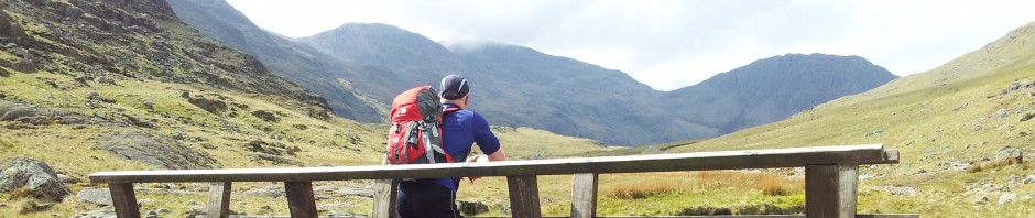


")
")


")