CONTENTS
- Cheviot Hills (14)
- Hadrian's Wall (4)
- Lake District (26)
- Lancashire & Cheshire (4)
- Northumberland (17)
- Random Stuff (13)
- Scottish Highlands & Skye (20)
- The Early Walks 1980 – 2000 (2)
- Tit Cam – Blue Tit Nest (4)
- Uncategorized (1)
- Zoo Review – Chester Zoo (1)
My Route Maps

-
Recent Posts
- Ben Alder and the Bike-Hammer-Brake Adventure
- The Wall Years – Two Men’s Competitive Obsession on the High Section of Hadrian’s Wall
- Probably the best route up the Cheviot from Langleeford – via Lambden Valley, College Valley and the Hen Hole – (13 miles)
- How to access the Coquet Valley and Cheviot Hills by car through Otterburn Military Ranges, via Dere Street
- Adder Encounter in the Cheviots, Northumberland
Top Posts & Pages


-
Mountain Forecasts


Tag Archives: Gray Crag route
Wainwrights on Wednesday – Hartsop Dodd, Stony Cove Pike, Gray Crag, Thornthwaite Crag, High St, Rampsgill Head and The Knott
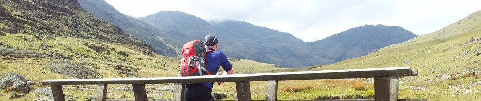
Clear weather and the chance of a rare midweek Lake District trip;- it doesn’t get much better than this. A 12 mile circuit over 7 Wainwrights with 3,800 ft of ascent starting from the car park at Hartsop village. After … Continue reading
Posted in Lake District
Tagged Atkinson's Monument, Caudale Head, Gray Crag route, Hartsop Dodd route, High Street route, hiking, John Bell's Banner, Lake District, Lake District walks, Rampsgill Head route, Routes from Hartsop, Social Hiking, Stony Cove Pike route, The Knott route, Thornthwaite Crag route
1 Comment

