
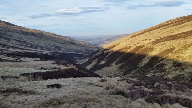
Long ago the Cheviot was an exciting volcano which unfortunately evolved into today’s peaty boggy upland plateau. Summit views are disappointing and there’s few features, yet at 2,674ft this is England’s highest point outside the Lakes & Pennines so a draw for many walkers. Best routes are probably from north west and College Valley, whereas those of us approaching from the south face the remorseless slog over Scald Hill from Langleeford in the Harthope Valley.
As a variation to this route I diverted off to reach the northern Lambden Valley, following the river before ascending up the side of the Bizzle. After navigating the summit bogs to reach the huge trig of the Cheviot, the descent is over Cairn Hill then down along the Harthope Valley back to Langleeford.
- Why do this route? Well it’s certainly different and you leave the world behind as it’s bloomin quiet, I saw no one for 5 hours. The best views from the Cheviot are from the edges and on this route extensive views north open up which are usually hidden.
- Disadvantages? Could seem a bit soul destroying losing that initial height gain to drop into the northern valley. Also no nice pavement to follow on top, you’re at the mercy of the peat bogs and have to steer through them. Easier than it looks though.
- Extra ascent and mileage which is either an advantage or a disadvantage depending on how far/long you want to walk.
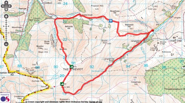
- Click on my Social Hiking Route Map above to zoom in/out
- Date = Sun 8th March 2015
- Distance = 13 miles (20.8 km), anticlockwise
- Duration = 6hrs 23mins, (start 12.06, finish 18.30)
- Total Ascent = 3,030 ft (923 m), max height the Cheviot 2,674 ft (815m)
- Start/Finish = Car park east of Langleeford, Harthope Valley, Northumberland
After a short drive along the very pleasant Harthope Valley I parked at the familiar large layby east of Langleeford. The walk starts along the standard route south west along the road then turning off right and angling west onto the open hillside towards the Cheviot. (For this route a better choice may be to cross the road from the car, heading north west following a curving track along the Hawsen Burn. Have done this twice before however in summer there can be annoyingly dense high bracken to wade through).
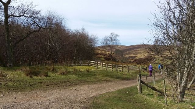
Leaving the road to start up to Scald Hill
I was soon walking uphill and feeling a lack of fitness due to lack of hill days. I hadn’t felt up for this walk but have learnt to ignore that and just get on with it. Did manage to overtake a couple though, who as it turned out would be the last human beings I’d see till back in Wooler hours later.
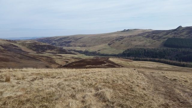
Looking back east to the distant hazy sea, over the initial ascent
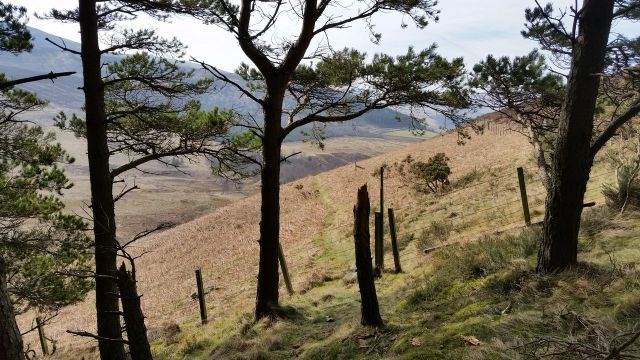
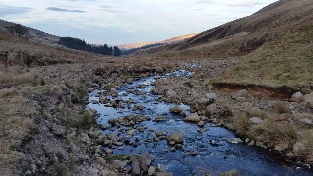
About 2/3rds of the way up Scald Hill I started the diversion by leaving the path, turning northwards heading initially towards Broadhope Hill across tufty grass. Over a stile a soggy peaty path dips down then up alongside a fence, before finally taking a left/west turn to begin the Lambden Valley section.

Diverting north from the path towards Broadhope hill across grassy stuff
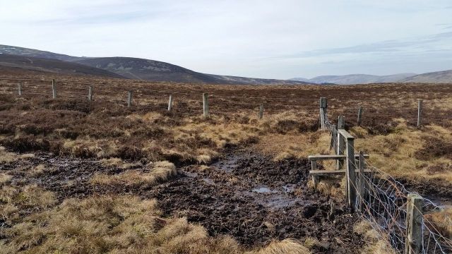
Crossing the stile over typical peaty Cheviot terrain

Follow the fence, dip down then up then turn left at the gate

At the gate turn west to start the Lambden valley section
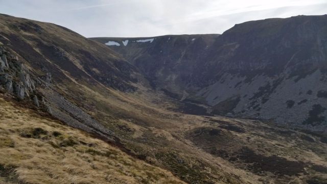
These are views here many Cheviot baggers will miss, looking along the Lambden valley to the Schill and across the northern slopes of the Cheviot.

Now to follow the Lambden valley, with the Schill distant left

North eastern brooding slopes of the Cheviot
The path drops gradually through open heather moorland then briefly joins a forest road before an interesting 4 minutes through woodland. Bit of fun here winding round tree stumps, dodging conifer branches, before emerging into the open over a stile. (Update – some trees now block the start of the forest path).
Join the forestry track before the tree section

If possible, angle left at the post into the trees, or if fallen trees block the way, go over the stile, follow the fence then back into the wood to find the path
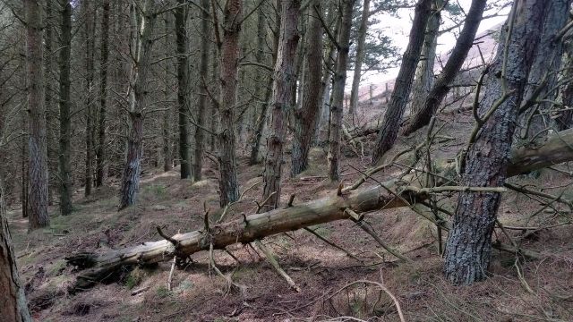
Dodging tree stumps adds variety to the day
Through the trees and over the stile
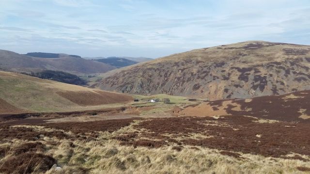
A sense of solitude kicks in as the route carries on westwards gently down to the isolated buildings of Goldscleugh. By now all previous height gain has been lost and Langleeford already seems a million miles away.

Goldscleugh, it’s quiet here
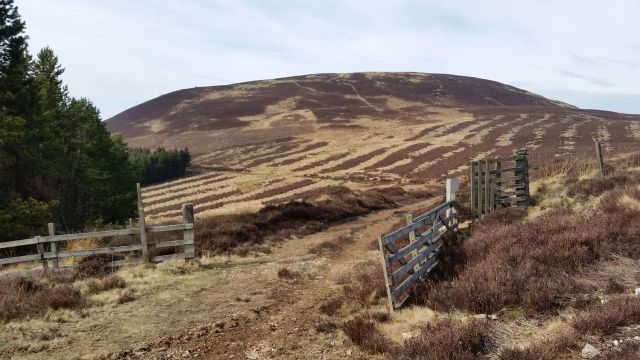
A final road section takes you to the equally isolated farm at Dunsdale, where the ascent of the Cheviot starts all over again.

The road west with the Schill far ahead

Dunsdale ahead, leave the road at the post & take the left track through the heather
Dunsdale’s a good place for a refueling stop before the inevitable steep slog uphill, also a good place to survey the Cheviot in all it’s northern glory. Far more interesting than it’s dull southern slopes. The obvious feature is the Bizzle, a steep cleft formed by the ice age. There are routes either side, I fancied recreating one done 20 years ago in snow up the eastern side.
From Dunsdale the ascent goes left of the Bizzle cleft up to the Cheviot
Wasn’t necessarily looking forward to this as I could still remember the peaty bog fest awaiting up on top. A path looked visible heading up to a cairn which would hopefully ease progress, so off I plodded. Unfortunately the path kept away from the Bizzle’s edge then petered out, so I veered right to get the cliff views. Nice views but surprisingly breezy, a northern wind was funneling up the flanks making progress hard. Had to move away and ended up on spongy energy sapping grass, before eventually reaching the cairn of Great Hill. My lack of fitness was evident here but the views back down kept getting better and better, with the white farmhouse of Dunsdale getting smaller and smaller.

Remorseless is the word, heading up by the Bizzle

Looking down at Dunsdale, getting smaller
The Bizzle from above, slightly blurred due to the strong wind

Eventually the cairn seen from Dunsdale is reached and the hard work eases on Mid Hill. Had a short rest sheltered (slightly) by the cairn from the wind. Views though were great, different is the word to use here. Pity it was hazy though as really wanted to check the northern horizon, will have to return with binocs on a clearer day.
On Mid Hill, hazy but good view, the College Valley running mid left to right

On Mid Hill looking west over the Bizzle to Braydon Crags & the Schil
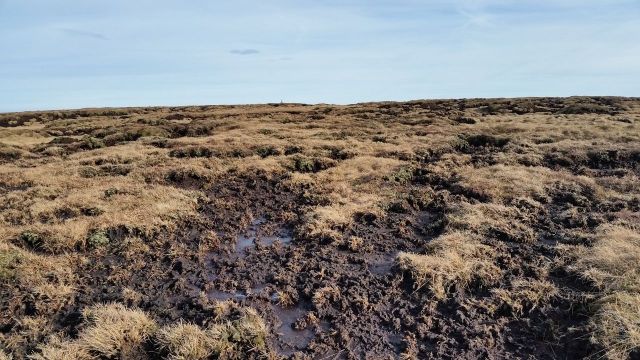
No putting it off, now for the bogs, I was hoping for a track to follow but after a quick wander over the crags I found nowt. Was just a case of taking a bearing and picking a line through the scattered peat hags. Depending on how weird you are there may be some satisfaction in this challenge, my route turned out reasonably ok, no wet feet, no snorkel or flippers needed.

Looking south at the boggy plateau ahead, Urgh!

Looking back north over the exciting terrain
Hope on the horizon, is it a bird, is it a plane, no it’s a bloody big trip pillar

So close and yet so far, some concentration is needed to stay dry
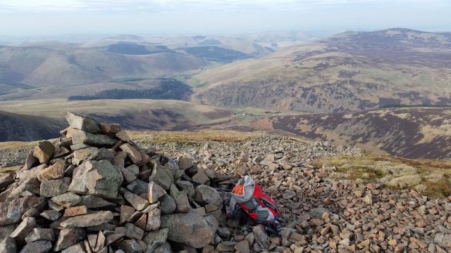
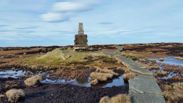
An uplifting sight on this peaty plateau is spotting the huge summit trig on the horizon. Soon I was very close then started laughing at the boggy mess barring the way. Discovered some footwear lost in the mire, fortunately no one still attached. Inspired by the challenge of maintaining dry boots I used skills honed in the maze at Tatton Park to weave through. A final turn west to reach the sanctuary of the stone pavement then walking up to the solid foundations of the trig. I ate brownies on top and took a video to celebrate. Of the scenery, not the brownies.
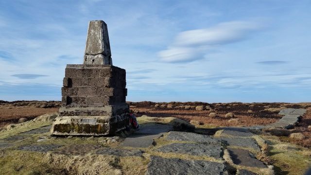
The Cheviot


Video from the Cheviot, turn sound down, bit windy;-
According to Wikipedia; “The view is obscured greatly by the flatness of the summit plateau. Nevertheless, on a clear day the following are visible (from west, clockwise); Broad Law, Moorfoot Hills, Pentland Hills, the Ochils, Lammermuir Hills, Lochnagar, Ros Hill, Long Crag, Urra Moor, Tosson Hill, Burnhope Seat, Cross Fell, Helvellyn, Scafell Pike, Skiddaw, Sighty Crag, Peel Fell, Queensberry“.
I’ve certainly seen the Lakes from the Cheviots, never yet the Pentlands but to see the Munro of Lochnagar would be amazing. Today due to the haze I mostly saw bugger all, and bugger all people were up here too, completely deserted, which was nice.
Descent options to Langleeford are, in speed order;-
- quickly follow the pavement east descending rapidly on decent ground to the car
- west along the pavement then curve south down then east along the Harthope Valley,
- full circuit over Hedgehope – some bad peat to negotiate but very nice on Hedgehope
Tempted to do the first, didn’t have time for the third and I fancied something different. So I did a number two, (maybe should rephrase that). The lowering sun through the hazy light with a hint of lenticular clouds was fantastic, very peaceful.
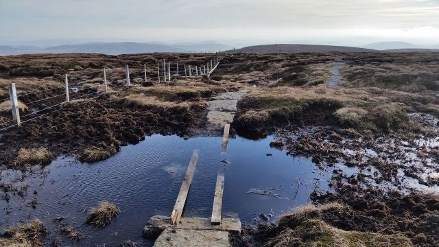
DO NOT leave the pavement, my pole went deep and I nearly followed it

Nearing the turn off, with Windy Gyle 5 miles in the distance
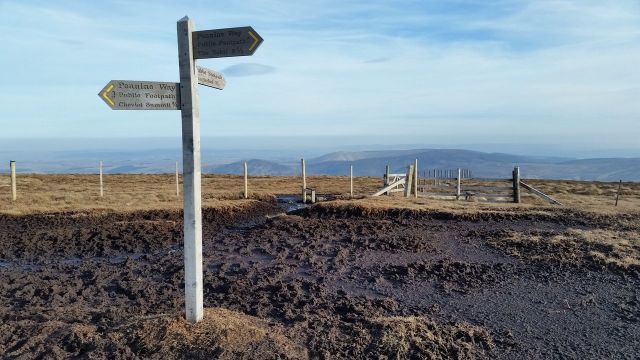
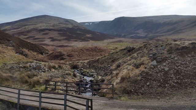
Turn south at Cairn Hill for the Harthope Valley or Hedgehope

Descending the Cheviot looking south
My first time along the valley and I was initially ok with it then a little nonplussed. It’s longer than you think and of course views are limited in a valley. There was a choice of keeping to the stream or a path slightly higher on the northern side which seemed to keep a straighter line and avoid little ups & downs. Still it was different, though I certainly wouldn’t fancy this as an ascent route, far too tedious, the other two options are better.

Turning east at this signpost for the Harthope Valley path
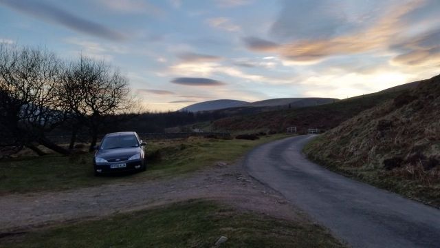
Back to the car near Langleeford, last in the car park as usual 🙂
Would I recommend this? Well, Yes & No;- No if you’re after a quick ascent up the Cheviot. Yes if like me, you fancy something different and longer. Next time I hope to be fitter and will explore the west side of the Bizzle over to Braydon crag.
On the theme of doing something different I recorded an audio commentary for this walk;- only 9mins 58 seconds if you fancy a listen;- http://voicebo.com/widget_v1/9tEuKn
- Also here’s a longer 16 mile route from Langleeford including the Schill
I’ve honestly tried to love the Cheviot but my preference is still the upper Coquet Valley walks up Windy Gyle with all the variety on offer 🙂 Check some out here


Not tried it yet … The Cheviot. Managed a walk on Sunday into southern Cheviots around Alnham. Nice views all around. Saw Hedgehope but Cheviot always obscured by cloud!
Yeah the Cheviot is some 6ooft higher than the other hills, so gets the most cloud. Some say it looks better in cloud too 😉
Completely different conditions to my walks! The tussocks, bogs and wind would challenge me. The scenery is beautiful though. So open and hilly! I usually have to be at the very top of a hill/mountain here to see into the distance. It is quite scrubby/forested terrain in the National Park areas I walk around Brisbane – either wet rainforest or dry eucalyptus and acacia bush. I like having a view into the distance such as on your walk. Great pics.
Thanks. Our hills are a bit barren in comparison, deer & sheep eat everything and much land has been stripped & maintained for grouse shoots etc. Makes walking easy but means theres no vegetation drawing up moisture. It rains a bit here too so gets a bit soggy 🙂
Pingback: Probably the best route up the Cheviot from Langleeford – via Lambden Valley, College Valley and the Hen Hole – (13 miles) | MART IN THE HILLS