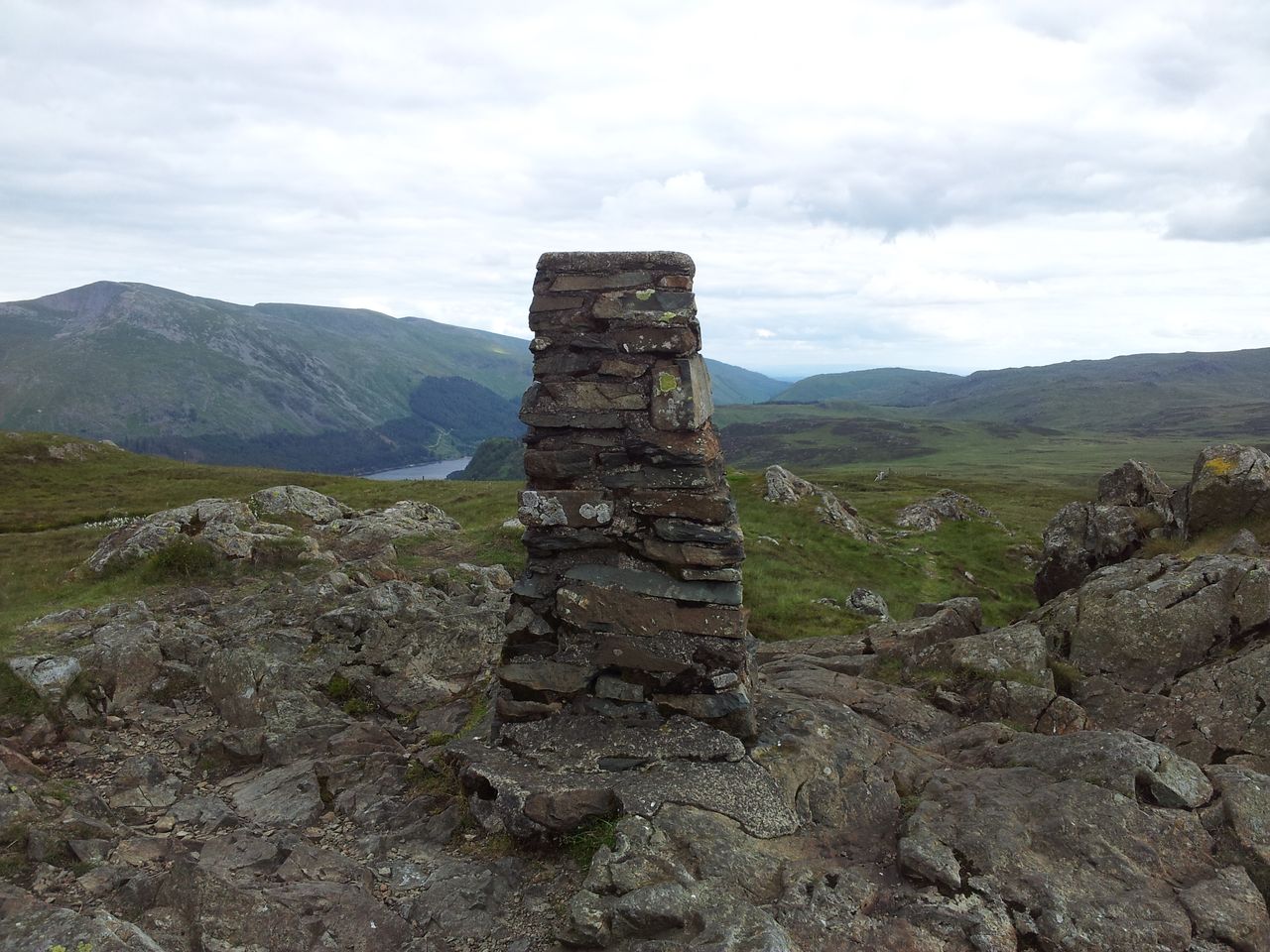
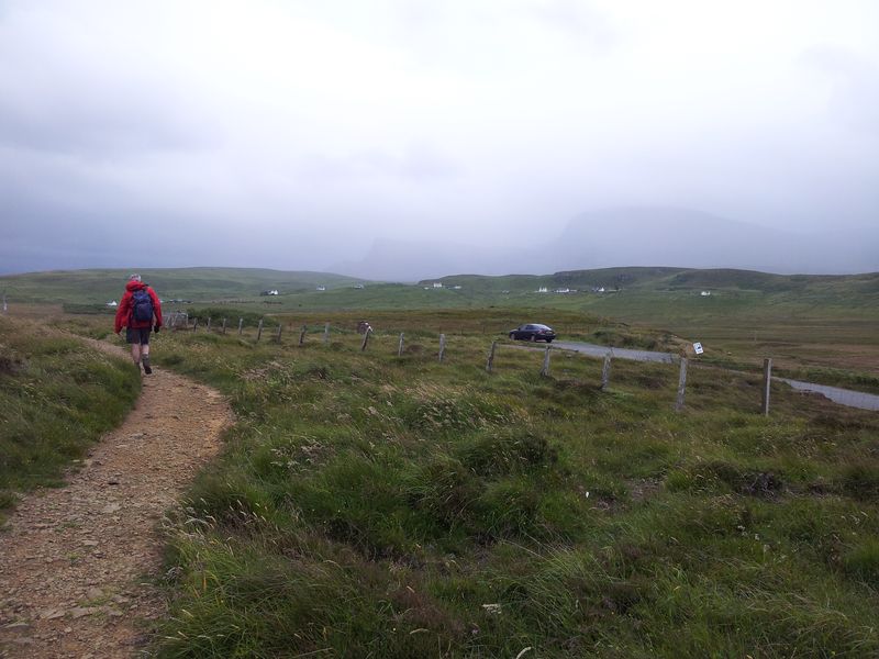
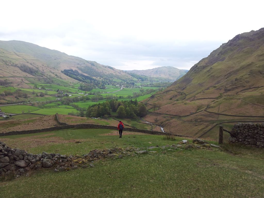
A return to Lancashire’s West Pennine Moors during a Bank Holiday weekend with more time for a longer walk. Had heard of the ‘Chorley 4 Peaks’ via Twitter but this started from the town whilst I preferred keeping to the countryside. I found a GPX route out to Great Hill from the same Lower House Car Park I’d used last time. Then by adding my previous route on Winter Hill & Rivington Pike it made an interesting lengthy circular walk. The traditional 4 Peaks route includes Healey Nab so today would be a Chorley 3 Peaks walk. Choosing to go clockwise meant getting the long farm fields approach section out of the way first. This also had the incentive of finishing on the more interesting higher section to Rivington Pike, leaving just a pleasant downhill stroll to the car. Weather was excellent with equally excellent views over Lancashire and beyond.
Distance = 12.1 miles (19.5 km)
Duration = 5 hrs 40 mins (start 11.45 am – finish 5.25 pm)
Total Ascent = 2,080 ft (634 m), highest point Winter Hill 1,496ft
Start/Finish = Lower House Car Park (free), end of Belmont Rd off Sheep House Lane
Date & Weather = Sunday 7th September 2014, sunny spells, quite clear
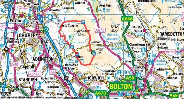
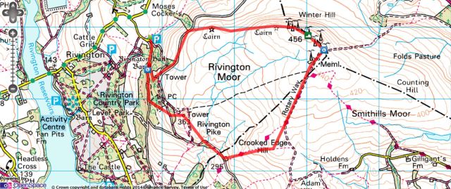
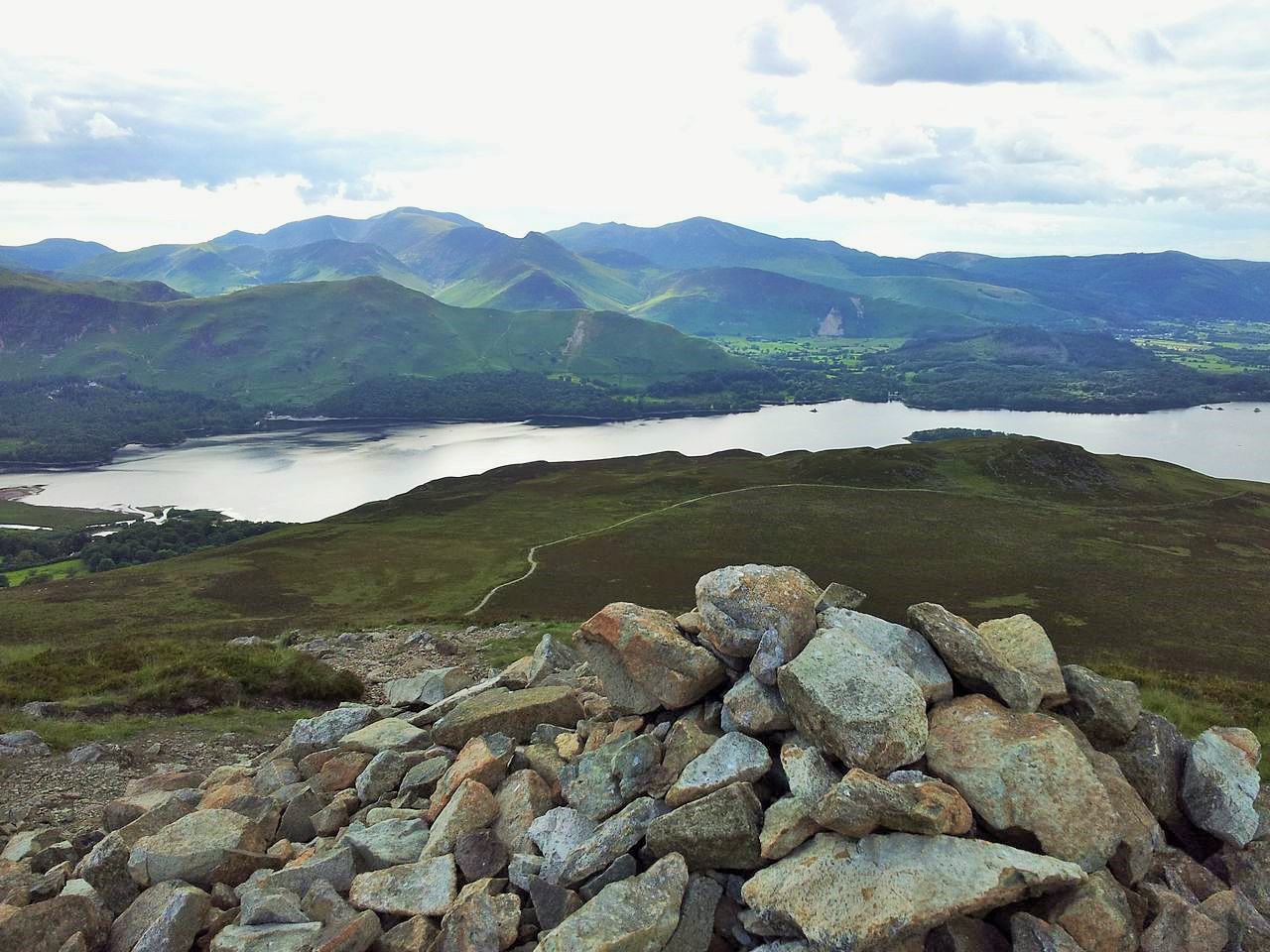
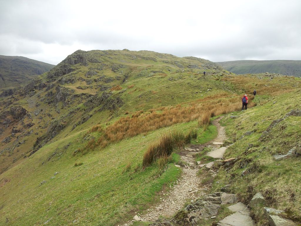
Click on the Route Map below to zoom in/out
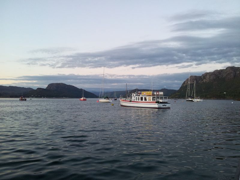
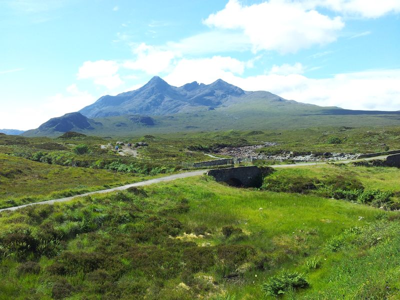
Chorley 3 Peaks Route, White Coppice, Great Hill, Winter Hill & Rivington Pike from Lower House
Route Summary – Walks work best in stages, so here’s the 4 stages that worked for me.
Lower House to White Coppice; (1hr 25mins)
White Coppice to Great Hill; (55 mins)
Great Hill to Winter Hill; (1hr 25 mins inc delay)
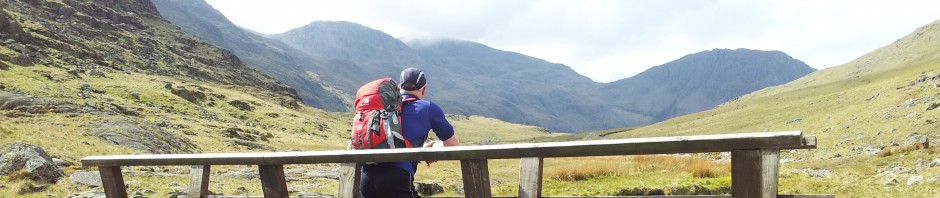
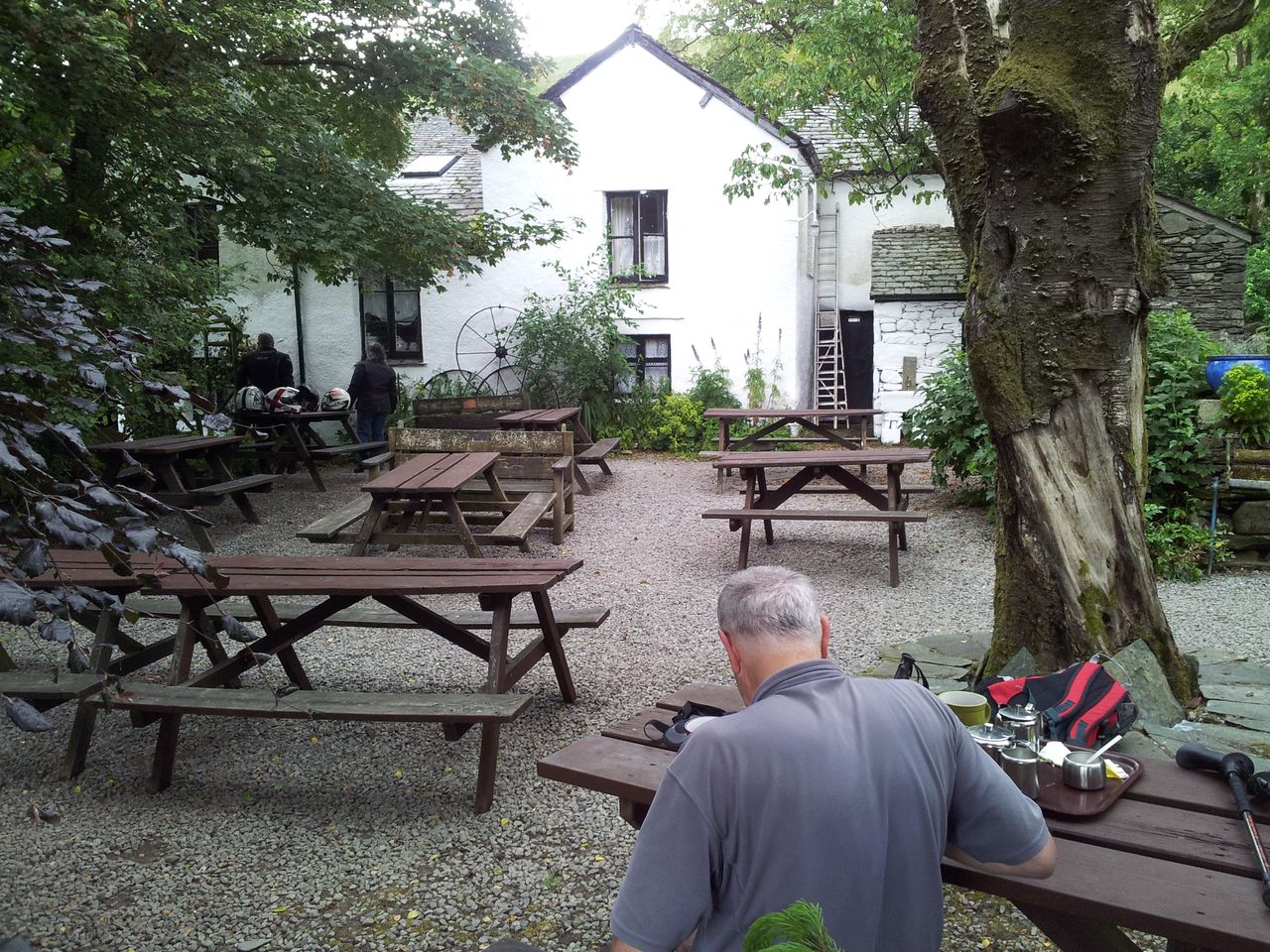
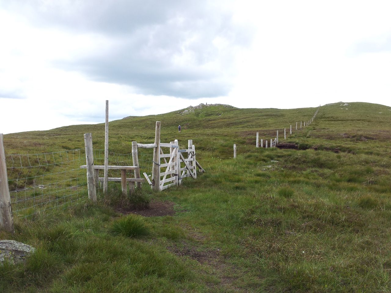
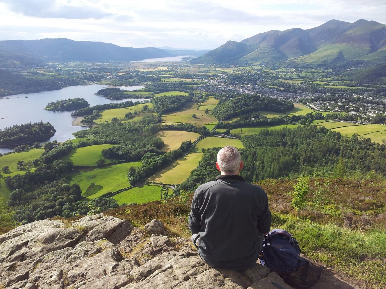
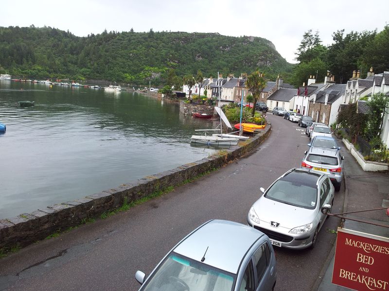
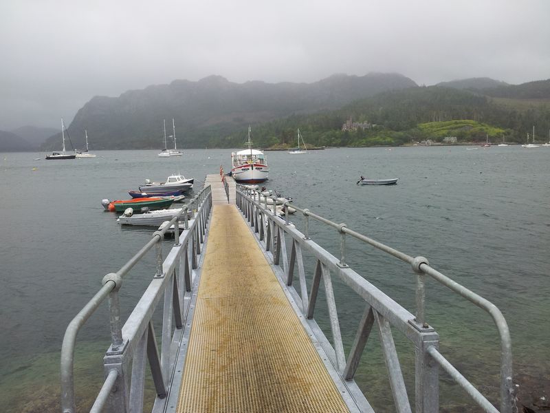
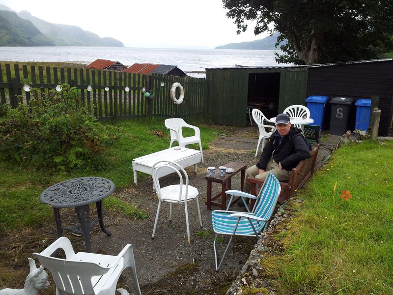
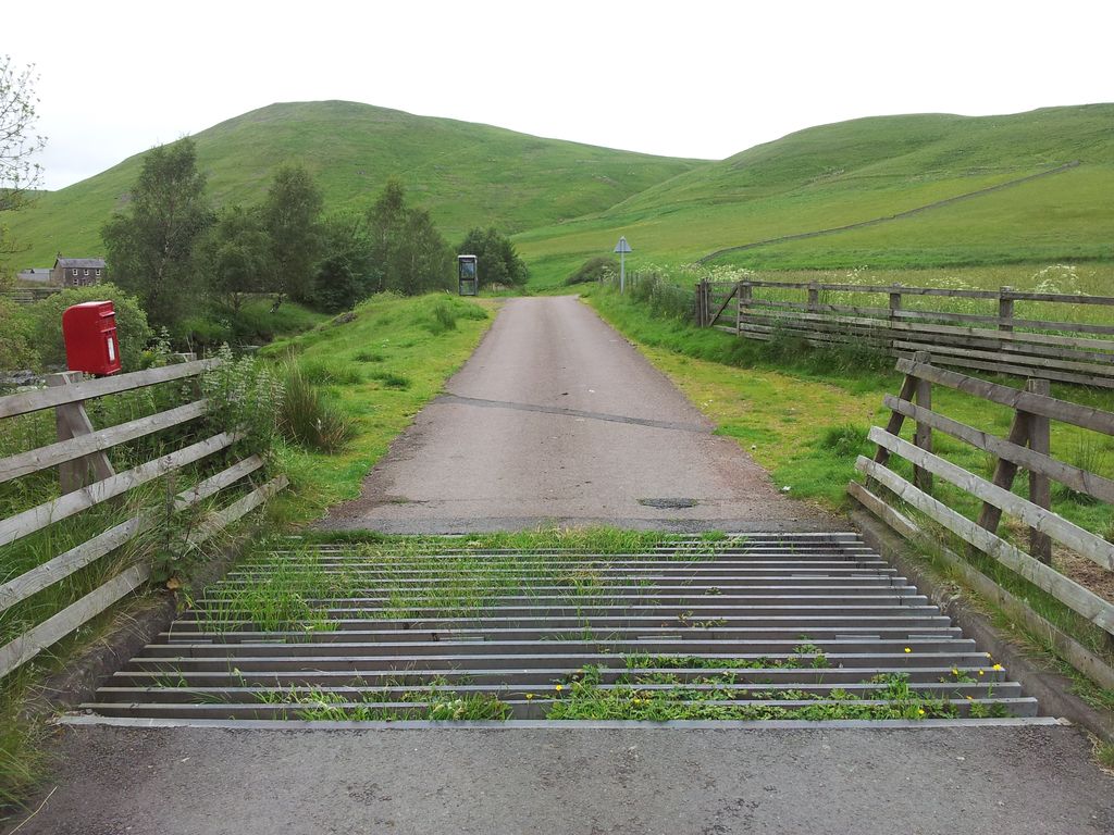
Starting Point; Lower House Car Park SD6314 (aka Pigeon Tower Car Park), at the end of Belmont Rd off Sheep House Lane. If lucky there’s an ice cream van waiting for you!
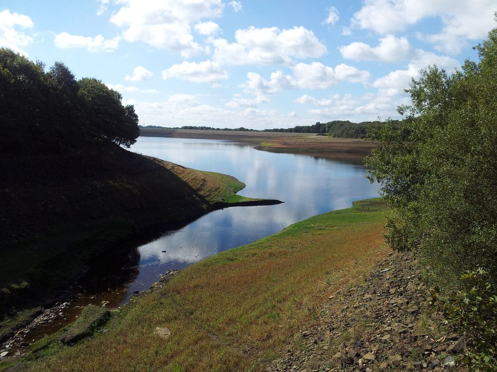
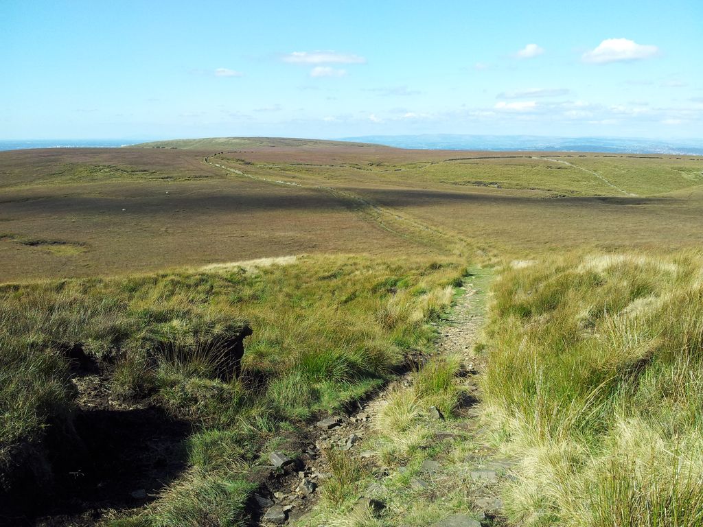
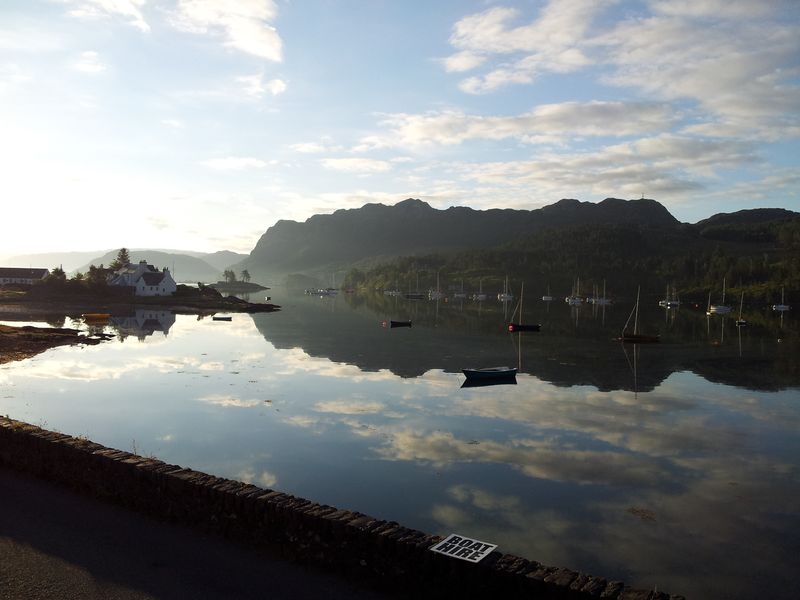
Stage 1 – Lower House to White Coppice; (1 hr 25 mins). From the car park I walked north west back up Belmont Rd turning right on to Sheep House Lane, along Dean Head Lane to Hodge Brow which descends to Alance Bridge over the River Yarrow and Yarrow Reservoir.
Alance Bridge & Yarrow Reservoir – 12.00
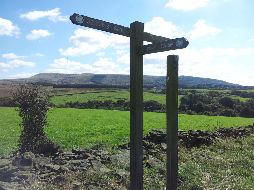
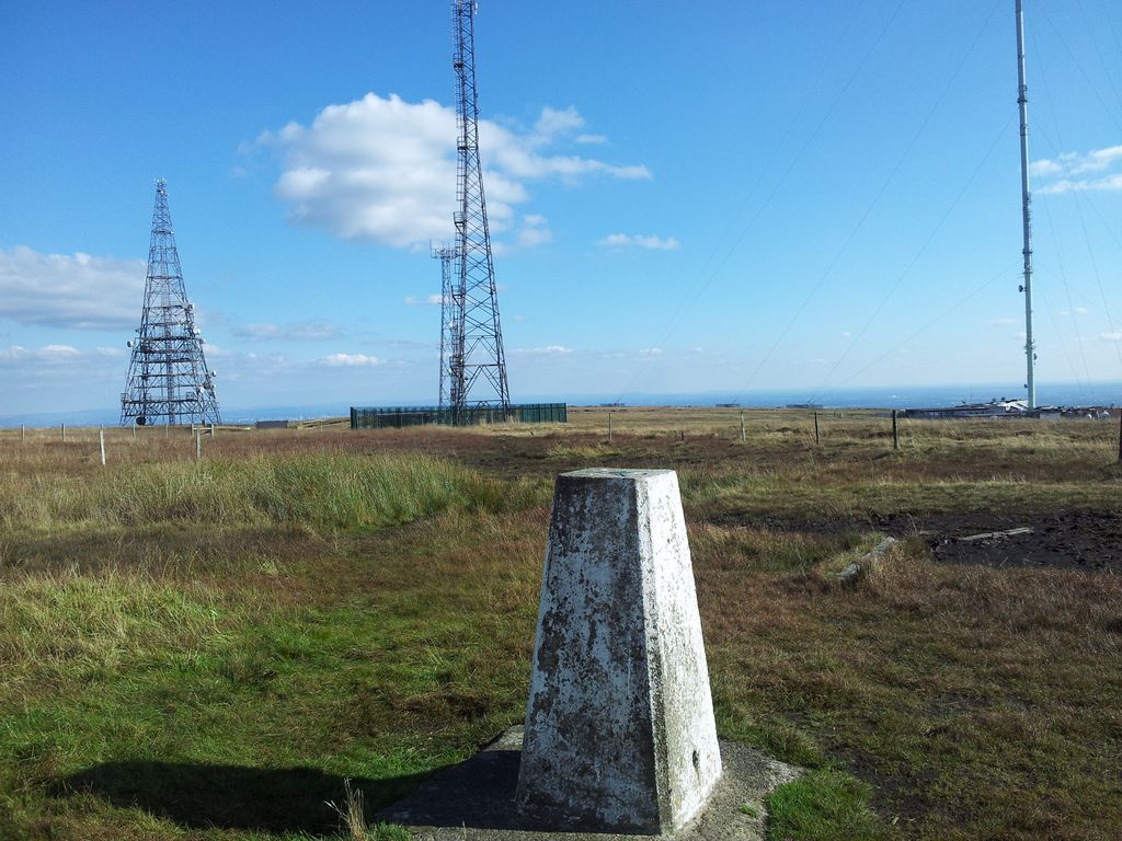
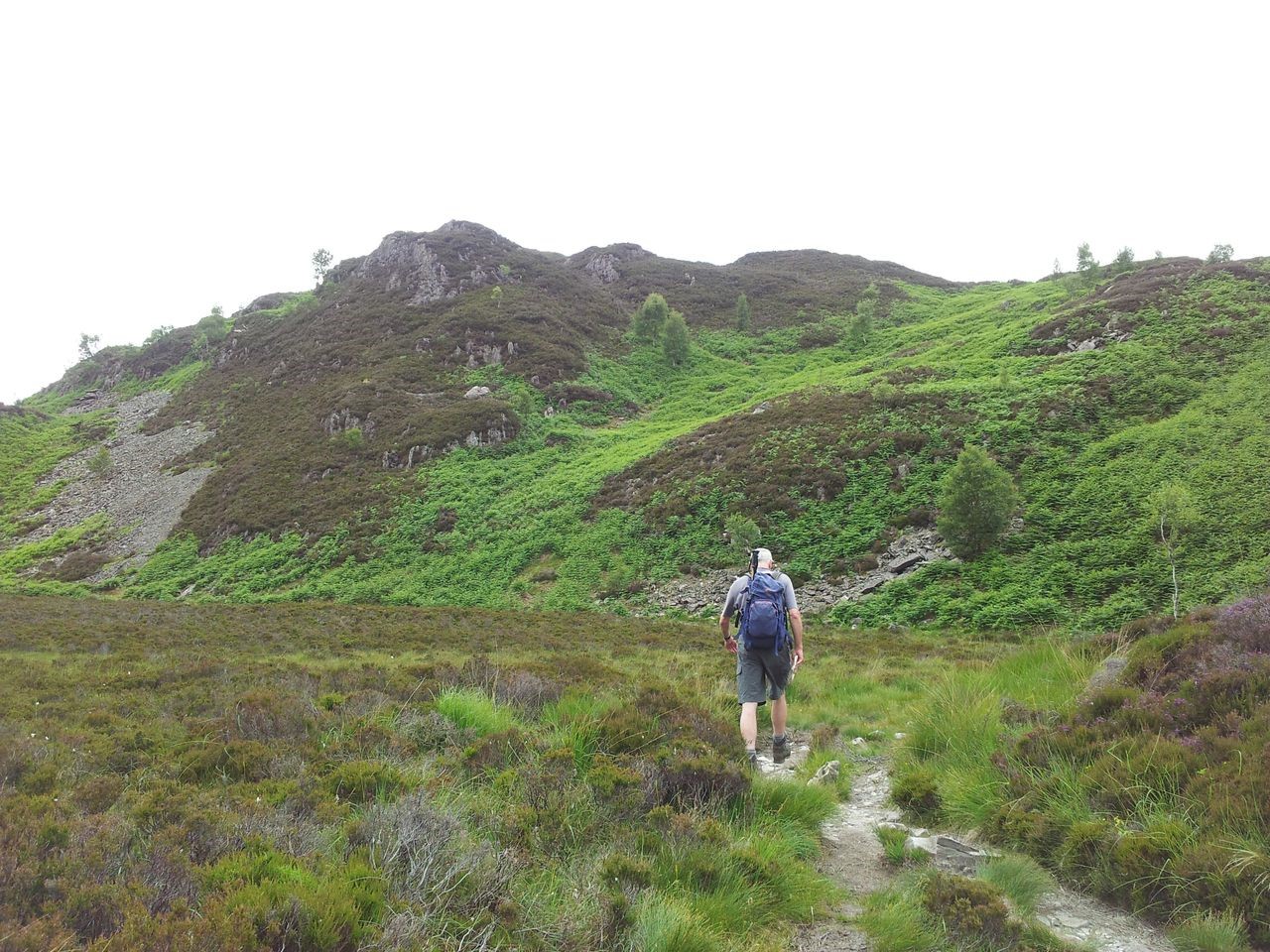
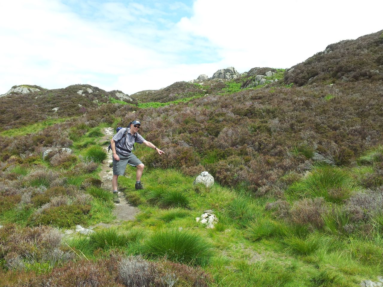
Once over the bridge instead of following the road left/west I went straight up through a gate north into the farm fields, along an initial path which petered out. A little height gain gave views back to Winter Hill, that 1,035ft aerial is pretty unmistakable.
Follow the sign to Jepsons Gate, kinda. Winter Hill back there – 12.10
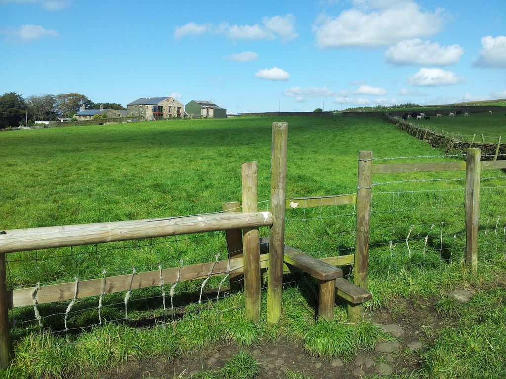
My downloaded route was a saviour here as it made things extremely easy. It showed a line through the farmyard below but I couldn’t see any way through. See the green building?
Jepsons Farm, head for the green building – 12.15
Looked like I was walking into a dead end but sure enough a hidden stile appeared and a narrow path through the farm. Hardly visible until next to the bloomin thing.
Jepsons Farm hidden stile – 12.20
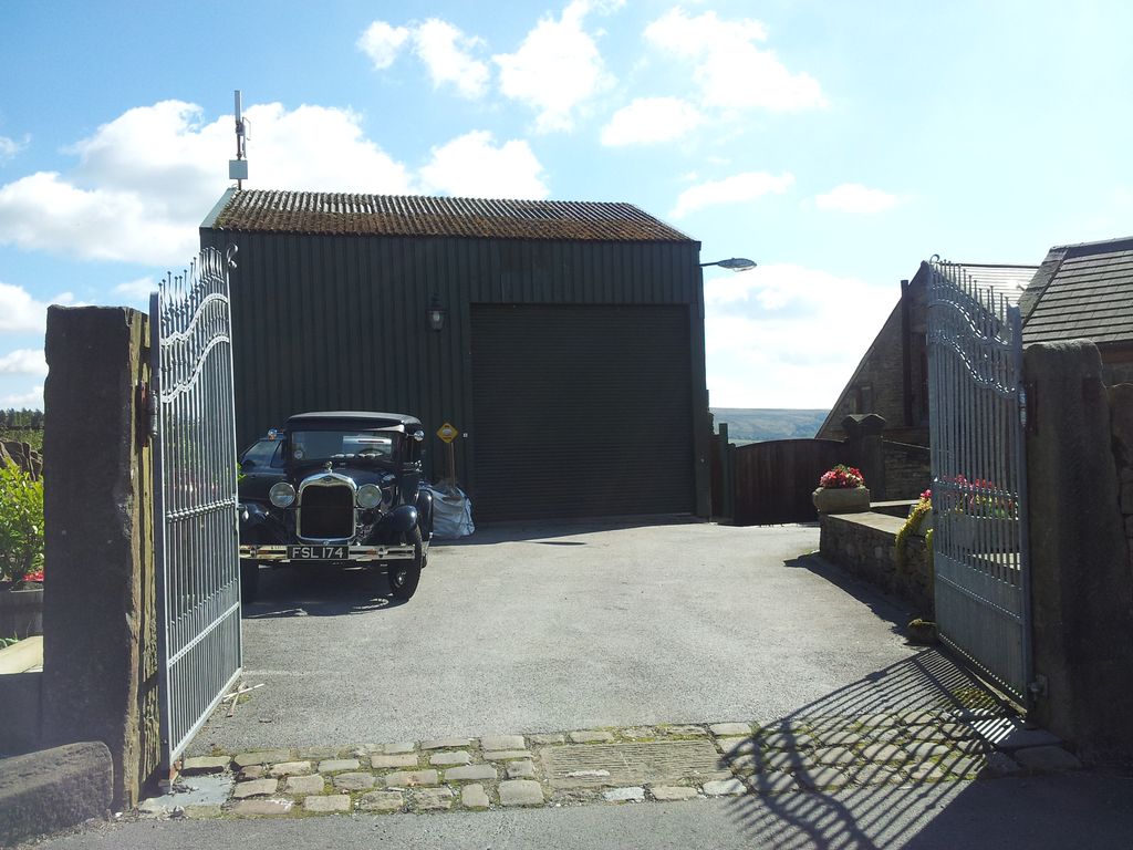
Through the gates and past the vintage cars, not sure if those gates stay open
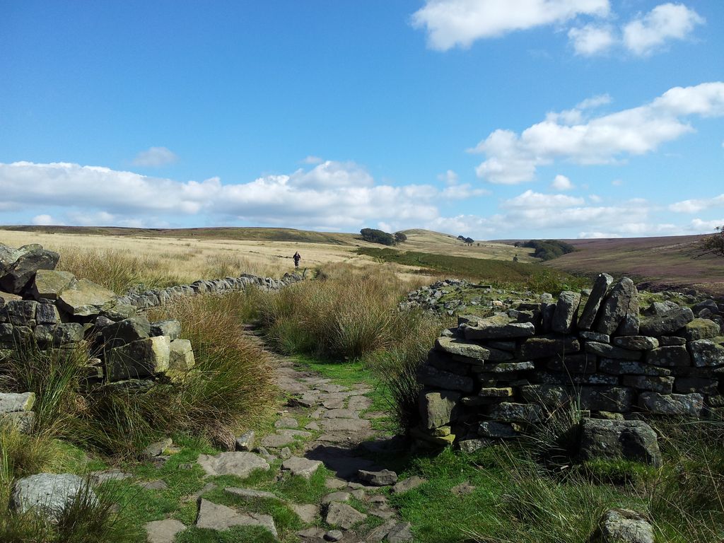
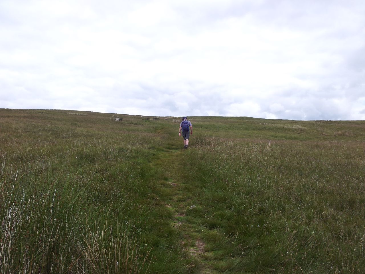
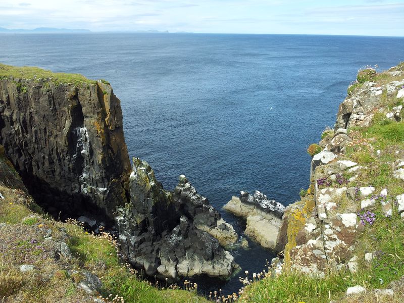
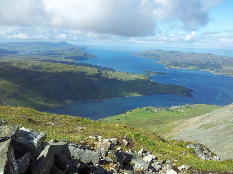
Through the iron gates and along Moor Road a few yards to a stile up & over the wall back into green farm fields. I continued between two sets of trees then negotiated round another farm and back onto Moor Road. Across the road was another stile into another farm field which dropped more steeply down into trees on a good path skirting a small dam turning north west through Spen Wood. Eventually emerging on the east banks of Anglezarke Reservoir. I was very relieved to see the back of the farm fields.
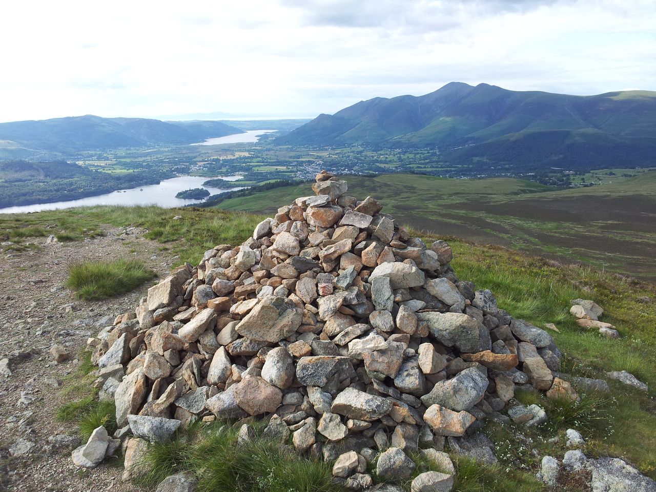
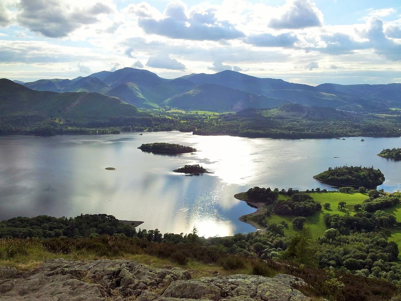
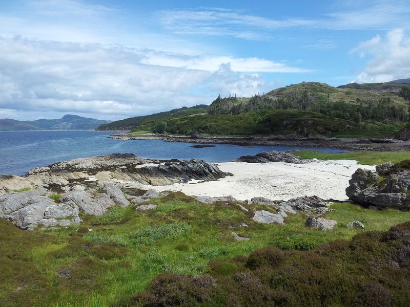
Anglezarke Reservoir – 12.45
The path continued north past families out for a stroll and cyclists out for a cycle. I went wrong a couple of times but let’s pretend that didn’t happen eh:-) Eventually at the north end of the reservoir I crossed Moor Road again, turned left to a wooden gate heading initially east, bending north. This was an excellent level track following the River Goit out towards the hamlet of White Coppice with the shoulder of Anglezarke Moor to the east. After the long ‘walk-in’ I was really keen to get up onto the open fells. Some superfluous info on the mini Lake District Chorley Reservoir system around here.
Stage 2 – White Coppice to Great Hill; (55 mins)
Carry on left, do not head straight for the high path from here (as I did) – 1.10pm
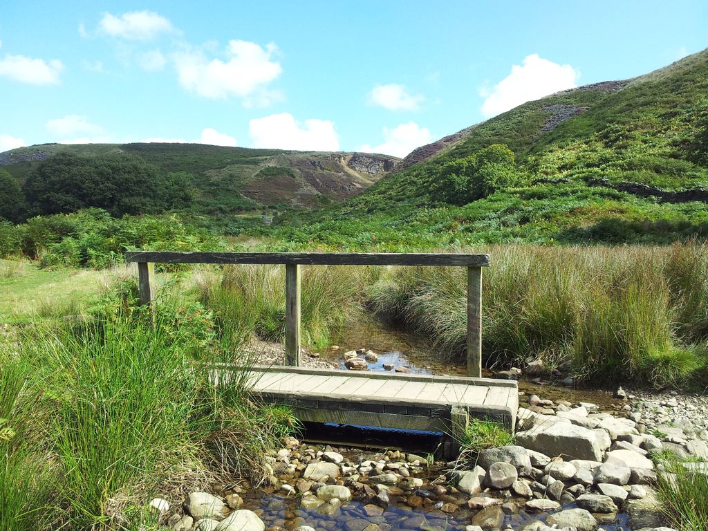
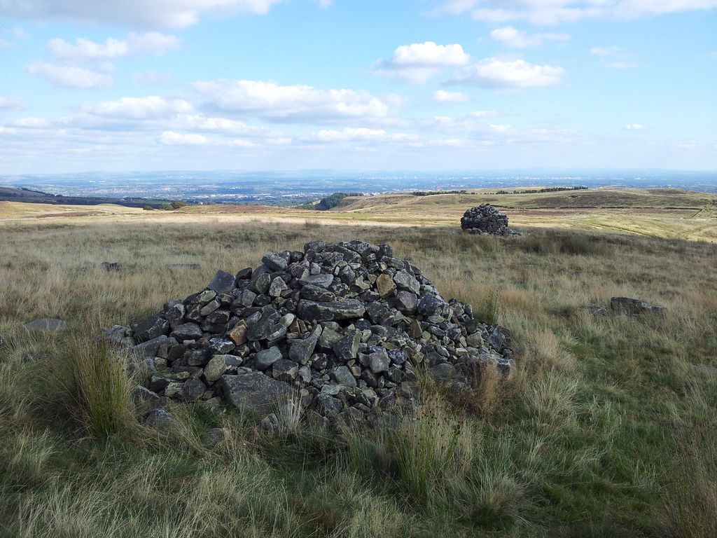
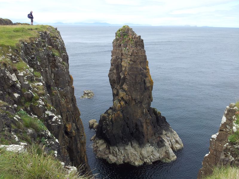
After 10 mins walking from the road the ascent route came into view and I eagerly headed off towards it from the little footbridge above. This was a bit premature and I should have carried on a few more yards as it brought me to a surprising feature. Only problem was I was the wrong side of it.
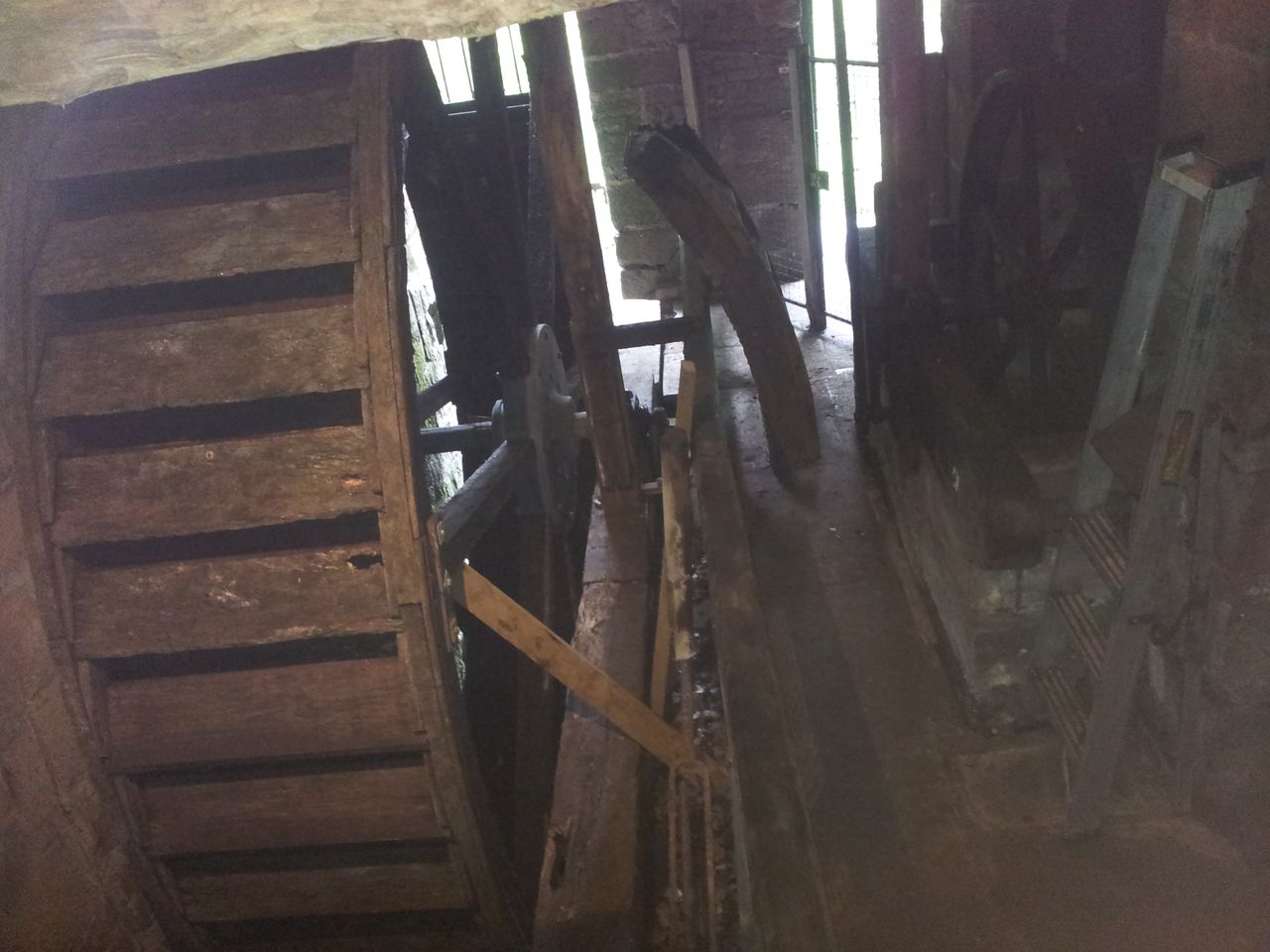
White Coppice Dean Black Brook, I’m the wrong side of the Sluice Gate
This was Black Brook, so named due to the peat apparently (even though this made it brown). The Brook once powered a water wheel for Leicester Cotton Mill down in White Coppice. Doesn’t look much in the photo but that’s a 5ft dangly drop past the green bit. Rather than just walking back round, I chose to dangle down the dangly bit, it wasn’t elegant but hopefully no one noticed. Sensibly I’ve corrected my slight errors in the Social Hiking route link at the start, I wouldn’t want anyone dangling their dangly bits here.
Black Brook, evidence of old mining, the path goes up far left
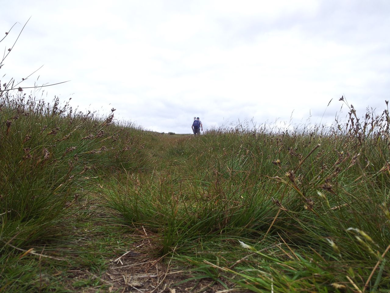
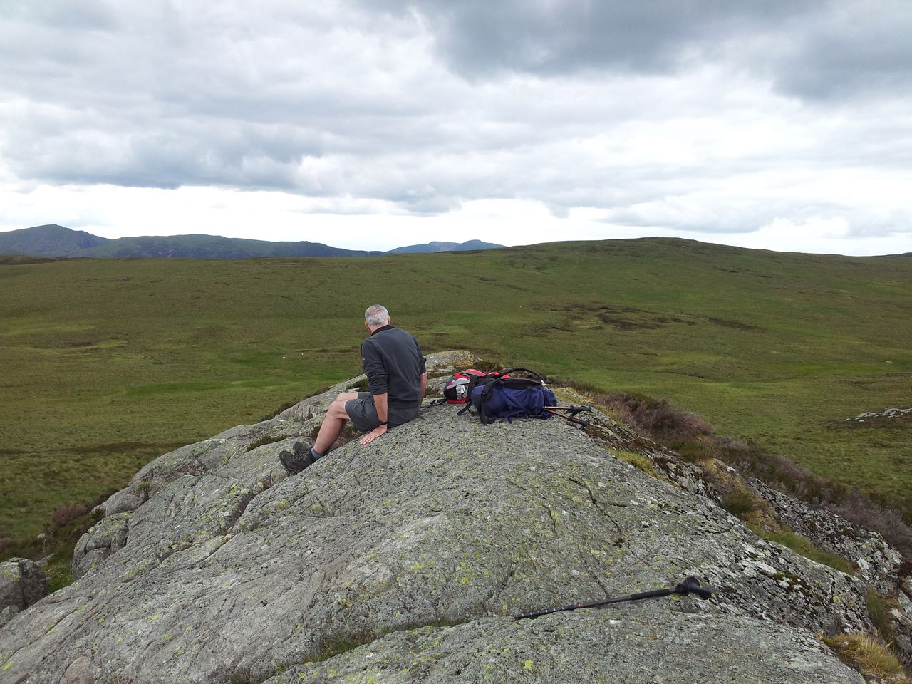
The path climbs up the north side of the Dean heading east. At last after 1.5 hours some ascent and views west to the coast. Also at last I had a 5 min sit down & choccy brownie.
View down the Dean, Healey Nab left & White Coppice right – 1.20pm
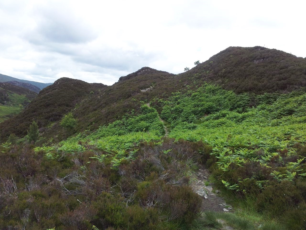
After a short climb the path levels then gently rises, Great Hill in the distance – 1.40pm
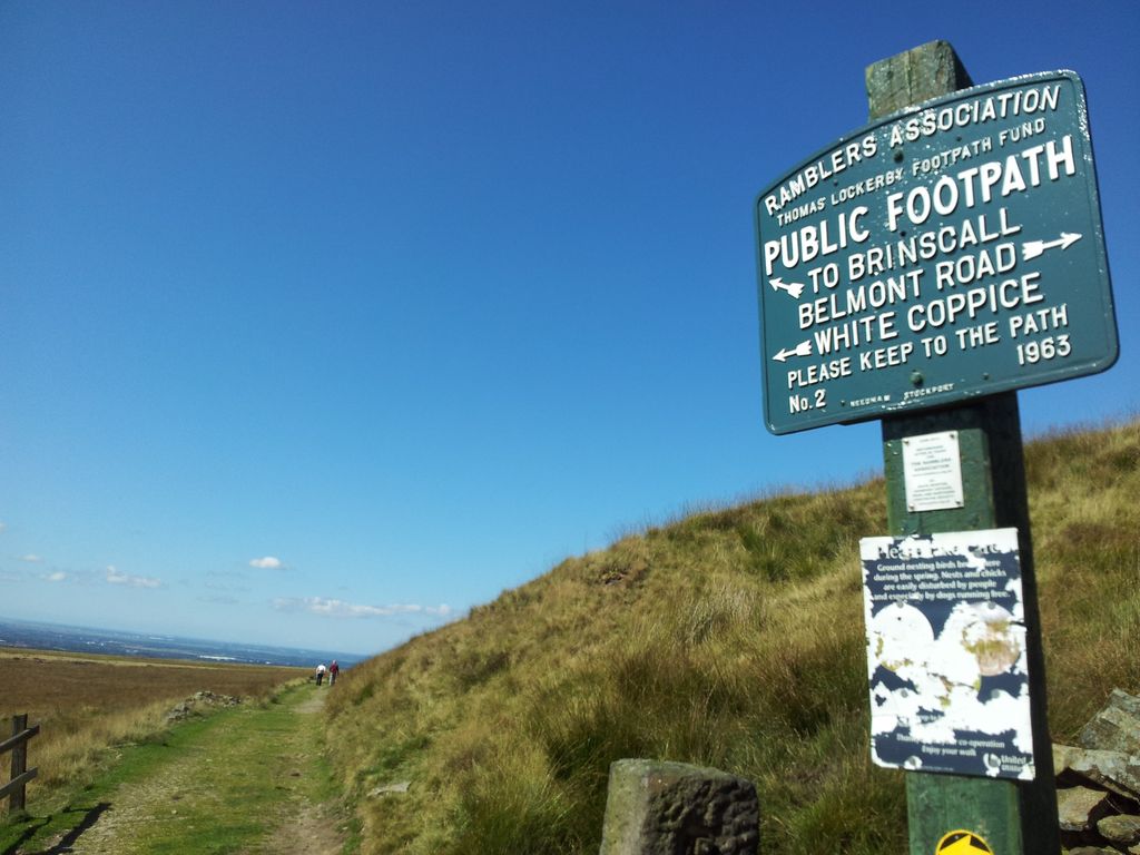
Nice sign and annoyingly it’s younger than me – 1.50pm
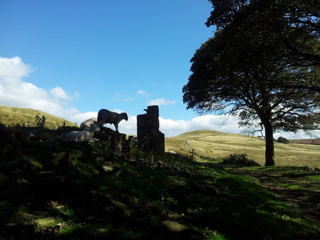
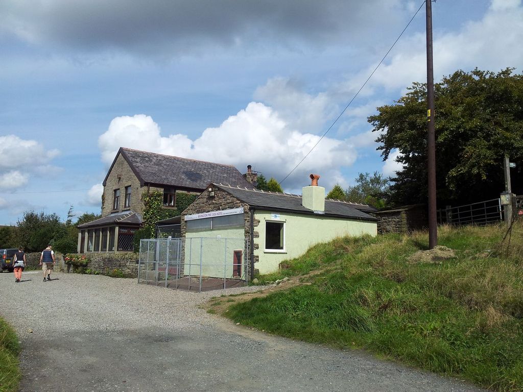
Sheep poser at Drinkwater’s Farm, Great Hill ahead
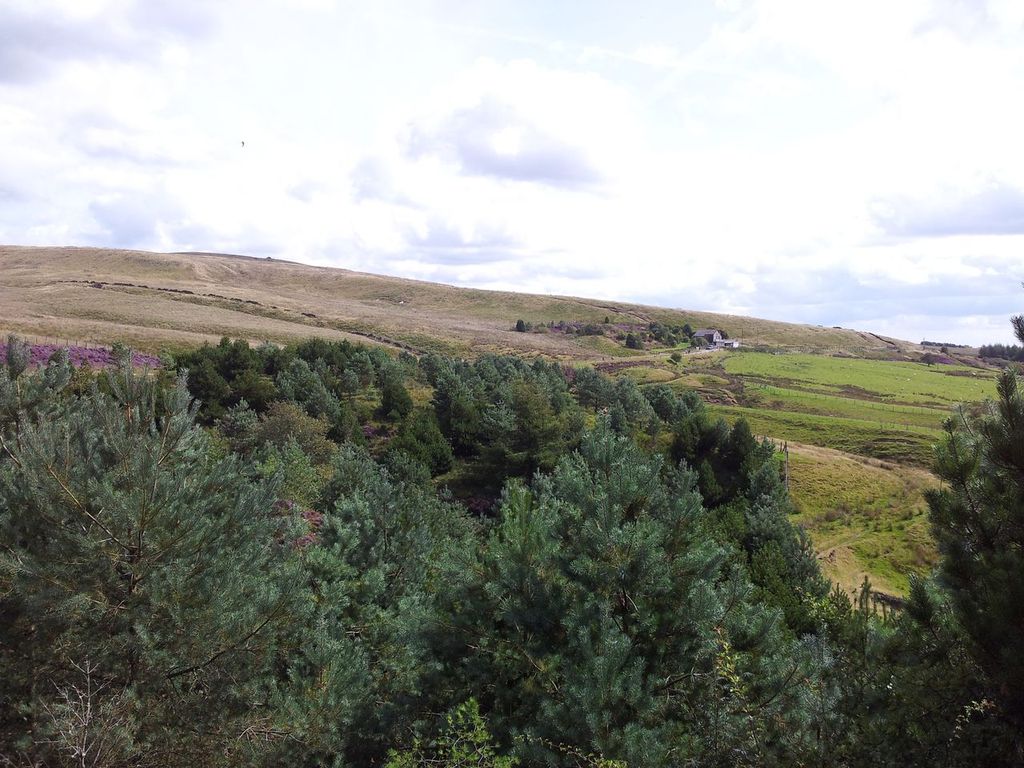
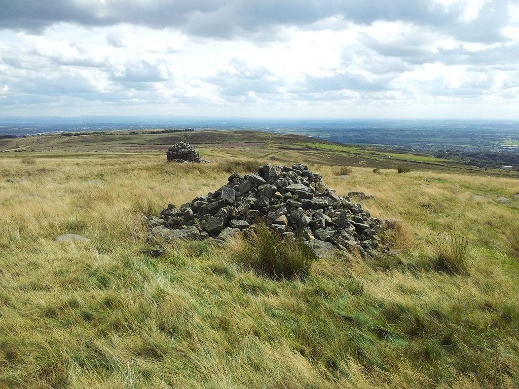
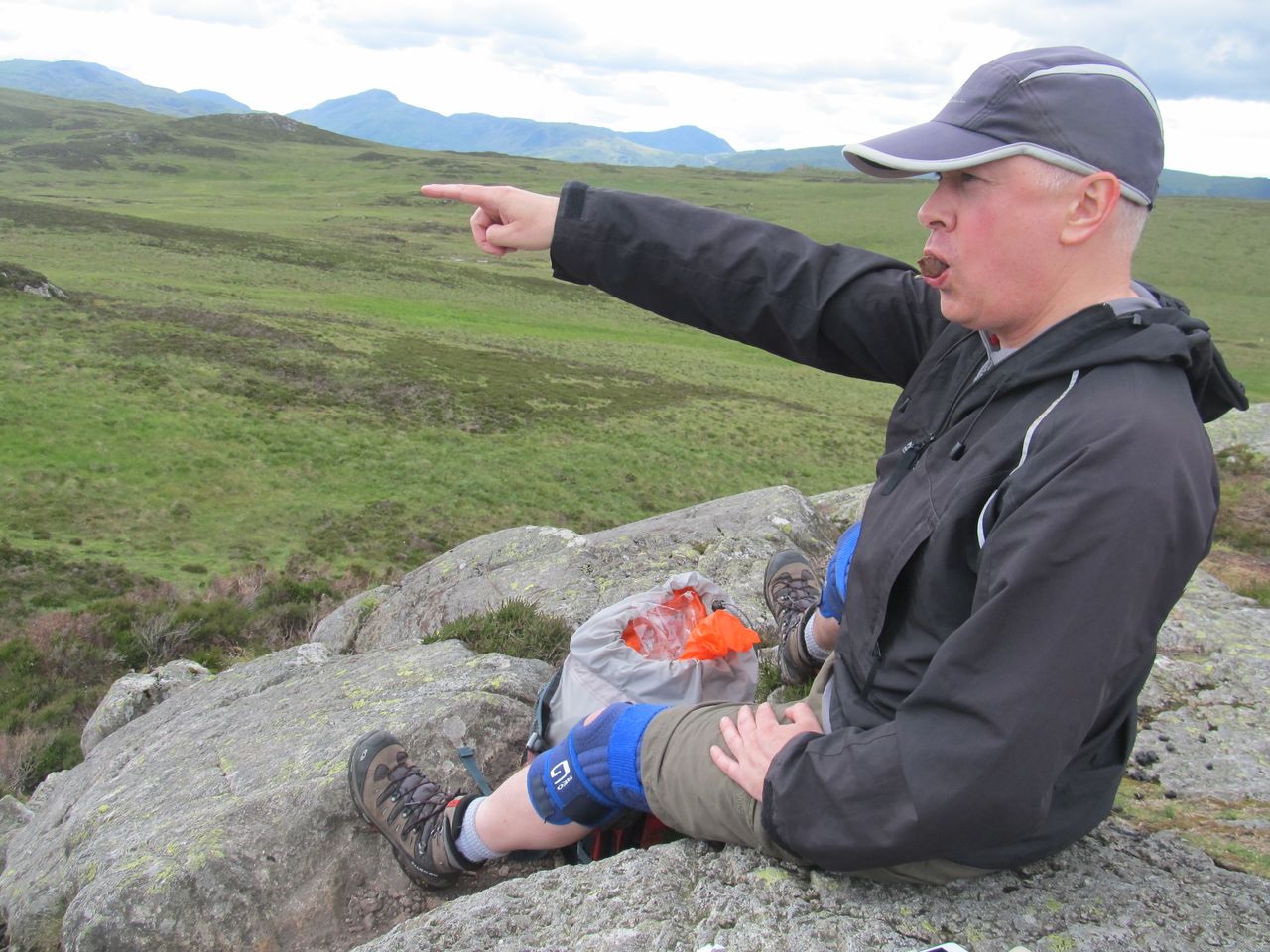
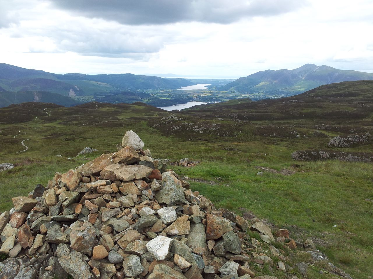
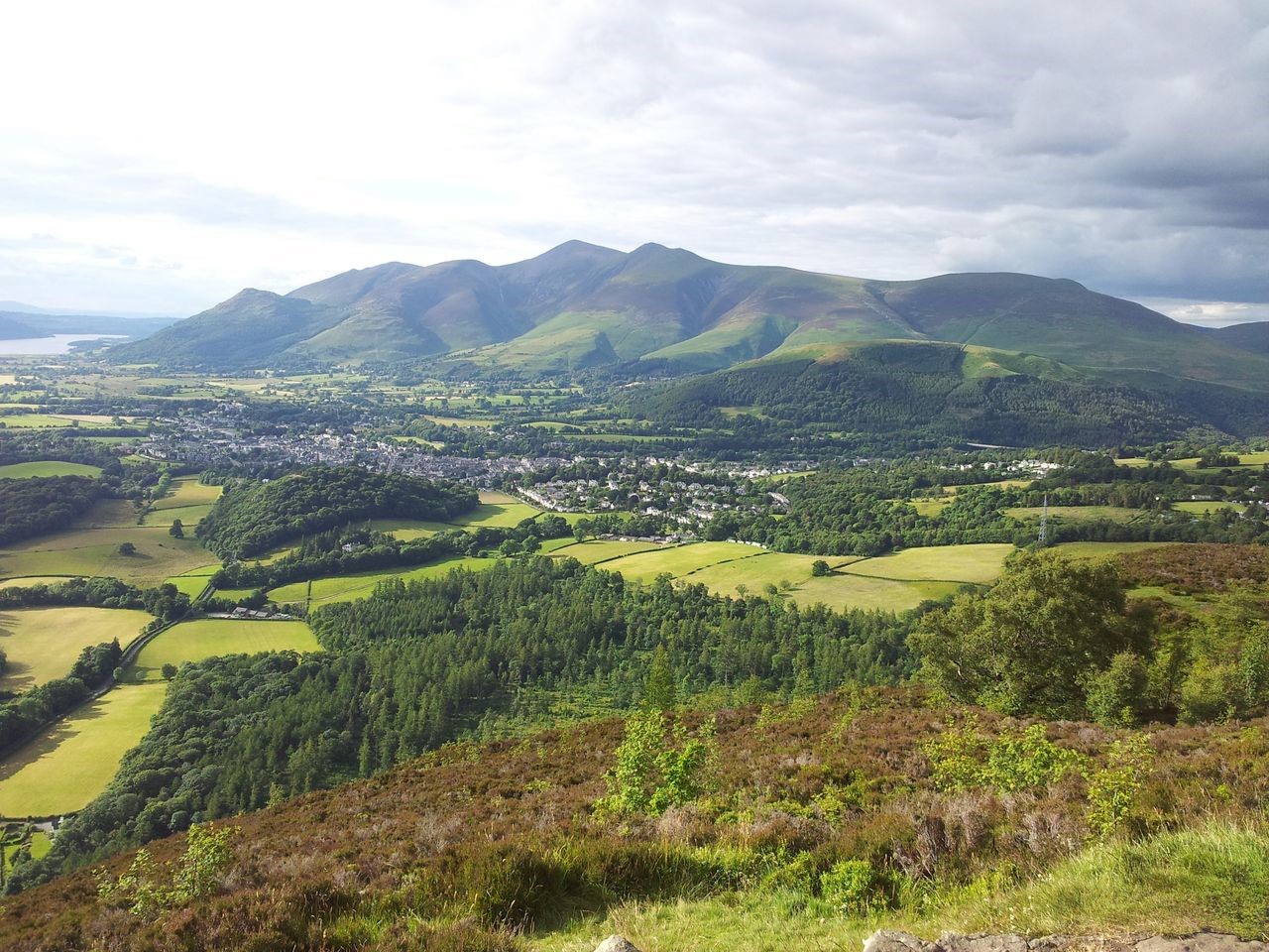
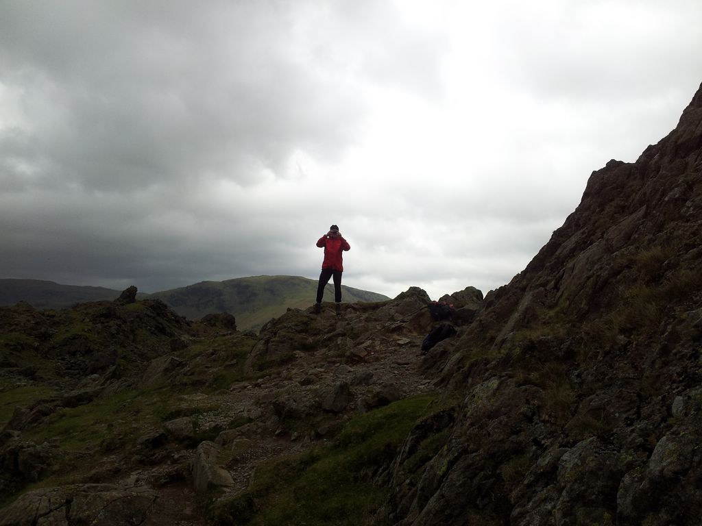
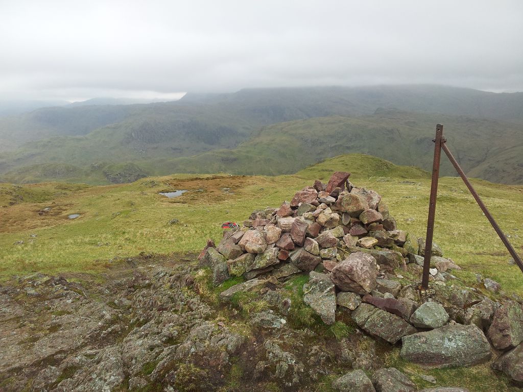
Drinkwaters was apparently used as target practice during the second world war, probably less attractive to sheep back then. Took less than an hour to reach Great Hill from White Coppice inc a 5 min break. A really good path and a gentle angle made for good progress into the West Pennine Moors. Great Hill is merely the 1,252ft high point of a flattish mound but the views really are Great.
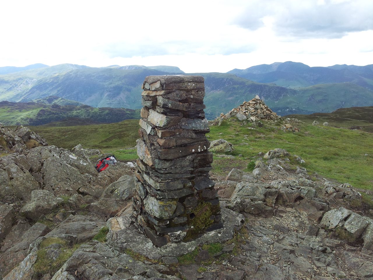
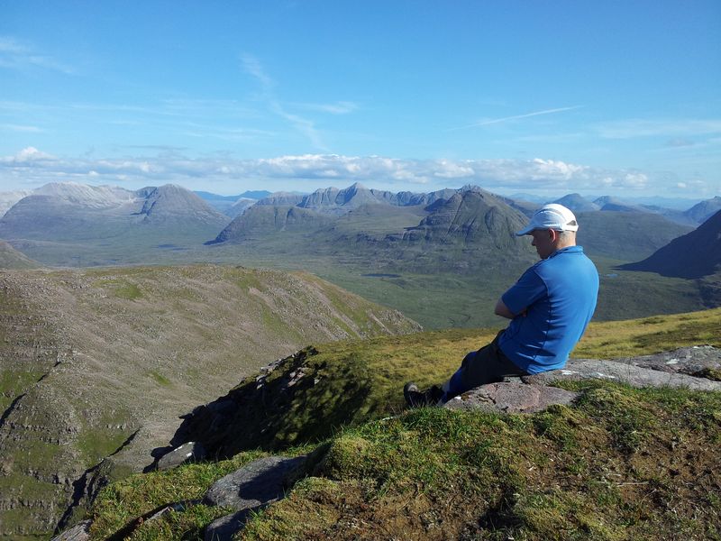
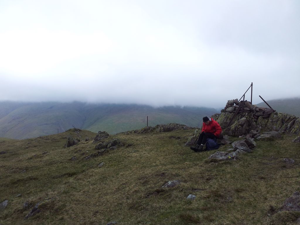
Great Hill 1,252ft, north west to Darwen Tower – 2.08pm
And the other Great thing was I was completely alone up here, even for 15 minutes of Great viewing appreciation. I got the binocs out, it was Great.
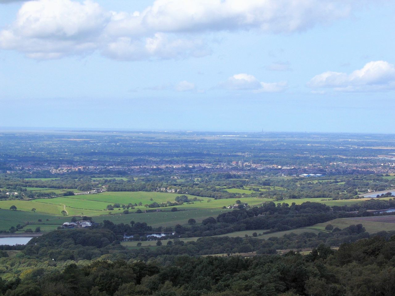
Great Hill out to the Lancs coast, Blackpool Tower’s out there somewhere
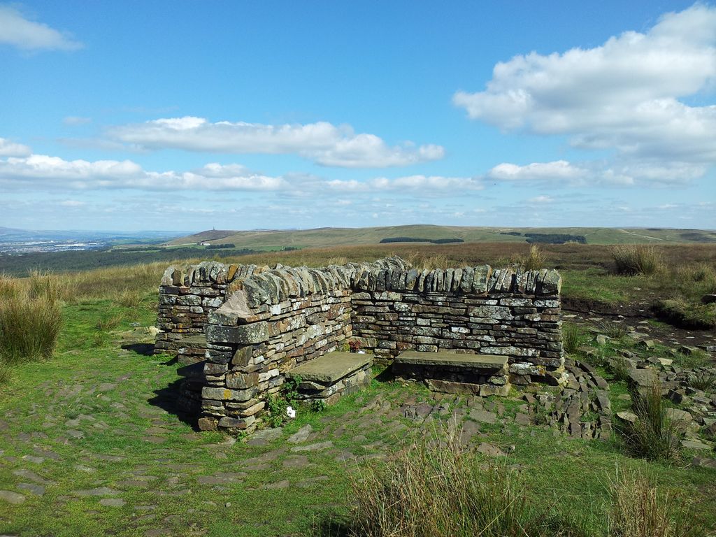
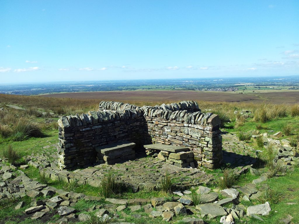
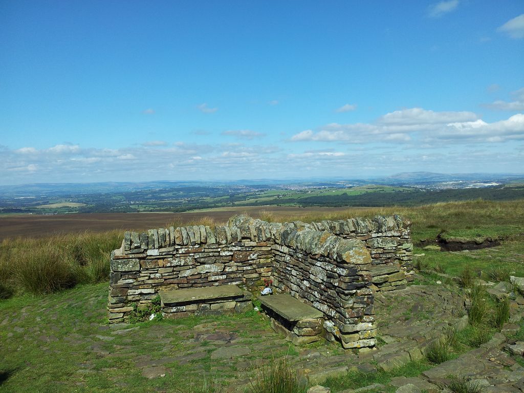
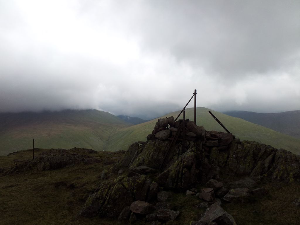
I wondered what story lay behind this surprisingly nifty cross shaped shelter with 4 angles to hide from the wind and a surprisingly attractive round block paved base. Turns out it was built in 1999, kinda flattens the magic 🙂
Great Hill northwards, looked like Whernside & Ingleborough
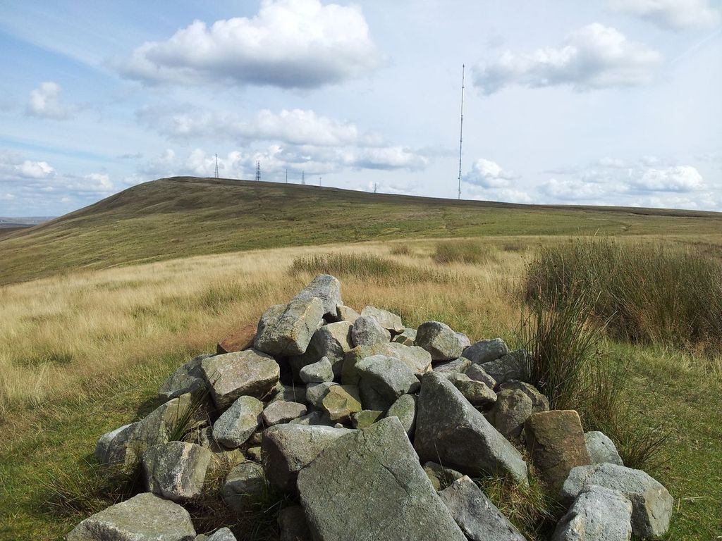
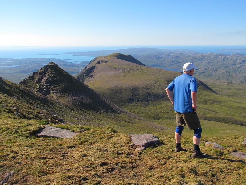
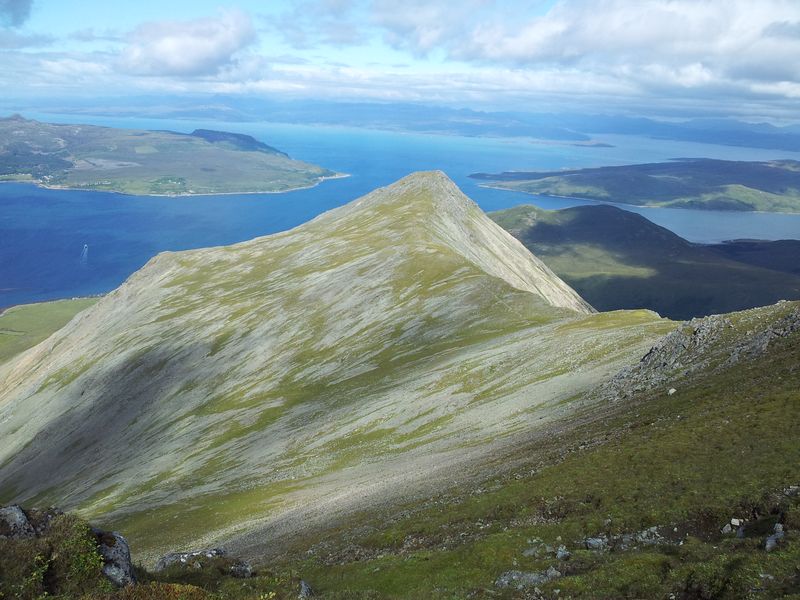
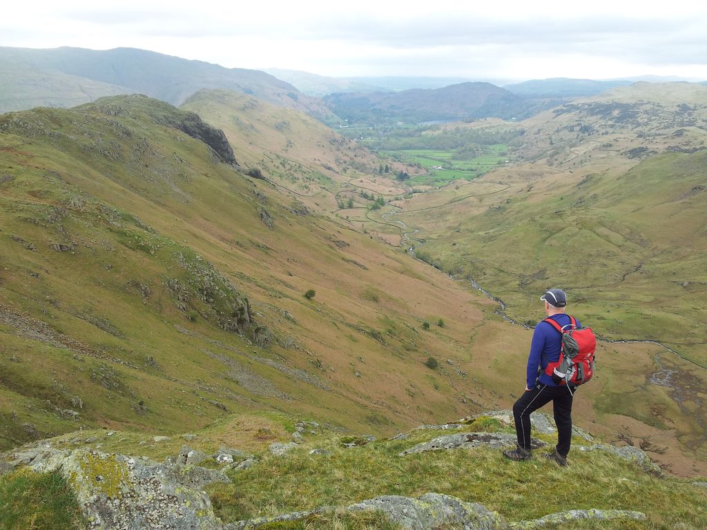
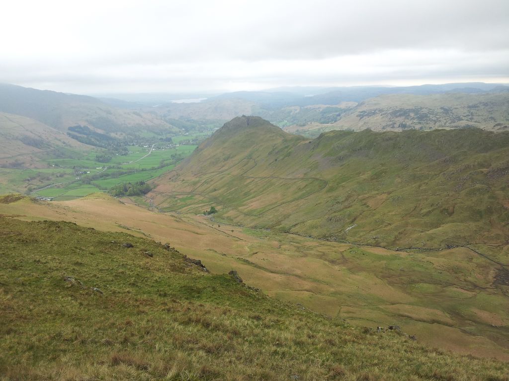
Great Hill looking south and the route to Winter Hill
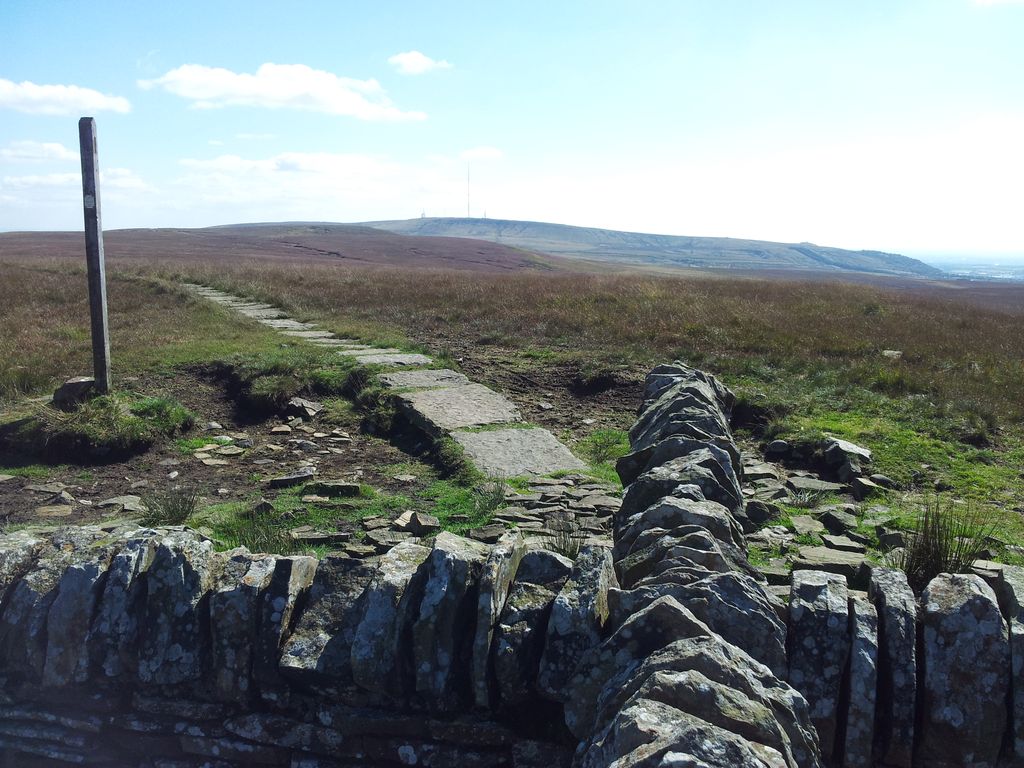
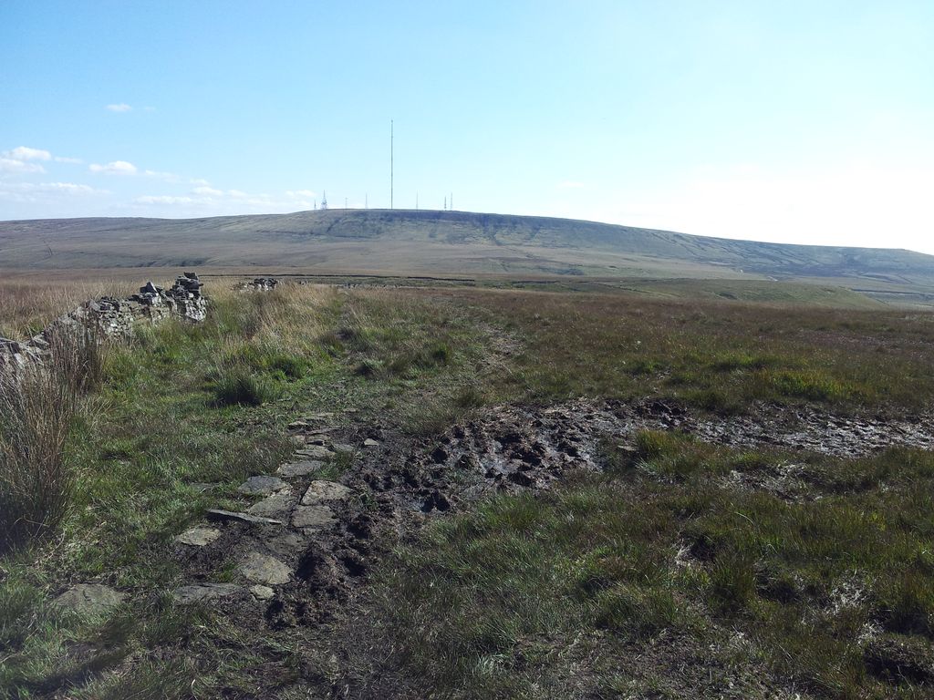
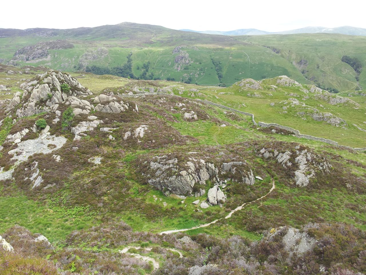
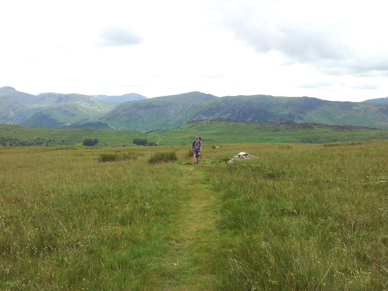
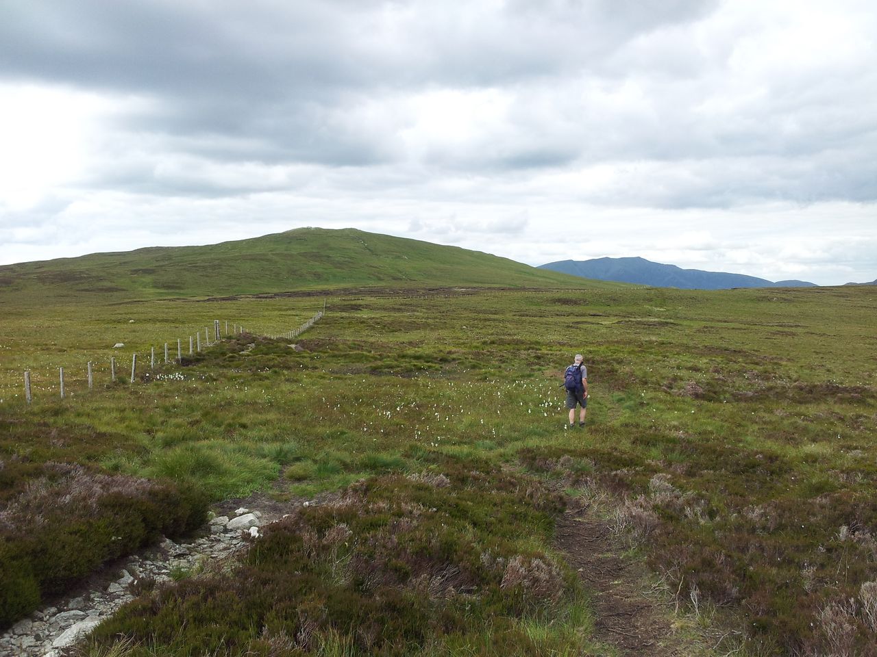
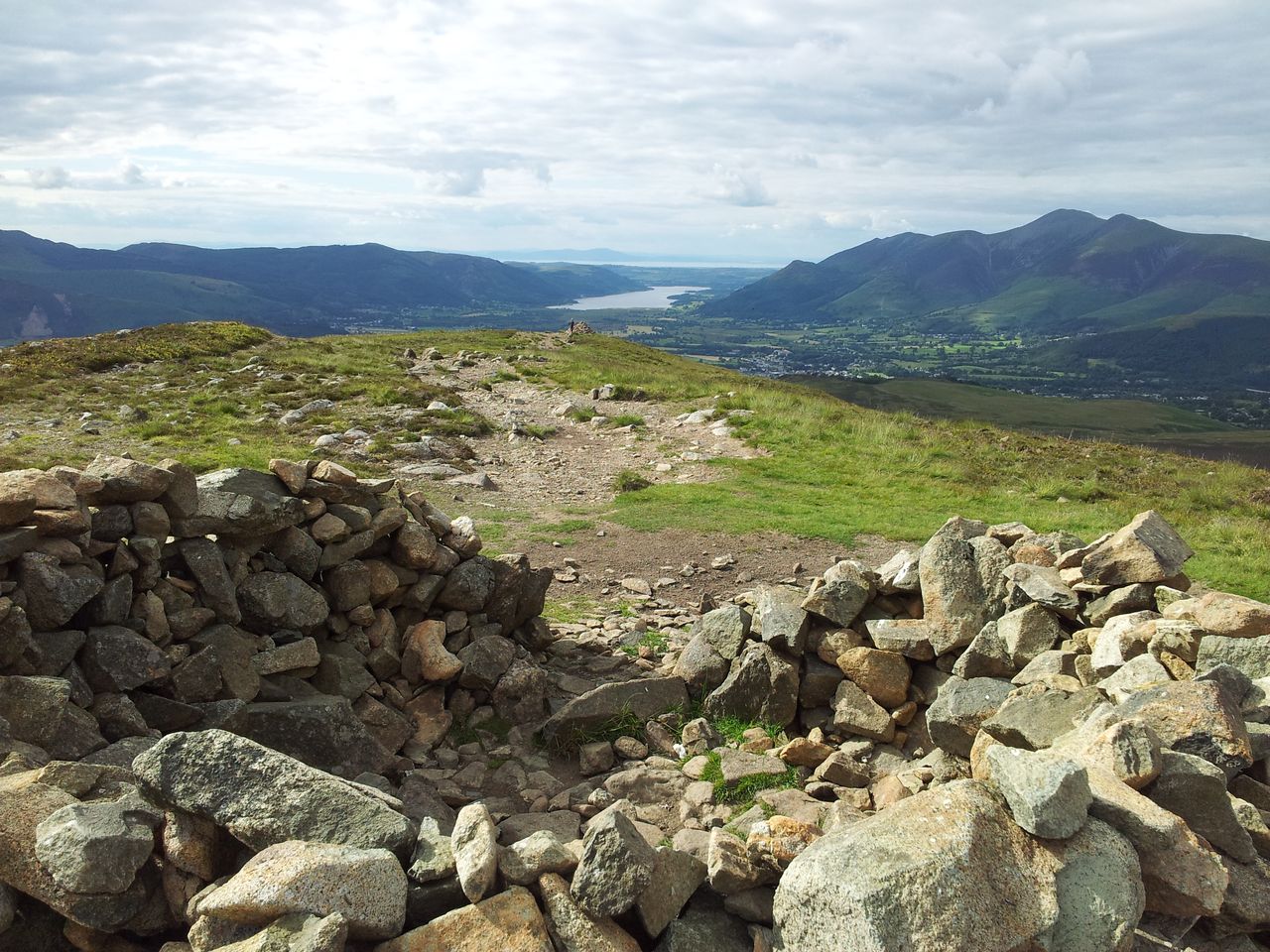
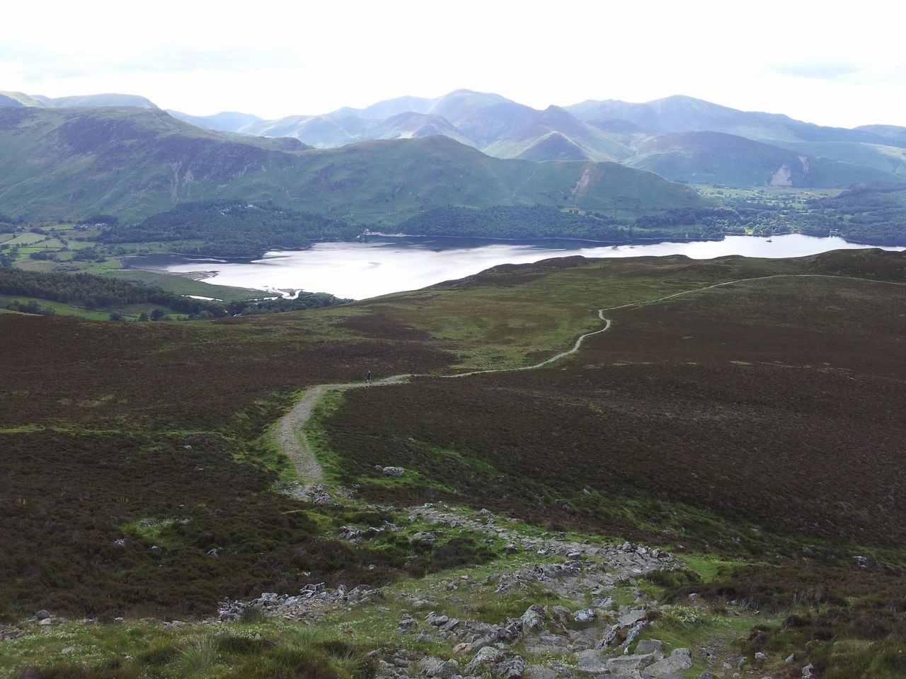
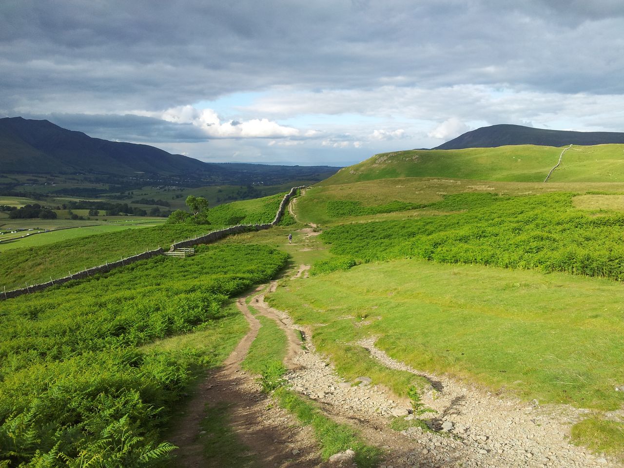
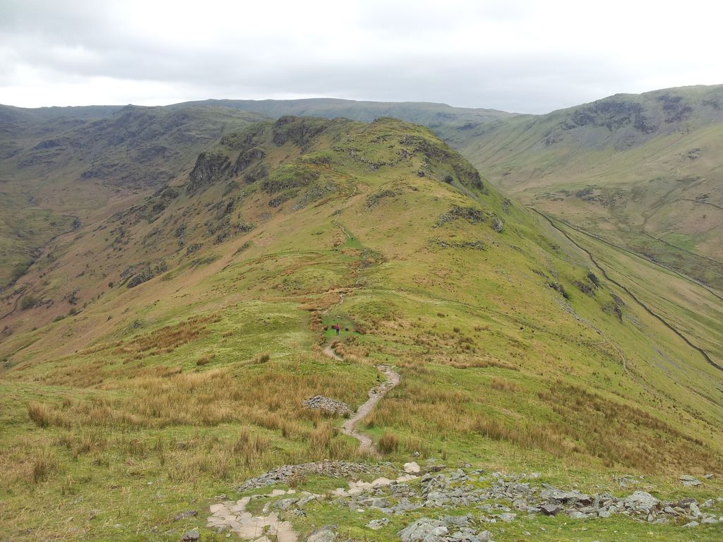
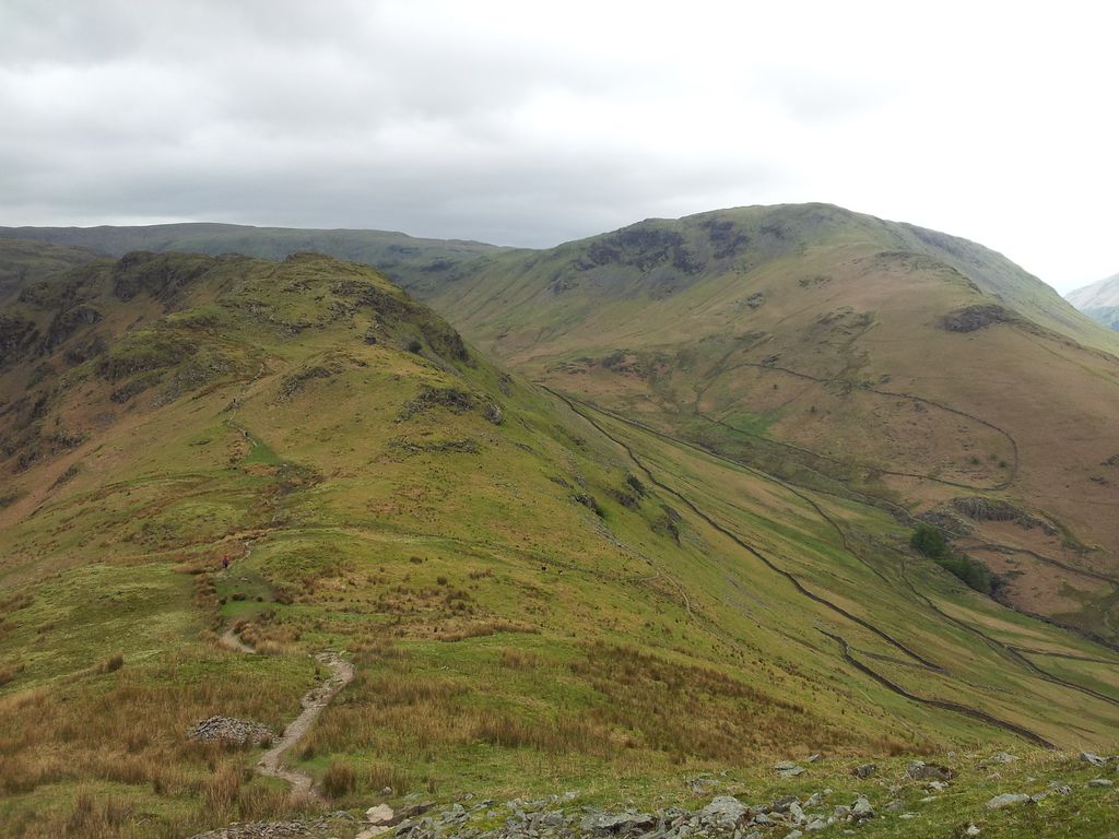
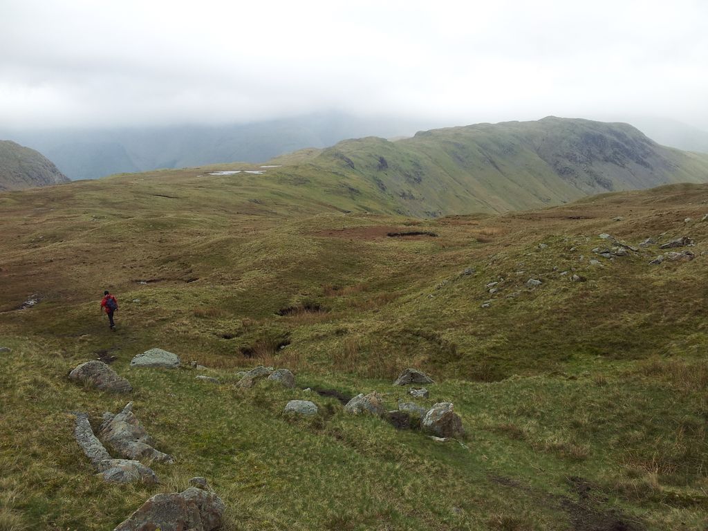
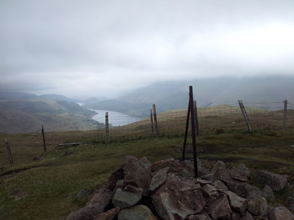
Stage 3 – Great Hill to Winter Hill; (1 hr 25 mins). I left Great Hill to follow a flagstoned path snaking over the moors southwards to Winter Hill. Apparently laid by landowners United Utilities in 1999 this was very much appreciated. Must have been previously arduous traversing this peaty boggy landscape in anything but drought conditions. Reminded me of the Cheviots, with a notable exception, the reassuring ever present vista west to the distant Lancashire coast. Nice to be home.
The path to enlightenment, or rather south to Winter Hill – 2.34pm
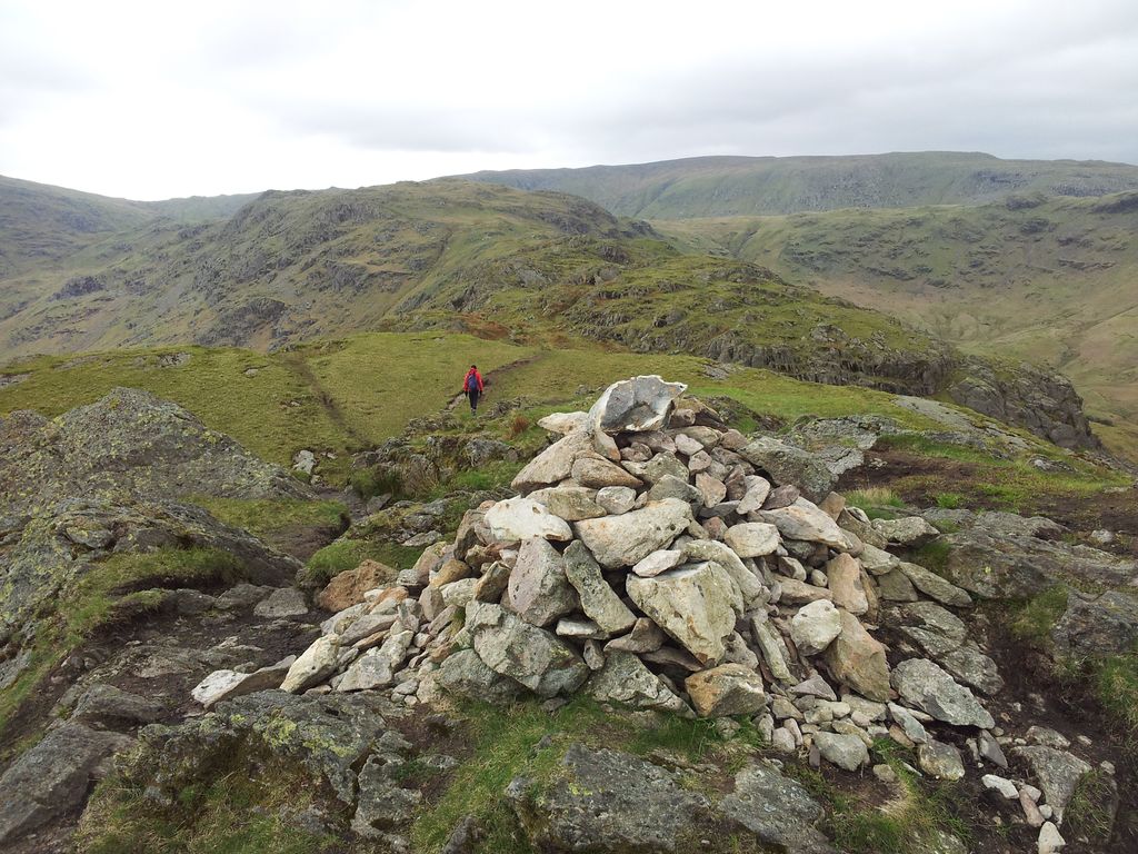
Looking back to Great Hill – 3.00pm
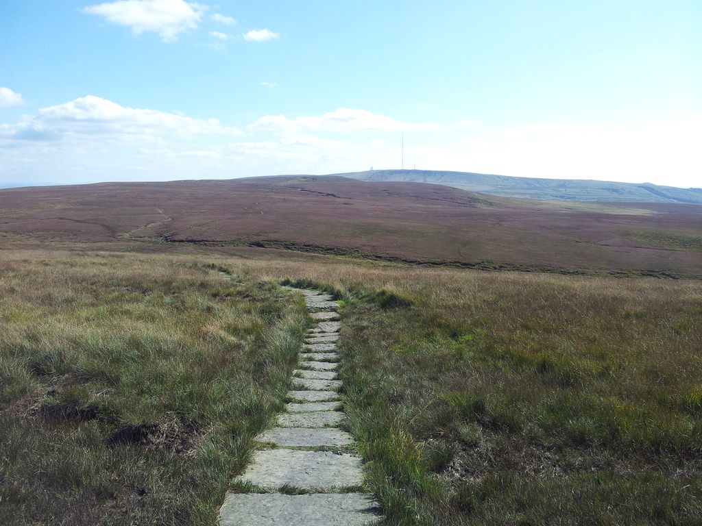
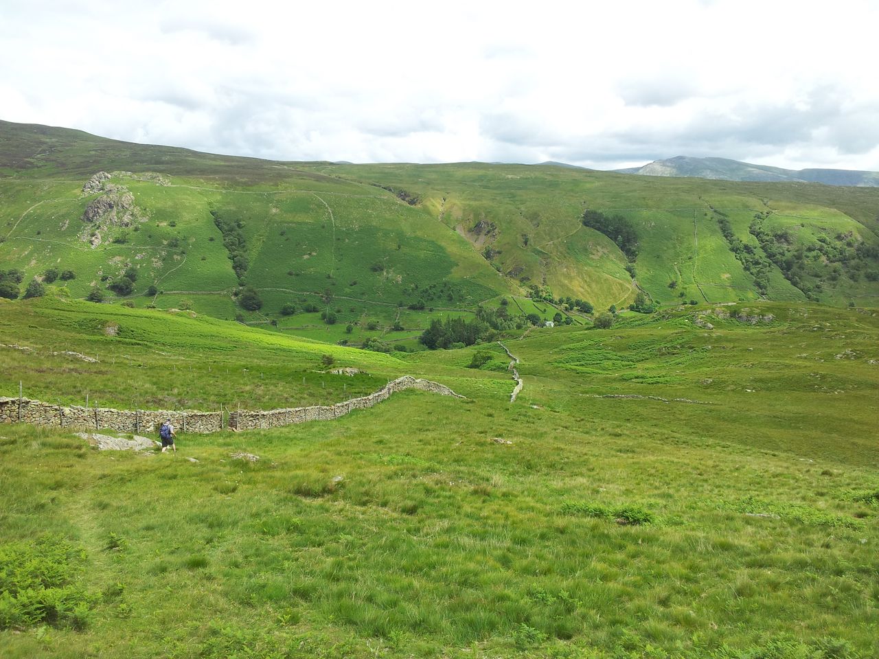
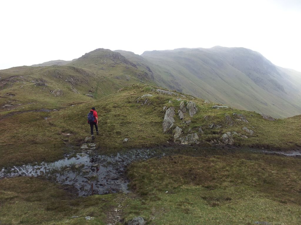
I suffered a few technological delays up here with my mobile persistently switching off. I particularly wanted to track this route so after two battery changes I was eventually away again. Unfortunately the flagstones end before the moorland descends down to Rivington Road. I followed the remnants of a drystone wall with little difficulty on this dry day. A wet day will be more boggy.
Ran out of flagstones – 3.10pm
Descending to Rivington Road & a few parked cars – 3.20pm
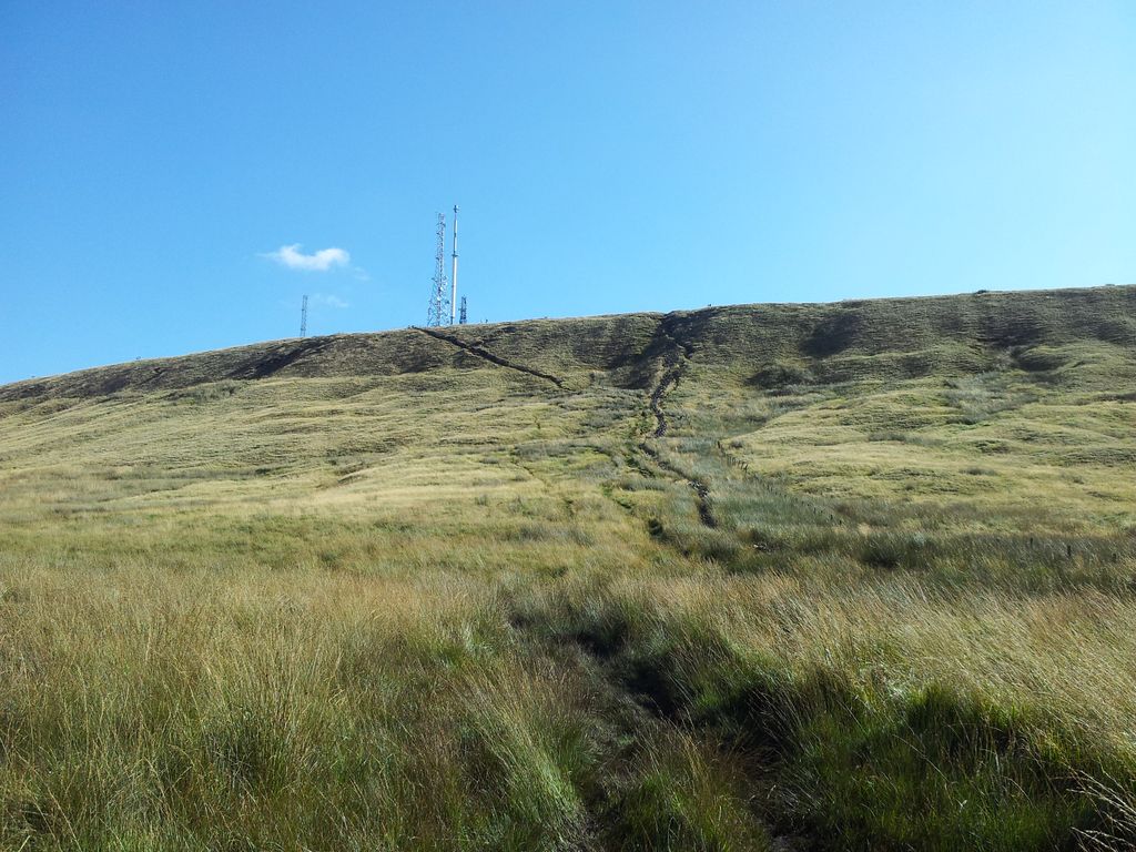
Crossing the busy road is quite a contrast to the past hour, I’d only seen a couple of people on the moors yet now there were countless motorbikes whizzing past. After a quick brownie break I started up the short sharp ascent along Horden Stoops to Winter Hill.
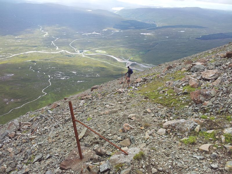
Final steep slippery path up to the trig pillar – 3.40pm
The final section along a steep diagonal crumbly path was a little slippery, it’s a direct but hardly uplifting route up and would need a little care going down. Views north however improved with every step. It was a good day to be in the hills.
Belmont & Reservoir – 3.52pm
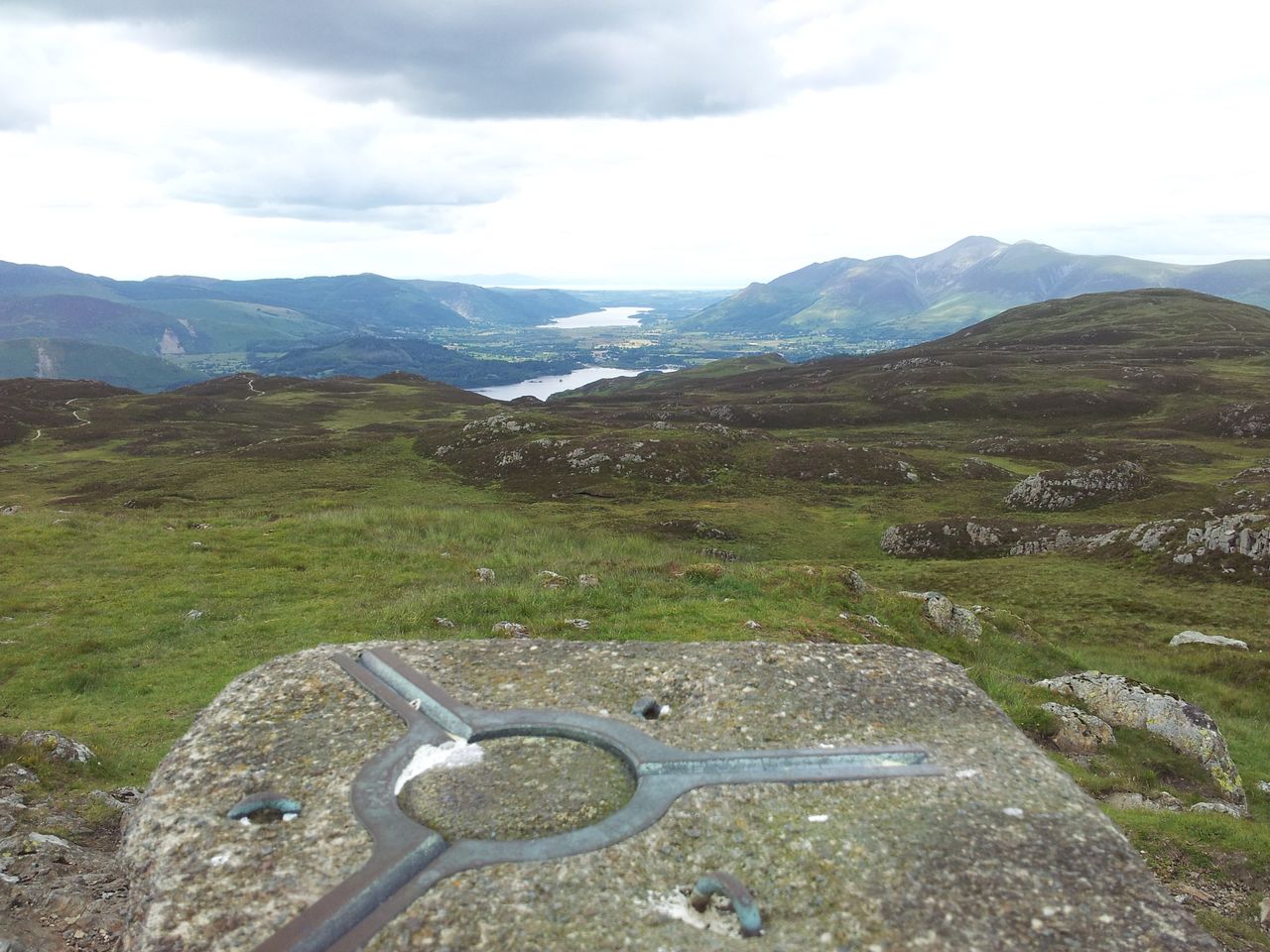
At last the satisfaction of reaching Winter Hill trig point, the highest spot of the day and a top full of interest, the views extensive. Taken less than 20 mins from the road but a slow 1hr 25 mins from Great Hill due to the phone problems. Worth taking a few moments up here though and I ended up chatting to a cyclist who pointed out Snowdon, first time I’ve ever seen it properly. Last time here the Welsh mountains were hazy yet with binocs I could see the Isle of Man. This time it was the reverse, although could again pick out the Langdale Pikes & Bowfell in the Lakes.
Winter Hill trig point and aerials
View north from near the trig, back over my route from distant Great Hill – 3.54pm
Chatted with a couple of senior walkers who’d come up from Belmont and discussed the views. They’d never been on Rivington Pike so I recommended the route from Lower House & Lever Park. They also hadn’t seen the ice sign so set off to see exactly that.
Stage 4 – Winter Hill to Lower House car park; (1 hr 10mins). Time for me to get moving, so I joined the service road to the big aerial. Got talking to a local who pointed out the spot where the 1958 air disaster took place, just yards from the main building. He said he remembers the disaster as a kid as he was in the school playground and saw helicopters overhead for the first time. Passed Scotchman’s Stump, scene of an unsolved murder in 1838, which is nice. This is certainly a hill top with a difference, if every top was like this it wouldn’t be good, but they aren’t and this is. There’s logic there honestly.
Scotchmans Stump – 4.20pm
And then the Ice Sign, I do like this……..
The Ice Sign (from all the supporting cables) – 4.30pm
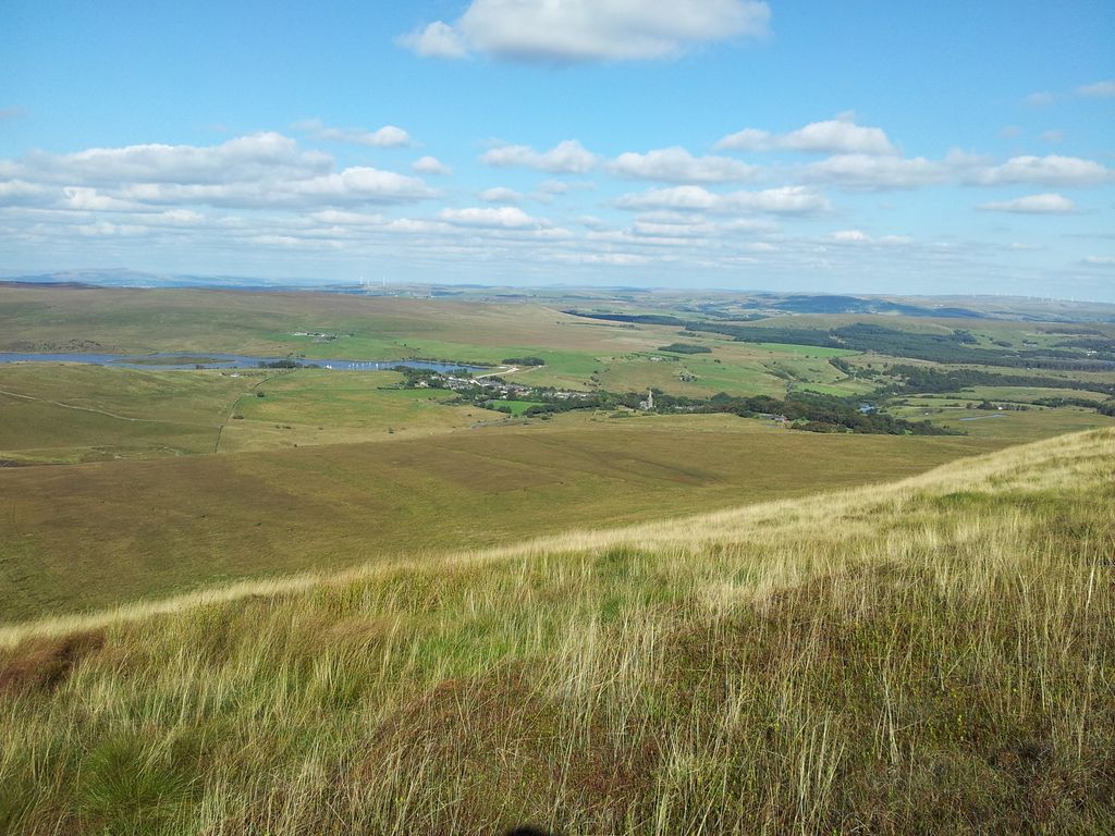
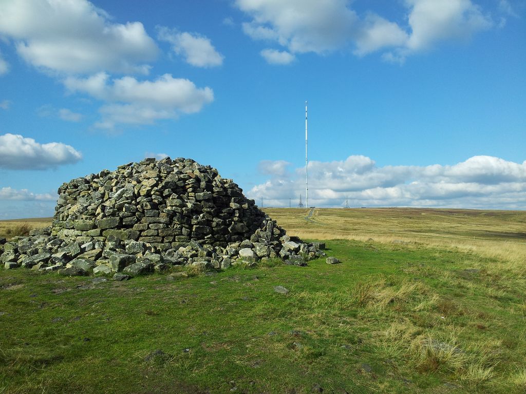
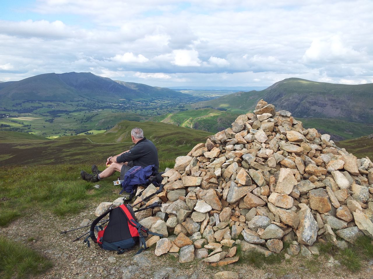
From here I left the service road and picked up speed almost jogging (don’t tell my knee joints) along the gentle descent south west to the Two Lads cairns on Crooked Edge Hill.
Two of the Three Lads – 4.36pm
Main Two Lads cairn looking back to the service road and Winter Hill mast – 4.37pm
From Two Lads I picked up a path west down to the Dog Kennels (Pike Cottage), joining another private road running north west towards Rivington Pike. Then a short pull up to the Tower and the last ascent of the day, hurray!
Rivington Pike ahead via Dog Kennel dip – 4.38pm
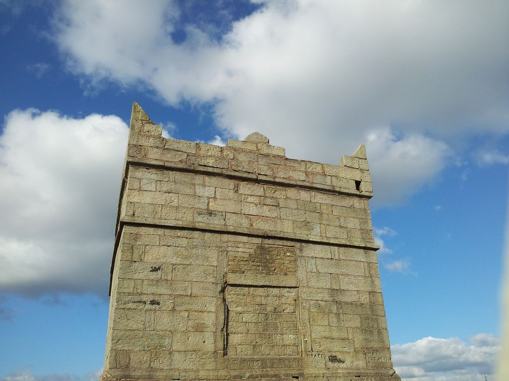
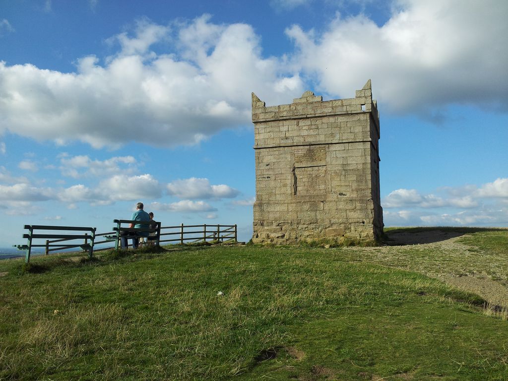
Pike Tower, built in 1733, coincidentally I arrived at 17.00
From the Pike looking back at the road route from Two Lads (far left) – 5.05pm
Rivington Pike, bit quieter at 5.05pm
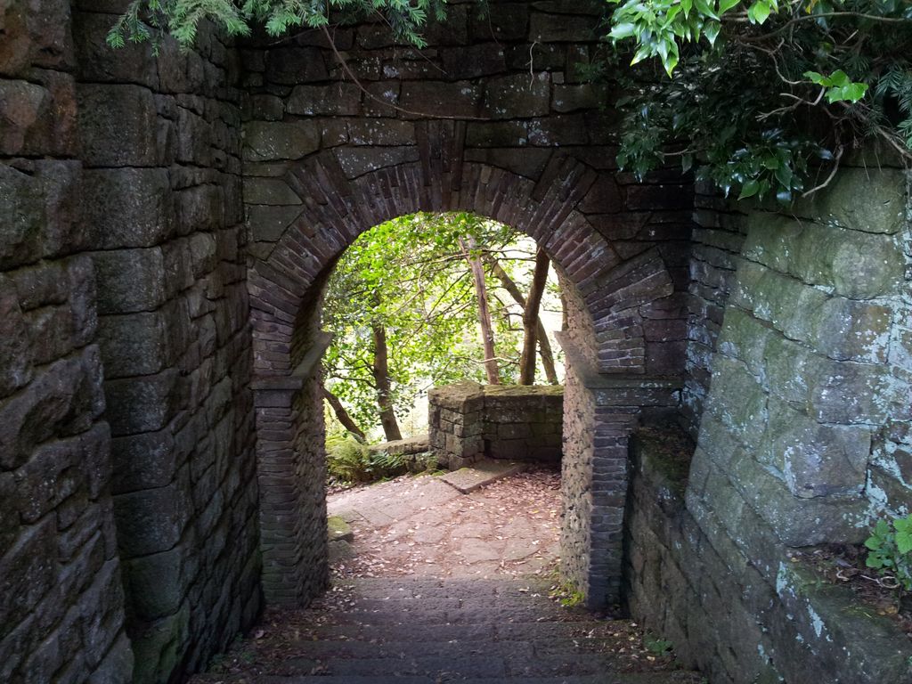
From the Pike I hurried down towards the car park, diverting through the remnants & ruins of Lord Levers Italian style Terraced Gardens. Quite fascinating and a nice way to end the day. Full of interest oop here, I could just as easily have gone via the Pigeon Tower.
Terraced Garden remains – 5.17pm
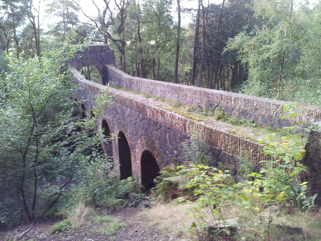
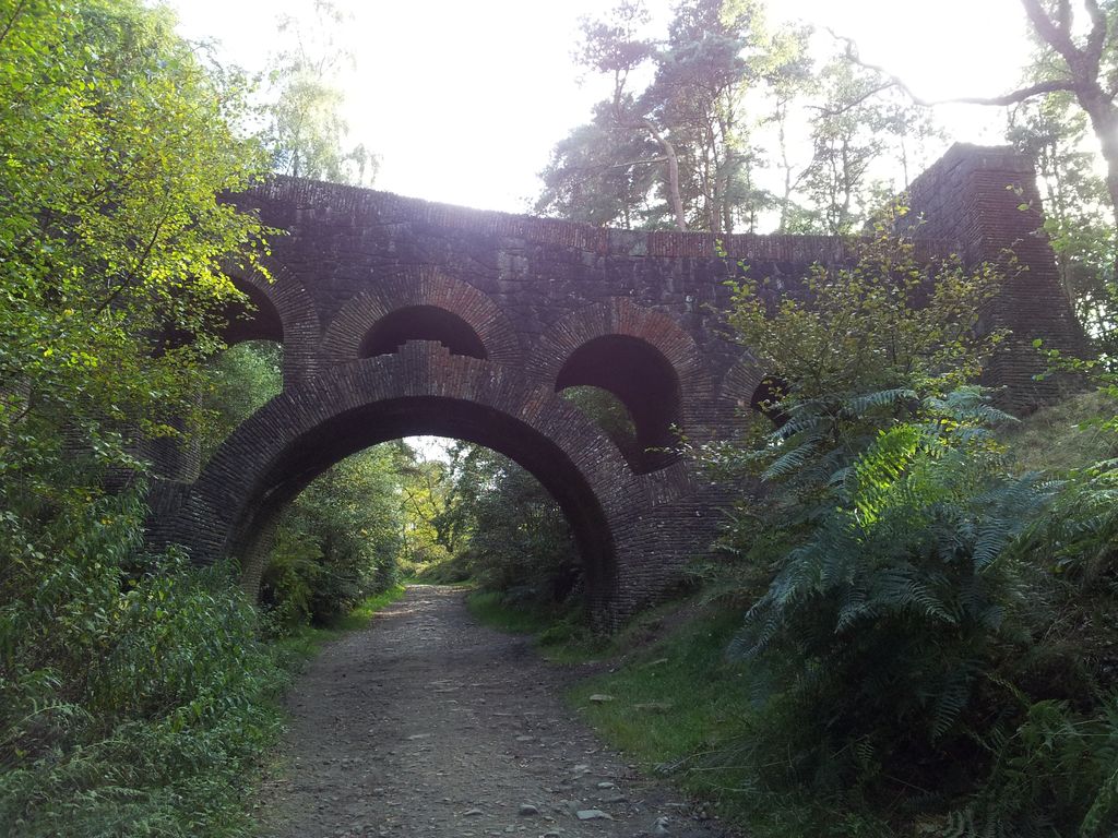
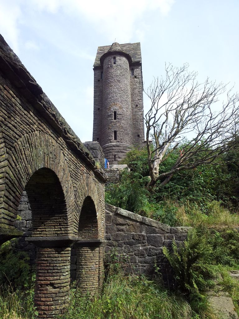
Then across the impressive Lever 7 Arched Bridge turning right to join a main track north.
Lever Seven Arch Bridge
Lever 7 Arched Bridge – 5.21pm
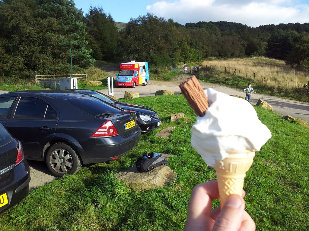
It’s a great track to finish, gently descending to Lower House car park, where my keen senses detected an ICE CREAM VAN ALERT. The van was about to leave and I consumed his last cone of the day, sweet.
The last ice cream of the day, a 99ner, half flake, half 9yr old – 5.30pm
In decent weather I’d always do this route clockwise as the highlight is undoubtedly eventually getting up to Winter Hill with the lowlight the faffy section along to White Coppice. Wouldn’t fancy finishing on that approach section at all. Depends what type of landscape turns you on, I was relieved to get out of the woods and onto the fells. Also the later you get to the Pike the quieter it will be. Great Hill despite it’s unassuming appearance is actually a great viewpoint, ample reward for all that stumbling around farm fields 🙂
Whilst on parent visiting duties in south Manchester I needed a quick local walk to maintain some hill fitness. Previous attempts round Dunham Park had been too flat, so a cunning plan emerged for something higher. Winter Hill is the big Lancashire lump by the M61 above Bolton, the one with a ginormous aerial on top. It’s a very recognisable hill, one of the first things I notice when driving along the Lancs motorways. It’s visible from many Lakeland peaks, and on a fine day years ago I could see it from my bedroom window in Sale. Checking the tinternet (as the locals call it) I soon found a circular walk and downloaded a GPX route. The expectation was for bleak moorland with little of interest except a good view. I was very pleasantly surprised and would definitely recommend this route.
Total Ascent = 1,218 ft (371 m), highest point Winter Hill 1,496ft
Start/Finish = Lower House Car Park (free), end of Belmont Rd off Sheep House Lane
Date & Weather = Sunday 24th August, sunny spells, good visibility
Click on the Route Map below to zoom in/out
Rivington Pike and Winter Hill from Lower House – Route Map (anticlockwise)
Instead of bleak moorland the suggested route starts in a country park, Lever Park named after the soap guy William Lever who became Lord Leverhulme. He donated land to the people of Bolton and opened a park in 1904 with gardens, footpaths, model castle and even a zoo. More info on Lever Park here (scroll down a bit). The place was heaving with lots of families, cyclists and a few walkers buzzing about, obviously a popular place on a Bank Holiday weekend. Without a map I’d Googled a postcode which took me to the main Barns Car Parks (very busy), I then diverted further north west to the start. Thanks to Matt @mypennines for his walk info here and also to Alex @atkypne for his GPX route on Social Hiking here.
Starting Point; Lower House Car Park SD6314 (aka Pigeon Tower Car Park), end of Belmont Rd off Sheep House Lane. Views started straight from the car however no views whatsoever of my comfy lightweight boots which unfortunately were still at my parents. So the walk would be done in old worn out trainers & liner socks, luckily for the most part this wasn’t a problem but I’d recommend light boots for the damp areas on top.
From the car park I walked across the road where the tarmac ends and gravel track begins. There’s an immediate fork with either one taking you southwards to Rivington Pike but my route took the one on the right. This is initially through trees and soon comes to the surprising Lever 7 Arched Bridge. Nothing to do with Lever Arch files it’s part of the Lever gardens and is pretty impressive.
Walk under Lever’s Bridge
The track continues to gently rise up to another fork where I beared left, passing various inviting paths branching off which may hopefully be explored some other time. Soon the trees lessen and the landscape opens up in the photo below.
Follow the path with Rivington Pike up ahead, great views right
The path curves through the trees meeting the other track that had forked left outside the car park. There’s then just a short steeper section with wooden steps up to Rivington Pike.
Final steps up to the Pike
View back north west from Rivington Pike (Pigeon Tower top right)
Rivington Pike is the familiar turret seen up on the west side of Winter Hill, at 1,191 ft it offers one hell of a view over west Lancashire and parts of Cheshire. In decent weather I’m sure you won’t be alone up here and understandably so. Good to see so many people getting outside and enjoying the walk and fresh air. For many the Pike is as far as they go and that’s understandable, a wonderful short walk giving huge reward for minimal effort.
Rivington Pike 12.55pm, just 25 mins from Lower House Car Park
The landmark Pike Tower is a Grade II* listed building on the summit. The tower is square in plan with sides of 16 feet (4.9 m) in length and is 20 feet (6.1 m) high. It was built with a wooden roof, three windows and a door which are now blocked up. The roof was hidden by a parapet with pointed corner and intermediate steps. Inside it retains a fireplace and once had a chimney. Its single room is 13 feet (4.0 m) square with a stone flagged floor and was originally wood panelled. There is a cellar. It was built as hunting lodge in gritstone and was completed in 1733. John Andrews of Rivington Hall built the tower on the site of an old beacon using its stone for the foundations.
Rivington Pike
Rivington view over Bolton Reebok Stadium & beyond
View over Rivington Reservoir with the Wirral beyond, Liverpool top right
Lancs coast, Ribble Estuary (top left just) and Blackpool Tower
Pigeon Tower below, Preston & Deepdale Stadium with the Lake District above
What’s needed here is a quick 360 degree shaky video, hang on here’s one…..
Pike Cottage/Dog Hotel bottom left, bit of Manchester top left, Trafford Centre & Chill Factor middle
From the Pike I left the crowds behind to descend down the east side over a tarmaced track through a gate to follow an obvious straight grassy path rising up to the aerials on Winter Hill. Was planning to divert off on another path branching south east to the cairns up on Crooked Edge. Checking my downloaded route I realised I’d gone the wrong way so quickly retraced my steps to join the track/road below Rivington which I followed round to the ‘Dog Hotel’ kennels in the pic above. Best route from the Pike would be to drop south east to pick up the path, the pic below taken 2 weeks later shows this.
From the edge of the Pike, take the track curving right then left to meet the road in centre
On the private road to the Dog Hotel/Pike Cottage with Crooked Edge Hill and Two Lads rising left
Turn east by the side of the Pike Cottage/Rivington Dog Hotel (kennels), through a stile
From the kennels a path rises by the side eastwards through a stile steeply at first then levelling off as you approach the Two Lads cairns.
Ascending to Two Lads looking back along the route from the Pike
Two of the Three Lads that make up part of Two Lads?
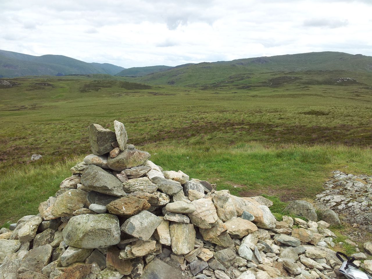
As many have pointed out there are 3 cairns on Two Lads, one of which is the main cairn. I couldn’t find a definitive explanation of the name just a possibility it’s the graves of two sons of a Saxon king, any other suggestions welcome?
Main Lad back to Rivington Pike
Two of the Three Lads, I’m confused now 🙂
One older lad looking to Winter Hill & the way ahead
After a quick snack sheltering from a slight breeze behind the main cairn I set off straight for the aerials. There was a hint of damp grass in places before joining the access road.
Winter Hill, finally up here rather than down there, looking up here!
Approaching the Transmitting Station brings a complete change of scene with buildings & various aerials scattered about, like an old Dr Who set from the Jon Pertwee Unit days.
Winter Hill Transmitting Station
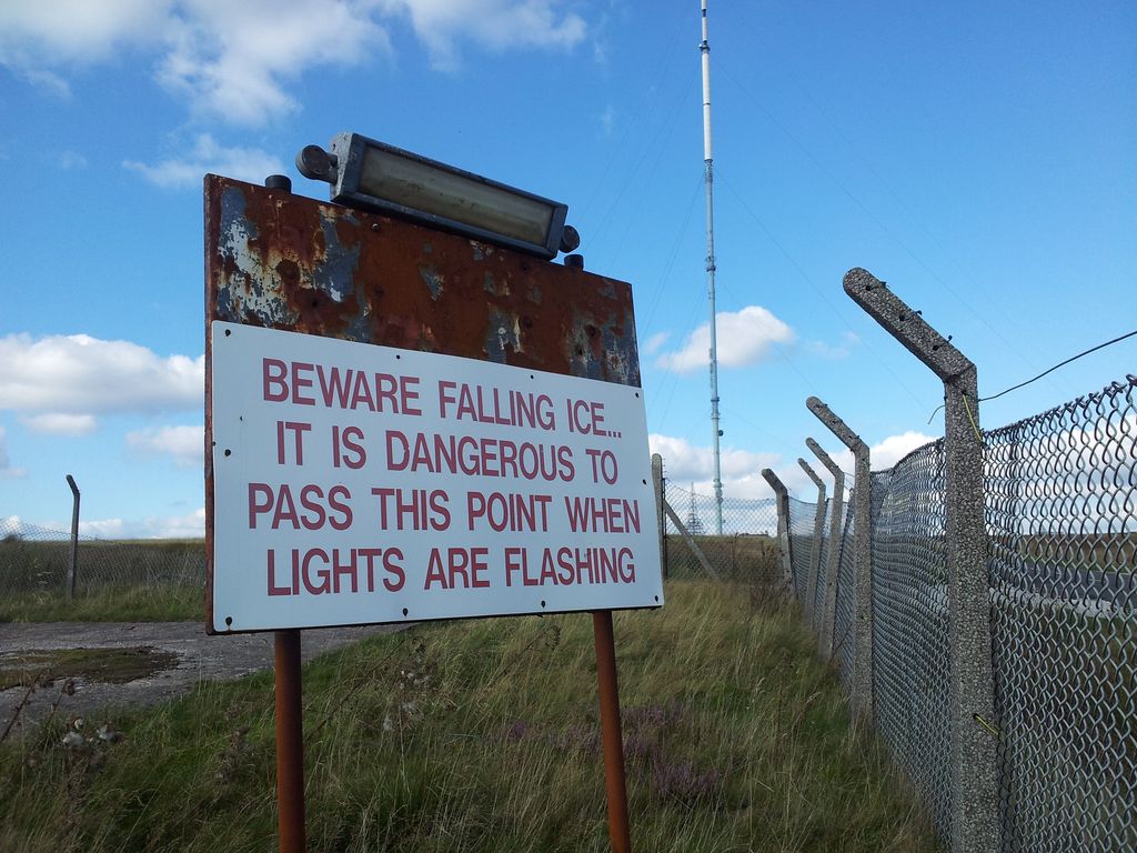
ICE!!!
The ice sign had me thinking, then realised it’s from the lengths of high cables. Would be interesting in winter up here so will add that to the to-do list, avoiding falling ice of course.
A section of the 1,035 ft Winter Hill Mast,
It’s dominated of course by the main mast in fact I had to watch my step as I couldn’t stop looking up. Apparently made of cylindrical sections allowing maintenance to be mainly done from inside therefore giving shelter from the weather. Thanks again to Wikipedia, more info on the Mast & Winter Hill. It used to beam telly pictures over a wide area in fact locals would climb up here if their telly went off to give the aerial a bang, (no they didn’t).
Air Disaster plaque, 35 killed 1958 in bad weather
Just a few yards past the buildings on the right is an iron post, easily missed, in fact so easily missed that I missed it. But on a return I spotted it, Scotchmans Stump, scene of a murder, hey it’s great fun up here.
Scotchmans Stump
Only a handful of people up here and the area did seem worth a look around. However I couldn’t linger so followed the road which then turns west/left between more smaller masts. Nestled inconspicuously in this flat landscape is the Winter Hill Trig Pillar, add this one to the list of strangely placed trig points 🙂
Winter Hill’s innocuous Trig Pillar
Trig Pillar looking back south east
Despite being 305ft higher than Rivington Pike the views south and west didn’t seem as impressive, probably due to the flat top. However the previously hidden hilly north and eastern horizons do open up. Definitely worth taking the binocs on this walk, managed to identify Bow Fell & the Langdales in the Lake District very clearly. Bear in mind you can also see the Snowdonia mountains too and the Isle of Man, all over various Lancashire cities sprawled below.
After a chocolate brownie stop by the trig I rejoined the road west past another couple of buildings until the road stopped. A boot marked track goes around the last fenced aerial and out onto the open moor. Spotted a rescue helicopter below that had buzzed past earlier, ambulance had just arrived, hope not too serious.
Rescue Helicopter
I followed my route plan westwards heading for Noon Hill on the right in the photo below. Worst bit of the walk for me as it meant crossing a marshy section which tested the resoluteness of my old worn trainers. If anyone spotted an old guy here leaping dodgily from reed clump to reed clump swearing loudly, then this was me. No probs in boots.
Rivington Pike left, I headed to Noon Hill, right
From Noon Hill looking back at Winter Hill (obviously)
From Noon Hill west with one damp trainer! I also have another foot not pictured
Interesting reading that Noon Hill was an ancient bronze age burial cairn! From Noon Hill it’s a short easy descent down to a gravel track/road which comes out at the Pigeon Tower.
The Pigeon/Dovecote Tower
Quote from About Rivington;- The Dovecote Tower, commonly known as the Pigeon Tower, stands at the northwestern edge of the Terraced Gardens. Italian in style, the Tower was built in 1910 by Lord Leverhulme as part of his extensive Rivington estate. The first two floors were home to ornamental doves and pigeons, whilst at the top was a small sitting room that was used as a lookout over the boating lake, and by Lady Lever as a sewing and music room.
Info board on the Terraced Gardens
The path drops down behind the Pigeon Tower into the remains of the Terraced Gardens. This featured in Countryfile Magazine’s Top 10 Lost Gardens (thanks Google).
Terraced garden remains
Impressive view back up to the Tower
From here there are paths and stone steps down through various features, my downloaded route descended towards the car park earlier but I stayed on one of the paths then taking a right turn to walk over the Lever Bridge. Definitely worth a detour, then it’s a right turn once over the bridge northwards and back to the car park. Even an ice cream van waiting!
The Lever Bridge from above
So a hugely enjoyable short walk admittedly in excellent conditions with very interesting views throughout. Along with Blackpool Tower and Bolton’s very own Peter Kay, surely Winter Hill via Rivington Pike is a Lancashire icon and I’ll certainly be returning for more. Thanks for reading.
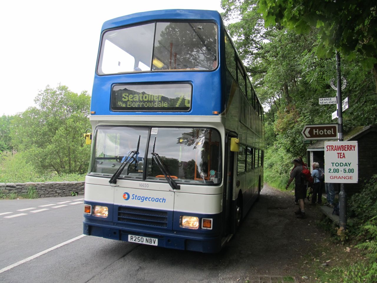
Interesting walk over 6 north central Wainwrights on the high ground between Derwent Water & Thirlmere. We parked at Keswick, taking the no 78 bus down the B5289 to Grange. From here it’s an L shape linear route back to Keswick with a refreshing Watendlath tea break thrown in. A modest start over modest hills gradually improving to save the best till last with a grandstand view of surrounding mountains. Forget busy boggy Haystacks, surprisingly I found these less busy boggy fells more fun. You can even finish with a pint at the Dog & Gunn.
Total Ascent = 2,825ft (861 m), max height High Seat 1,995 ft
Start/Finish = Keswick to Grange by bus & walk back to Keswick
Date = Sunday 29th June 2014, weather good slightly hazy, improving
Click on my Social Hiking Route Map below to zoom in/out
Kings How to Walla Crag Route Map on Social Hiking
Starting Point
Park anywhere in Keswick and catch the no 78 Seatoller bus from the main bus station or along the route. The buses are a bit seasonal so best check times here.
Route Summary – in 3 stages (including lot’s of stops on tops)
Grange to Watendlath; (1 hour 20 mins)
Watendlath to High Seat via Armboth Fell; (2hr 20 mins)
High Seat to central Keswick; (2hr 55 mins)
Route Detail & Pics from Sunday 29th June 2014
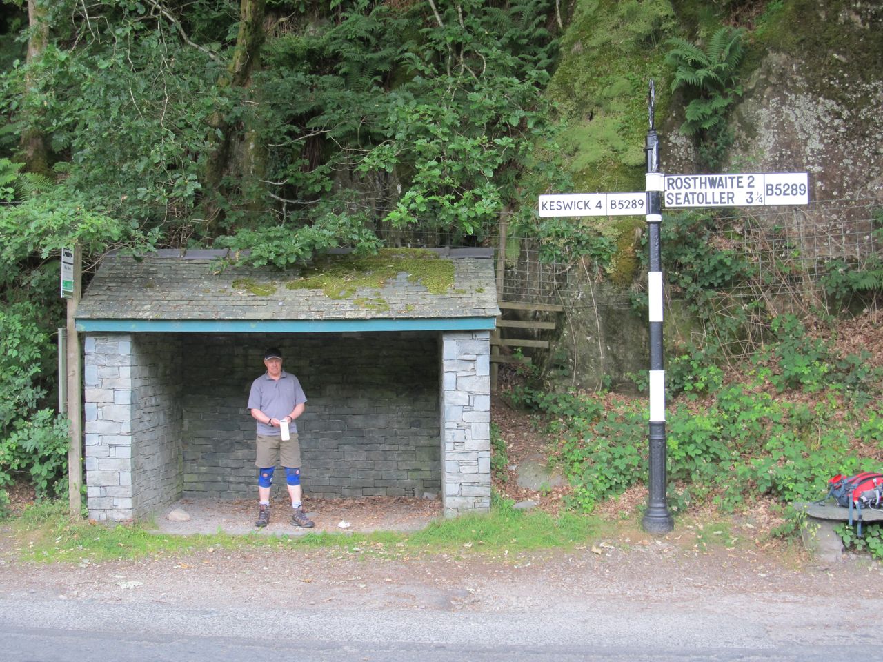
Stage 1 – Keswick via Grange to Watendlath; (1 hr 20 mins from Grange) – We parked in the maize of little east Keswick streets full of B&Bs and popular names. Then a quick dash through the centre to the bus station on Crow Park Rd. Been a while since I’ve hopped on a bus so relatively exciting. Those more used to public transport maybe just thankful it all went to plan. Left Keswick at 10.50am arrived at Grange bus shelter at 11.08am (approx).
Poetical pole assembly on Wordsworth St, Keswick 10.40am
Off the Bus at Grange – 11.08am
Beware this man spotted hanging round bus shelters with his phone flap dangling
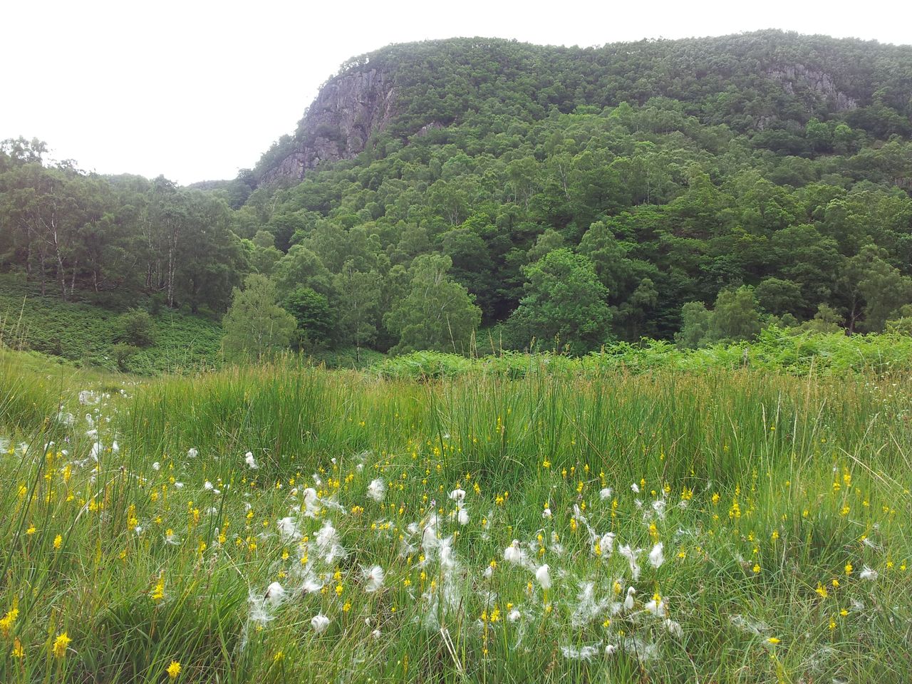
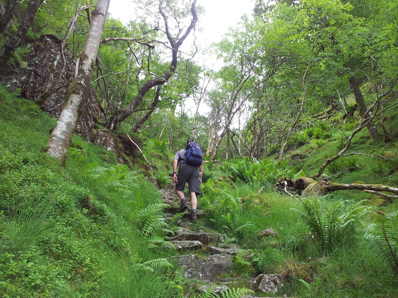
From the bus stop it’s a short road walk south to a wooden gate on the left. Then east through trees and ferns out into the open before ascending rocky steps through trees.
Cotton Grass & Great End Crag, the route going through trees on the left – 11.20am
Through the equatorial forest – 11.45
Turning south the objective is Kings How, not a Wainwright but a very pleasing easily accessible viewpoint to start the day.
Kings How up ahead, turn right then along the skyline
A mini classic view from the shoulder of Kings How – 12.10
Short heathery stroll to the top of Kings How
We sat around the top for a while enjoying the views. Always fun seeing familiar fells from a quite different vantage point, then playing name that Wainwright. I’m crap at this.
Kings How view south to Bessyboot, Rosthwaite Fell & Glaramara – 12.15
From Kings How it’s a descent south eastish (new word) through the bracken.
On way to Grange/Brund Fell somewhere over there-ish – 12.45
We nearly walked past a cut-off path going east so thought it best to point this spot out to anyone interested. Please take note as unfortunately Alan can’t stay in this pose indefinitely, (not in those shorts anyway).
Turn off east at the path here!!
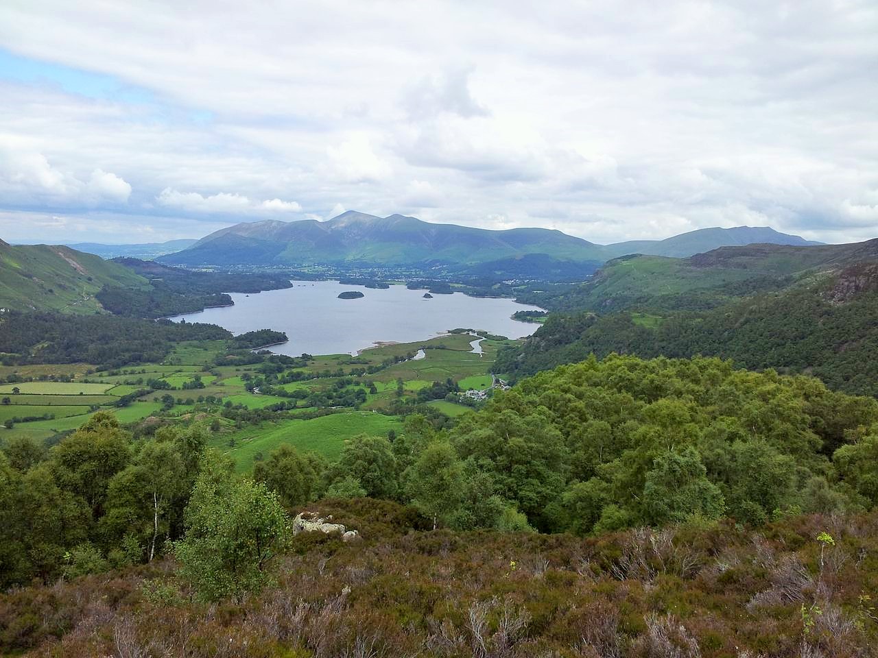
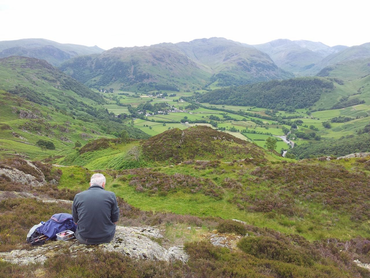
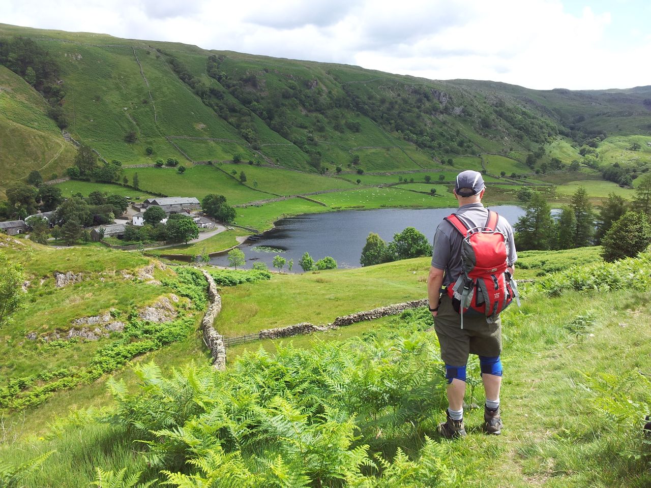
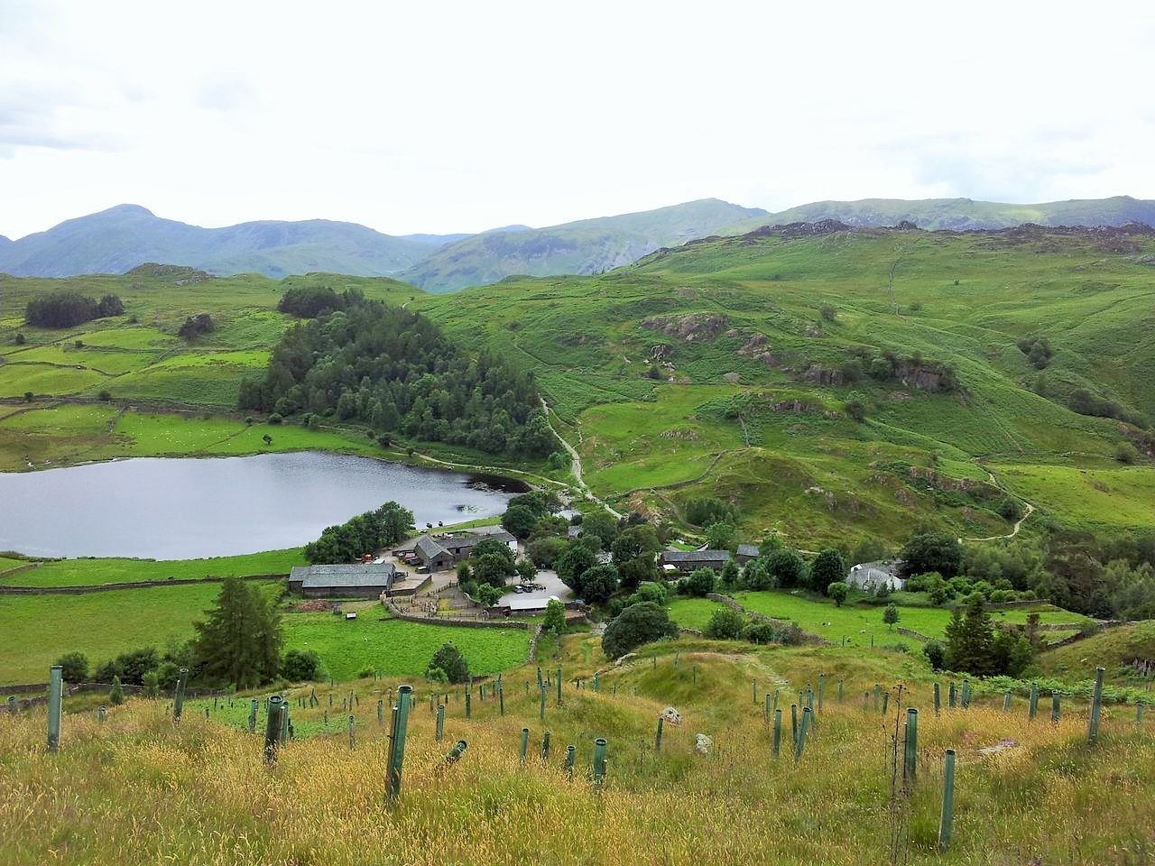
Soon we arrived at a jumble of rocky bumps which marked the first Wainwright of the day, Grange/Brund Fell. Not totally sure which one was the actual top but one did seem the highest and it had a path so hopefully we got the right one. Thought Kings How was easily the better top. It’s then a matter of finding a route down to the obvious path heading east. We are heading for the hills over the dip in the photo below. But first that dip hides the hamlet of Watendlath and the chance of a nice cuppa tea. Hardcore hiking this!
View east from near Grange Fell, High Seat top left, Watendlath’s down in the valley 1.10pm
Descending east down to Watendlath – 1.20pm
Mighty fine view, Watendlath & Tarn below (I’m posing, not having a wee) – 12.30
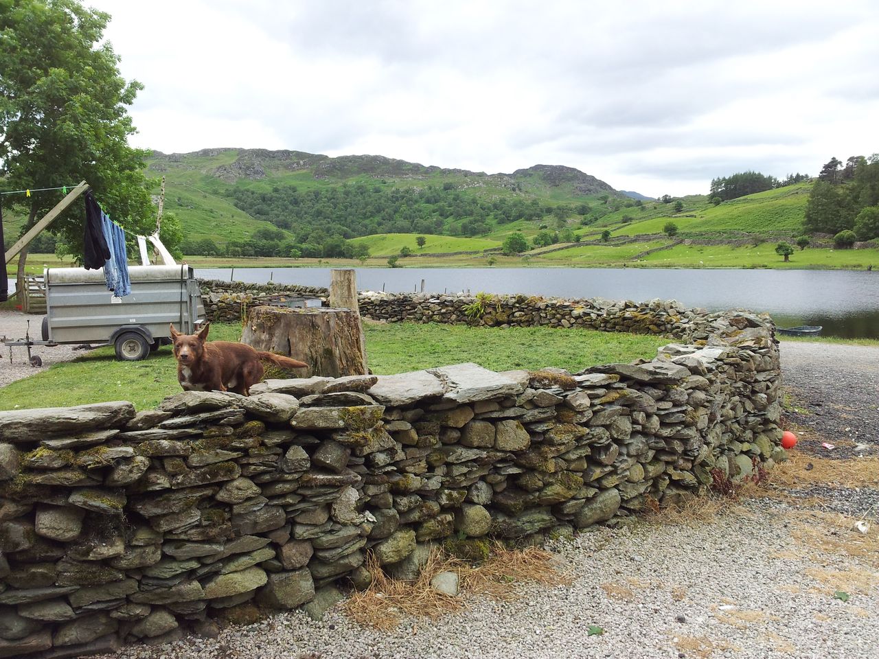
If you haven’t visited Watendlath before (and I hadn’t) then you’re in for a pleasant surprise. For once we were in no rush so stopped at the Farm Tea Shop for a good while, watching the birdies searching for cake crumbs. A few families and other walkers were scattered around the village, a few fisherman dotted around the Tarn. Very pleasant.
Watendlath rest and cuppa, wow it’s already 2.00pm
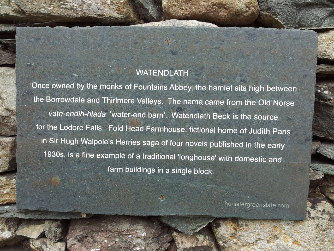
Couldn’t see anywhere to sit inside so perhaps a different experience in poor weather. Some info on Watendlath from invaluable Wikipedia;- the hamlet is 863ft above sea level and is owned by the National Trust, the name is Old Norse for “Water End Barn”.
Watendlath Tarn & excited doggy heading my way – 2.15pm
A sign
Not sure how but the times on my photos showed we were in Watendlath nearly 2 hours. This is what happens when you sit down for a cuppa in your fifties! Right we’d better get moving then!
Stage 2 – Watendlath to High Seat via Armboth Fell; (2 hrs 20 mins) – After a brief wander around the buildings we found a path by the car park which makes a steady ascent eastwards to regain lost height.
Looking west and back down at Watendlath – 2.30pm
Once over the shoulder it’s time for the grass section of the walk and a section renowned for it’s boggyness. Firstly we headed for High Tove and Wainwright no 2.
On way due east to High Tove – bit featureless – 2.55pm
Oh hold on there’s lots & lots of grass!
On a kind of grassy upland plateau, looking back west – 2.55 pm
The remote top of High Tove, so remote it was full of girls
Expecting to be here alone it was a little surprising to find a group of girl campers ensconced on top. Managed to somehow exclude them from the picture below which looks out south east to the next target Armboth Fell. Expecting Armboth Fell to be obvious it was a little surprising to find it not very erm obvious. There wasn’t a dominant high point just a few scattered bumps in an oasis of greenness.
3.00pm – High Tove to Armboth Fell, which is erm somewhere out there!
Two distant figures were spotted sat on one rocky bump so we figured that’d be it. Looked like we had to cross a watershed but a feint track was picked up which we soon crossed across to the rocky bump. We had been very lucky after a spell of dry weather we didn’t encounter any boggy problems. This is not typical.
The Wainwright that is Armboth Fell – 3.35 pm
One could be forgiven for wondering why Alfred listed this particular spot in his guidebooks. However it struck me sat up here that the remoteness in the middle of a grassy boggy plateau was actually quite nice. Wainwright wasn’t a people person and in an increasingly popular Lakeland he wouldn’t have met many people up here. He would also certainly have been alarmed at the sight below.
No mate, I ran out of brownies somewhere back there, honest.
From Armbroth the next destination is High Seat however we chose to retrace our satisfyingly dry route back to High Tove rather than try a straighter route over the unknown grassy tussocky moorland. We were soon back on High Tove then turned north following another potentially damp grassy track up to High Seat. Again we were very lucky finding firm ground, one peaty section even reminded me of the Cheviots.
Grassy path to High Seat up above – 4.05 pm
Follow the fence posts!
Nearly there, can just see the trig point
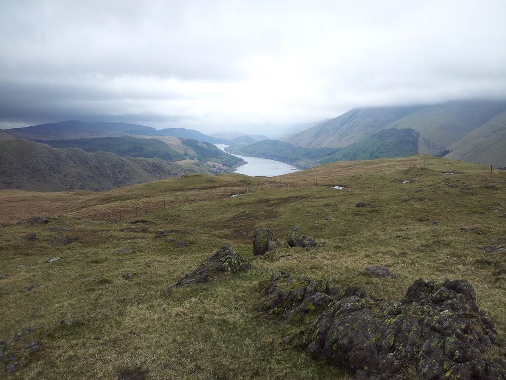
On High Seat & a hint of views to come, looking north over Derwent Water & Skiddaw – 4.35pm
Stage 3 – High Seat to Keswick; (a slow 2 hrs 55 mins) – Reaching High Seat brought environmental improvements with firm ground and the best views of the day so far.
High Seat looking west over the Newlands fells & Grasmoor
High Seat looking south east to Helvellyn, Thirlmere & modest Steel Fell
High Seat north with Bleaberry Fell, Derwent & Bassenthwaite – 4.40 pm
The highest point of the route at 1,995ft and another place to linger with inviting views particularly northwards. Good to see Thirlmere at last and south down to now familiar Steel Fell where we’d walked from Grasmere two months earlier. Soon time to carry on north descending slightly on a green track winding across and up to penultimate Wainwright Bleaberry Fell.
On Bleaberry Fell 1,936ft – 5.20pm
Bleaberry Fell north east to Blencathra & Clough Head
Thought the scenery up here was particularly nice, a granstand view over higher fells which were distant enough not to make you feel boxed in. The angles are different from the usual, in fact the whole walk is a little different from the usual. This was the best bit.
Another fine Bleaberry Fell view north
Over Cat Bells, Grasmoor, Grisedale Pike – 5.55 pm
The path curving north to Walla Crag, still quite high above Derwent Water – 6.00 pm
View back to Bleaberry Fell top left – 6.25 pm
The path meets a fence which is crossed via a gate which takes you through to another wonderful viewpoint up on the final Wainwright 1,243 ft Walla Crag. Extremely fine scenery looking down on Keswick and beyond. It was late and the midges were out but apart from them this would make a fine evening walk from Keswick.
Coledale Fells from Walla Crag – 6.30 pm
The famous Walla Crag Old Man
A very pleasing angle on Skiddaw
The descent seems pretty obvious, but we managed to bugger this up slightly by detouring too far north east and missing a gate which would have brought us down to Keswick earlier. Alan’s memory of this walk was a little confused here so I blame him 🙂
Descent north east, should’ve cut off left, we carried on too far – 6.50 pm
We ended up thinking we could nip over to see Castlerigg Stone Circle but this was much further east so we retreated and swung round to Keswick. Probably lost 15 mins.
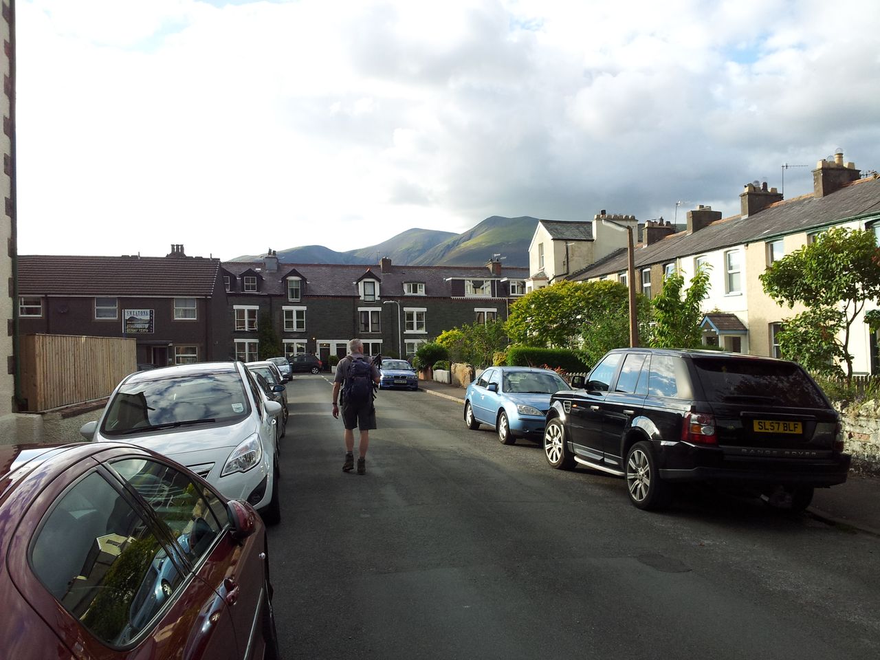
Keswick streets – 7.30 pm
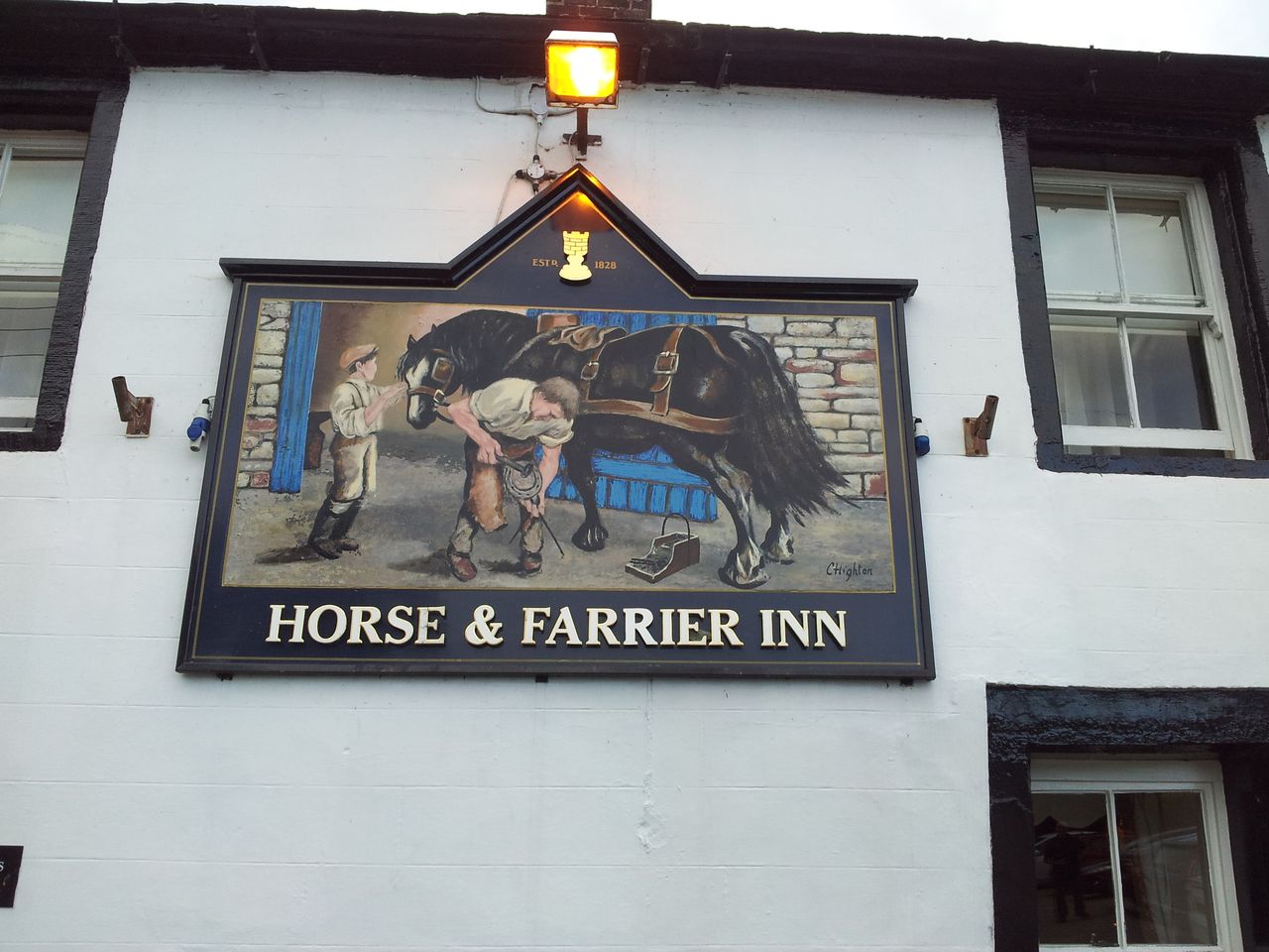
No time for that pint in the Dog & Gunn, we were hungry, so were quickly into the car and driving east on the A69. First visit to the Horse & Farrier at Threkeld. Well run quality pub, very friendly and decent food, seemed a bit expensive for us.
Tried this on the drive along the A66
So a different day in the Lakes, lowly fells with spacious views finishing in grand style. Definitely one to do from south to north for the ever improving views over the northern fells. Good to have no schedules and time limits on this one taking advantage of the long daylight hours. It’s tempted me to risk trying another bus ride too. Thanks for reading.
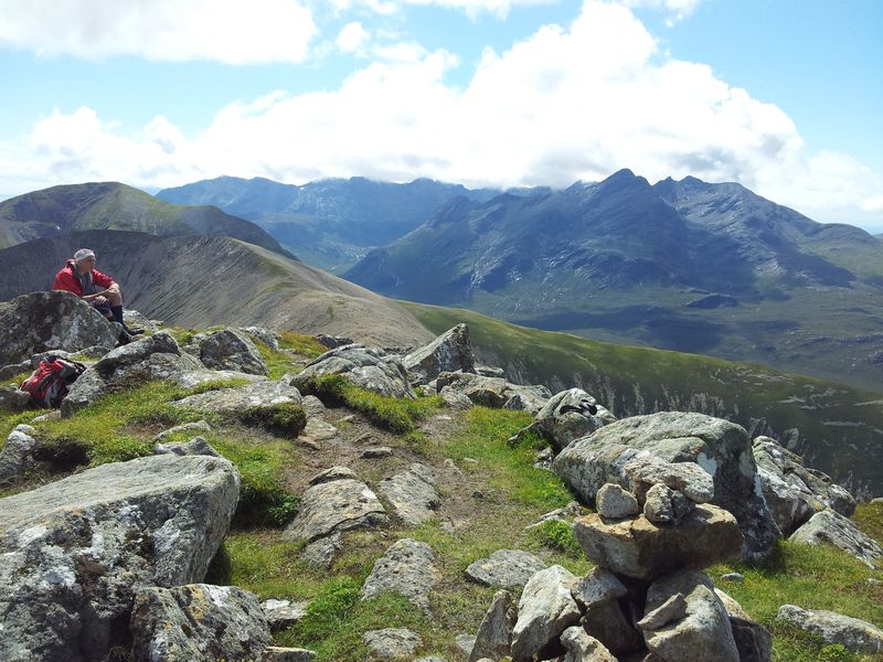
To misquote Charles Dickens;- “It is a far, far better thing I do now than I have ever done; it is to a far, far better place that I go than I have ever known.” Yes time for a trip to the majestic north west Highlands. It’s difficult putting into words the feelings of anticipation and excitement during this visit; however to make this post more interesting, I will try:-)
Six nights had been booked long ago in a small cute, incredibly friendly guest house in a small cute, incredibly friendly coastal village. With a 7 hour drive up to the Highlands and the same back, this left only four full days to try and fit everything in. So it’s more of an adventure than a holiday, there’s so many places to see, things to do.
And it’s not all about the Munro’s. Lack of time & fitness have sadly conspired with dodgy knees to make completing all the 282 Scottish mountains over 3,000ft an unattainable goal. The upside is the many excellent lower mountains waiting to be discovered plus the coastal walks, boat trips, scenic drives, places of interest, wildlife, eagles, food, pubs & beer. Impossible to fit it all in especially when we only get up there twice a year. As my mate Alan points out, many of the Munro’s can be boring lumps so I haven’t got the time to devote solely to them, it’s all about the fun.
Walking Targets – top mountain targets in order this trip were;- remote coastal Baosbheinn north of Torridon, the Red Cuillin of Skye, Beinn Damh in Torridon. All of these needed clear weather as they offered outstanding views (oddly no Munro’s this time). Love the coastal walks up there too so revisits to Rhubba Hunnish for whale spotting plus Sheenas Tea Rooms & the Sandaig Islands on our final morning would hopefully be included. Anything else would be a bonus.
Concerns – apart from the unlikely event of a car breakdown, the main worries were fitness & weather, with a slight midge concern. At least in July the long daylight hours make the days seem longer, it’s a fine time to visit the Highlands.
Fitness – a huge concern, due to lack of walking I wasn’t hill fit, this was gonna hurt.
Food & real ale – sorry, this isn’t wild camping, it’s a highland holiday….erm adventure. Anyway we don’t get up there nearly enough so want to enjoy it whilst we can, with some decent food & ales where possible.
Motivation – why do we do this? Easily forgotten amongst the focus on targets, timings, weather, route choices, tiredness, aches, pains, midges etc. Whilst on top of a 2,400ft mountain on the Isle of Skye, drooling over an incredible breathtaking view I was reminded that it really is all about the fun, whatever it takes! I’d rather have incredible clear views from a Highland coastal walk than trying to tick off a lumpy Munro in claggy rain & wind. Can get the latter experience anytime in the Lakes or Cheviots, so when in the Highlands I want to try and see stuff I can’t see the rest of the year:-)
One trip one blog – wanted to include everything, so well done if you make it to the end.
Most used words – views, weather, stunning, rain, amazing, wonderful, excellent, pint.
So what would make a good trip? Well there’s always a chance of 6 rain filled days so we start with low expectations and take it a day at a time. For starters we just hope for good weather on that special drive north. This time we definitely got it:-)
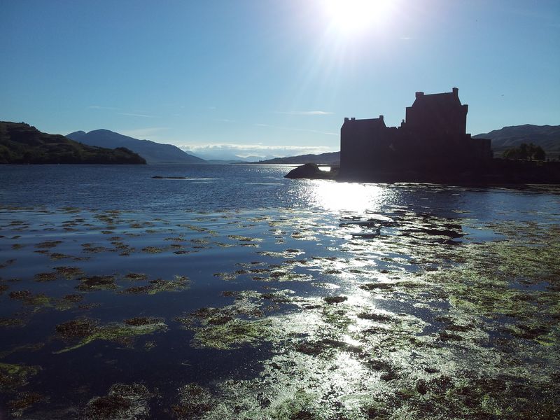
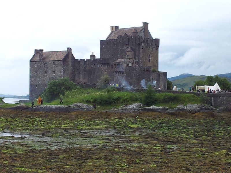
Eilean Donan Castle on the drive up to Plockton 9th July 7.20pm
Excellent scenic 6hr 25mins drive up to Plockton from Hexham, quick stop for ice cream at Tyndrum, quick photo stop at Eilean Donan Castle. Finishing with the amazing single track coastal road from Kyle giving awesome views to the Cuillin & Applecross hills. Arrived in Plockton at 7.45pm, (more on this drive see Driving to the NW Highlands).
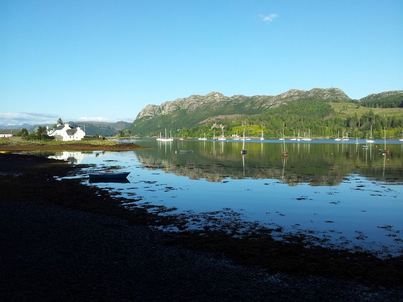
Harbour St scene from outside the guest house, arriving in Plockton 7.50pm
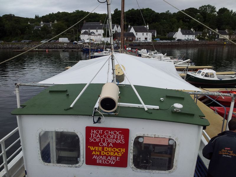
Excellent meal at the Plockton Shores Bistro, then the traditional evening walk across the Wicker Man causeway, past Hamish MacBeths house to the loch pontoon.
Plockton pontoon 10.20pm, an evening tradition, tonight it’s actually too light
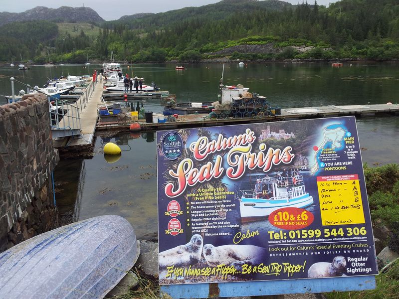
Looking east from the pontoon, with Calum’s seal cruise boat moored overnight
Disappointing ale choice at the Plockton Inn, slightly better at the Plockton Hotel, then back to the guest house to unpack and then repack for the hills. Tomorrow’s forecast was excitingly and surprisingly excellent 🙂
6.00am from the guest house window, (I was only up for a wee)
Mackenzie’s Guest House & Callums gift shop
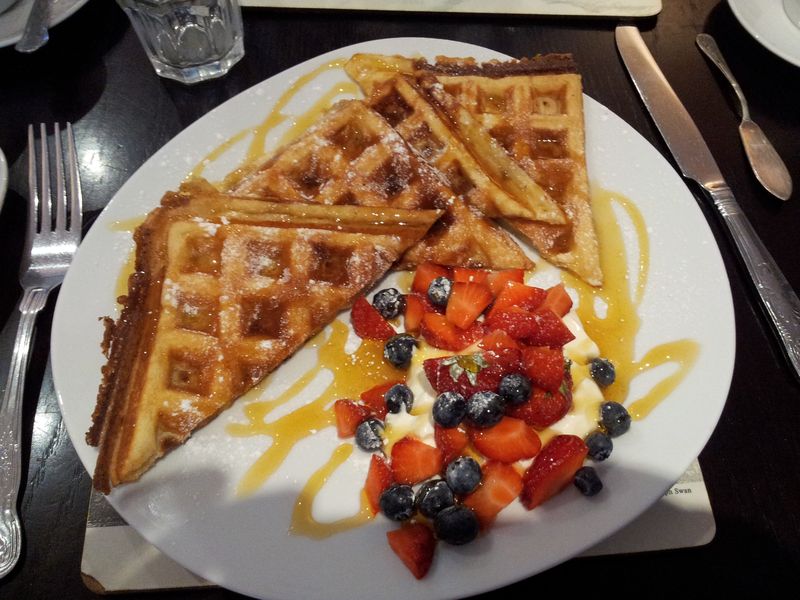
Accommodation was Mackenzies guest house on Harbour St, home of Callum’s Seal Cruise, ran by wife Jane & trained opera singer daughter Fiona. Offering the most incredible views over Loch Carron, there’s 3 bedrooms with a shared breakfast table ensuring everyone chats in the morning. It’s very social and guests are often foreign travelling around Britain so always interesting. A wholesome cooked breakfast is available but we find at our age the best fuel for a hill day are their tasty waffles:-)
Waffles for breakfast
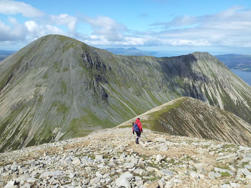
And today would definitely be a mountain day with both the Met Office & MWIS promising scorchio weather. Brilliant, this made decision making easy, we were off to tackle number one target remote Baosbheinn, and we were packing the suncream.
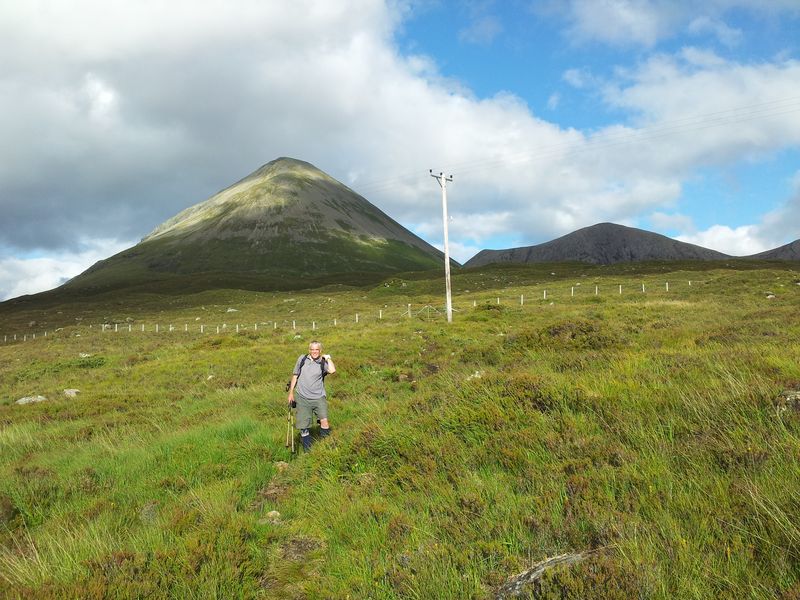
Day One – Long sunny day up Baosbheinn (pron Booshven)
We first caught sight of this coastal mountain from Beinn Alligin back in 2001 and were immediately fascinated by it’s shape & remoteness. Having recently done Torridon’s Slioch and Beinn Eighe we fancied something different so Baosbheinn had become no 1 target. After a 65 min drive from Plockton via Achnasheen, we arrived at the Red Barn to be met by masses of evil clegs thumping against the car window. It’s a 7 mile walk-in before the ascent even starts, it was a boiling hot cleggy midgey day and my fitness slowed us down. It took ages but we did it and the views were simply stunning, I like a bit of blue sea with my mountain views nowadays so Baosbheinn very definitely hit the spot. I’ll do a separate blog on this later with many photos, here’s three & a video.
Ascending Baosbheinn with Torridon behind
Views from the top of Baosbheinn
Views over northern end of Baosbheinn out to the Outer Hebrides
At 2,871ft Baosbheinn is a Corbett so many Munro baggers may miss this one which is a pity, this is a mountain to remember, it’s position parallel to the coast almost unique.
The hot weather, scale and terrain caught me out making us very late, I blame the views too as they’re absolutely compulsive on that mountain. This meant a rush to find somewhere to eat and after a couple of hasty phone calls we ended up at the Old Inn Gairloch. Food was okish with easily the best pint of the trip, Dundonnell breweries An Teallach ale, discovered last July in Ullapool. The Old Inn serves food till after 9pm, a massive bonus in the Highlands. Had a quick drive north around Gairloch’s main village then a speedy drive to Plockton with not one car ever in front of me. More of that please!
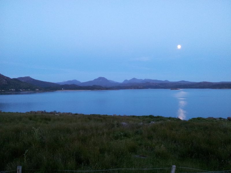
Gairloch moon at 10.45pm with Baosbheinn middle
Day 2 – Plan A,B,C + D, a taste of Red Cuillin mixed with Rubbha Hunnish
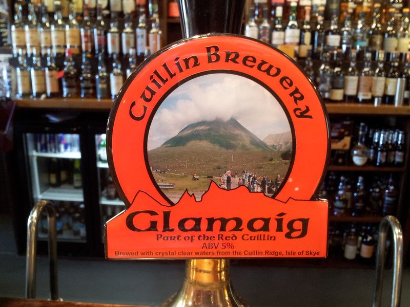
Slept poorly, my body totally knackered, if we were going to have a rain day could this be it please? Nope, another stunning morning with forecasts suggesting a deterioration later, but enough time for a mountain. With rain forecasted tomorrow every weather opportunity had to be taken, so after more breakfast waffles we headed off to walk target number 2, Glamaig, Red Cuillin, Isle of Skye.
12 hours after the Gairloch pic & another stunning Plockton morning – 10.15am
There’d been no time to sort gear the previous night, so it was a lateish start with my body protesting slightly. Thoughts of Skye soon changed that and after a 45 min drive we arrived at Sligachan – and look at those blue skies!! Love Skye, enough said. Some slight uncertainty on todays route, the preferred one being the horseshoe including the two Beinn Deargs which looked fine from the car park. Not sure I had the energy also timewise it would turn into a rush which defeated the aim. The main reason for doing Glamaig was the reported sensational views of the island & of course the Cuillin Ridge. We wanted to sit up there with binocs and take it all in rather than be dashing back, so plan B, no horseshoe just Glamaig, let’s go!
The Black Cuillin from Sligachan (anyone notice that cloud behind)?
Anyone notice that cloud behind the Cuillin? Anyway some slight uncertainty now over the start as my downloaded Walk Highlands route suggested starting left of the Allt Daraich gorge, so we strolled up to the Sligachan Bunkhouse to suss it out. Met the chatty guy who runs the place who explained they had to install a gate out back due to the Walk Highlands routes. Traditionally the term “left of the stream” was always viewed from upstream, causing some misinterpretation! He said the route was boggy plus the scree ascent from the west was tortuous & if he was going solely up Glamaig he’d go straight up & down. This also involved more tortuous scree of course, either way was tough. We discussed the Glamaig hill race, shook our heads incredulously over the times then went back to the car to regroup. By then that bank of cloud behind the Cuillin had become very noticeable, surely that wasn’t the weather front coming in 4 hours early, naa impossible. Right then, a direct ascent of Glamaig it was, change of mindset, refocus and off we set, let’s go!
The amazing 10 minute Glamaig adventure
We made the short road walk to the path used for the Glamaig Hill Race thanks to the advice from Bunkhouse man. Anxious glances now being made to that cloud bank which had advanced remarkably. The Cuillin Ridge was now in cloud and it felt like this wasn’t some temporary thing, we’d seen interesting weather here before and this was only going to get worse. Bla Bheinn was now also disappearing all within half an hour of perfect blue skies. We stopped for urgent talks, if Glamaig wasn’t going to be clear then today would be a waste of energy as we’d have to return one day for those views. We figured the evening front had arrived early and that meant rain. Can’t remember us ever doing this before but after 10 mins Glamaig was called off and substituted for plan C – head out to Trotternish away from the big mountains for the Quirrang or Plan D, Rhubbah Hunnish.
Five mins later we were in the car heading along the Skye coast northwards past Portree anxiously scanning the skies. Quick stop at the Kilt Rock viewpoint, couldn’t believe the cool wind that had come out of nowhere. Not that wind was a problem but Quirrang was quickly ruled out as this was another route for a fine day.
Kilt Rock
So finally we were left with Plan D, our third trip to Rubha Hunish, a walk out to the most northerly point of Skye and the best place on the island for whale spotting.
Parked for Rubha Hunish with the weather front creeping in over high ground
It’s a 2.5 mile level walk out to the basalt cliff edge where an interesting steep rocky path descends to the lower headland. Full details here on Rubha Hunish, I can’t guarantee whales but can guarantee an excellent adventure.
Sea stack on Rhubha Hunish (with old ropes attached), the outer Isles on the horizon
Rubha Hunish cliffs birds and blue sea
After walking round the fascinating eastern cliff edges, we sat down on the most northern point staring at the sea, waiting and staring, and staring, and look there’s a whale!!
Whale spotting on Rubha Hunish
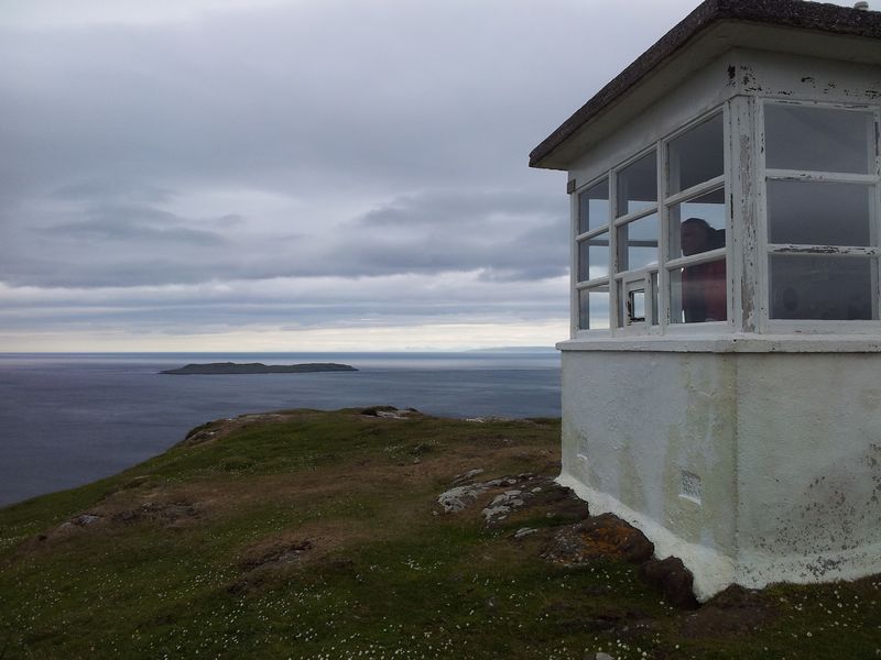
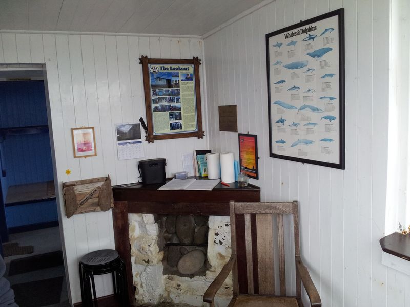
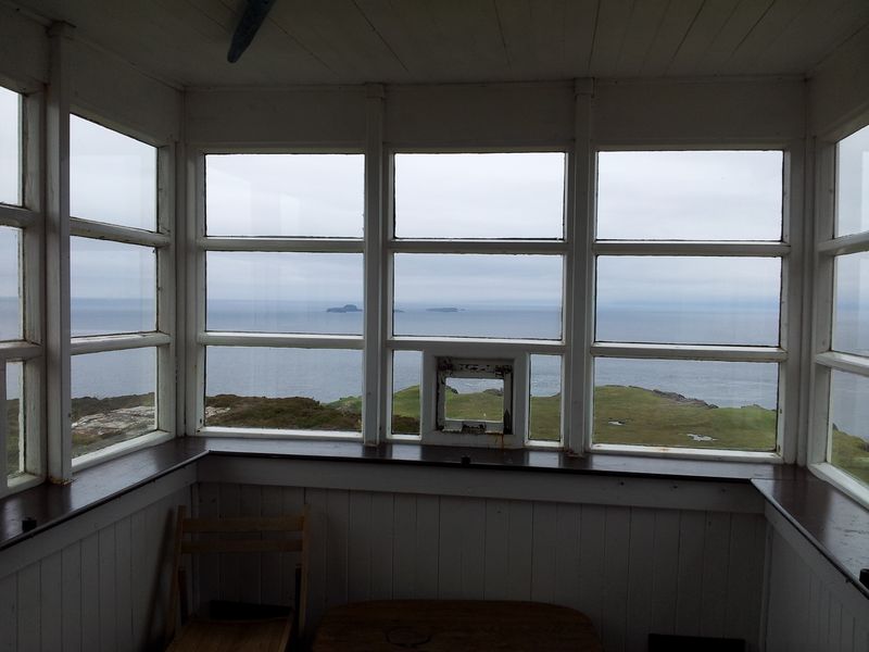
Nope, just the swirling currents where the waters meet, but this is an excellent spot for Dolphins, Porpoises, Minke Whales etc. This time I saw nothing, Alan saw a fin though which we assumed to be Dolphin, 2 years ago we briefly saw a Pilot Whale. Leaving here is difficult however after retracing the route up the rocky steps there’s an extra bonus visit to the fascinating Lookout, an old Coastguard station now a bothy with one helluva view. Binoculars are supplied and an interesting guest book listing whale sightings. We met a couple on the way there for the night, it’s a special place, more info here on the Lookout.
Rubha Hunish from the Lookout
Lookout, it’s Alan looking out at the Lookout
Inside the Lookout bothy, with whale spotting chart – you don’t get that in the Lakes!
Looking from the Lookout over Rubha Hunish to the outer Isles
Returning to the car at 7pm, the hills now misty & wet
During the afternoon that weather front had gradually engulfed the Trotternish Ridge and Outer Isles. Rain looked imminent and drizzle started just after we drove off. This time we went west via Uig to make a circular drive back via Portree. Food was booked in Broadford and we managed to fit in a pint of Pinnacle at the Slig.
Quick pint of Pinnacle at the Slig
Glamaig 8.15pm looking uninviting , the Black Cuillin completely shrouded
Food at the Red Skye restaurant west of Broadford, nice, very friendly and busy with locals which is a good sign, a little overpriced. Pint at the Plockton Hotel. With hindsight we were happy with the days decisions, could have been much worse.
Day 3 – Rain Day – Being a Tourist around the Kyle & Eilean Donan
Day 3 was a washout with grey clag, rain and drizzle. After a lazy morning we drove out the back of Plockton for a possible coastal walk but the rain kept forcing us back to the car.
Ok it’s a Highland Coo at Duirinish Station crossing
Given the limited rain options we headed for the nearest big town to sample all it had to offer. Yes it’s Kyle of Lochalsh and it’s offerings in poor weather are starkly modest. After walking round the hardware store and any other shop that seemed slightly interesting we ended up down on the docks and train station. Suddenly a mass of activity as the ridiculously short 2 coach Inverness train pulled in jam-packed with people. Taxis arrived, bikes were unfolded, cases were lugged and then suddenly normality returned. Anyone notice those logs on the right!
Train arrival at Kyle of Lochalsh – we know how to have fun!
The logs were being delivered by a convoy of lorries then being loaded into a boat by a crane driver who obviously has a job for the summer.
Crane driver loading logs onto boat at Kyle, this may take a while!
The rain eased momentarily so we drove off for a pint at the Clachan pub at Dornie, we’d briefly checked this pub out before and it seemed good. Also saw an advert in Kyle for a mountain shop 914 Outdoor near Eilean Donan castle so would call in there too. The shop had ceased trading at Xmas and the pub was closed till tea time; so we called into the Eilean Donan car park instead.
Eilean Donan in the mist and rain
Turned out the castle was having a re-enactment weekend by the Sealed Knot Society. Lots of shooting and dodgily dressed highlanders. We didn’t go in, just hung around the car park and visitor centre. Wow it was busy, people from all over the world descending from cars, coaches, cycles, motorbikes, motorhomes, you name it. Staggering in fact! Scotland’s most photographed castle, rebuilt in 1923.
Eilean Donan battle re-enactment, it was busy, very very busy
Back in Plockton 6.50pm, Harbour St from the guesthouse window
Food back at the Plockton Shores again, very good! Tomorrow’s forecast also very good!
Plockton Shores Saturday specials, nice!
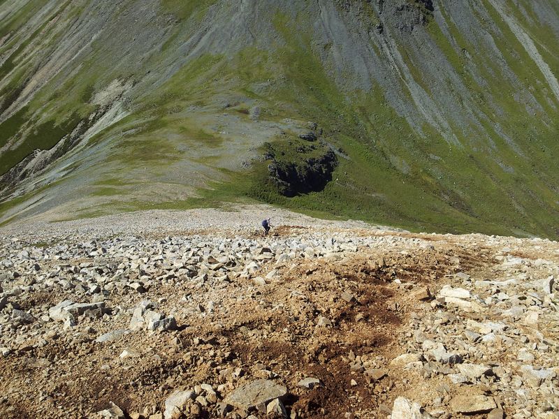
Day 4 – Return to the Red Cuillin & this time it’s personal
Body rested, forecast encouraging, so time for a second attempt at Glamaig and this time we’d try for the full horseshoe route, this time it’s personal:-) Back at Sligachan then a slow soggy slog up to the first top Beinn Dearg Mheadhonach. The cloud did come down during our ascent but by the time we reached the top conditions had improved and gradually became near perfect. Whilst the mainland peaks remained smothered most of the day, we had blue sky on Skye with quite staggering views. Very happy with our route choice today and broad smiles all round. Particularly pleasing looking down at the familiar winding Skye coastal road along to the Trotternish Ridge with the Outer Hebrides beyond.
The Black Cuillin from the Red Cuillin with an old man in a red top
Light & texture on Glamaig before the scree descent, look at that inviting reascent!
Scree descent to the Bealach na Sgairde, gaelic for ‘not knee friendly’
On the steep scree slope up Glamaig looking over Beinn Dearg Mhor, Blaven right, my feet below
We discovered that the advice 2 days ago from Bothy man was spot on, the southern scree slope up Glamaig is a right bugger. We tried picking out lines of grass amongst the crumbling scree but the angle was never anything other than unrelenting. Neither of us would’ve been happy slogging up this to be met by a mist filled top. Luckily it was quite the opposite with amazingly wondrous views, these hills deserve their recommendations.
View north from Glamaig over Trotternish, the Storr, Raasay & the NW coast
From Glamaig east over Scalpay to the cloudy mainland
Amidst the mountain splendour up on glorious Glamaig was one nagging undeniable truth. No way were we going back down the ascent route, so this meant a direct scree descent to the Sligachan. Time to lengthen the poles, tighten the knee supports, grimace and go for it.
Scree
We tried following fence poles (advice of bothy man) then Alan went left, me right as we valiantly and spectacularly failed to find a decent route down. The scree was vicious, we had to keep moving, the angle never wavered, there was no rest for old men.
Same spot as 2 days ago, this time very satisfying meeting level ground
The classic Black Cuillin view from Sligachan, anyone notice that cloud – it’s fine 🙂
Random pint in the Slig, nothing specific, any pint will do!
Duirinish village on the drive back to Plockton – a favourite
My knees may never recover but that was a damn good day. Food at Plockton Shores.
Day 5 – Varied Day – Calum’s Seal Trip, Rain, Coast, Evening RNLI Exercise
An iffy forecast for our last full day in Plockton with rain & low cloud due by late morning. Today would be made up as we go along, firstly the essential experience of any Plockton visit, Calum’s Seal Cruise. The peaceful sheltered scenic waters of Loch Carron make for a wonderful boat trip full of interest with Calum’s entertaining commentary lifting this experience well above other local trips (Kyle). Can’t recommend this enough, it’s more than just the seals, Calum is the perfect host full of humour and local stories.
Calum’s Seal Trip, just do it
The Sula Mhor leaving Plockton
Loch Carron in deteriorating weather
Spotted in Plockton – it’s McWainwright
Landing back in Plockton
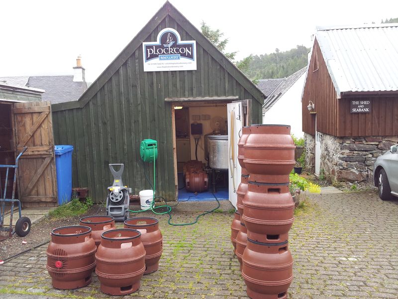
Another wonderful experience, I was too busy watching the seals to take photos. With almost perfect timing the rain arrived as we landed. Before heading back to the room for a cuppa we did a quick walk around Bank St spotting a man washing beer kegs outside a green shed. We had unwittingly discovered the Plockton Brewery, ran by Andy an ex naval officer who has been brewing beer here in 2007. Cheekily I asked for a brewery tour and cheerfully he obliged.
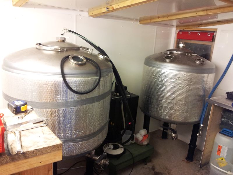
Plockton Brewery
Andy does this as a hobby mainly supplying the Plockton Inn rather than the Plockton Hotel, we assumed the latter prefers stacking up the number of new guest ales. Common mistake this, I’m sure tourists would much rather have a local brew choice especially when it’s a good pint. Apparently the Inn usually also stocks London Pride because there’s a local guy very keen on it; now there’s consumer power for you:-)
Plockton Brewery
We thanked Andy for greatly improving the local real ale choice and for his time, nice guy. Then back to the guest house for a cuppa. Despite the rain we took a gamble and made the short drive out to Duirinish station again to attempt a quick coastal walk. The Highland coos were out and we drove past this……
Load of Bull (actually they’re calves next to him)
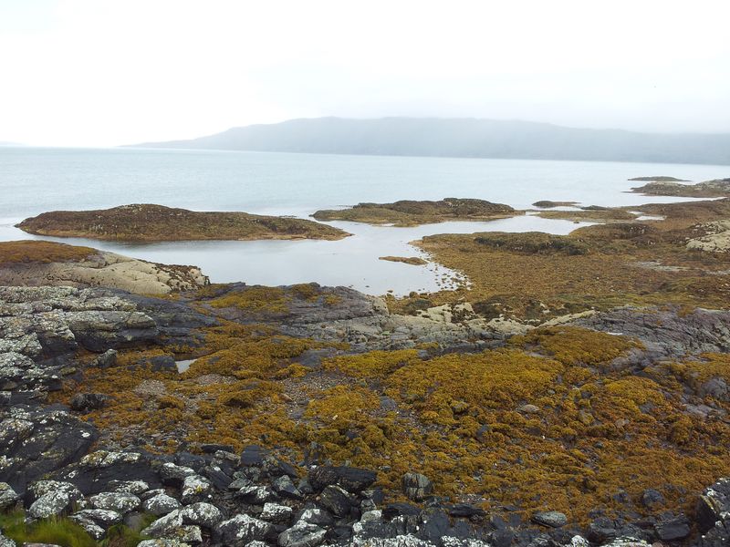
Parking at the station we walked across the level crossing then down a narrow ‘road’ to Port Ban then Port-an-Eorna. The route’s from Walk Highlands, a 2 mile coastal circuit that despite the weather was very enjoyable. Always nice being at the coast up here, would be even nicer in decent conditions with views to Applecross & Skye. Still I’d definitely do this again.
Port-an-Eorna on the coastal walk
Drizzly but still good at the coast
Spotted a few seals with the binocs & briefly chatted with a local guy walking his Golden Retriever. He told us the spot below was good for otters, we saw none of course.
Sat here for a while staring at the lack of otters
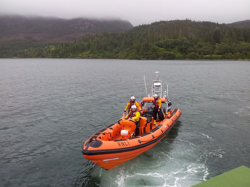
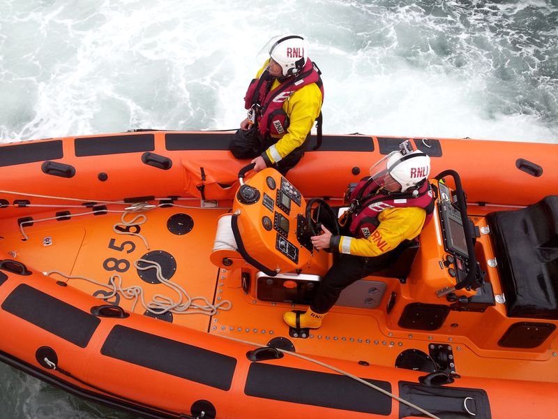
Raining again so back to the guesthouse where we met Calum outside who invited us for a special evening boat trip. The Kyle lifeboat crew had asked for help with an exercise, Calum would sail out in the Sula Mhor then cut engines so the RNLI could tow us back. We were right up for this, our last evening in Plockton too.
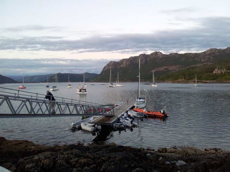
Return to the Pontoon at 7pm
The weather had deteriorated and it was unusually windy out on Loch Carron. A brief phone call by Calum confirmed the rescue exercise was still on, in fact all agreed it was going to be very useful practice conditions.
Cutting engines out on a surprisingly windy Loch Carron
The RNLI arrived into the Loch at impressive speed having taken just 15 mins from Kyle. Ropes were carefully attached and the towing operation began.
The Kyle RNLI arrive
Roping up
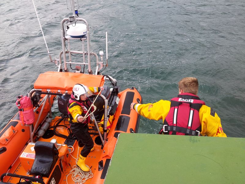
The high crosswind was proving an interesting challenge with the crew eventually roping their lifeboat to the Sula Mhor so they could steer both boats carefully to the pontoon. This took some doing but they managed it and it all made for compulsive viewing.
Engines full on, steering both boats
A second lifeboat crew had driven over from Kyle and were waiting on the pontoon. They helped secure the Sula Mhor before taking their turn on a second exercise.
Handover to the second RNLI crew
Brief rest between exercises 8.05pm
Unfortunately we couldn’t stay onboard as food was booked at the Plockton Inn at 8.30pm. Remarkably the second exercise never happened as a real rescue took over, with a stricken yacht losing it’s mooring and in need of help, even made the local news here. Many thanks to Calum for the invite, loved every minute, fascinating final evening in Plockton.
Plockton evening, appearing deceptively calm
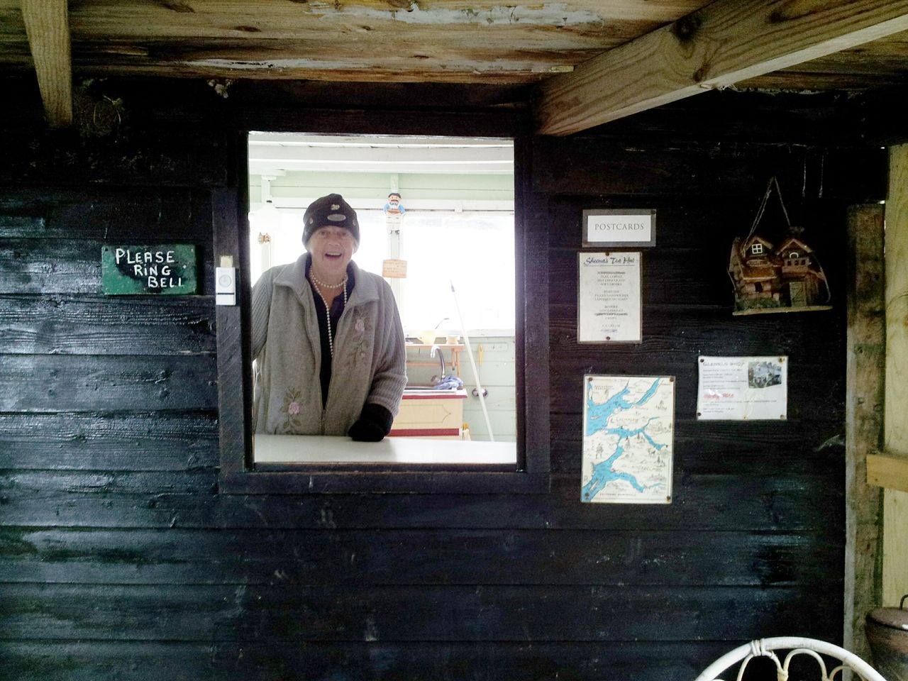
Final Day 5 – Sheenas Tea Hut & The Sandaig Islands then Home
Waffles for breakfast, a good chat with Jane & Calum then it was goodbye to their guesthouse and to Plockton. The word reluctant doesn’t sum it up, however still just enough time for a final adventure. On the way south we diverted to Sheenas Tea Hut and the Sandaig Islands. The Tea Hut is at the end of the road from Glenelg to Arnisdale. Sheena has been serving tea here for years and it must be one of the most remote and wonderful situations to have a cuppa. Calum had heard she may have retired however we were reassured by a local at Corran that she was still there. As we approached the bungalow we were met by a smiling Sheena, she said “I’ll always be open, until they take me away in a box, I like meeting people”. Tea is £1 a mug, some more details here.
Sheena smiling in her Tea Hut 16th July 2014
Inside Sheenas Tea Hut, all seems normal
Sheenas Tea Hut July 2014, the drizzle didn’t dampen the fun
Holy Cow! Outside Sheenas Hut
From Sheenas we drove back along the coast parking at Upper Sandaig for a quick walk down to the Sandaig Islands. Another wonderful setting, former home of author, basking shark harpoonist & otter man Gavin Maxwell. Lucky again with the weather as it had brightened up just in time.
The Sandaig Islands down there, with the Cuillin just visible on the horizon
Sandaig beach and a rare red kite (ok not the bird variety)
Sandaig looking north
Luckily the tide was out and after the winding forest track down to the beach we sat on a high point looking for otters. We saw several boats, several Oyster Catchers, one Glenelg ferry and several seals, but sadly once again no otters.
Seal spotting on sunny Sandaig
The route back through a field of giant ferns mixed with camouflaged brambles was an unenjoyable challenge, so instead I’ll end with a picture of white beach from Sandaig. More details on the Sandaig Islands here.
Sandaig
And so that’s it, a 6 hour drive back to Hexham then beer at the Dipton Mill. If you’ve actually read this far then give yourself a prize, alcohol may help 🙂
Rather than a bagging trip this was a varied adventure, we covered a few miles, met lots of locals and enjoyed every minute. My knees may one day recover from Glamaig, the Sandaig Island bracken may one day be removed from my boots; but the memories will remain for ever.
Last October I wrote a post here called I Miss the Hills. Whilst whale watching in remote northern Skye I got a call from my dad who had just managed to hit his face on a cupboard door knocking him unconscious and breaking his shoulder on the way down. I had to drive down from Plockton to Manchester to help out with him & my mum, leaving the wonderous peaceful glistening sea behind in wonderous weather. I didnt blame my dad one bit 🙂
Whale Watching, Rhubha Hunish, Isle of Skye 28.9.13
Finally it’s time to return to beautiful Plockton, so having wrapped my dad in bubble wrap for the week I’ll be making that wonderous drive northwards on Wednesday lunchtime. It’s such a wonderous drive that some sad bugger wrote a blog in tribute to it all; Driving to the North West Highlands. Fitness is pretty poor this year so there wont be many big walks, I’ll be happy with anything, fingers crossed for the weather as ever of course. Let’s see what excellent adventures lie ahead, can’t wait.
Rhubha Hunish, Isle of Skye talking to my Dad 4.20pm 28th Sept
It’s been difficult getting regular walks in this year as I’m making fortnightly trips down to my parents in Manchester. Ages ago I booked a week in the Highlands and that week draws near, so I managed to nip across to Dunham Park for 2 brisk walks to get some exercise & relive my childhood. I used to cycle here as a kid so it has many happy memories, jumpers for goalposts etc. On Saturday I managed to add a pub diversion across the river Bollin too, I don’t remember that as a kid.
Distance = 4.1 miles (6.5 km)
Duration = 1 hrs 24 mins
Total Ascent = Only 200ft 🙂
Start/Finish = As close to Smithy Pool as possible as it’s free
Date = Saturday & Sunday 5th & 6th July, sunny
Click on the Route Map below to zoom in/out
Dunham Park Route – covers much of the park except the Gardens
Dunham Park is situated near the wealthy stockbroker/mega-rich footballer belt of south Manchester/north Cheshire.
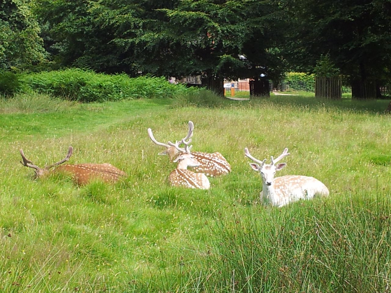
Starting Point; I found a space where Charcoal Rd turns right where it joins Smithy Rd. Anywhere round here will do to accees the stile by Smithy Pool. If you’re a National Trust member then park at the main car park further on, there’s bags of room and has the impressive addition of a large brand new visitor centre. My aim was to walk as fast as possible around the park, though some areas are closed to the public giving the deer some privacy. There are lots of Fallow deer here, how many exactly I’ve no ideer. Pity I didn’t have time to visit the gardens as these are well worth a stroll around in the summer. Dunham is on the flightpath for Manchester airport so there’s a fair bit of aerial activity which I actually quite liked.
Oh deer
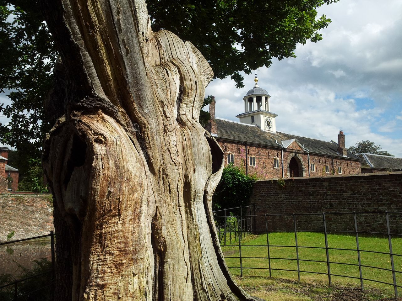
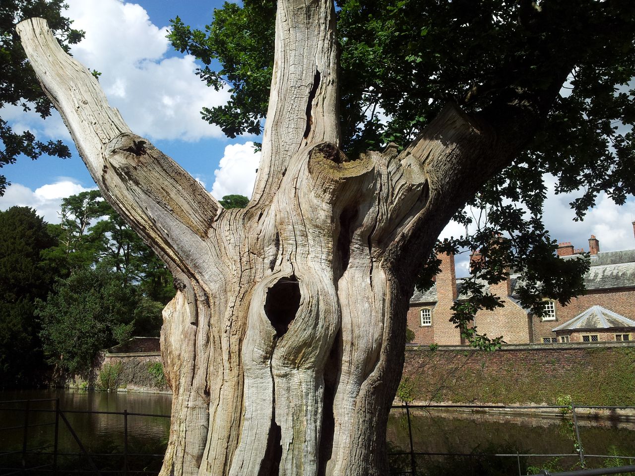
Magnificent tree, it’s been around a while
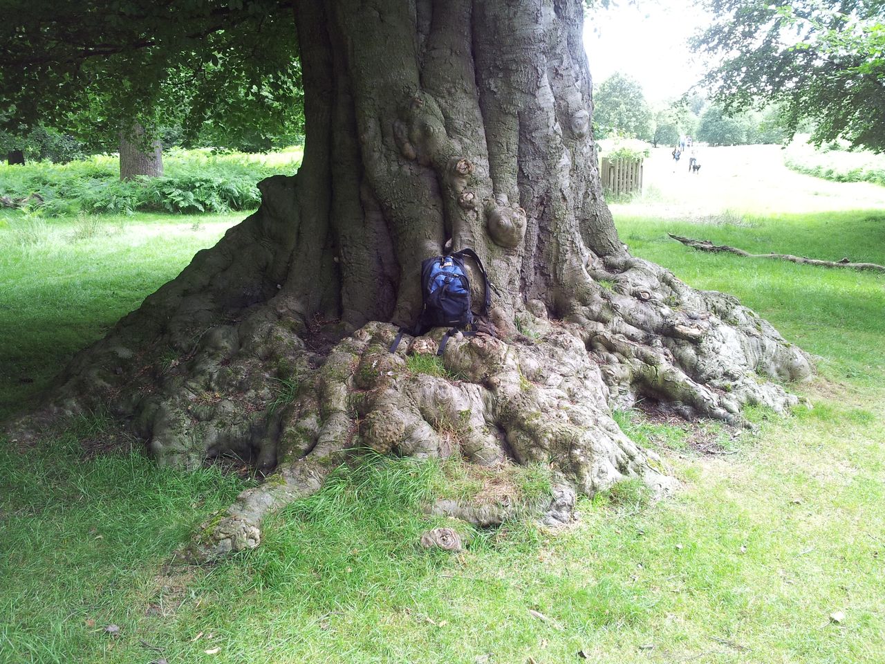
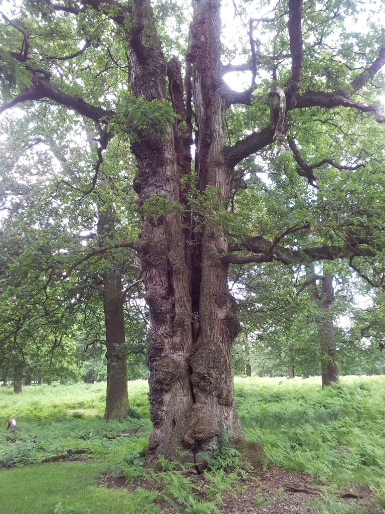
Quote from Wikipedia “Dunham Park covers an area of 192.7 acres (780,000 m2) and is part of the Dunham Park Estate, run by the National Trust (grid referenceSJ740870). The park is mostly “pasture-woodland or park-woodland” and has been since the Middle Ages. Many of the oak trees, which make up the larger part of the woodland, date back to the 17th century. Dunham Park is the only place in the northwest of England with such a concentration of old trees, and one of only a few remaining in England, making it a site of national importance. The park supports a range of animals, including fallow deer and over 500 species of insect.” Think I met a few of the latter – actually many of them are beetles.
Split tree
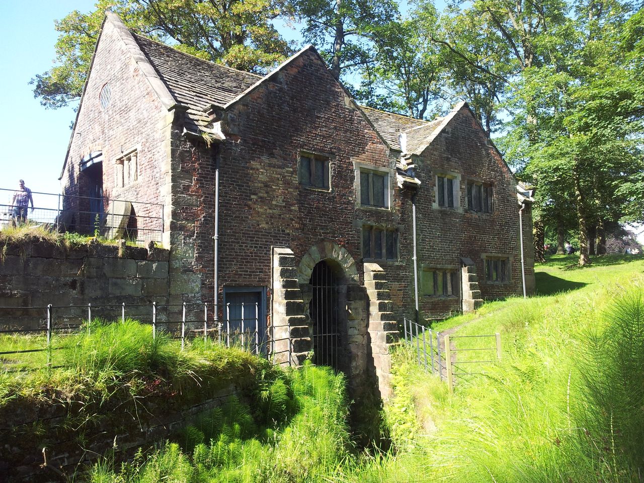
The Pump House
Inside the Pump House
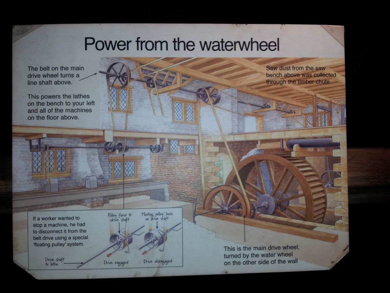
Water Wheel
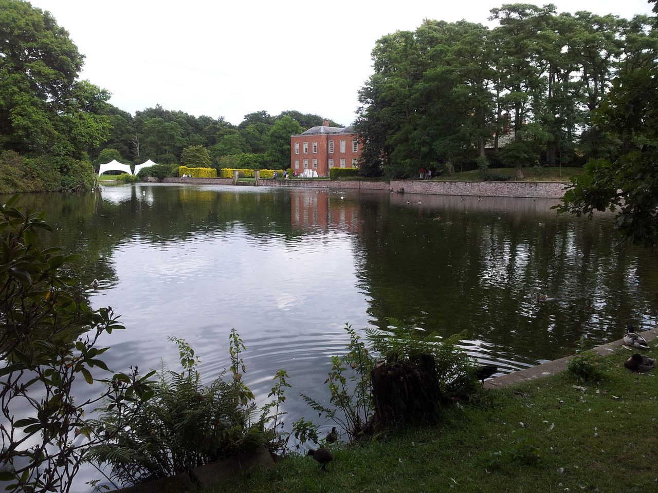
Dunham Massey Hall
Clock Tower
The moat & Stables Restaurant
Roof needs some attention
During the 1st World War Dunham Massey Hall was used as a militay hospital, there’s a wartime theme and exhibitions to celebrate the centenary.
War time theme 🙂
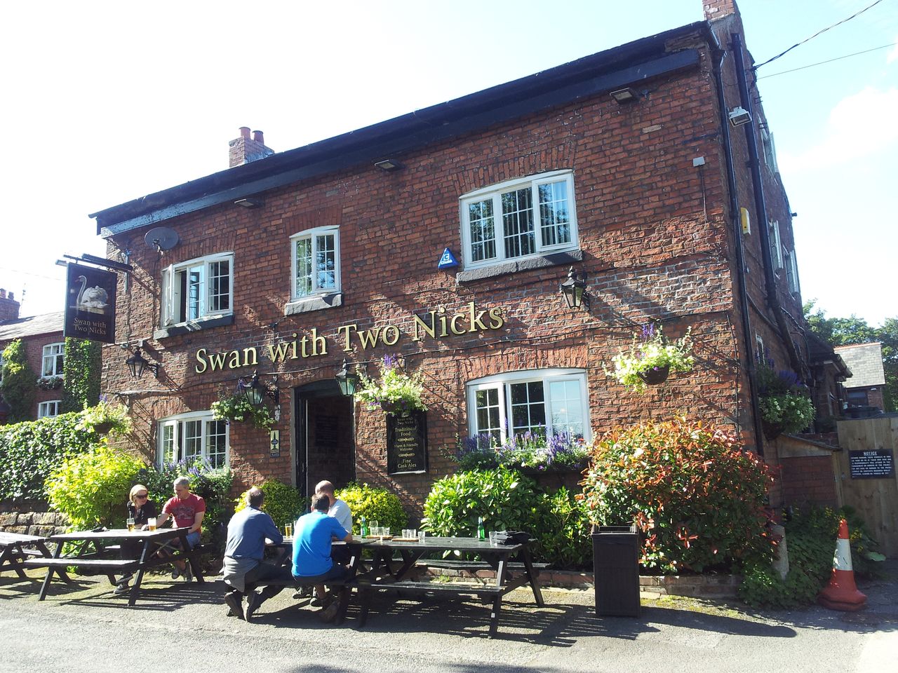
A short diversion can be made to the Swan With Two Nicks from the west entrance on a straight path across an entertainingly narrow footbridge over the River Bollin.
Diversion to the Swan With Two Nicks, Little Bollington – beer!
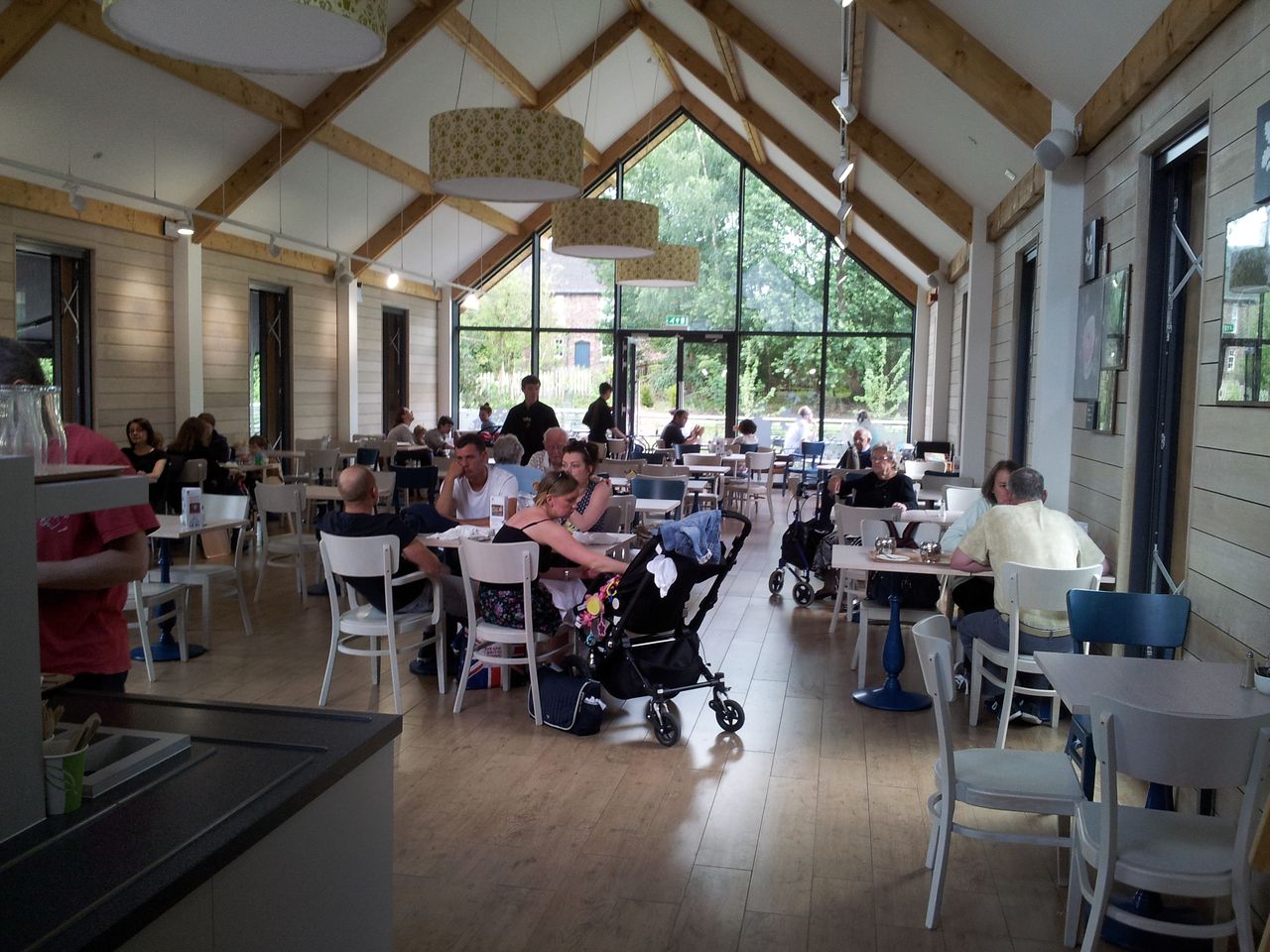
I returned for a walk around the new visitor centre complete with the usual National Trust gift shop & eatery. Very airy and roomy, didn’t realise this was going to be so large but Dunham’s a busy place.
Part of the brand new Visitor Centre
Hall & Gardens over the lake
Lake & House
Old tree & Clock Tower
Some characterful trees here
The House and deer
Enjoyed revisiting Dunham, at 15 mins drive from my parents & where I was born, this may become a regular exercise opportunity. Must rejoin the Nat Trust at some point to get back into the gardens too. Total of 8 miles & 400ft of ascent for the two days, that won’t get me ready for the big mountains, just the best I can do in the limited time 😉
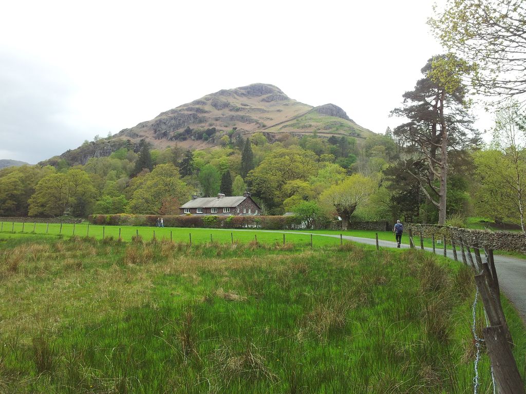
Helm Crag is probably my favourite small hill in the Lakes and the best way to scale it is straight up from Grasmere. On any other approach it’s just an outlying fell yet from Grasmere it becomes a mini Matterhorn. This 4 hour walk heads straight up Helm Crag from the Village and beyond for a horseshoe above Dunmail Raise to Steel Fell. Must admit to knowing nothing about Steel Fell until today! The walk can just as easily be done anti clockwise, either way make sure you get down in time for tea & cake at Baldrys:-)
Total Ascent = 2,398 ft (731m), max height Steel Fell 1,814 ft (553 m)
Start/Finish = Grasmere Village
Date = Sunday 27th April 2014, low cloud with rain imminent
Click on the interactive Route Map below for more details;-
Helm Crag to Steel Fell route via Gibson Knott & Calf Crag from Grasmere
Starting Point – Grasmere Village I’m a huge Grasmere fan. There’s an irresistible bustle about the place, it’s full of walkers, excellent tea shops, good food and real ale – yet evenings can be quiet as a quiet thing. Today was the last day of a Grasmere birthday weekend with excellent food at the Oak Bank Hotel. After another full breakfast and a reluctant check-out we were luckily allowed to leave the car parked at the hotel for this final jaunt. Low cloud and the threat of rain wasn’t going to put us off, the plan being to finish on Steel Fell, a new Wainwright for us. We just hoped the greyness would stay high enough to get some new views.
Route Summary – in 3 stages Timings are just a guide with a few stops added, it was another late start & there was no rush to end the walk early or to leave the Lakes;
Grasmere Village to Helm Crag; (1 hr)
Helm Crag via Gibson Knott, Calf Crag to Steel Fell; (1 hr 45 mins)
Steel Fell descent back to Grasmere Village; (1 hr 15mins)
Route Detail & Photos from Sunday 27th April 2014Stage 1 – Grasmere Village to Helm Crag; (1 hr) – The day started by turning north west up Easedale Rd at the junction near Heaton Cooper studios. The road is fairly quiet and rises gently past some houses until bending right by a bridge & cottage. You cross the bridge for Easedale Tarn but stay on the road for Helm Crag.
Alan taking the road to Helm Crag 11.35am
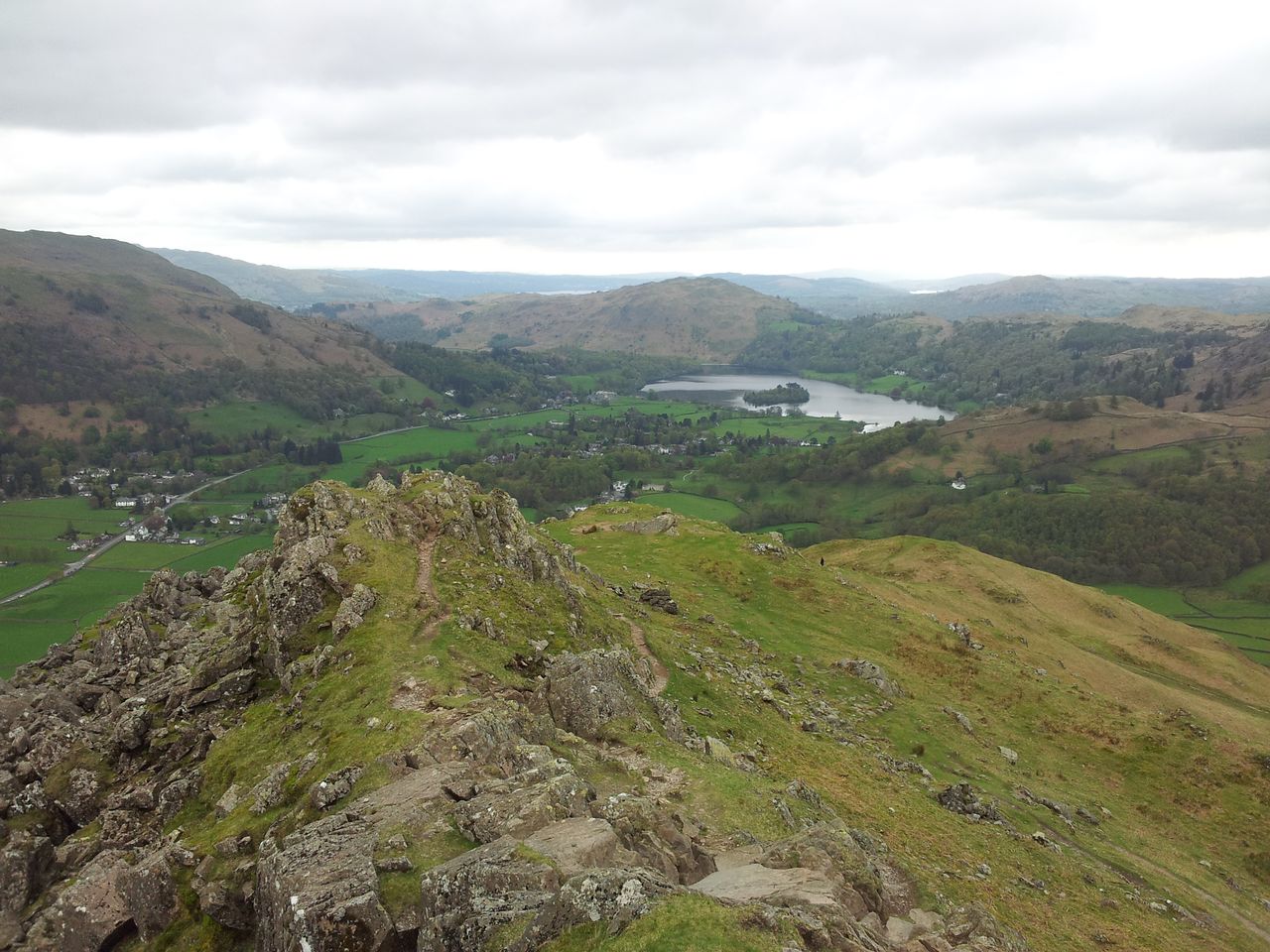
The private road passes the house above continuing to a junction between cottages. There a right turn is taken up a cobbly track through a gate then another gate, then upwards where the managed stone path starts zigzagging up to Helm Crag. There’s level bits just when you need them as the path snakes initially west then up to a grassy ‘playing field’. Go to the east edge for great views over Dunmail Raise where you might see jets screaming below you on a weekday. Finally it’s a steeper rougher rocky path to the top with a hint of easy fun scrambling at the end (or a grassy bypass path). Helm Crag is an excellent introduction for anyone new to the hills giving a taste of mountain adventure with wondrous views. It’s understandably & deservedly a magnet for walkers, tourists, families & sheep; if the weather’s good you won’t be alone long on Helm Crag.
The vew from Helm Crag over Grasmere
And for the adventurous there’s the challenge of the Howitzer, never achieved by Mr Wainwright or Martinthehills. My excuse being it’s always very windy….or wet & slippy….or I’m in a rush…or any other excuse I can quickly think of. I’ve had a tentative look mind so one day I might grow a beard and have a go, after all Julia Bradbury did it – and no beard too!
Helm Crag with Steel Fell peeking behind the aged walker – 12.25
Stage 2- Helm Crag to Steel Fell via Gibson Knott & Calf Crag; (1hr 45 mins) Once past the Howitzer the ground suddenly dips enough to give Helm Crag an identity all of it’s own. As with many Lakeland dips this is passed more quickly than it looks then once the high ground is reached the ridge traverse starts, not that it’s really a ridge.
Th dip north from the Howitzer to Gibson Knott, Alan a dot – 12.35pm
Looking further east to Steel Fell
Gibson Knott 1,385ft looking north – 12.55pm
A winding way ahead 1.10pm
Back to distant Helm Crag & Grasmere village, took years learning to pose like this – 1.25pm
Been a few years since we walked this section and it seemed more fiddly this time, even though last time was deep in clag. Alan was getting keen to divert north east asap due to the threatening weather, the cloud was now on Seat Sandal & getting lower. There’s a watershed to avoid so we delayed leaving the main path until just before Calf Crag where we looped off north then swung south east. Soon we picked up a decent grassy track with reassuring boot marks. Can’t think of a moment when boot marks aren’t reassuring 🙂 Cloud lowering further though and starting to drizzle.
The loop east round to Steel Fell, Helvellyn & Fairfield smothered 1.45pm
Starting to rain, looks like the lowering cloud’s going to beat us – 1.55pm
From here the route up to Steel Fell was surprisingly straightforward and we tried to hurry before our potential new Wainwright views disappeared. The brief rain had come & gone, the weather all around had closed in but at least on Steel Fell summit we had views.
Steel Fell summit – better than expected – 2.15pm
View north from Steel Fell over Thirlmere – 2.15pm
The summit is surrounded by high ground so I walked out to the western edges for a retrospective view of our route here. Somewhere down there is the source of the River Rothay which winds through Grasmere, Rydal, Ambleside and into Windermere.
Views west, over the start of the river Rothay up to Calf Crag – 2.25pm
Views south over Helm Crag with Windermere above – 2.25pm
It was quiet up here, big contrast to Helm Crag, bet this was rarely visited before the ‘Wainwrights’ became popular. Bet the views are even better on a fine day too…but hey what’s happening with this weather, that cloud’s lifting, that’s not supposed to happen!
Thirlmere brighter – 2.30pm
Oh hold on, no it’s not!
Actually no the cloud’s come down again – 2.35pm
Seat Sandal on the right, cloud lifted again – 2.40pm
It was getting a bit nippy now but the cloud did start to lift a little and then a bit more, and then a steady improvement for the descent, lucky.
Stage 3 – Descent from Steel Fell to Grasmere; (1 hr 15 mins) This is virtually a straight grassy line south east which descends quickly and easily. Views are nice and it was all very uplifting. Bit like the cloud.
Steel Fell summit view south – 2.45pm
Following the straight path down south east from Steel Fell – 2.50pm
Helm Crag’s Howitzer – 3.00pm
Approaching Helmside in the trees – 3.10pm
Soon it’s a roasdside walk back to Grasmere and we passed a cottage I stayed at for my first Grasmere weekend years ago. I remember it being dark at night, memories eh!
Stayed here years ago – 3.45pm
Back in Grasmere there was plenty of time for a quick boot change and nice cuppa Farrers leaf tea & creamy jam scone at Baldrys. Recommended.
Baldrys leaf tea & scone with a hint of cream – 4.30pm
Sadly we left Grasmere diverting to Keswick for a pint at the Dog & Gun. We really didin’t want to leave the Lakes. Cracking long weekend where everything went to plan 🙂
On a clear day there may be advantages in doing this particular route starting up Steel Fell and going anticlockwise, maybe I’ll try this one day. And maybe I’ll get up the Howitzer. Lot’s of maybes one certainty, I’ll definitely be back in Grasmere, get the kettle on 🙂
Here’s an even more interesting version of the classic Fairfield round via a scenic approach walk along the lakeside paths of Grasmere & Rydal Water. Seven Wainwrights in total including hopefully 3 new ones for us, Low & High Pikes on the central ridge plus Stone Arthur on the return. The route was a last minute choice after catching an opimistic Met Office forecast after breakfast on a rainy Grasmere morning. Thankfully the late start was proved to be more than justified on this classic Lakeland walk.
Total Ascent = 3,809ft (1161m), max height Fairfield 2,864ft (873m)
Start/Finish = Grasmere Village
Date = Saturday 26th April 2014, cloud & rain clearing
Click on the interactive Route Map below for more details;-
Fairfield Round route from Grasmere – via Rydal Water, High Pike, Fairfield, Great Rigg & Stone Arthur
Starting Point – Grasmere Village
I’m a Grasmere fan, yes it’s touristy but every morning there’s an irresistible bustle of walkers gathering excitedly in the streets before dissipating out onto the fells. Some return in time to visit the irresistible tea shops whilst others cut out the middle man and head straight for irresistible Tweedies bar. I’ve stayed in a few guest houses and many of the hotels, it’s become an annual birthday weekend and winner of ‘best evening meal of the year’ 2 years running!! Today was another rare treat. leaving the car parked and walking straight from the Hotel – after a class cooked breakfast too:-) It ain’t exactly wild camping, it’s a Grasmere weekend.
Route Summary – in 5 stages
Route inspiration from Paul aka @barry_the_cat who ‘pioneers’ similar and longer walks from Ambleside, usually including a Grasmere Tea shop. Bit like a Highland day with a civilised rest & nice cuppa tea thrown in. This walk felt like five stages, the timings below are just stage to stage, so don’t include some stops, overall time was 6hrs 52 mins and will vary of course.
Grasmere Village to Glen Rothay Hotel & Badger Bar; (1 hr 13 mins)
Badger Bar to start of ridge near High Sweden Bridge (50 mins)
Ascent of middle ridge over Low & High Pike’s to Scandale Head; (55 mins)
Scandale Head via Hart Crag & Dove Crag to Fairfield (1 hr)
Fairfield back down to Grasmere Village via Stone Arthur; (1 hour 5 mins)
Route Detail & Pics from Saturday 26th April 2014
Stage 1 – Grasmere Village to Glen Rothay Hotel & Badger Bar; (1 hr 13 mins) – The day starts with a walk through the village and it’s morning mix of walkers, shoppers & tourists. Behind the Red Lion join Broadgate passing the Jumble Rooms and Tweedies, then making a right turn at the Garden Centre T junction west along Red Bank. It’s a slow burner however it’s always better to start gradually after stuffing yourself with a quality full English. Have discovered that leaving out the sausage helps nowadays as sausage often takes ages to digest. And thats the hillwalking tip of the day folks, no sausage no pain:-) The road continues to rise gently past the Gold Rill hotel and Faeryland boat hut – can certainly recommend a row around Gramere from here (on a nice day). Unfortunately there’s no quick way down to the lake yet due to the marshy woody shore so we continued along the road for another half mile eventually meeting a footpath sign pointing left which angles down to the shore. Finally it felt that the walk had started on this popular attractive path clinging to the lake with great views. A new path for us and an encouraging start.
A late start from the Oak Bank Hotel, Grasmere – 11.17am
Grasmere (the lake bit) looking north to Helm Crag & Seat Sandal – 11.40am
Grasmere Heron!
End of the Lake – 11.50 am
We carried straight on past the old bloke (Alan), should have gone right – 11.50 am
After 30 mins we reached the south end of Grasmere lake just below Loughrigg. Here we made a slight navigational error carrying straight on north west past the bridge (above) to follow the river Rathay. The path winds through an attractive wood eventually looping round to join path to the south side of Rydal Water. We could/should have turned right at the bridge going due east over the side of Loughrigg to shortcut the loop to Rydal Water.
Rydal Water lakeside path, Alan on a mission – 12.15
End of Rydal Water – 12.25
Having whooshed up and down the A591 it was pleasing to finally walk around these lakesd, both of these make very pleasant strolls if you were in a strolling mood. Today we weren’t, as despite the interesting 70 minute approach walk we hadn’t gained any height yet and were itching to start climbing a mountain. Weather had thankfully improved just as promised by the fairly reliable Met Office. Section one to the bridge opposite the Badger Bar complete. Now for the vague bit.
Crossing the bridge over the Rothay with the Glen Rothay Hotel & Badger Bar – 12.30pm
Stage 2- Badger Bar to foot of middle ridge near High Sweden Bridge; (50mins) We crossed the bridge over both the Rothay and a very busy A591, passing the Badger Bar full of people lazing in the garden enjoying a pint. This wasn’t tempting of course, not one bit (oh yes it was). Instead of ending the walk here sampling real ales we followed the road a few yards east taking a left turn by a cute country cottage & Rydal Church. Another attractive spot, some say you get the odd tourist around here?
Turn left at the cute cottage but watch out for tourists – 12.31pm
Rydal Church – 12.32pm
Approx 100 yards uphill past the Church instead of taking the main route heading north west to Nab Scar, we turned off east/right at a sign for ‘Rydal Hall Gardens & Tea Shop’. Surprisingly only 3 mins later we found ourselves at Rydal Hall Gardens & Tea Shop.
Turn right at the Rydal Hall sign – 12.35
Rydal Hall tea shop – 12.40pm
Ok now for the vague bit, both our previous ascents of Fairfield had been up via Heron Pike and down via Snarker Pike missing the Wainwrights of Low & High Pike. Problem was we werent exactly sure how to get up to this middle ridge. At the back of the Hall we spotted open fells through trees, walked up towards it realised it was wrong and hastily rejoined the tourists walking through the Rydal Hall complex. No one had noticed and we retained our manly mountain dignity. There’s probably a suitable route from here but we decided to play safe and skirt round past the Rydal Yurts following the good track which was now heading south east to Ambleside, away from Fairfield. We were looking for the earliest opportunity to turn left up that ridge, intially this was barred by trees then there was no sign of a feint track indicated on the map, so we vaulted the fence & started up through farm fields. Ascent at last! Bit tiring this, better stop for a photo excuse.
Heading up farm fields, looking back at the track from Rydal Hall, Nab Scar right – 12.55pm
Zoomed pic of a Sea King on the crags above Ambleside, seemed to be delivering sacks of paving material
Fun in farmland – 1.00pm with Sea King back again in the distance
We progressed in a disorderly direction till we came to the days biggest problem, an impressively feckin huge high wall, and we were on the wrong side. We followed the feckin huge high wall till we found a gate which was locked, then another gate, same story. The feckin huge high wall seemed to go on for ever, so we reluctantly & carefully had to climb it which wasn’t too easy. Putting this irritation behind us we had at least joined the main path just south west of High Sweden Bridge. Would we follow this section the same way again, no as there’s a feckin huge high wall to climb 🙂
Reaching the main ridge having scaled the FHH wall below, Windermere above – 1.25pm
Stage 3 – Ascent over Low & High Pikes up to Scandale Head; (55 mins) Now for an immediate mountain scenery upgrade as the route follows the feckin huge high wall snaking along the ridge ever upwards. Apart from a slight dip in the middle. Low Pike turns out to be a cracking little top with excellent views. At times the path is both sides of the FHH wall with walkers either side, just a matter of sussing out what looks best and driest. Good mountain route this and would be good in descent too.
Walking north, Red Screes distant right – 1.35pm
Low Pike & High Pike ahead – 2.00pm
On way up to Low Pike, the view back to Windermere – 2.05pm
Alan nearing Low Pike – 2.10pm
Great view from Low Pike to High Pike & Red Screes – 2.15pm
View south from Low Pike over Ambleside & windermere – 2.15pm
View south west over Rydal Water & Loughrigg – 2.15pm
On way to High Pike – bloody wall’s still there – 2.35pm
The old & the new, Alan & a gate, High Pike summit 2.50pm
View south from High Pike – 2.50pm
View north from High Pike, not much ascent left – 2.50pm
Stage 4 – Scandale Head via Hart & Dove Crags to Fairfield; (1hr) After nearly an hour of uphill graft next to that feckin huge high wall it came as a welcome relief to reach the main ridge and turn north west. Views open up all around now and there was even some blue sky. Very happy with the weather, better than expected or hoped for, we assumed we’d be in cloud by now. Fairfield looks & feels close, it’s just over that high ground…and a bit further. First Dove Crag….
Dove Crag ahead – 3.20pm
Dove Crag cairn looking south over more distant Windermere 3.25pm
Dove Crag northwest and the way ahead – Alan’s buggered off again – 3.30pm
Quick 5 min stop on Dove Crag and first thoughts of dinner tonight. The Oak Bank food is excellent and it’s waiting back in Grasmere later. Next it’s Hart Crag just 15 mins away.
Hart Crag with the mound of Fairfield top left – 3.45pm
Hart Crag south to Windermere also Coniston over Great Rigg – 3.45pm
Mountain panorama from Hart Crag – 3.45pm
Final pull up to Fairfield remaining – 4.00pm
Well worn highway to the top of Fairfield – 4.10pm
Fairfield summit was popular as usual so we walked past the various cairns to do the summit stop on the northern slope. Away from the throngs and offering far superior views than from the flat top. The Helvellyn range and St Sunday Crag are a bit special. We didn’t stay too long, time was pressing and I’d been thinking of that evening meal again 🙂
Bit of snow in the gully down to Deepdale – 4.20pm
St Sunday Crag – 4.20pm
An impressive angle on the Helvellyn range – 4.20pm
Quick Fairfield summit video, no commentary needed, mostly;-
Stage 5 – Fairfield to Grasmere via Great Rigg & Stone Arthur; (1hr 13 mins) Time to head back, so we skirted round the top via a slight diversion west for views of Seat Sandal. We would have descended over this if we had more time however we decided to come down over Stone Arthur instead. A familiar feature up above Grasmere village yet never previously visited. First though we had to head south then back up to Great Rigg.
Start of the descent from Fairfield south with Great Rigg ahead – 4.45pm
That’s Helm Crag in the middle, side on, looks tiny – 5.00pm
Seat Sandal with a glimpse of Grisedale Tarn – 5.00pm
Final ascent of the day was made up Great Rigg and then it’s downhill all the way back to the restaurant table in Grasmere Village. We broke off the ridge path to head straight for Stone Arthur on a feint forgiving path, nice gradient, the knees approved.
Descending south from Great Rigg, Stone Arthur mid right, Grasmere above – 5.00pm
View south from the same spot – 5.00pm
Leaving the main ridge highway to head for Stone Arthur – 5.05pm
Stone Arthur 1650ft is a little underwhelming from above, we expected more stones and at least one Arthur. Couldnt see a cairn anwhere which is rare for a Wainwright. Despite this the views are nice with a different view of a very familiar Grasmere. Pleasing to be here after so many visits to the village. Did I mention there was a meal down there with my name on it?
Fantastic view of Grasmere from Stone Arthur – 5.25pm
Rather than a straight descent to Grasmere the path drops south then sharp west keeping high above Greenhead Gill. Eventually this leads down to a bridge and a track by some desirable houses to meet the A591 at the Swan Hotel.
5.30pm
5.50pm
6.05pm
Helm Crag – 6.15pm
Swan Hotel & A591 – 6.15pm
Oak Bank Hotel, Grasmere Village – 6.25pm
Back at the hotel after a really excellent hill day, varied views, some new paths, new Wainwrights and a few familiar ones. The lakeside route round Grasmere & Rydal Water was a fascinating start, just need to work out a better way up from Rydal Hall if ever there’s a next time. Also particularly pleasant walking past my unused parked car and straight into the hotel. Boots off, complimentary sherry, deep hot bath, relax then the best food in Grasmere.
7.50pm – Food!! – and this is just the accompanying bread with 3 butters
Oak Bank pork starter – excellent!
One more day left and a forecast of rain, see the next exciting episode of erm this blog!
Nowadays I rarely have a definite route in mind when heading for the Coquet Valley, it tends to manifest itself during the drive up. This time I fancied something familiar but slightly different, so a clockwise circuit of Windy Gyle from Trows Rd End fitted the bill. Hopefully I’d be finishing with a late blast up Shillhope Law so the plan was amended to make a first ever start from Wedder Leap car park. Reckoned I’d appreciate the car being closer for the descent. First surprise was how busy Wedder Leap was and the second was finding convenient benches for boot changing. Now this was handy so I’m petitioning the National Park to install benches at all my usual parking slots – even the ones in the far north Highlands, sounds reasonable to me. It was a late start as I’d been videoing my Tits, as you do (erm better include a link).
Total Ascent = 2,922ft (891m), max height Windy Gyle 2,031ft, 619m
Start/Finish = Wedder Leap Car Park, Barrowburn
Date = Sunday 1st June, hazy sun, nice breeze,
Total people seen = 6 (only 3 couples)
Click on the interactive Route Map below to zoom in/out
Coquet Valley Route from Wedder Leap – Mozie Law, Windy Gyle, Shillhope Law 13 miles
At last a decent mild forecast meant I could walk light for the first time this year in shorts, T shirt and with my favourite 18 ltr Camelback sack. Walking in shorts and light boots gives me that Braveheart ‘FREEDOM’ feel.
Start/Finish Point
The National Park Wedder Leap Car Park just before the Barrowburn Tea Room. This is a 15 min drive west of Alwinton along a scenic single track road, but mind the sheep and beware hidden potholes. It has a special feel up here in the Coquet Valley.
Route Summary (over 5 stages)
Wedder Leap up the ancient bridleway of The Street to Mozie Law (1hr 40mins)
Mozie Law along the Pennine Way to Windy Gyle (40 mins)
Windy Gyle via the Border Gate down Clennel St to The Middle (1hr 10mins)
The Middle via Fairhaugh & Kyloe Shin up to Shillhope Law (1hr 10 mins)
Shillhope Law back down to the car at Wedder Leap (30 mins)
Route Detail & Pics from Sunday 1st June 2014
Stage 1 – Wedder Leap Car park to Mozie Law (1,811 ft, 552 m) – 1hr 40mins; First time in this pleasant car park with an interesting info board explaining this was the site of a thriving community years ago. Not sure how old that bench was but it came in handy and once booted up I turned left for a nice & easy 15 min road walk along the river Coquet past Barrowburn Tea Room. This was a new angle on familiar hills so inadvertently I ended up walking backwards for a few seconds whilst looking at a possible descent from Shillhope. Suddenly my phone & poles went flying and I hit the deck with a thump – now who the hell put that bloomin cattle grid there!!! Luckily only a slight bruise so I gingerly carried onwards arriving 5 mins later at Trows Rd End (my usual start point) having kept a watchful eye for stray cattle grids. I’m sure that last one crept up on me.
Wedder Leap Car Park, note comfy bench
Car Park info board, the tale of Wedder Leap
Leaving Wedder Leap – 12.55pm
Road walk starts, Barrowburn in the distance
Bridge over the Coquet used on the return it’s EXTREMELY deep here
Barrowburn with the Deer Hut & Camping Barn far right
My nemesis – the camouflaged Barrowburn cattle grid:-) (taken 2 weeks later)
Trows Road End car park with The Street starting up above the bridge – 1.10pm
Trows Road End, smugglers & Slymefoot info board
This is Trows Rd End which used to house the Slymefoot pub and also marks the start of an ancient bridleway The Street, (wonder which came first the pub or bridleway). The Street is one of my favourite descent routes from Windy Gyle with good views and a gentle gradient for tired knees. Last time I tried it in ascent it seemed less fun but this time it turned out very pleasant indeed. Much better weather this time mind, it was blowing a gale before. The route curves up by Bought Law & Swineside Law to meet the Pennine Way then north east up across to Windy Gyle but I decided to add a 1/2 mile diversion off west to Mozie Law before retracing steps. Why, because it’s there, actually I just fancied adding a top even though it’s uninspiring and I’d done it before. Sometimes I’m just a top tart; (should rephrase that).
On The Street looking along Rowhope Burn over Trows Farm up the shoulder of Windy Gyle
The Street heading north west along the first level section – 1.45pm
Mozie Law is a quirky name for a grassy lump, if it wasn’t for the unexciting summit feature of a wooden post you’d never know you were on a top:-) Anyway here I arrived for a 5 min food stop before retracing steps along the paved Pennine Way to head directly up for Windy Gyle. Note of caution, some of the slabs are covered in water but beware putting your boot off the pavement for any reason unless sure of your footing. You’ll never be seen again, poles come in handy for probing 🙂
Now turned left along the Pennine Way & Border path, that’s Mozie Law ahead – 2.25pm
Mozie Law summit post! This view to the Cheviot & Windy Gyle far right aint bad – 2.35pm
Mozie Law looking south east over The Street & the days final hill, Shillhope Law
Stage 2 – Mozie Law to Windy Gyle via Pennine Way (2,031ft, 619m) – 40mins; A short section from Mozie Law turning back down the Pennine Way paving slabs to rejoin The Street. The view is somewhat more pleasing in this direction with the bulk of Windy Gyle dominating the horizon. The route keeps roughly to the high ground and across what I call the ‘Windy Gap’ of Windy Gyle then a short pull up to the impressive summit cairn and shelter. The fence also marks the Scottish border so hop over quickly as you might need a passport soon 🙂
Descending from Mozie Law with Windy Gyle ahead – 2.45pm
Rejoining The Street bridleway then following the high ground up to Windy Gyle
I’m guessing Windy Gyle is roughly 1.5 miles away 😉
This bit’s a short trudge up and over – 2.56pm
The ‘Windy Gap’ of Windy Gyle often has a cold wind blasting – 3.10pm
Windy Gyle is my favourite spot in the Cheviots (so far) a fitting highlight to any Cheviot’s walk with wonderful views particularly northwards. Some of my other posts mention the interesting history – bronze age burial mound, murders, whisky smugglers, aliens, (made the last one up). You’re exposed to the weather up here so it’s good to find that summit shelter lives up to it’s name and I’ve enjoyed many flasks of tea sat in here. Today though was mild, breezy and a bit too hazy for decent pics. Annoyingly some of the stones have been scratched on recently, looks like foreign names, very pointless and irritating. Apart from that I love it up here and find it difficult to leave it out of any route.
On Windy Gyle towards the Cheviot & Hedgehope (annoying rock stacking) – 3.20pm
The classic Windy Gyle summit panorama north to the Schill
Stage 3 – Windy Gyle, Border Gate, Clennel St to The Middle (1hr 10 mins);- Never easy leaving Windy Gyle, unless your hands are numb with cold after taking too many photos:-) From the cairn the Pennine Way is rejoined by walking a few yards south to meet the fence and cross over the stile. Jump the mud to follow the pavement east down to the Border Gate past another couple of cairns.
Descending Windy Gyle, first south & over the stile then turn left – 3.30pm
Pleasant view north from a lower cairn over Cocklawfoot
First time I’ve hopped over to this cairn from the path and then noticed the familiar star topped metal post was missing. You can just see it in the photo below. Doubt it’s got any significance but managed to wedge it back up at a slight angle before continuing down.
The route east following the fence & Pennine Way to the Border Gate – 3.40pm
Hexpethgate – the Border Gate, the Cheviot ahead, turn right for Clennell Street – 4.00pm
That log in the photo above makes a good seat if ascending this way. From here turn south along Clennell St another ancient bridleway used by farmers to take their livestock to English markets. Also used by whisky smugglers and today a scary old guy in shorts & knee supports. The next section starts on flattish open moorland with limited views but is a means to an end.
Clennell St flat section – head dead centre, we’re heading for Shillhope on the horizon
Clennell St, The Middle, the forest & Shillhope Law on the horizon left – 4.25pm
The landscape soon changes as Clennell St drops down to meet the Usway Burn which is followed for the next hour & a half. Another crosspaths below where Clennell St heads to the forest above the hut. After a short bait stop our route goes right up and over a small fun hill called The Middle. For some reason I like it here, nice situation looking up the Usway valley.
The Middle
Reaching the Uswayford road, Leaving Clennell St – 4.30pm, bait stop
View back from The Middle showing the route travelled skirting the forest left – 4.40pm
Route from The Middle goes south through the trees then eventually up to Shillhope – 4.45pm
Stage 4 – The Middle via Fairhaugh & Kyloe Shin to Shillhope Law (1,644ft) 1hr 10mins); Now for another change of landscape as the route passes through a short section of forest. Rather than go straight south over Middle Hill it’s always preferable to divert down to the remote cottage of Fairhaugh. This means turning down a dark ghostly unnerving path known as the Forest of Death – so called due to the ancient legend;-“Deep in Fairhaugh forest lies darkness, death and prickly pine cones” Nope I made it all up, but it can be very dark and very quiet, love it. Just a hint of dark coniferous forest is enough.
The Forest of Death – Kidland Forest, it gets darker than this – 4.52pm
Assuming you make it through in one piece the path follows the west side of the Usway Burn south west past Fairhaugh which was boarded up but can be hired out and must make a cracking base for a walking holiday here.
Fairhaugh – 5.00pm
After a short ascent through less dark trees open ground is reached at a stile and gate. The usual option would be to descend straight down to Barrowburn on an excellent track following the Hepden Burn. However to make the day more fun I headed left up over Kyloe Shin and followed high ground for the ascent up to Shillhope Law.
Kyloe Shin looking back north to the Kidland forest section -5.13pm
The area is dominated by greeness with no rocks in sight, except for one famous legendary ancient rock I often sit on, locals call this the Marts Arse Stone, honest they do.
Marts Arse Stone with Shillhope Law ahead, Usway Burn left, Barrowburn off right
Lack of hill fitness was catching up and I’d not been as quick as usual, it had been tempting to carry straight down to Barrowburn and the car but I was determined to take advantage of a day in the hills and get the best from it. Even if it killed me 🙂 I like Shillhope it’s somehow more than a grassy bump and provides excellent views up the Coquet Valley. I’ve had the shite scared out of me by huge artillery barrages from the nearby Otterburn ranges, I’ve seen the Lakeland Fells & today I was here at the end of the day instead of the start. Sitting against the trig point gives you a view of most of the route.
Shillhope Law – 5.50pm
Shillhope Law after a 10min rest, Windy Gyle left, Forest of Death centre – 6.00pm
Stage 5 – Shillhope Law back down to Wedder Leap (30 mins); Now one great thing about finishing high on Shillhope is the comforting feeling that the car is close AND it’s downhill all the way! The descent is down the ascent path veering off north west towards Barrowburn. I fancied checking out a rock feature I’d spotted just before reversing into the cattle grid earlier. Sometimes if you’re lucky you might catch a fleeting glimpse of a couple of horses in this area. They are very shy and always keep their distance so you must be very quiet shhhhh – oh hold on they’re behind me. Ok they aren’t exactly shy.
Not so shy horses – 6.15pm
I found the rocks which gave a view down to Wedder Leap and more great views over Barrowburn and up the Coquet valley. It was almost worth encountering the cattle grid.
Wedder Leap below in the trees
Barrowburn and the Upper Coquet valley – 6.15pm
Barrowburn, the Deer Hut and the Upper Coquet valley
From the rocks I descended north west down towards Barrowburn but turning sharp left at the deerhut to pick up a path to Wedder Leap (bottom left in pic above. This follows a wall to a gate where you follow a line of trees to the small footbridge over the Coquet. Remember to look down as it’s deep, very deep, see the story on the info board at the start. (I discovered 2 weeks later you can also reach the gate directly west from the rocks).
Wedder Leap below – 6.30pm
Another rewarding day in the Cheviots and apart from 3 couples my only company was the birdies with innumerable Skylarks and Wheatears.
Must revise my preference for anti clockwise routes to Windy Gyle, this was good fun and as always there’s alternatives depending on fitness and available time etc. Lucky having this area just over an hours drive away, it’s not the Lakes but there’s a lovely green peaceful quality to the place.
PS. Times are what it took me on the day, sometimes I’m quick, sometimes slow, these will vary for others depending on fitness, conditions, rest/photo stops etc. I did this walk 2 weeks later thinking I was faster – and I was 20mins slower 🙂
And now the concluding part of the Blue Tit nest box adventure 2014! Unlike last years tragedy everything seems to be going extremely well. Nine eggs (2 more than last yr) were laid from 27th April to 6th May which had all hatched out by Sunday 18th May. All nine chicks are still loudly chirping away 14 days later entering the final week. Just a slight concern over one chick that seems to have fallen behind the others, I’ve named him Tim. This is nature of course and if 8 out of 9 make it out then they’ll have been very successful. Here’s a quick summary of events with some dodgy photos and far better videos, it’s truly been fascinating watching their daily developments.
Quick reminder the nest box is situated in my small garden on the outside kitchen wall – having it on the inside wouldn’t work at all:-) Hidden in the roof is the camera which links to either my televison or laptop. It uses infrared in low light and at night which gives black & white images, whereas during the day colour depends on available light. The box came with small perspex side windows to allow full colour photography however I felt the birds weren’t keen so I covered these in winter. Next evening a female moved in to roost overnight and has happily stayed ever since. Viewing is limited to mornings and evenings due to work – until I get that lottery win.
Earlier blogs described Week One & Week Two, so now after all their hard work will the chicks make it out unscathed?
Day 14 after hatching – Sun 1st June 2014
Day 15 – Mon 2nd June 2014
Day 16 – Tues 3rd June 2014
Morning saw a sudden silence in the box, all chicks huddled low and parents chirping a warning nearby. Turned out to be a cat strolling nonchallantly through the garden. It’s become an increasingly noisy place in that box so the longer this process takes the more chance predators have of discovering them. As well as a birdtable both parents are on a timetable and it’s one they seem to follow independantly of the chicks progress. Fortunately this years chicks are keeping up and on Tuesday evening the mother didnt return to sleep in the box. She did this last year and 3 chicks died of cold by morning. This year it looks entirely understandable as the chicks are well developed and space is getting limited for 10 bodies trying to get a decent nights sleep. There’s always at least one chick itching, pruning or stretching.
Tues evening at 7.10pm, 3.6.14 – already looking much bigger with well developed feathers
Day 17 – Wed 4th June 2014
Both parents returned early to start the feeding though one chick is definitely smaller than the others. It’s getting walked over but is still getting food and hanging on in there. I’ve called it Tim, not sure why.
Wed morning at 8.15am, 3.6.14
Day 18 – Thurs 5th June 2014
Thursday evening, 8.30pm, parents are feeding till after 9pm!
Feeding Thursday evening, check out the videos for frenzied feeding action
Day 19 – Friday 6th June 2014
Each day the chicks looked noticeably more developed and today they finally looked ready. Lots of activity and movement in there with wing stretching, beating and curious chicks at last jumping up to the entrance hole to peek outside. Goodness knows what they made of the world, hope they didn’t notice my untidy garden as I haven’t mowed the lawn since they started nesting.
8.10am Friday 6.6.14 and it’s getting very active in there!!
It was a sunny morning but if they were leaving today would they take Tim or would he be left behind!! Unfortunately after leaving for work I had to go away over the weekend and couldn’t return until Sunday night. Frustratingly the world would have to wait to find out.
Sunny Friday morning 6.6.14 with a chick peeking out
Great videos taken today, the last ones!
Saturday had seen some electric storms which wouldn’t have helped. If Tim remained then how long could the parents return to feed him whilst trying to look after 8 fledglings out in the open. On Sunday I returned very late to check the camera and see the perfect image below. A silent empty box, they had all made it, Tim was free.
Sun night 8th June -a silent empty Box, will miss them but great that all nine made it!
Summary
24th March – nestbuilding starts
27th April – first egg laid
6th May – final 9th egg laid
18th May – all hatched
6/7th June – all fledged
Notice on the videos how their voices get deeper as the week progresses 🙂
Food was mainly caterpillars, grubs, greenfly/aphids and also some suet mix I’d put out for the adults.
Feeding went on till 9.30pm some nights taking advantage of long daylight.
Parents don’t return for another brood, the box will be full of fleas etc so I’ll clean it out for autumn by removing the nest & filling with boiling water, leaving to drain & dry.
Hopefully the female will roost from October.
Certainly been a priviedge watching these small birdies over the last few weeks and thank goodness the World Cup has now started as alternate entertainment 🙂
Here’s how my mobile looks with all the photos. See you all next year!
PS: there’s now another nest in the garden, not quite as cute & exciting, they’re too big for the box, Woodpigeons! Still I’ve never seen a small baby Woodpigeon.
PPS: Hoping to be able to stream this live next time via Ustream or Earthcam, couldn’t get it working this spring in time. Will aslo try to improve the light and colour, all assuming they nest again.