CONTENTS
- Cheviot Hills (14)
- Hadrian's Wall (4)
- Lake District (26)
- Lancashire & Cheshire (4)
- Northumberland (17)
- Random Stuff (13)
- Scottish Highlands & Skye (20)
- The Early Walks 1980 – 2000 (2)
- Tit Cam – Blue Tit Nest (4)
- Uncategorized (1)
- Zoo Review – Chester Zoo (1)
My Route Maps

-
Recent Posts
- Ben Alder and the Bike-Hammer-Brake Adventure
- The Wall Years – Two Men’s Competitive Obsession on the High Section of Hadrian’s Wall
- Probably the best route up the Cheviot from Langleeford – via Lambden Valley, College Valley and the Hen Hole – (13 miles)
- How to access the Coquet Valley and Cheviot Hills by car through Otterburn Military Ranges, via Dere Street
- Adder Encounter in the Cheviots, Northumberland
Top Posts & Pages


-
Mountain Forecasts


Tag Archives: Bloodybush Edge
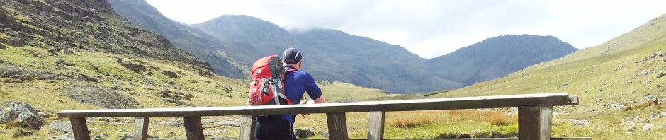
Cheviots Walk from Slymefoot in Upper Coquetdale – Barrowburn, Uswayford, Bloodybush Edge, Davidsons Linn, Windy Gyle and Loft Hill (13 miles)
Quick Trip Report from Sunday’s 13 miler in Northumberland’s Cheviot hills. This is a variation on my previous couple of routes just to illustrate the choices available once you get to know the Upper Coquet area. I also tried the … Continue reading →
Posted in Cheviot Hills
|
Tagged Barrowburn, Best Cheviots view, Bloodybush Edge, Cheviot Hills, Cheviots, Davidsons Linn, Loft Hill, Routes from Barrowburn, Rowhope, Slymefoot, Social Hiking, Trows, Trows Road End, Upper Coquet, Upper Coquetdale, Uswayford, Whitebridge, Windy Gyle, Windy Gyle route
|
1 Comment

