
An interesting walk in an area of outstanding scenery just north of Ullapool. Approaching from the west gives an entertaining scramble with beautiful blue sea views across the Summer Isles and distant Outer Hebrides. Even more inspiring are vantage points to the wilderness of Assynt with it’s uniquely individual mountains. Finally to end the day a gentle descent that personally I’d like added to every mountain.
- Distance = 6.6 miles (10.6 km)
- Duration = 4 hrs 40mins, (give yourself more time for the views)
- Total Ascent = 3,687 ft (1,124 m)
- Tops = Ben More Coigach 2,438 ft (743m), Sgurr nan Fhidhleir 2,313ft (705m)
- Start/Finish = Layby near Culacraig east of Achiltibuie, off coastal road from A835
- Date = Saturday 4th October 2014, start 1.30pm – finish 6.10pm
- Click on the Social Hiking Route Map below to zoom in/out

Coigach and the Fiddler Route Map, anticlockwise from near Culnacraig
Transfer day on our October 2014 Highlands trip, after 3 nights in Plockton we were heading for 3 nights in Ullapool. We needed a mountain walk along the way, so Plan A was drive to Ullapool and do Coigach, leaving a short drive back to town for evening food & ale. Morning weather in Plockton was surprisingly good, almost too good as the best weather was supposed to be further north. Anyway after a reluctant goodbye to much loved Plockton we drove on past much loved mountains, all looking lovingly clear.
Morning in Plockton – a very late 9.50am

Leaving the guest house in perfect weather, look at that sky!
We took an indirect but rapid driving route zig zagging east through Achnasheen then northwest via Garve. After an hour’s drive the lovely blue sky ended in an unlovely dividing line of impenetrable cloud. Ben Wyvis in the east was shrouded as was lovely An Teallach in the west. Approaching Ullapool our first sight of Coigach looked even worse, then it started to rain. All those lovely clear mountains passed along the way just to arrive in damp greyness.
Very flattering photo of Coigach ahead at 11.40am
Coigach was one we wanted for the views, but no point turning back now so onward up the A835 past Ullapool, turning west at Drumrunie with fingers crossed. First choice of route from the east looked grim and very wet. The alternative from the west seemed a long drive away then a glimpse of blueness out to sea gave us the encouragement we needed. So off west we headed, passing lovely Stac Polly on a scenic loop around the lovely coast through Achiltibuie.
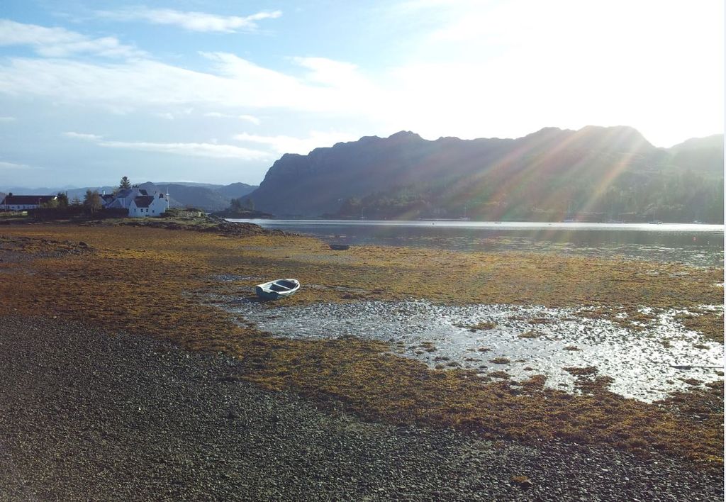
When stuck in a cloud of crapness one can only hope that the weather did what it did that day. Yes it was windy but there were no complaints as we arrived 30 mins later near Culnacraig under blue skies, eager to get walking.
There’s a layby with space for a few cars here, oddly a bit of shattered windscreen glass on the ground. Finally we set off on an anti clockwise route at 1.30pm, walking east along the road, soon turning off northeast following an obvious path heading upwards. Course this was our first mistake, we had completely missed the correct path heading southeast. Now we were heading instead directly for the Fiddler up our descent route, and had gained a bit of height before realising. I blame the long drive and over eagerness, mixed with sheer laziness to check the map.
Anyway rather than turn back we decided after uttering a few swear words to contour southeast hoping to angle above the gorge of the Altt Nan Coisiche stream. This was hidden from view but a definite barrier on the map. Luckily this worked out ok, a slight dip crossing the stream but putting us back on course after losing maybe 10 mins. The views out to sea were outstanding, the weather now thankfully exceeding all expectations.

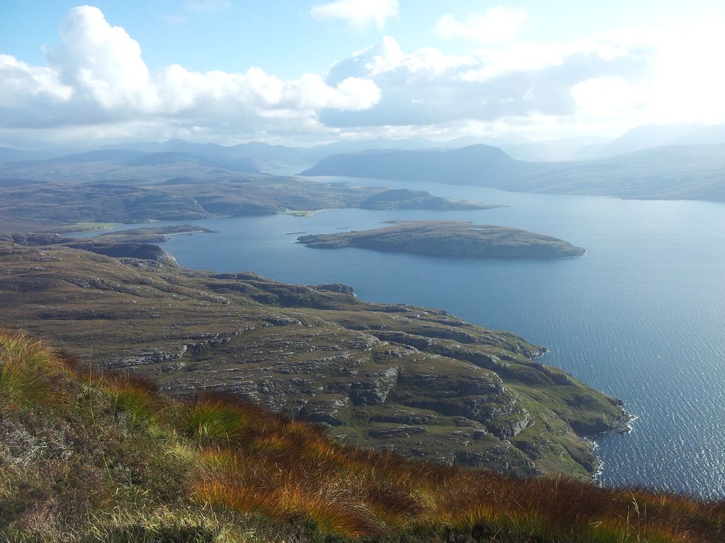
Culnacraig in the trees, the car in centre, the Summer Isles beyond – 1.45pm

I do like a bit of blue sea in my views
Hey there’s even more blue sea over there too
After some grassy slogging there was now just a straightforward ascent up and over that little steep bit ahead, then on to Coigach….we mistakenly assumed.
On the way up to Garbh Choireachan – 2.20pm
The ascent up the Garbh Choireachan (the steep bit ahead) certainly looks easy, but it’s further than you think. Lots of boulders to walk around which gradually develop into rocky and scree terraces, it seemed to take an age to reach the skyline ahead.

On the way up to Garbh Choireachan – 2.50pm
Views opened up south down Loch Broom over hidden Ullapool on to the Fannichs. Nice.
Views opening up south down Loch Broom
And still the views west get better – 3.00pm

Finally nearing the skyline of Garbh Choireachan – 3.20pm
We hoped to reach a definitive ‘top’ with 360 degree views however every step seemed to yield more boulders ahead. There’s a myriad of tempting tracks, some clearly worn by humans, some by animals and some by natural erosion. We just wanted to crack on to Coigach but were now meeting a strongish wind from the south. So we ended up slanting left around the ‘top’, seemed like people had done this before including on a couple of GPX routes I’d downloaded. Again it took a while to scramble up to the skyline, still not sure of the best route here to be honest. With more time and less wind we’d probably have gone straight up. Either way we found ourselves on a surprisingly interesting ridge section. Course we would have known this had we checked things out properly beforehand. Going to mention that ‘views’ word again.
Along the Garbh Choireachan ridge
Along the Garbh Choireachan ridge looking east
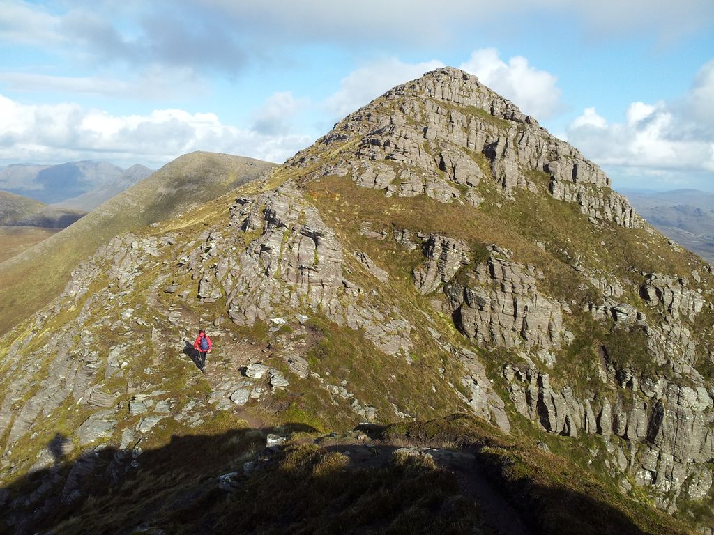
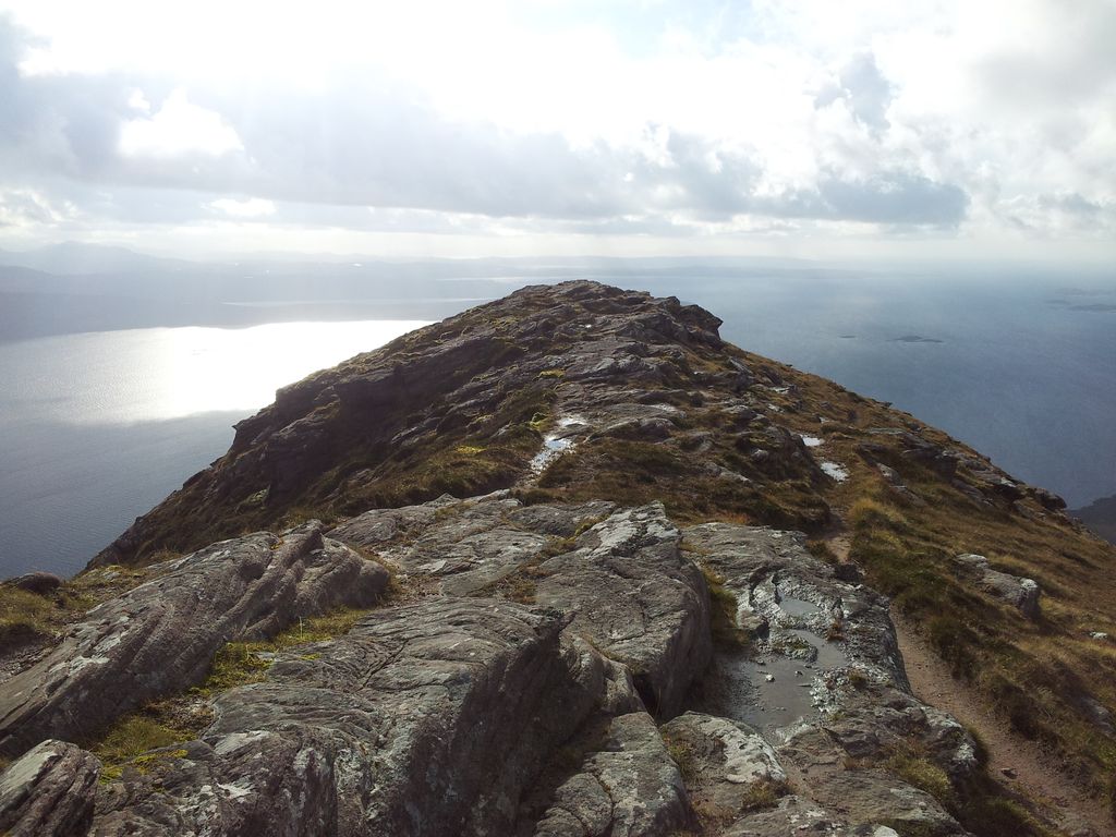
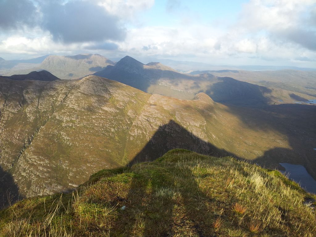
Fascinating ridge walk ahead, sometimes on top, often along a side path with the ground sloping below. Never realised that this big lump beyond Ullapool was going to be like this.

From Garbh Choireachan to Coigach (right) and the Fiddler centre below Stac Polly & Suilven
And then one of those rare special moments, Alan saw it first as it took off from a distant boulder. Then it soared upwards and over Coigach with barely a wingbeat. Yep a Golden Eagle. The world stopped revolving, bodies stopped breathing, mouths gaped open, and then it’s gone. All you hear is the voice inside your head screaming “Come back” 🙂
Looking back west along Garbh Choireachan, lot’s of sea to see
Eagles apart, the ridge is entertaining with some mild scrambles, how entertaining depends on the individual. Hint of exposure in parts and I used to love things like this but today I was less comfortable due to the wind. Kept expecting a gust to knock me sideways. It’s a pity we were mainly forced along the side bypass path rather than enjoying views on top. Another day maybe when concentration levels don’t need to be as high.
Just as the ridge ends and eases there’s a final sting where the path drops steeply to avoid more difficult scrambling. Not a favourite bit with my dodgy knees:-)
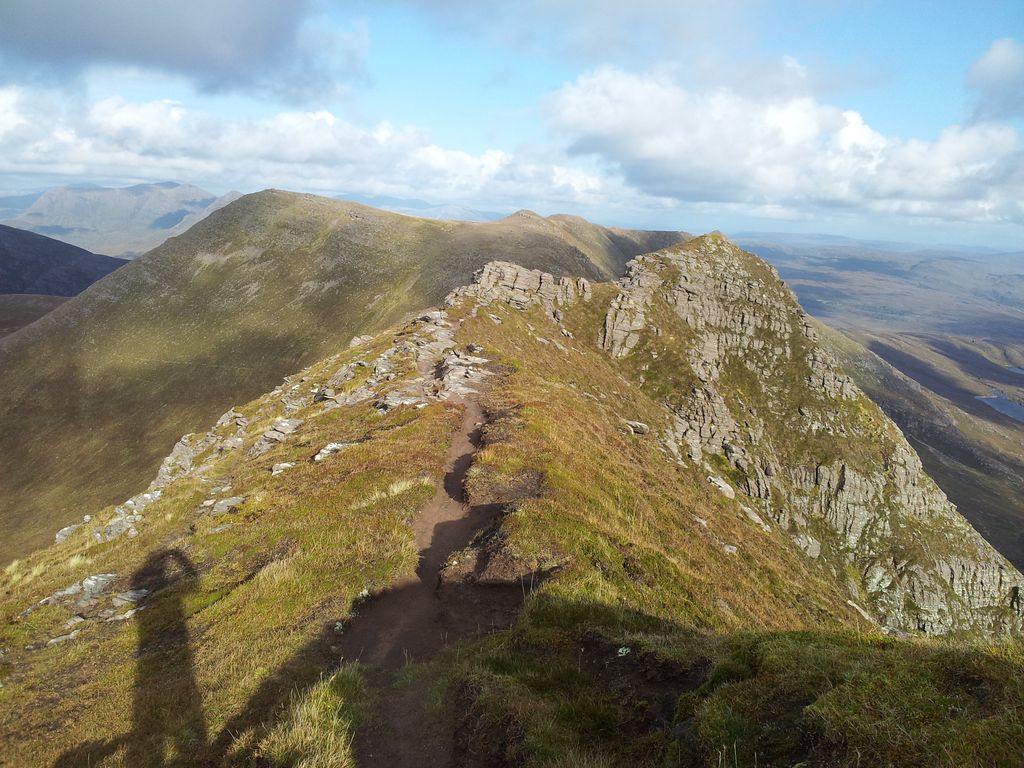
The end of the Garbh Choireachan ridge

3.50pm – in the dip looking back to the Garbh Choireachan, now for the easy stuff
From the bealach we noticed a much lower path circumventing the ridge along the northern scree slopes. Perhaps a quicker but far less entertaining way up/down if needed. Now 2hrs 20 from the car, the ridge had certainly slowed us down more than anticipated. Fortunately everything becomes pretty straightforward from here and it’s only a ten minute easy pull to the top of Coigach.

On Coigach – 4pm
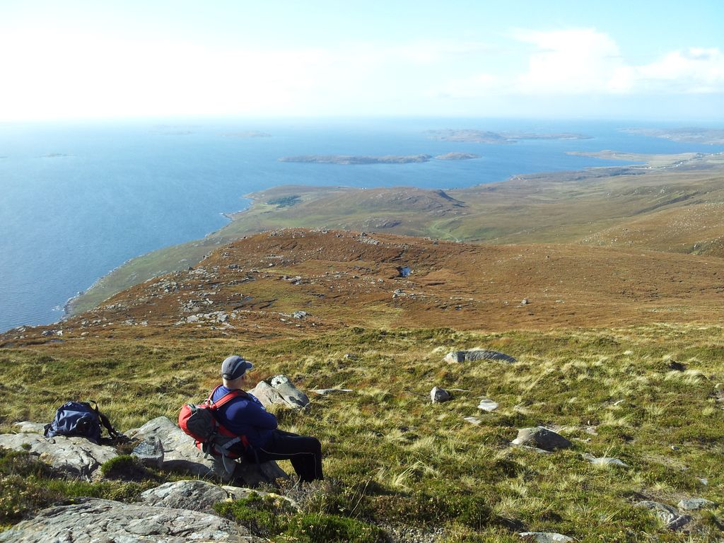
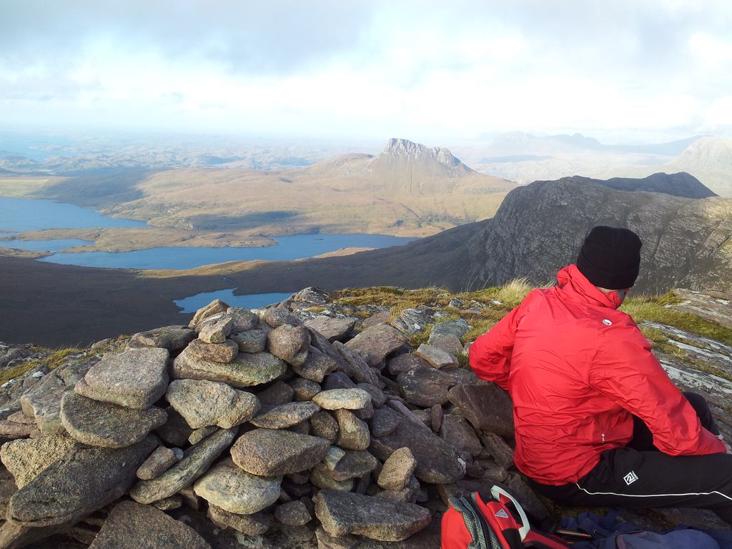
On Coigach there’s a welcome shelter where we stopped for refreshments; on Coigach the scenery is inspirational. One wonderful window across Assynt, spoilt only by the inglorious vision of an old man munching a Mars Bar.
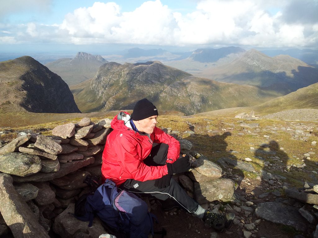
Ben More Coigach, wilderness, mountains, men, and Mars bars

From Coigach south down Loch Broom

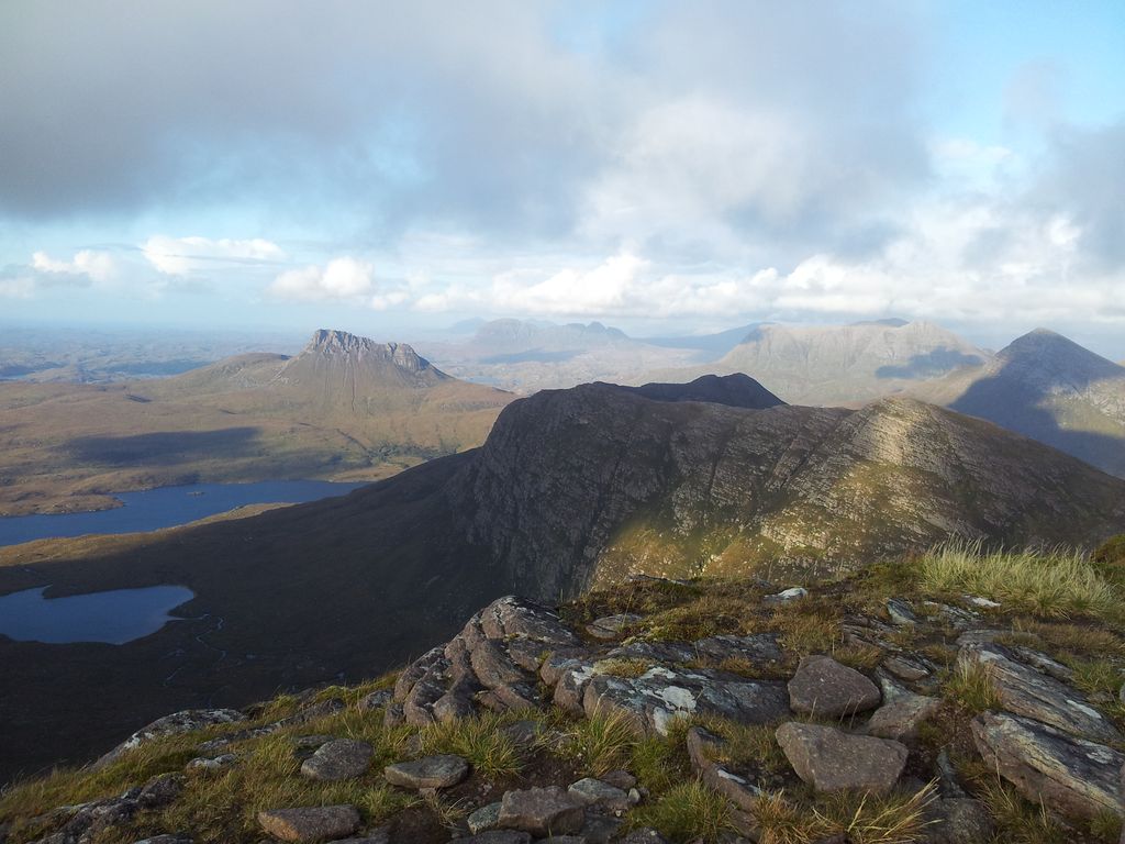
From Coigach over our ascent route and Garbh Choireachan

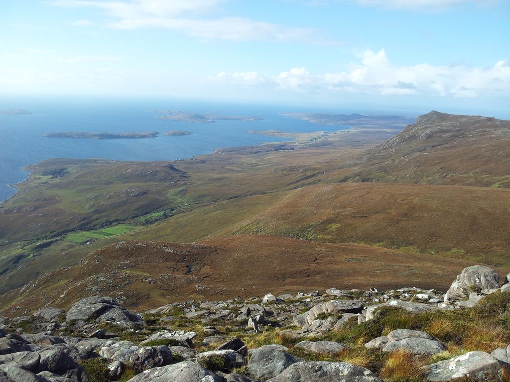
Views west over the Summer Isles from Coigach. Below lies our later descent route
After 2 hrs drooling at views south, east and west; now time for even better ones north.

The Fiddler from Coigach with Assynt beyond
More Fiddler and Assynt from Coigach with our route swinging right then left
Just imagine all these photos from Coigach put together to make one dodgy 360 degree video? Well a team of specialists have done exactly that!!
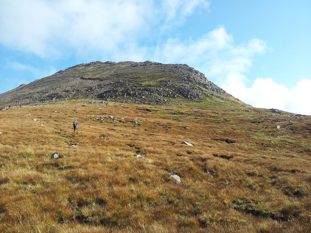
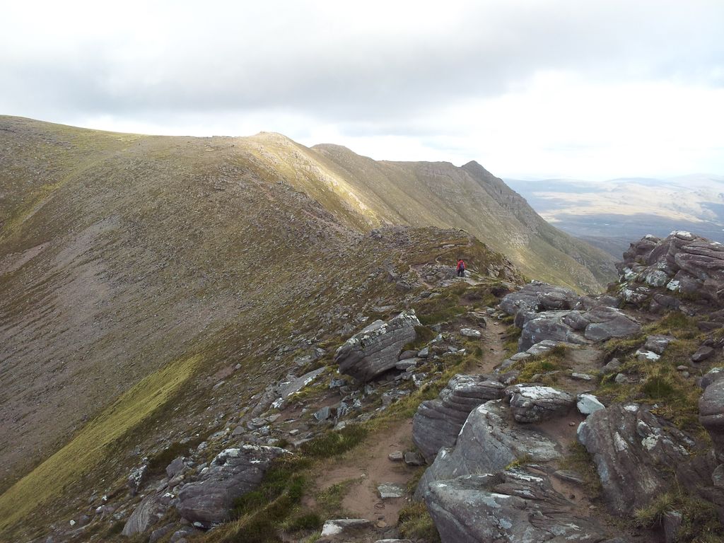
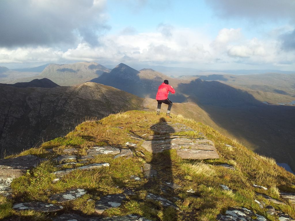
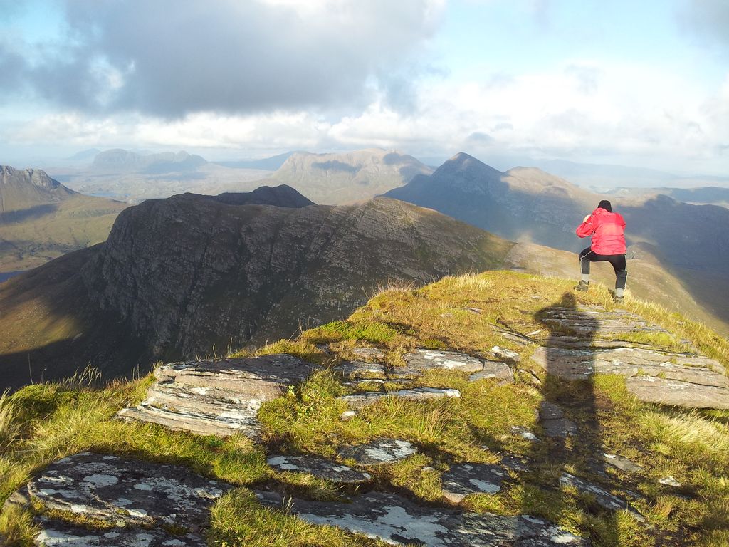
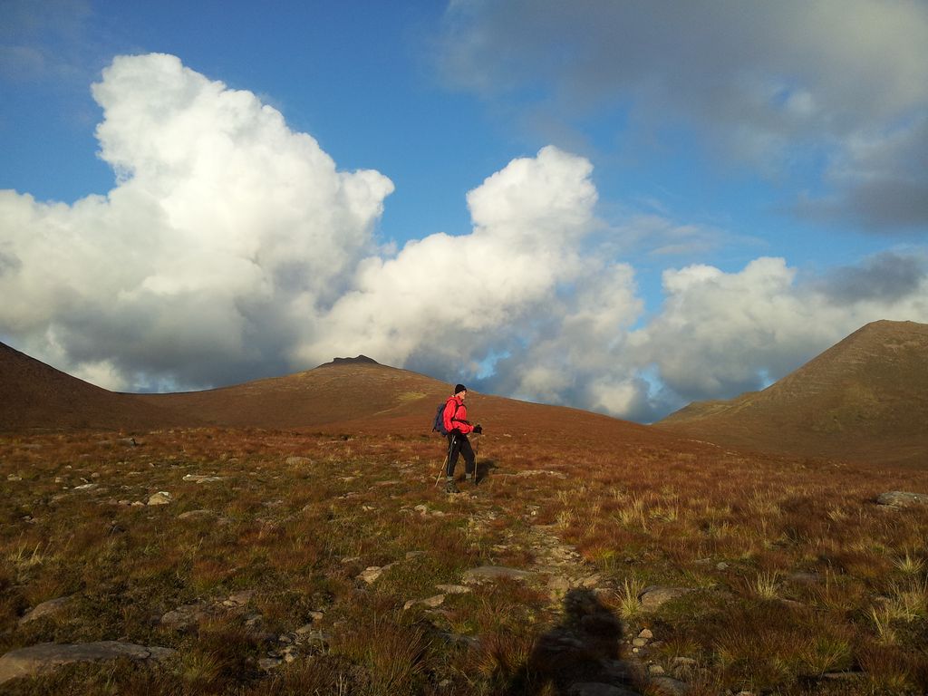
Only time for a 15 min stop then from the cairn we picked our way north eastwards across a strangely flat lunar surface. The aim is to swing round towards the spur of the Fiddler, but not too soon. We probably swung slightly late but there are no difficulties here and progress is swift if slightly boggy.

Alan approaching the Fiddler – 4.30pm
Before the final ascent we looked down at one of the alternative paths from the east. Didn’t look too inviting, though the scene above it did. Also spotted a couple behind us, the first humans of the day and an advantage of the less popular hills (Grahams).

Looking down north over Lochan Tuath before ascending the Fiddler – 4.40pm
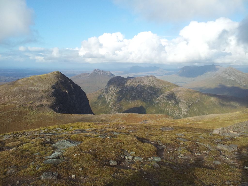
A steep steady 15 minute ascent brought us to the last top of the day Sgurr Na Fhidhleir. This incredible vantage point favoured by photographers is marked by a small cairn with little shelter. Only a few feet away are sheer cliffs plunging downwards to a green lochan filled wilderness. Strongest winds of the day here so crouching best for photography.
Views north from the Fiddler, more interesting than Mars Bars
What a situation and what a wonderful view, quite incredible. See below.
Assynt with Stac Polly, Suilven, Cul Mor, Cul Beag and distant Quinag
Walking out slightly to the north east tip gives a vertiginous experience, as if you’re detached from the ground. Remote Seana Bhraigh
Should have raised my arm shadow here and pushed him off
Assynt
Look at the shadow of the Fiddler cast against the mountainside below!
Shadow of the Fiddler

Mart very definitely in the hills
Much fun on the Fiddler trying to identify the horizon, remote Seana Bhraigh spotted in the east. Quite a difficult place to leave even on a windy day, if any calmer I might still be up there. 5.15pm though and we needed to get down in time for an Ullapool evening meal. Now for that descent; nothing special, just a straightforward southwest line back to the car on sloping moorland.

Descending south west from the Fiddler
Back up to the Fiddler from the descent to the car
However soon the ground becomes surprisingly sandy, lightly cushioning footsteps making walking a pleasure. Add in the gentle gradient and an ever enticing seascape and lowering sun over blue island-dotted seas. All helps to make this the perfect descent for a guy with dodgy knees, I loved it and we raced down. (Ok gets a bit eroded at the end).

Descending to Culnacraig, the Summer Isles glistening like a glisteny thing

Back at the road, 6.05pm, looking up at the now more familiar Garbh Choireachan
Back at the car just 55 mins later at 6.10pm, a walk of 4hrs 40 mins with some brief time on tops, never enough time of course. Highly enjoyable, amazing scenery, yes you could tick this off in the cloud but it’s one for the views most definitely. Now back to Ullapool, check in at the B&B then food and beer. The drive back was spectacular, bibs required for persistent drooling.
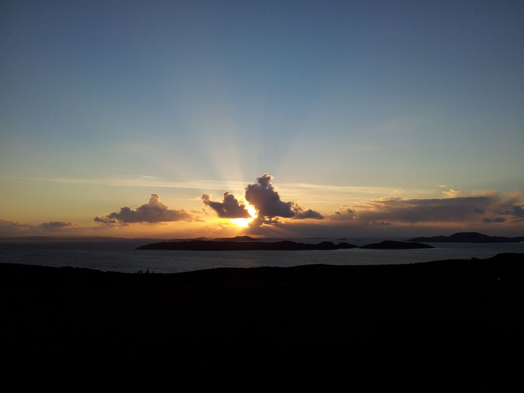
Summer Isles sunset

Stac Polly – 6.40pm
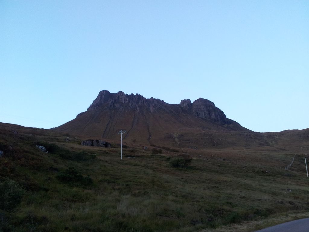
Stac Polly, ok ok it’s Pollaidh not Polly
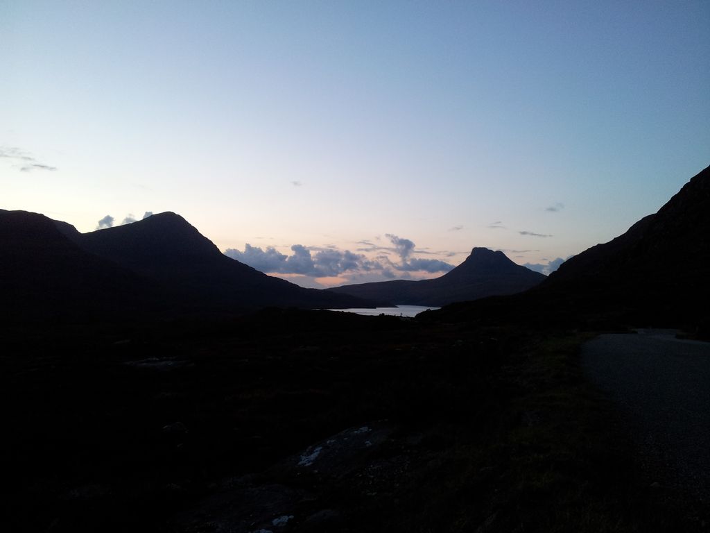
Final scene nearing the A835 with the Fiddler left, Pollaidh right – 7.00pm
Good food at the Arch Inn, Ullapool, best beer was the An Teallach.
Driving Stats
- Left Plockton; – 9.55am, Garve 11.00am, Ullapool 11.30am, Culnacraig 1.05pm
- Depart Culnacraig; – 6.25pm, junction with A835 7.07pm, Ullapool 7.25pm
- Achiltibuie is 25 miles drive from Ullapool
PS; on the coastal drive to Culnacraig I spotted a ‘Piping School‘ which for one brief moment I thought was to do with icing cakes, I kid you not. We just don’t see these things in England.
See the previous days walk up the The Quiraing and Sron Vourlinn, Isle of Skye (6.5 miles)


Wow! Such magnificent scenery! I have nothing like that in my local area. I love how rugged and wild it looks. The shapes of the rocks are interesting too, in that they are rounded and layered. For someone who has a dodgy knee you do very well!
Yes it’s certainly a very unique and distinctive landscape in this area. Almost as far north as it gets which adds to the magic 🙂
The weather! You scored bigtime! Lol. My friend is moving to scotland next week for good, so another excuse to visit and hit some trails!
Very thankful for that weather and those views, although the next couple of days weren’t so kind. Both knees dodgy, I strap them up, use poles & take ibuprofen. Then I’m fine 🙂
Ibuprofen is definitely a hikers best friend!
Ha absolutely, take the edge off box pain. About to take some as I’m off to the Cheviot hills 🙂
Lucky! Im stuck with a 3 year old in the city. Gotta get out there soon before i lose my mind! Enjoy!
Thanks. Much lighter longer here now, no midges, no chance of sunburn and no haze. Good time to get out, I’ll think of you from a hilltop 😉
Amazing landscape.
Absolutely. It’s one of those places on the must see list. Hope to head back up there in autumn 🙂
Great writ up and fantastic photos and videoMartin, I’ve still got them ones to do yet 🙂
Many thanks Lee, such a fantastic area, pick a decent day if possible!