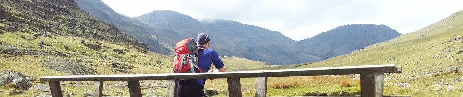
After 3 months without a big walk circumstances & the weather finally came together and I made the 75 min drive up to the White Bridge at Slymefoot in the Upper Coquetdale Valley of the Cheviots. Having done most of the paths from there I was happy to recreate a classic route I’d semi-created back in November, but with a few diversions. The weather was pretty excellent, hazy in the distance feeling like Spring for most of the day & damn good fun.
Leaving the car a bit late at 11.25am I set off south east along the roadside, turning off again at Barrowburn Tea Room but then diverting south east straight up Shillhope Law. It’s a great little hill with excellent views & after 4 visits I’ve yet to meet anyone up there!

Looking west up the Coquet Valley & down to Barrowburn from near the top of Shillhope Law

Shillhope Law summit cairn looking north
A Skylark soared singing sweetly overhead, which was soon drowned out by impressively booming heavy artillery fire from the Otterburn range just south across the valley. You could see the odd puff of smoke rising and the barrage continued off & on for a few hours.

Upper Coquetdale west from the top of Shillhope, the military land is south of the river.
I retraced my steps down Shillhope then turned north to take in the green bumps mid right in the pic below. The route then goes up the snowy path through the small forest in the middle then up the snowy path past above right to meet the Border Ridge.

Looking to The Cheviot top right with the Border Ridge on the horizon & Windy Gyle top left

Descending from Shillhope, looking s east along the Usway Burn to The Castles & Batailshiel Farm

Looking back south at Shillhope
First green bump was ‘Kyloe Shin’, great name, crap bump. The next one was higher at 433 metres and again was perhaps not worth the diversion but what the hey it was great to get out and the views were never less than impressive. Descending to the Hepden Burn path this view suddenly emerged of the remote Fairhaugh Holiday Cottage ….

Fairhaugh below, the route goes far left to top middle
It was bloody brilliant to be up in sunny hills again however what with the diversions, Tweeting & picture taking, I still hadn’t travelled very far from Barrowburn, so it was good to get back on the path & start heading north through the small forest section to emerge on the nicely situated Middle Hill with it’s views of green bumpiness.

Descending from Middle Hill looking north, I nipped up Hazely Law on the right
Continuing the theme of picking off additional bumps I nipped up Hazely Law which at 499 metres was….quite unremarkable. I found a small bog getting back to the main path too.

Ascending Hazely Law looking back over Middle Hill with Shillhope in the distance
Now it was time to get moving and head up to the Border Ridge which turned into a bit of a slog due to the claggy snowed up path. In the Cheviot’s it’s usually best to keep on the paths as the surrounding terrain can be very unfriendly. The legs felt it here. I saw a cyclist heading off into the forest & that was the last person I would see till back in the car.

Looking north over the Border Fence on the Border Ridge & Pennine Way. Scotland 10ft away.

The Cheviot right & the Schill left, at the Border Fence, (slight shadow problem)

The sign points the way west to Windy Gyle, well sort of.
")
The Border Ridge & Pennine Way with Windy Gyle summit cairn beckoning. Except this is a false summit 🙂

Heading up to Windy Gyle, looking back down the Border Fence to the lumpy Cheviot (weird shadow)

Summit Cairn of Windy Gyle ahead
It’s always pleasant reaching this summit even though today due to the extra height and lowering sun Windy Gyle lived up to it’s name with a cold wind cutting in. Time to whip out the Balaclava & Buff – good thing I was completely alone so no one saw me in the Buff.

Windy Gyle
")
Windy Gyle at 2,031ft (619 metres)

The view north from Windy Gyle on the Scottish border
Windy Gyle is the only hill in the WORLD to be listed as both a Scottish ‘Donald’ and an English ‘Hewitt’ & ‘Nuttall’. The stone shelter here is excellent though I didn’t stop long as I couldn’t be bothered to add extra layers:-) It was 3.50pm & I figured it was a 50 min stroll down to the car by the quickest route, or at the very least 90 mins of fast marching down the longer ancient drovers route called ‘The Street’. Sense prevailed for once, after all I’d had a good walk so there was no need to extend the day, I’d even be home at a sensible time for a change. This was a good plan….then I briefly thought that the extension might only add around half an hour. And in that brief moment the decision was changed, and the day got longer. Still I was sensible for at least a whole 2 minutes, a commendable attempt.

The fabulous view north from WINDY GYLE, a favourite.
I headed west straight after taking the above photo moving pretty fast to generate some heat, I’d kept fingerless gloves on for the usual food & photo tasks so my hands weren’t stinging numb for a change, just cold. 30 mins later I’d reached the junction with The Street & Pennine Way near Mozie Law.

Joining The Street drovers route, looking back at Windy Gyle now 30 mins away
The Street is an excellent path, most guides use this as the ascent route but I prefer to descend down here as it retains height and gives views almost down to the car.

Looking down The Street with the path ending down at Slymefoot mid picture. Shillhope in the distance

Sun setting west over the Border Ridge from Bought Law, just 10 mins more descent down to the car
If you like the far north Lake District hills then you should certainly enjoy the Cheviots. You won’t see too many people & it can be very peaceful, except on rare Otterburn Artillery days:-) This route was on mostly reasonable ground avoiding the notorious Cheviot bogs, I recommend it, click on the map below to zoom in/out.
- 12.3 miles (20 kilometres)
- 2,900ft (878 metres) of ascent on Viewranger
- 6 hours with a slow start and fast finish.
- Start/Finish – Slymefoot/White Bridge, Grid Ref: NT859114, 6 miles north west of Alwinton on the singletrack road, half a mile past Barrowburn Tea Room. A small plaque named ‘Trows Road End’ marks the small parking area.
Note; if driving via the A697 (Morpeth – Wooler) then the B6341 is now the only way into Rothbury, as the B6344 road is closed from Weldon Bridge to Rothbury due to major landslips, possibly until 2015!
Take care on the single track road past Alwinton, there’s a few potholes usually covered by puddles. Thanks for reading 🙂

Windy Gyle Route Map Cheviots Feb 17th, click to zoom


Loved the photos- looked like you had a great day !!
Thanks, yeah it was great weather for a welcome change at last so it was excellent to get out. Failing blizzard or downpour I was definitely getting up there. Am lucky having it near, only took me 20yrs up here to discover:-)
Looks really lovely. I am planning on going here again as well, but I don’t know the area well. Last year I started from the area near Linhope, slightly more to the East. Do you recommend any books with routes?
Did you go via the Ingram Valley as I haven’t done that one yet? I started with a simple Windy Gyle walk, I think the drive along Upper Coquet valley is excellent & gets a bit addictive. There’s quite a few small variations if you start near Barrowburn depending on the distance you want to cover. Basically you are aiming to reach the Border Ridge and return. Most comprehensive guide must be http://www.cheviotwalks.co.uk
Any more queries just ask 🙂
Thanks! Yes, Ingram Valley it was. Did you ever go to Linhope Spout? I know it is Dutch, but the images might be nice for you at http://www.runpower.nl/archives/00000574.html That is my weblog. and here http://www.runpower.nl/archives/00000572.html is the other side of that area. I will check your link to see some more routes!
Hi, haven’t been over to Linhope, only strayed over that side when I did The Big One (all the 2,000ft tops) and was up Cushat Law. Seemed very boggy ground that way, how did you find it?
Have visited Davidsons Linn a few times which is the other waterfall in the Cheviots.
Nice blog & pics & doggie 🙂
Hi Martin
I thought it was pretty good, but these two times where my first ofcourse. Lots of discover obviously. I downloaded some tiles in Viewranger as well for my phone. I also have handheld navigation by now but some more detail seemed better.
Maybe we can go together one time, you seem to know your way around 🙂
Yeah would be happy to show you Upper Coquetdale, it feels like a second home now, think it’s pretty special. Think I’d slow you down though, no running for me now with my knees, I can walk fast though 🙂
Pingback: A wintry weekend walk up Windy Gyle from Wedder Leap – Cheviots 9 miles) | MART IN THE HILLS