Classic Scafell Pike Circuit from Seathwaite via a pint at Wasdale Head

Thirty years ago after driving to Wasdale Head I clambered up a hill called Great Gable, it was my first ever mountain. Later it was Yewbarrow then Pillar & Steeple, all done from Wasdale. Eventually I discovered there were other valleys in the Lake District yet Wasdale will always be my favourite.

Recently after walking from Seathwaite, me & my mate Alan were on top of Lingmell before continuing on up to Scafell Pike, Great End & Seathwaite Fell. Lingering on Lingmell we gazed down at Wasdale Head (as you do) reminiscing about the good old days and realising it had been 12 years since we last stood down there.

One of us came up with a route idea for a circular walk from Seathwaite up to Scafell Pike including a pint at the Wasdale Head Inn for posterity. This Sunday the weather was perfect for such a walk so we set off from Hexham parked up near the farm and set off.

Looking back down Grain’s Gill, Skiddaw in the distance

We’d chosen the Grains Gill route from Seathwaite up to Esk Hause to make a proper circular walk. My first time up that one and very impressed with the path & the gradient.

Great & Green Gables from the Sprinkling Tarn to Esk Hause path below Great End

We made good progress and as we gained height and the views opened up we realised this was going to be one of those great hillwalking days. For once the light was clear with distant views, hardly a cloud in sight, no rain, not too hot, not too cold, not too windy, no midges…..but tons of people. Well you cant have everything.

Panorama from the col south of Great End looking west over Lingmell, Pillar, Kirk Fell & Gable

From the slopes of Scafell Pike, Lingmell, Pillar, Grasmoor (I think)

Having left the car at 10am we reached the summit nearly 3hrs later after slowing due to the distracting views. I’ve been up there in all sorts of weather so this was a time to linger.

From Scafell Pike summit cairn to Great Gable, Skiddaw, Styhead Tarn, Derwent Water, Keswick, Blencathra, Great End plus many many more

I’ve also been up there twice alone, but unsurprisingly not today. Things were a little chaotic at times but hey at least all these people were outside enjoying the great outdoors. Oddly these 3 kids & 3 adults were later seen heading up Lords Rake. No fear there then.

A moments solitude on Scafell Pike summit – or maybe not

We had forgotten how extensive the views can be up here with the Isle of Man & the Galloway hills the clearest I’d ever seen. Blackpool Tower and Northumberland’s Cheviot & Hedgehope (83 miles away) were all confirmed with binocs. Here’s another panorama view, have I mentioned the word ‘view’ much yet?

An extreme panorama shot from Scafell right through to Fairfield

After 50 minutes on top it was time to reluctantly get moving and also time to reverse my first ever Scafell Pike ascent from Wasdale up to Mickledore.

Mickledore, last time I was here, I had hair

Everything had been going extremely well it was 2.20pm and the plan was to get down to Wasdale for 3.30pm, 45 mins in the pub, 2hrs back to Seathwaite, plus a spare 30mins, therefore reaching the car by 6.45pm, with sunset at 6.30pm. Hold on, what was that descent time again! Ok we’d underestimated that one and after picking our way through the eroded crumbly top of Mickledore that car park down there wasn’t getting any closer.

From the top of Mickledore looking down to Wasdale, Yewbarrow above

We really had to pick up the pace descending then eventually found a sign pointing to ‘Wasdale Head’ taking us around the foot of Lingmell. I actually thought Alan was taking the piss when he read the sign out. Didnt know this path, but it saved some time AND kept height giving more of those ‘views’.

Wasdale – The Return

Wasdale Head now ahead and there’s a pint with my name on down there. This isn’t posed by the way, this is just how I walk when I smell beer.

Wasdale Head Inn ahead, I need beer and I need it now!

And finally we stepped into Wasdale again and the pub beckoned. Oh and views too!

Wasdale Head Inn with Pillar beyond. This was nice, very nice

3.40pm. It had been 12 years and I spoilt the moment by walking into the side phone box thinking this was the pub entrance. No one saw me so think I got away with it. Last time the pub was heaving, this time empty with everyone outdoors. Decent choice of beer, we chose the Loweswater Gold 2012, a good year and a cheeky pint.

Mountains, walks, Wasdale Head, beer, happiness

If Cumbrian Ales want to use this pic to endorse their very refreshing tasty Loweswater Gold then my rates are fairly reasonable. Or they could take one themseves. Drat!!

Marginal utility of happiness just increased exponentially

Wasdale Head is a particularly wonderful place, particularly for a pint, with ‘views’ everywhere. The one’s below were across the cute iccle bridge to Kirk Fell& Gable. We were highly tempted to have more beer but it was 4.15pm & very reluctanly time to start walking. Incidentally last time here was my ridiculous mountain bike ride around Great Gable, Gatesgarth, Black Sail & back down to Wasdale, tiredest I’d ever felt, (blog to follow 1 day). We set off up towards Sty Head, me remembering how hard it’d been pushing a bike up.

Kirk Fell

Kirk Fell and Great Gable

On the way to Styhead, arguing over who chose this route! Thankful we only had one pint

  Arriving at a deserted Styhead Tarn at 5.40pm. Only downhill ahead at last now.

Styhead Tarn, full of little fish rising for flies

Bet this hasn’t been photographed before? Well maybe a little.

Styhead Tarn (again)

Looking down to Seathwaite at 6.20pm

We got back to the car for 7pm just before darkness and very satisfied with the day, a real Lakeland classic,

  • Distance  =  12 miles (19.3 km)
  • Ascent  =  4,500 ft (1,372 m)
  • Time  =  8 hrs
  • Start  =  10.00am, finish = 7.00pm
  • Start/Finish  =  Seathwaite, park at roadside as near to farm as possible
  • Date  =  October 7th 2012
  • Thanks for reading

Later over a pint we theorised about next time adding Great Gable on the way back, these things always seem so much easier in the pub over beer.

Click on the map below for an interactive route map via Social Hiking…

Scafell Pike & Pint Route Map

Click on the map for Scafell Pike & Pint Route Map

Posted in Lake District | Tagged , , , , , , , , , , , , , , , | 13 Comments

Sheena’s Tea Hut and the Sandaig Islands – NW Highlands Trip Day 2

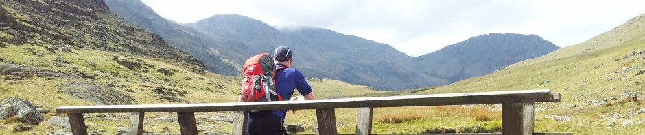
A fascinating afternoon visit to two remote locations near the original Skye Ferry. Day 2 (updated) – overnight the storm arrived with rain and wind loudly thumping on the guesthouse windows. Waking up tired from Thursdays Slioch walk I quickly checked a few forecasts which all seemed grim. Looking out at Plockton from the bedroom it was far darker and windier than the photo below suggests though at least the rain had eased.

Early morning rougher than it looks

We finished unpacking before eventually heading out in the car along the single-track coast road towards Kyle, scanning the weather. Skye didnt look too inviting so we turned left to Glen Shiel with the aim of having a drive round or if lucky an afternoon walk. We took the opportunity to check out one of the Highlands most imaginatively titled cafes below…..which was unfortunately “closed for refurbishment” (ps now open).

Always raises a smile when passing

Whilst sat in the car park taking this photo we formulated a plan to drive up the the 9 mile Mam Ratagan pass from Shiel Bridge to Glenelg on the west coast. There were a couple of coastal walk options away from the big mountains that were pulling the bad weather down. It would also be a chance to look around an area we’d only visited once before when doing Beinn Sgritheall in July 2000.

Sheena’s Tea Hut – Corran (updated)

The memories of that day came flooding back as we drove over this superb no-through road. Once past Glenelg you hug the shore with views across to Skye then if you drive far enough the reclusive and remote north side of Knoydart bursts into view across Loch Horn. We passed a sign and Alan reminded me of a strange obsession we had all of 12 years ago. The sign was for ‘Sheena’s Tea Hut’. We never had time to visit back then but had been fascinated by the various signs and its startlingy remote location. An indelible impression had been left that day and we had resolved to return someday for that remote cuppa. We had even jokingly fantasised many times about Sheena, was she an attractive lonely smiley Highland lassie desperate for male company, full of tales of Highland life and shortbread? Anyway the chance to revisit on a non-mountain day was too good to ignore and we decided to drive on beyond Arnisdale to the end of the road at Corran and hopefully finally meet siren Sheena.

Sheena’s Tea Hut and neighbours – from the path

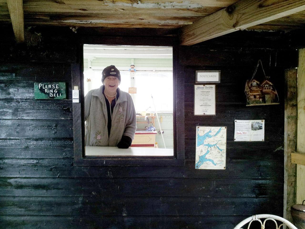
We parked up at Corran, walked over a bridge past some small cottages and saw a final sign pointing to the very last cottage. At last after all these years we stood looking at the scene below. Sheena’s cottage is to the left, and the “tea hut” is a little green timbered shed which you walk through (passing the Highland cattle) to a small fenced patio garden. In the shed is a counter and on the counter is a door bell. I looked at Alan, he looked at me, I pressed it. Nothing happened, I pressed again, nothing. Alan in typically negative fashion said “nah must be closed, she probably doesnt live here anymore”. We stood in the patio garden gazing at the scenery about to leave when we heard a gate unlock, and then some steps, and then a mysterious figure appeared……it was Sheena……and she was 74 yrs old.

Happily supping a cuppa at Sheena’s Tea Hut – July 2012

I said “hello, didn’t think you were in”, she replied immediately “didn’t stop you ringing the bell did it”. Sheena may be elderly but she’s an admirably feisty lady:-) She served us from the counter & made 2 refreshing mugs of tea which we eagerly supped sat smiling in her patio. Anyone travelling around this area should make the diversion to Arnisdale and enjoy this truly wonderful experience. Feels like the end of the world, views around and across to Knoydart are an absolute delight and you won’t forget or regret it.  Sheena returned for a chat about the Swallows trying to nest above the counter. Amazingly she gets some custom most days but doesnt get out much as she’s tied to the tearoom. Nice lady, hope she’s around for years to come, I’m still smiling about Sheena’s Tea Hut.

The view west from Sheena’s Tea Hut – how good is this!!

Update July 2013; very glad to report that the Tea Hut is still open with a young lass helping to serve. Sheena is a bit more unsteady on her feet and complaining of a bad back, but admirably she said, “things could be worse“. I replied, “yes, you could be living in a big city“; she replied, “I’d NEVER live in a city, I wouldn’t even live in GLENELG, there’s too much going on“. PS; Glenelg has a population of 200. Quote of the holiday:-)

Revisiting Sheena's July 2013

Revisiting Sheena’s July 2013

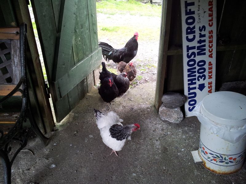
Update July 2014; despite lack of signs and some rumours of retirement we were delighted to be met by a smiling Sheena outside her Tea Hut. When asked how things were she replied, “I’ll always be open till they carry me out in a box, I like meeting people“. Those Swallows had returned from Africa nesting again above the hatch then some chickens casually strolled through. We were the first customers of the day, soon joined by a couple who’d been singing at the Ceilidh House the previous night. A neighbour had assured us all was ok, Sheena had fallen a couple of times as “she still insists on walking up the valley for kindling“, but the community were keeping an eye on her. Some elderly cyclists were heading that way as we drove to Sandaig, ka-ching Sheena 🙂

Sheena smiling in her Tea Hut, July 2014

Sheena smiling in her Tea Hut, July 2014

Inside Sheenas Tea Hut

Inside Sheenas Tea Hut

Sheenas Tea Hut July 2014

Sheenas Tea Hut July 2014 – bit rainy this time

Holy Cow!

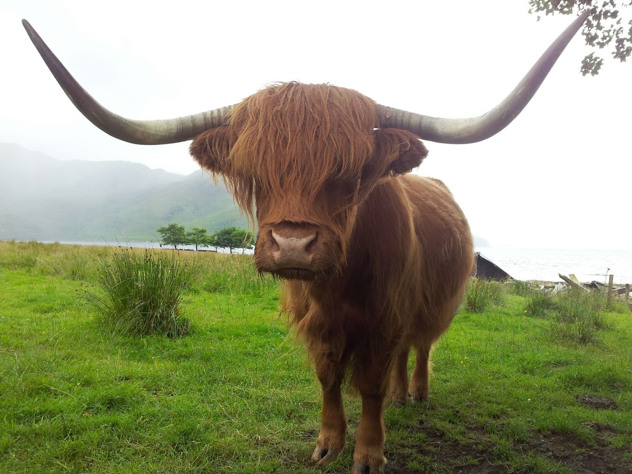
Holy Cow! Outside Sheenas, nicely posed

Update 2015;- Just heard that Sheena has now finally retired and moved to Uig in Skye. Wishing her all the best, hope she doesn’t find it too busy there 🙂 Sad news but good to hear she is ok. Wonderfully the Tea Hut lives on, the legacy now passed to Sheena’s daughter Lorraine. Will be visiting in summer to update further.

Summer 2015 update – all open with an increased refreshment range!

(Now back to 2012). Another amazing thing that afternoon was how the weather magically improved as we drove down towards the Tea Hut. Patches of blue sky had appeared although the inland upland areas still looked rough. The view below was from outside the Tea Hut westwards back along the road with the tent-like Sgritheall beginning to clear.

Sgritheall

Looking west over the mouth of Loch Horn, Knoydart to the left, Skye in the distance

We still had a walk to do but there was no rush to leave, so once back at the car park we nipped into the unmanned Ceilidh House & Heritage Centre which houses an interesting pictorial history of the area. Hundreds had lived and fished here before the clearances.

The Heritage Centre at Corran

Back in the car we stopped briefly when finding some mobile reception to book food at the Plockton Inn that night. The view at this point was pleasant, the temperature now 21 deg.

Every view is glorious here, you don’t want to leave – in good weather 😉

The Sandaig Islands & Camusfearna (updated)

Soon we got to Sandaig, the starting point of the short walk located between Arnisdale and Glenelg. In typical Highland fashion there was no village, just a house on the road. We couldn’t find the forest track at first then discovered we’d parked south 200yards the wrong side of the house. Anyway soon we were off walking through the mostly felled forest zig zags and the Islands appeared below.

Sandaig Islands below – does me bum look big in this or what?

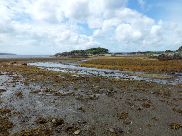
A few minutes further you arrive at the picturesque scene below, note a glimpse of Cuillin in the middle distance. Continue down via a gate into a grassy field with the Islands ahead.

Sandaig Islands – good news the tide’s out 🙂

This field was ‘Camusfearna’ the home of author Gavin Maxwell who I remember as the author of the popular book and nature film from my childhood Ring of Bright Water Based on his experiences with otters the film was about a Londoner (Bill Travers) and his pet otter Mij living up on the Scottish coast. Maxwell lived here in partial seclusion and it turns out his life was far less straightforward than I imagined. Author, adventurist, wartime secret agent, shark fisherman and poet;- he was certainly a complicated character. Despite having once machine gunned a basking shark he later became an ardent conservationist and the inspiration to many aspiring naturists including wildlife presenter Terry Nutkins. Maxwell’s ashes are buried under this memorial stone at Sandaig.

Gavin Maxwell memorial stone

This lies on the exact position of his writing desk in his croft destroyed by fire in 1968

Maxwell’s favourite otter Edal had inspired the writing of Ring of Bright Water, sadly in 1968 a fire broke out at Camusfearna killing the otter, Maxwell was apparently devastated. There’s also a memorial to Edal just a few yards away heavily shaded under a tree. Maxwell died just one year later in 1969. We revisited 15th July 2014 which I’ve just discovered was Maxwells centenary, here’s a fascinating article by John Lister-Kaye on the interesting life of Gavin Maxwell.

Memorial to Maxwell’s otter Edal

We moved on across to the Sandaig Islands, here looking back to Camusfearna (by the dark Conifer trees). That’s also Beinn Sgritheall on the centre horizon, now perfectly clear.

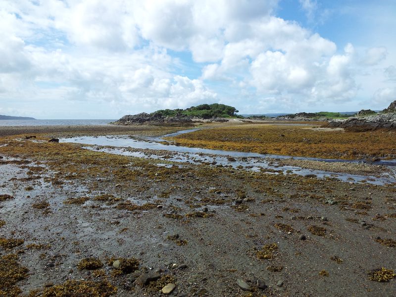
View from the Sandaig Islands east to the coastline

Managed to fight my way around rocks and ferns to the highest point for these pics.

West to the unreachable end Island

Noticed a white ‘rock’ which with binocs looked like a polar bears face, honest….

It’s a Polar Bear’s face, it is!!

In reality it turned out to be the rear end of a seal, which apparently is less rough than a badgers. Counted 24 seals resting here, some cunningly disguised as rocks (& Polar Bears).

Sandaig seals, many seals

Looking north the weather had really improved from winter to summer, warmer than photos suggested and I hadn’t even thought of packing a T shirt or shorts. We sat watching the seals, I’d noticed the channel below was a little smaller than before but the water was completely calm there. Five mins later I turned round and channel was under water. With hindsight this is probably why it’s called the Sandaig Islands! Luckily only a few inches so we dashed back to the main section. Nearly got wet so beware 🙂 Glenelg tide times here.

Channel in the middle was underwater minutes afterwards

This little white beach was a very very pleasant spot, I remember thinking I’ll be back in the office sat behind a desk soon, so take it all in.

Simply beautiful

Final view below before heading back along the stream north of Camusfearna and up through the trees to make it a more circular walk back to the road and car.

Looking west and that’s Knoydart mid right, difficult to know where to look 🙂

This was a really enjoyable easy 4 mile round walk and heavily recommended, we were out for nearly 3hrs most of which was strolling around. Here’s a map of the area showing the road from Shiel Bridge to Corran and the walk in red. To zoom in/out just click on the map to see it fully on Social Hiking. More details of the route on Walk Highlands or just ask!

Sandaig Islands Route Map, click to zoom out

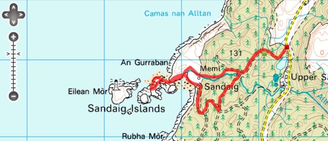
Updated Sandaig Islands Route Map showing correct start, click to zoom out

Sandaig Islands Update July 2014 – Quick update to stress the best visiting time is at low tide for the Islands and also a fern warning. At low tide you can get out to all but the last island. Sometimes the shallow stream pictured below can involve a wet feet/boot crossing when getting from the beach to the Islands. Not a huge problem, kids take their shoes off, I managed a careful dry boot crossing.

Sandaig Islands stream crossing

Sandaig Islands stream crossing

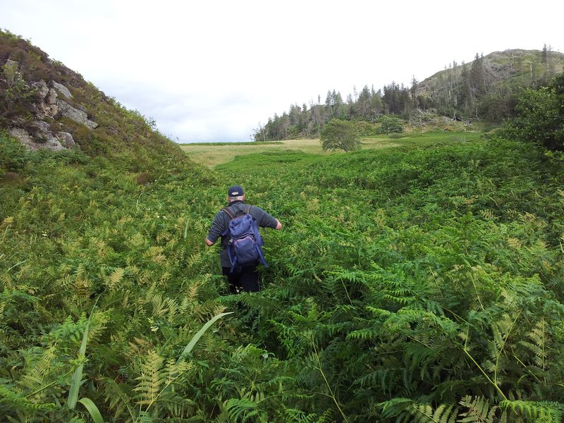
The circular route was more complicated on the return route going south east around the stream due to the bracken/giant unremitting ferns. Previously this hasnt been a problem but in July 2014 they were a pain and we couldnt find a straightforward route ending up with a few scratches & boots full of undergrowth. There’s the odd camoulflaged bramble too so a return via the approach route is probably best till autumn this year 🙂

Sandaig Islands ferns

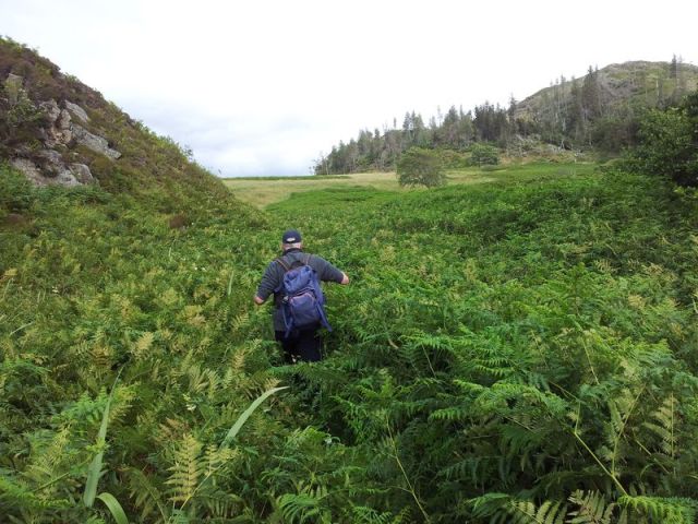
Sandaig Islands ferns on the return route, trying to head top right

On the drive back from Sandaig we diverted for a welcome pint at the Glenelg Inn, a very rare proper pub in the Highlands. Looks a decent place to stay/eat although most tables already had ‘Reserved’ on them by 6.40pm, so if you want to eat best to book.

The Glenelg Inn – obviously

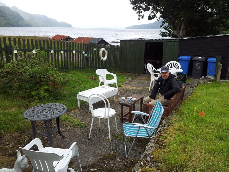
We sat in the hot pub garden, possibly the best pub garden view in the world, watching the tide coming in and the ferry to Kylerhea, (once the main Skye ferry until rail came to Kyle). This was yet another one of those places you really didn’t want to leave.

Surely one of the best pub garden views (not including Alan)

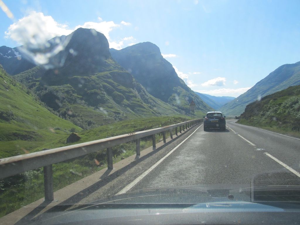
Reluctantly we dragged ouselves away as later that evening we had a meal in Plockton booked. Clinging on to every last view we stopped at Mam Ratagan for the classic one over Shiel Bridge and the majestic Five Sisters (eventually climbed 1 year later).

The Five Sisters of Kintail – slight foreground shadow problem here maybe?

The Five Sisters of Kintail in full, not the best light but certainly can’t complain.

Now straight back to Plockton, no time for any more stops. Oh hold on, here’s Eilean Donan yet again, 7.30pm. How are we supposed to find time to eat with views like this 🙂

Eilean Donan 7.30pm

Finally back to Plockton for food, beer & the traditional evening walk across the causeway.

Plockton evening from the causeway

Followed by the traditional evening view from the floating pontoon east over Lochcarron.

Plockton pontoon view, that’s Calums Seal Cruise boat moored

Last look at Lochcarron from Plockton’s Harbour St 11.15pm

So after a crappy cold, wet, windy start to the day it had turned into a cracker – and all this despite a gloomy forecast saying it wouldn’t improve. We didn’t leave the guest house till midday and managed to pack a lot into the next eleven hours. Also just goes to show it’s not all about Munro’s, there’s plenty of variety and surprises in the Highlands especially around the wonderful coasts.

As we supped our pint of Plockton Ale……in the Plockton Inn……in the village of Plockton, we looked forward to what tomorrow would bring.

  1. Slioch from Incheril – North Highlands Trip Day 1
  2. Waterstein Head and Neist Point – In Search of Sun, Highlands Trip Day 3
  3. 2 Men Alone on a Mountain (only 1 does Twitter) – The Curious Tale of Sgurr Na Stri

Update – Sheenas Tea Hut & the Sandaig islands has now become our traditional morning diversion each time we leave Plockton for the drive home. I urge you to try it and please do so in good weather to make it extra special. Thanks for reading.

Here’s some info on the area Glenelg & Arnisdale with a link about Gavin Maxwell  plus that interesting article on Maxwell’s life and legacy. Glenelg Bay tide times.

Posted in Scottish Highlands & Skye | Tagged , , , , , , , , , , , , , | 10 Comments

Slioch from Incheril – North Highlands Trip Day 1

For various reasons this year I’ve been limited with time off work, hence a Highland trip becomes a rare holiday adventure involving not just mountains but coastal walks, views, wildlife, good food, good beer and a decent little Bed & Breakfast. The aim in June was pure fun, preferably walking under the cloud level and all crammed in to only three & a half working days off.

Heres my Audioboo after leaving work at 1.30pm heading west to pick up my mate Alan (more of him later) and on to the M6 & M74 for the magical drive up to Plockton.

I enjoy this drive so much I had to create it’s own page in tribute Driving to the Highlands. Happily everything went to plan this time especially the weather so after 6hrs 15 mins from Hexham including a classic photo break at Eilean Donan Castle we arrived in Plockton, half unpacked at the guest house then walked round to Harbour St for a meal at the Loch front Bistro the Plockton Shores. The evening scene was perfection, like an oil painting, the wind as still as a still thing, the Loch as calm as a calm thing.From Harbour St Plockton June 20th 8.20pmHarbour St Plockton June 20th 8.20pm

The Shores has a nice relaxed atmosphere, friendly staff and tastyfood. We were starving by then so quickly studied the many fish dishes on the menu, before ordering the duck. Now it was time to relax with the driving done, food ordered and stunning views outside. A familiar voice boomed from the next table, it was broadcaster & journalist John Sergeant dining with some younger guys. Couldn’t work out their strange technical conversation at first then sussed they were his film crew. Even more interesting, Black Pudding & Goats Cheese starterour Stornoway Black Pudding, Grilled Apple & Goats Cheese Stack had arrived – and it was truly a thing of beauty – even tasted as good as it looked.

We left the Shores for the traditional evening walk across the stone causeway (crossed by Edward Woodward in the Wicker Man), past Hamish MacBeth’s police house & over to the pontoon reaching out on the Loch – a peaceful viewpoint with fading light & glistening water gently lapping, like a lapping thing. Then back down the main street, passing John Sergeant interviewing someone (apparently for the One Show). Even more interesting was a decent pint of locally brewed real ale in the Plockton Inn. Then finally back to the guest house to finish unpacking, hook up to the wireless, check the weather & plan for tomorrow.

Top target this trip was Slioch, one of the Torridon giants, a huge lump of rock dominating Loch Maree. It’s summit promised views north & east over some of Scotlands most remote and prized Munros, a few of which we’d never seen before. Like all the best Munros this was one we wanted to do in clear weather though the forecast had been for a pleasant Wed evening followed by a front quickly moving north on Thurs bringing cloud gales and rain.

Back in the guest house I finally got some wireless internet connection, I should point out my Smartphone o2 3g reception has been officially measured by experts as “shite”. Shite in the hills, shite in pubs, shite in restaurants, occasionally ok in certain areas within a radius of 2 feet. So finally the evening Met Office Mountain Weather forecast loaded which predictably was….wait a minute, completely different! I checked more weather sites and it looked like that front would cover most of the UK reaching Lochaber by afternoon but Torridon would be clear till evening. It seemed we had got lucky and if we headed northwards we would be in the right place at the right time, so we burst into sudden unexpected and uncoordinated rucksack-packing before getting some sleep.

Next morning further weather checks confirmed it should be dry with cloud well above the summits although there were some differences over the progression of that front, but what the heck we’d decided on our number one target, Slioch, after all who knew what the weather would be like the next days so we had to grab the opportunity. Now a full fried breakfast is usually not the best thing for a long hill walk as the protein take ages to digest. So after a full fried Scottish breakfast with extra sausages we started the drive to Torridon. Conditions however weren’t ideal and as we reached Achnasheen the east wasnt looking good at all. Torridon also had some cloud as did Slioch but I convinced Alan that things were improving and by the time we reached Kinlochewe a patch of sun sat over our route.

We arrived at the car park at Incheril and quickly set off on the long flat walk along the river with impressive views to the silvery bulk of Beinne Eighe, another bigger Torridon giant and another future target.

This is a great walk-in, the only downside being no height gain after 4 miles however the ascent soon revealed itself as we reached the shores of Loch Maree. Meanwhile the weather seemed to be changing and we started nervously scanning the skies.

Turning right we started the slog up the mountain, the photo below looking down at where I’m standing  above, (if that makes sense). There had been lots more scanning of the skies and a reluctant acceptance that the weather was deteriorating earlier than forecast.

An eerie murkiness was approaching from the south and as we crested the col we could see there was still some way to the top. Alan made an impressive decision that we would break with the clockwise route and head east up the normal descent route to gain high ground quicker and increase our chances of views to the remote Munros. Alan was a man on a mission, he fastenend his pack and started off at speed. I resolved to do the same….after taking the above photo and faffing on with my phone looking for bleedin 3g. I noticed a bloke coming up fast behind and we murmured the inevitable “arweet”. He carried on along the normal route whilst I shot off after Alan across boggy land, (we would meet him later). Soon we started gaining height again and big things started to appear west. They were wonderous things, things we had read about in books, remote and lovely things.

The view we wanted – Fisherfield & more

These views grew increasingly exciting as we started naming the peaks one by one, ok we got some wrong but soon corrected this as we got higher and reached Sgurr an Tuill Bhain, Slioch’s eastern subsidiary top. The view below is north to the summit with the remaining route basically following the skyline and down left.

Looking north to Slioch's main summit

Looking north to Slioch’s main summit

From the same spot to the right, limited views north over Loch Garbhaig & north

From the same spot to the right, limited views north over Loch Garbhaig & north

Below from Sgurr an Tuill Bhain the rollcall of magnificent Munros are from the left, our first sight of A’Mhaighdean (often regarded as the most remote Munro) and Rhuad Stac Mor in the Fisherfield Forest. Next is the incredible Corbett Beinn Dearg Mor & then in the middle distance perhaps Scotlands finest, An Teallach (a picture hangs above my settee). To the right Beinn Tarsuinn & Mullach Coire Mhic Fhearchair. All these names trip easily off the tongue, like trippy tonguey things.

Dreamy remote mountains

Dreamy remote mountains

By now mist had formed on Sliochs summit, we had lost views south & west and a large cloud could be seen above my head sweeping in from the south. The weather had changed around us, five minutes later the cloud enveloped the mountain and that was the end of our views on Slioch. In some ways we had been very lucky, Alans decision to change route was inspired and we had briefly seen some wondrous sights. We started off to the summit when suddenly out of the mist a ghostly figure appeared. Well ok it was just the guy I’d met on the ascent who had by now made his way clockwise round whilst we were sat enjoying the sights. I was really curious so asked if he’d seen much from the summit of this mountain famed for its views. He answered glumly that he’d missed everything by 5 minutes and hadn’t seen a thing. I guess the last thing he wanted to hear was that if he’d changed route like we did he would at least have seen some of Scotlands most iconic mountains. Nevertheless in my excitement I reasoned he needed to know; thought he might be happy for us, but his face suggested otherwise. On we went around to the summit and posed for some pics on the Munro famed for its expansive views.

Came across this odd stone construction on the way down, cant quite figure why someone had taken the time to make this, or why I stood like that, maybe a magical magnetic force?

Magical magnetic Mart

Magical magnetic Mart

Route down to the Lochan, time to tighten knee supports & lengthen poles, as you do!

Route down to the Lochan, time to tighten knee supports & lengthen poles, as you do!

It's knee pain time, path is visible left of the big bump where I first met 'No Views Man'

It’s knee pain time, path is visible left of the big bump where I first met ‘No Views Man’

Looking back to Slioch summit from the path near the col entrance

Looking back to Slioch summit from the path near the col entrance

Although the weather front had hit sooner luckily the rain hadn’t yet arrived and we eventually reached the car without incident. We took the more dramatic western route back to Plockton through Torridon passing the majestic Liathac below.

Liathac

Liathac

We called in for a quick half in Shieldaig below, always a pleasant place, the bar had developed hugely since last time we dropped in. Looked a decent potential food spot.

Shieldaig

Shieldaig

Then back to Plockton for food in the Plockton Hotel which was just as disappointing as last year, the poorest meal of the trip. That night the rain came and gales raged against the window all night, we wondered how long the bad weather would last but reflected happily on the day even though we may need to get back up Slioch again for that full panorama.

  • Distance = 12.7 miles (20.44km)
  • Total Ascent = 4,400ft (1,341m) – max height 3,248ft
  • Duration = 7hrs 30mins – start 10.30am, finish 6.00pm
  • Start/Finish = car park at end of minor road at Incheril, east of Kinlochewe
  • Date = June 21st 2012
  1. Sheenas Tea Hut and the Sandaig Islands – North Highlands Trip Day 2
  2. Waterstein Head and Neist Point – In Search of Sun, Highlands Trip Day 3
  3. Two Men Alone on a Mountain (only one does Twitter) – The Curious Tale of Sgurr Na Stri – North Highlands Trip Day 4
Slioch Route

Click on the map for an interactive GPS tracked route for the day….

Posted in Scottish Highlands & Skye | Tagged , , , , , , , , , , , | 11 Comments

Driving to the North West Highlands!

Driving to the North West Highlands is an adventure in itself with a wonderful array of visual highlights helping to break up the journey into sections of pure joy. Ultimately it becomes an increasingly brilliantly evolving trip into a vast mountain wonderland.

Yep I still get extremely excited heading to the Highlands.  For those familiar with the western drive you know what awaits, for those that don’t then you really really need to do it – and hope the weather’s good.

This is how it works for me on a drive to Plockton:-

  1. Whiz up the M74, spot the first sight of a Munro (Ben Lomond), cross the Erskine Bridge, join the renowned A82.
  2. Try desperately to overtake any slow traffic before the narrow Loch Lomond section.
  3. Try desperately to concentrate on the bends rather than the views (repeat for next 4 hours)
  4. Pass the incredibly quirky Drovers Inn, often a food stop on the return journey, full of stuffed animals of every type including a Bear & a Haggis, you HAVE to call in!
  5. First sight of Ben More (my first ever Munro) & Stob Binnein,
  6. Drop into Crianlarich, (stayed here a few times), turn LEFT and prepare for fun, (though a new by-pass is being built to sadly miss the village entirely)
  7. See imposing Ben Lui to left, Beinn Dorain ahead

    Driving to the Highlands_6

    Beinn Dorain from the A82 through a fly covered windscreen

  8. Then Tyndrum (ice cream stop), Rannoch Moor, the little tree growing out of a rock,
  9. Next it’s everyone’s favourite, the peak of Buachaille Etive Mor the Shepherd of Glen Coe, it’s difficult staying on the road here!

    The Buachaille from the driving seat on the A82

  10. On through Glen Coe, the Aonach Eagach to the right, Three Sisters to the left, busy car parks, possible piper, Japanese tourists, then tempt death by trying to overtake a coach or lorry.

    Glen Coe - and the compulsory lorry

    Glen Coe – and the compulsory lorry

  11. Ballaculish Bridge (a personal favourite), never sure which way to look, probably left to Ardgour, certainly never straight ahead:-)

    Ballachulish Bridge

    Ballachulish Bridge

  12. Fort William – actually an anti-climax, but useful for overtaking a few slow tourists. The last petrol station past the town is also the last chance of cheapish fuel, (quick choccy break). Update July 2013, last petrol station more expensive than the first two.
  13. Off again with Ben Nevis to the right, hoping slow traffic turns off at Spean Bridge!
  14. Past the Commando Memorial,
    Commando Memorial

    Commando Memorial

    Commando memorial

    Commando memorial

    Commando memorial

    Commando memorial

  15. Carry on up by Loch Lochy past the Letterfinlay Lodge Hotel with it’s “Osprey Sun Deck” sign, (not a highlight, just think the names a bit tacky & I bet they never see an Osprey….or much sun),
  16. Finally leave the A82 behind, turn left on the A87 and up to the Glengarry Viewpoint where a whole new horizon of marvellous mountains bursts into view, causing yet more driving distractions.
  17. Drop down to the start of Glen Shiel, a stunning giant version of Glen Coe with imposing steep mountains and changing views, a memorable drive northwards best done in the quietness of an autumn evening.
  18. Leave the confines of Glen Shiel for the openess of Loch Duich and yet more breathtaking views this time over the water. Scotland’s most photographed castle, Eilean Donan lies ahead, ridiculously busy during the day but if a nice evening a quick stop at the car park yields stunning sunset pics. You can even hop over the wall onto the bridge and walk round the castle headland saving yourself a few quid.
  19. Eilean Donan sunset from the car park September 2011

    Eilean Donan sunset from the carpark June 2012

  20. Continue on and hopefully see Skye & the Cuillins before approaching Kyle of Lochalsh.
  21. Now there’s two roads to Plockton, the first should be ignored as it’s enclosed & tedious, the second however turns right at Kyle heading north east along the coast. This is a personal favourite of mine with incredible views west and north along a twisty single track road……
    On the Kyle to Plockton road looking north east

    On the Kyle to Plockton road looking north east

    …with the hamlet of Duirinish a particular highlight often with Highland Cattle. Sunsets over the Cuillins & Raasay offer further distractions in the rear view mirror.

    Duirinish on the Kyle to Plockton road with Skye on the horizon

    Shaggies and Bull in Duirinish on the road to Plockton

  22. If you haven’t driven off the road yet then finally you arrive in Plockton, simply stunning in its own right and a fitting end to a driving adventure. It also has some bloody good food and beer too.

Plockton evening from Harbour Street

So that’s my Highlands drive, thanks for reading my first blog and please do let me know if I’ve missed anything?

PS; for many years we’ve kept a “Driving Times” record in a little notebook in the glove-box; it’s kinda fun looking back, we even used to give each trip an amusing title. My mate Alan did this one, (more of him later) you can tell he’s an ex train spotter can’t you 🙂

Highlands Drive Times Notes

Geeky Highlands Drive Times Notes

PPS, more on this journey; Scenic A82 named best road in Britain

Posted in Scottish Highlands & Skye | Tagged , , , , , , , , , | 10 Comments